Blog · Critical infrastructure
India Airports Live Map: Delhi, Mumbai, Hyderabad, Chennai
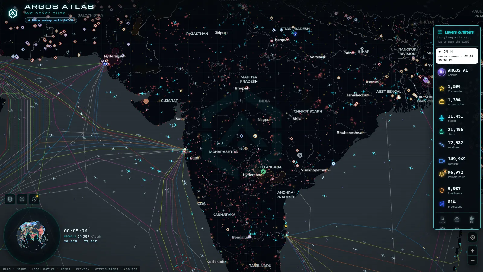
India's five busiest airports (Delhi, Mumbai, Hyderabad, Chennai and Bengaluru) all sit on the same live map, free and without registration. Open one and you get a card with its IATA and ICAO codes, its exact position, and the aircraft flying around it at that moment. The catalogue behind the map holds 47,927 airports worldwide and was tracking 11,486 flights in the air at the last count, of which 3,391 were positions estimated between signals rather than fresh receptions.
This is an airport by airport guide, one section each, with the map card next to the text. If what you want is the whole airspace at once (who is flying, which airline, at what altitude), the piece on live flights over India covers that. Here the unit is the airport: the codes, the runways and what is turning above them right now.
The essentials, in 20 seconds
- Delhi (DEL / VIDP), Indira Gandhi International, is the busiest point on the Indian map and the one with traffic overhead at almost any hour.
- Mumbai (BOM / VABB) works with crossing runways, so arrivals and departures alternate and the holding pattern offshore is often busy.
- Hyderabad (HYD / VOHY) is the only one of the five with public street cameras nearby in the catalogue, in Telangana.
- Military fields show up as well: Hakimpet, Dundigal and Begumpet around Hyderabad, and HAL Bengaluru inside that city.
- The airport layer is free and needs no account, and Indian airports are a small, well covered slice of the 47,927 in the catalogue.
What the India airports live map shows over Delhi
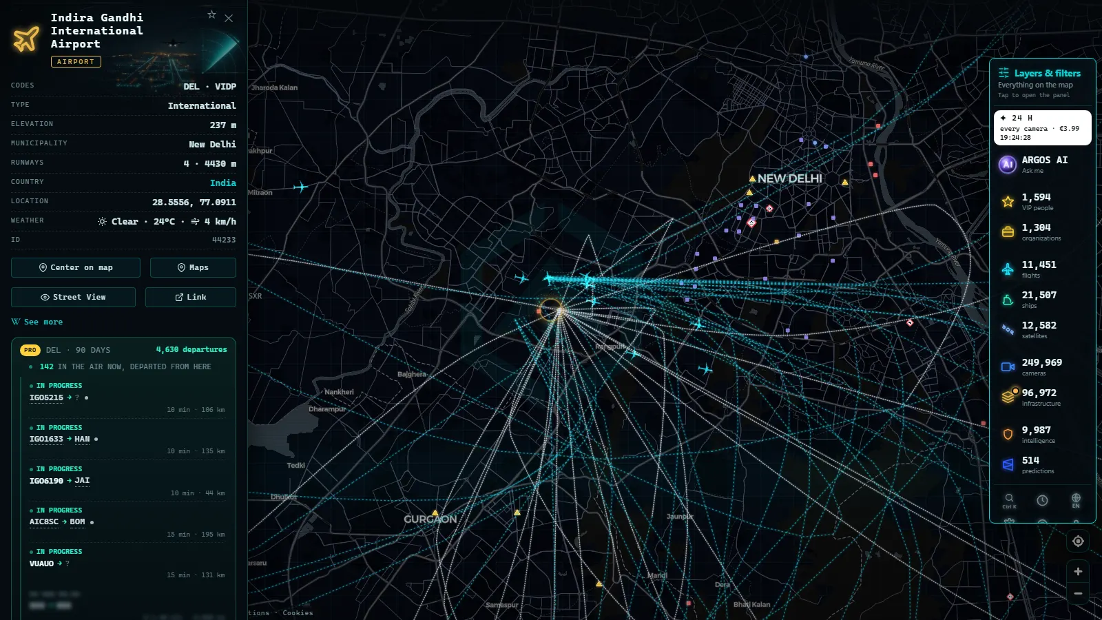
Indira Gandhi International sits at Palam, southwest of central New Delhi, and it is the reference point for the northern half of Indian airspace. Its codes are DEL for tickets and VIDP for flight plans, and the card carries both, plus coordinates and the aircraft within range at that second. IndiGo and Air India run their largest banks here, so the pattern is easy to read: a dense domestic push through the morning, then a long-haul wave towards Europe, the Gulf and North America after midnight local time.
Click the marker and the surrounding traffic comes with it: callsign, altitude, heading. If you open the live map cold, searching for Delhi lands you here first. What the card does not give you is the ground. No gate assignments, no runway in use, no delay board.
Noida International (DXN / VIND), the second Delhi airport
Noida International is the newest of the cards in this article, at Jewar, southeast of the capital in Uttar Pradesh, with the codes DXN and VIND. It exists on the map as a full airport entity, which is the honest way to show it: the point, the codes and whatever traffic the receivers pick up above it, which on many passes is nothing at all.
That contrast is the useful part. Put Jewar and Palam side by side at the same hour and you get the difference between an airport that is still filling up and one that has been saturated for years. The Delhi capital region is the only metropolitan area covered here with two international fields close enough that a single view of the map holds both.
From the ARGOS ATLAS channel.
Mumbai (BOM / VABB), one airport squeezed between two ports
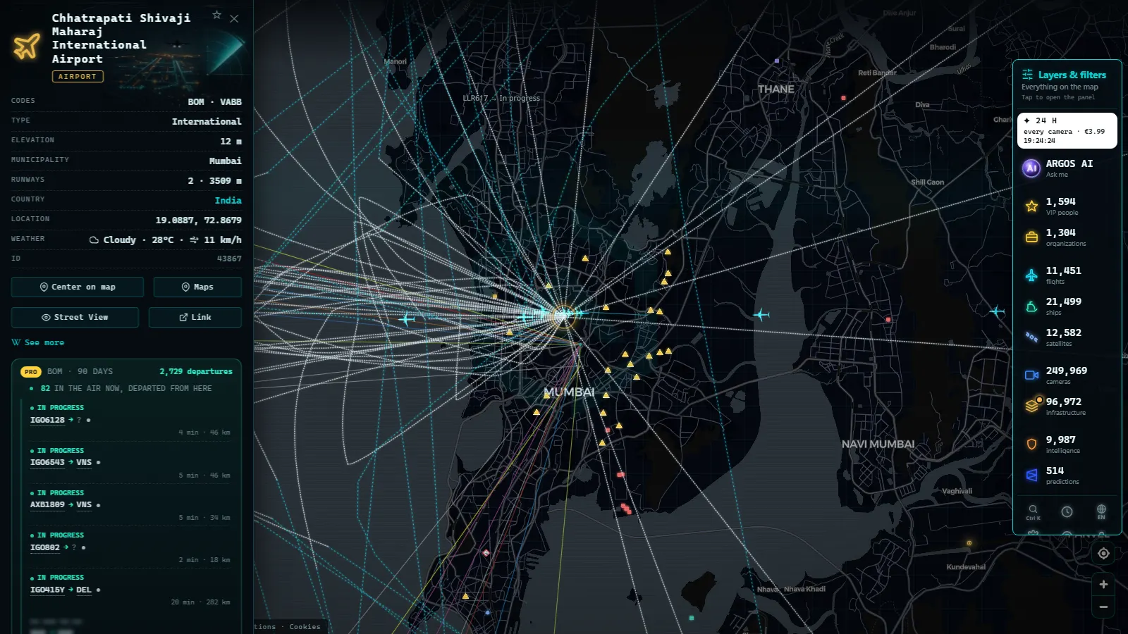
Chhatrapati Shivaji Maharaj International, BOM and VABB, sits inside the city at Santacruz and Sahar, hemmed in by neighbourhoods on every side. Its runways cross, so only one can work at a time, and the consequence shows on the map rather than in any timetable: at peak hours arrivals stack up over the Arabian Sea, turning offshore while departures go out.
Mumbai is also the clearest case in India of air and sea sharing a frame. The two harbour entities in the catalogue, Bombay on the eastern waterfront and Jawaharlal Nehru Port across the water at Nhava Sheva, sit a short pan away from the runway, so container ships at anchor appear in the same view as the approach. The city guide, Mumbai live on the map, goes further into that overlap.
Hyderabad (HYD / VOHY), the one with cameras on the ground
Rajiv Gandhi International, HYD and VOHY, is at Shamshabad, well south of the city, and it is the only airport in this article with public street cameras nearby in the catalogue. They are city cameras in Telangana, not airport cameras, so they will never show you an aircraft on final. What they give you is the one thing a flight tracker does not: weather and light on the ground at the moment a flight is inbound.
North of the city the map gets busier than the civil airport. Begumpet, the old city field, is still active, and Hakimpet and Dundigal are military stations within a short radius. Aircraft working those circuits sometimes appear with no airline and no route, which is exactly what a training sortie looks like on ADS-B.
Chennai (MAA / VOMM), the coast, the port and the power behind it
Chennai International, MAA and VOMM, is at Tirusulam, and approaches run along the Bay of Bengal coastline, which makes it the easiest of the five to follow visually: aircraft track the shore before turning inland. The port entity, Madras, is the other half of the city's freight story and sits in the same view.
Chennai is also where the power layer earns its place. The coal plants at Ennore, north of the city, are why that stretch of coast is dotted with infrastructure markers instead of being empty.
Open the card on any of them and you get fuel type and position. Vallur and North Chennai Extension both burn coal, and both sit close enough to the northern approach that an inbound flight on the right heading passes over them.
Bengaluru (BLR / VOBL), Kempegowda and the old HAL field
Kempegowda International, BLR and VOBL, is at Devanahalli, a long way north of the city it serves, and the traffic pattern shows it: the early domestic bank leaves before most of Bengaluru is awake. Search for Kempegowda on the map and the card opens with both codes and the aircraft in range.
The second field is the interesting one. HAL Airport, inside the city at Vimanapura, no longer handles scheduled passengers but is still flown, mostly by Hindustan Aeronautics on test and delivery work. An aircraft that takes off, orbits for an hour and lands back where it started is normal there, and that loop is the clearest signature of a test flight anywhere on the map.
The five airports side by side
Codes first, because searching by code is faster than searching by city, and one thing to watch on each.
| Airport | IATA / ICAO | City (state) | What to look for |
|---|---|---|---|
| Indira Gandhi International | DEL / VIDP | New Delhi (Delhi NCR) | The long-haul wave after midnight local time |
| Chhatrapati Shivaji Maharaj Intl. | BOM / VABB | Mumbai (Maharashtra) | Aircraft holding offshore while the runways alternate |
| Kempegowda International | BLR / VOBL | Bengaluru (Karnataka) | The early morning bank of domestic departures |
| Rajiv Gandhi International | HYD / VOHY | Hyderabad (Telangana) | Unlabelled traffic from the fields north of the city |
| Chennai International | MAA / VOMM | Chennai (Tamil Nadu) | Approaches tracking the Bay of Bengal shoreline |
| Noida International | DXN / VIND | Jewar (Uttar Pradesh) | Whether anything is moving above it yet |
Military airfields on the India airports live map
Military traffic is its own layer, and it is blunt about its limits. At the last count the map was tracking 101 aircraft flagged as military worldwide at the same time, a thin slice of everything in the air. Over India that usually means a handful at most: transports, trainers out of Hakimpet or Dundigal, the occasional tanker.
What you see is what broadcasts. Indian military aircraft are under no obligation to transmit ADS-B and combat types generally do not, so an empty sky over a known air base means nothing at all. The fields themselves do appear, as airport entities with their ICAO codes, which is the genuinely useful part: you learn where they are, not what flew today. The same pattern holds elsewhere in Asia, as the Philippines airports live map shows over Luzon.
How to use the India airports live map
Three habits make the difference. First, search by code: typing VOHY goes straight to one card, while typing a city name returns every entity in it. Second, zoom in before judging coverage, because at country level the markers cluster and it looks like nothing is moving. Third, treat estimated positions as estimates: of the flights on the map at the last count, 3,391 were calculated between receptions rather than received live, and over the interior of the subcontinent that share rises.
The camera layer is a separate thing, and a thin one here: 200,000+ cameras in the catalogue worldwide (count as of September 2026), very few of them in India. Treat any Indian camera as a bonus, not as coverage. The general guide to watching aircraft in real time explains how to read altitude, callsign and squawk once a card is open.
The points cited here
50 km
What you won't see
- Frames, not video. Camera cards refresh a still image on a cycle. No continuous stream, no sound, no rewind, so whatever passed between refreshes never existed for you.
- No faces and no number plates. Public street cameras are framed and resolved so that people and plates cannot be read, and nothing on this map changes that.
- No ground movements. Airport cards do not carry gates, stands, runway in use, delays or taxiing aircraft. If it is not broadcasting a position in the air, it is not there.
- Nothing with its transponder off. Military and some private aircraft do not broadcast, and over India that is the rule rather than the exception for anything in uniform.
- Patchy nights. Street cameras go dark or grainy after sunset, and a card that looks broken at 02:00 local time is usually just an unlit street.
Frequently asked questions
Is the India airports live map free to use?
Yes, and it needs no account. Open the map, search for Delhi, Mumbai, Hyderabad, Chennai or Bengaluru by name or by code, and the airport card opens with its IATA and ICAO identifiers, its position and the aircraft in range at that moment. There is no paywall on the airport layer and no registration step before you can pan around.
Which airports in India are the busiest on the live map?
Delhi (DEL / VIDP) carries the most traffic, followed by Mumbai (BOM / VABB), Bengaluru (BLR / VOBL), Hyderabad (HYD / VOHY) and Chennai (MAA / VOMM). Density on the map changes by the hour, so the ranking you see at 03:00 local time, during the long-haul wave out of Delhi, is not the one you see at midday.
What is the difference between the IATA and ICAO codes of Indian airports?
IATA codes are the three letters printed on a boarding pass (DEL, BOM, HYD, MAA, BLR). ICAO codes are four letters used in flight plans and by air traffic control, and every Indian one begins with V: VIDP, VABB, VOHY, VOMM, VOBL. Searching by the ICAO code is the faster route to a single airport card.
Can you see Indian military airfields on the map?
The airfields yes, the aircraft mostly no. Stations such as Hakimpet, Dundigal and Begumpet near Hyderabad appear as airport entities with their codes and their position, because a location is public information. Military aircraft are not required to broadcast ADS-B, so an empty sky over a base tells you nothing about what actually flew that day.
How current are the aircraft positions shown over India?
Live, with one caveat. Positions come from ADS-B receivers, and where ground coverage is thin the map shows a position calculated between the last two receptions. Of the 11,486 flights tracked at the last count, 3,391 were estimated rather than freshly received, and they are flagged as such instead of being passed off as live.
- Iraq Airports Live Map: Baghdad, Erbil, Kirkuk and Basra
- Colombia Airports Live Map: What El Dorado, MDE and CLO Show
- Data Center Map: 4,072 Sites and What You Can Actually See
- South America Airports Live Map: Bogotá, Lima, Buenos Aires
- Data centers in Mexico: the 4 cities and what you can check
- Data Centers in South America: Caracas, Lima, Buenos Aires