Blog · Live flights
The World's Busiest Air Routes (and Why Planes Don't Fly in Straight Lines)
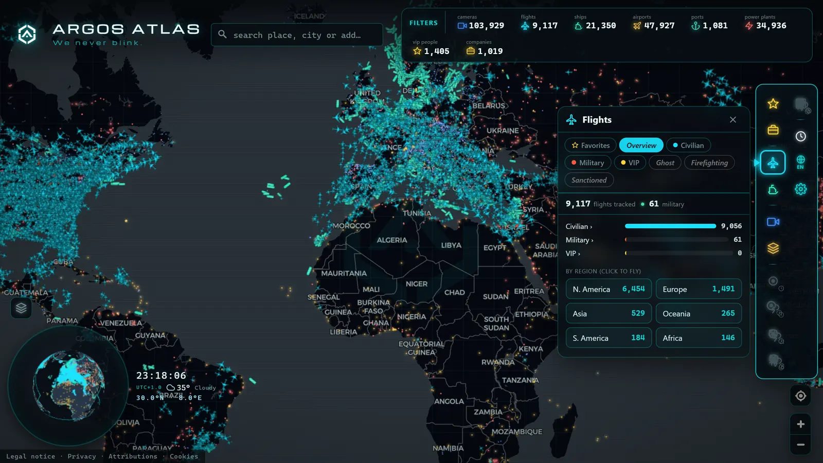
Open a flight-tracking map and trace the path of a plane crossing the Atlantic with your finger. Something looks off: instead of heading straight to its destination, the route draws a vast arc curving toward Greenland. Has the crew made a wrong turn? Not at all. That curve conceals one of geography's most elegant lessons, and it is the perfect entry point for understanding the world's busiest air routes, where traffic concentrates, why corridors are where they are, and what invisible forces bend the trajectories of thousands of flights every single day.
The Map Mystery: Why Does the Route Curve?
Start with the arc. The short answer: the Earth is a sphere and your map is flat, and something is lost in translation.
On a sphere, the shortest distance between two points is not the straight line you see on a map but a great-circle arc, the path you would trace if you stretched a piece of string across a globe between your origin and destination. When that arc is projected onto a flat map (which stretches and distorts areas far from the equator) it appears as a curve, often bowing dramatically toward the poles.
That is why a flight between Western Europe and the US East Coast appears to swing up toward Greenland: it is not detouring, it is taking the actual shortcut. The "straight" line on the map would, on the sphere, be a longer path. The same principle explains why many flights between Europe and East Asia overfly surprisingly high northern latitudes.
If you are curious about how maps turn a sphere into a rectangle (and what they sacrifice in the process) the mechanics are covered in detail in how online maps work. The projection your screen uses explains half the "oddities" you notice in flight paths.
What Else Bends a Route Beyond Geometry
The great circle is the starting point, but almost no flight follows it exactly. Acting on that ideal baseline are several forces that stretch, shift, and twist real-world trajectories:
- Jet streams: high-altitude rivers of wind that blow broadly west-to-east at mid-latitudes, typically between 7 and 12 kilometres above sea level. A plane riding one gains significant ground speed; one flying head-on into it loses it. That is why outbound and return legs between the same city pair look different on a map: eastbound flights chase the jet stream while westbound flights dodge it. A New York–London service typically lands 30 to 60 minutes faster than the return journey.
- Restricted or closed airspace: military zones, security-restricted areas, or entire regions that commercial traffic avoids. When an airspace closes (due to conflict, political decision, or a volcanic ash cloud) flows reorganise around the gap, sometimes adding hours of flight time. The 2022 closure of Russian airspace to most Western carriers rerouted dozens of Europe–Asia services significantly, extending flight times and operating costs.
- ETOPS rules for twin-engine aircraft: two-engine airliners operating oceanic routes must remain within a certified maximum diversion time from an adequate airport throughout the flight (60, 120, or 180 minutes depending on certification). This constraint shapes oceanic and remote routes, which are designed as chains of reachable alternates.
- Day-of weather: convective storms, forecast turbulence, volcanic ash, or icing conditions force tactical deviations that the original flight plan did not include.
The result is that every route is a compromise between geometry, wind, regulation, and weather. The trajectory you see on the map is the solution to that multi-variable problem for today; tomorrow's solution may look quite different.
Airways and Corridors: The Sky's Invisible Motorways
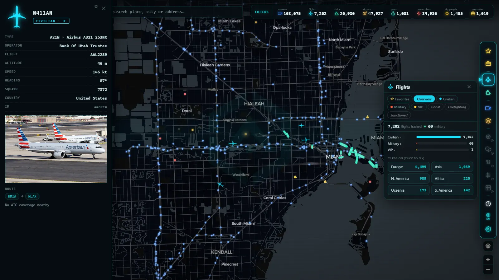
The sky is not an open field where each aircraft picks any direction it likes. It is structured into airways, predefined routes that link five-letter navigation waypoints, forming a network that resembles an invisible road map at altitude. Flights follow these sky motorways for much of their journey, which lets air traffic control organise and safely separate traffic flows.
The most fascinating case is the North Atlantic Track System (NATs). Every day, a set of parallel tracks is published, calculated according to the forecast jet stream position. If the jet shifts northward, the tracks shift with it. The result is that the transatlantic "motorway" changes location daily, and the hundreds of flights that use it queue up in those lanes like cars in rush-hour traffic, separated by strict rules on longitudinal distance, lateral spacing, and altitude.
The sky that looks empty is, in reality, full of invisible lanes that are redrawn every day according to which way the wind blows.
Alongside classic airways, modern navigation increasingly allows direct routing outside traditional waypoint networks, especially in advanced airspace environments such as those managed by Nav Canada or NATS in the UK. But the great corridors remain, and on a live map they are recognisable at a glance: look where the aircraft align themselves.
From the ARGOS ATLAS channel.
Where Global Traffic Concentrates
Now for the headline question: which routes carry the most flights? Exact rankings shift by year and by metric (seats offered, flights operated, passengers carried) so the honest approach is to describe patterns, which are very stable.
East Asian Domestic Routes
The city pairs with the highest flight counts in the world are almost always short domestic routes in East Asia: connections between major capitals and nearby cities or islands, served by dozens of daily frequencies on large aircraft. These are corridors where the aircraft functions almost like a continuous shuttle service. The Jeju–Seoul Gimpo route in South Korea, the Tokyo–Sapporo and Tokyo–Fukuoka corridors in Japan, and the Taipei–connections in Taiwan regularly feature at the very top of international traffic rankings, ahead of far longer intercontinental services.
The North Atlantic Funnel
Between Europe and North America, traffic is compressed into the North Atlantic corridor: hundreds of daily crossings concentrated in the day's published tracks. Viewed on a live map during the European evening, the ocean fills with a procession of lights moving in parallel toward the west, aircraft departing from London Heathrow, Amsterdam Schiphol, Frankfurt, Paris Charles de Gaulle, and Dublin, all funnelling into the same narrow band of sky. During the American pre-dawn, the tide reverses eastward. New York JFK, Newark, Boston, Chicago, and Toronto feed the return flow. It is one of the most hypnotic spectacles in flight tracking.
European Shuttle Routes
Europe repeats the high-frequency pattern at shorter scales: pairs of major cities connected by flights departing almost every hour during business days. The London–Amsterdam, London–Dublin, Paris–London, and Frankfurt–Munich corridors carry enormous traffic over distances that high-speed rail now increasingly contests. Even so, the density of these services remains remarkable, double-digit daily rotations between city pairs that would fit comfortably in a two-hour train journey.
Gulf Hubs and Asia-Pacific Flows
The great Gulf hubs (Dubai, Doha, Abu Dhabi) act as global connecting nodes, funnelling traffic between Europe, Africa, South Asia, and Oceania through a single bottleneck. On a live map they are unmistakable: a constant radiating star of routes in every direction, departing and arriving around the clock. Similarly, flows between Southeast Asia and Australia concentrate through Singapore and Kuala Lumpur, while Los Angeles acts as the Pacific gateway on the North American side.
What Air Traffic Reveals About Economics and Geopolitics
Air routes are an electrocardiogram of the world. Where there is commerce, tourism, and diaspora, flights multiply; where something breaks down, they disappear. Watching corridor evolution is reading current events by another means:
- Routes that appear when two economies begin to integrate: a new direct service between two cities often anticipates or consolidates a commercial relationship.
- Routes that vanish when demand collapses, a country becomes isolated, or a crisis makes operations economically unviable.
- Detours that become permanent when airspace closes due to conflict: flows divert, and with them come longer flight times and higher costs felt by passengers and airlines for years afterward.
- Seasonal tides made visible: tourist corridors that swell in summer and thin in winter, readable as annual rhythms, Caribbean routes bulging from December through March, Mediterranean routes peaking in July and August.
Analysts and aviation enthusiasts who track air traffic (much like those who follow military aircraft movements in real time) learn to interpret these changes with care. A new route or a detour is a data point, not a headline. But as a background thermometer, few things reveal the state of the world as reliably as its flight map.
Watch It Live: Corridors Draw Themselves
Everything above can be studied in a textbook, but there is a far more direct way to understand it: open a real-time flight map and let the corridors draw themselves. Zoom out to a global view and the patterns emerge, the parallel streams of the North Atlantic, the dense swarms above major hub airports, the rivers of traffic flowing between cities bound together by business or tourism.
In Argos Atlas you can watch these flows live on the world map, with dashboards by region that make it easy to compare where activity is concentrating at any moment of the day. It is the difference between reading about the great circle and seeing, with your own eyes, dozens of aircraft tracing it simultaneously toward North America.
Once you have spotted a corridor, the natural next step is to zoom in to the detail: pick a specific aircraft and put a name to it. The article on how to identify an aircraft by its registration and callsign gives you the tools, and the guide on how to watch planes in real time covers everything else.
'Busiest' Isn't One List: Flights, Passengers, and Corridors Mean Different Things
Search for the busiest flight route in the world and you'll find three different answers, because "busiest" gets measured three different ways, and each one points to a different kind of route.
The first measure is frequency: how many scheduled departures connect two airports each day. By this measure, the busiest routes are almost never the ones people picture first. They tend to be short domestic shuttles, a single city pair inside one country, flown by narrow-body aircraft making ten, fifteen, sometimes twenty rotations a day. A commuter hop of a few hundred kilometers can rack up more individual flights per year than any transoceanic pairing, simply because the aircraft turns around fast and the route never stops.
The second measure is passenger volume: how many people actually travel the route per year, independent of how many flights it takes. Here the ranking flips. Long-haul connections between major hub airports (the kind linking Western Europe with the Gulf, or North America with East Asia) carry far more people per flight on wide-body aircraft, even if they only depart once or twice a day. One widebody rotation can move as many passengers as a dozen short-haul hops combined, which is part of why the biggest airports in the world are built around hub-and-spoke long-haul traffic rather than shuttle frequency.
The third measure isn't a city pair at all: it's a corridor. A busy air corridor is a shared stretch of airspace, like a track across the North Atlantic or the lane linking Western Europe with the Gulf, used at the same time by flights heading to dozens of unrelated final destinations. A corridor can look saturated on a live map even when no single route inside it is a record holder, because the traffic is pooled from flights with completely different origins and endpoints that happen to converge into the same lane.
| Measure | What it counts | Typical winner |
|---|---|---|
| Frequency | Departures per day | Short domestic shuttle |
| Passenger volume | People carried per year | Long-haul hub to hub |
| Corridor | Aircraft sharing one lane | A shared track, not one route |
None of the three is "the" busiest route on its own: they're three different questions wearing the same word. Watching the live map for a few minutes makes the difference obvious: corridors thicken with traffic that never shares an origin or a destination, while the busiest single routes stay invisible unless you already know where to zoom.
Conclusion
The world's busiest air routes are not arbitrary lines: they are the result of spherical geometry, wind blowing ten kilometres above sea level, the regulations that order the sky, and the economics that decide which cities deserve an air bridge. Once you understand those forces, every curve on the map stops being a mystery and becomes information.
The best way to lock all of this in is to see it in motion: open the map on ARGOS ATLAS, zoom out, and watch how the corridors trace themselves across the oceans and continents. The sky has been telling you how the world works all day long, you just need to look at it with the right set of keys.
Frequently asked questions
What is the world's busiest air route?
Rankings shift depending on the year and the metric used, but the city pairs with the highest flight counts are typically short domestic routes in East Asia, connections between major capitals and nearby cities or islands served by dozens of daily frequencies. Intercontinentally, the North Atlantic corridor between North America and Europe is the heaviest transoceanic route system in the world.
Why do flight routes look curved on a map?
Because the Earth is a sphere and the map is flat. The shortest distance between two points on a sphere is a great-circle arc, which appears as a curve when projected onto a flat surface, especially on long, high-latitude routes. The aircraft is flying the straightest possible path; it is the map projection that makes it look curved.
What are airways?
Airways are predefined routes that structure airspace, invisible motorways in the sky that connect navigation waypoints. They let air traffic control organise and safely separate traffic flows. Their most dynamic version is the North Atlantic Track System, a set of parallel transatlantic corridors recalculated daily based on forecast winds.
Why does a flight sometimes take a huge detour?
The most common reasons are: riding or avoiding the jet stream (which can more than compensate for extra miles), circumnavigating restricted or closed airspace, avoiding severe weather, or (on oceanic routes with twin-engine aircraft) staying within ETOPS-certified range of a diversion airport. What looks like a detour on the map is usually the most efficient or the only permitted route that day.
How can I watch live air traffic corridors?
Open a real-time flight tracking map such as ARGOS ATLAS, zoom out to a global view, and let the corridors emerge by themselves. The parallel streams of the North Atlantic, the dense clusters over major hubs, and the rivers of traffic between economically linked cities all become visible within seconds.
- Track Flights in Real Time Over Mexico: A Complete Airspace Guide
- Live Flights Over Argentina: Ezeiza, Aeroparque and the Patagonian Airports
- Live Flights over Australia and Oceania: Qantas, Virgin Australia and Trans-Pacific Routes
- Live Flights Over Japan: ANA, JAL and the World's Busiest Domestic Routes
- Live flights over India: tracking IndiGo, Air India and SpiceJet in real time
- Live Flights Over Canada: Air Canada, WestJet and the Routes of the Great North