Blog · Live flights
Live flights over India: tracking IndiGo, Air India and SpiceJet in real time
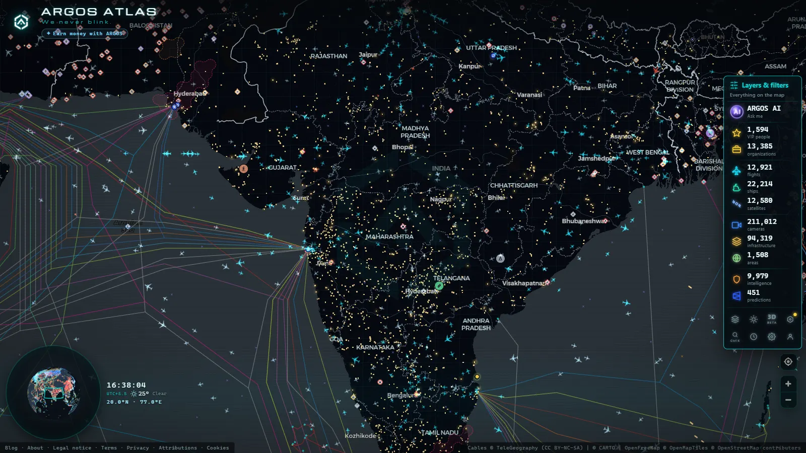
India's skies: one of the world's fastest-growing aviation markets
In less than two decades, India has transformed from a country where air travel was a luxury for the few into one of the most active aviation markets on the planet. A rising middle class, vast distances that make flying far more practical than ground transport, and booming domestic tourism have together pushed Indian aviation into a new era. During peak hours, hundreds of aircraft crisscross the subcontinent simultaneously, connecting megacities, regional hubs and tourist destinations in a constantly shifting web of routes.
ARGOS ATLAS makes that web visible. The interactive map shows every active flight over India in real time, with each aircraft displaying its registration, airline, altitude and speed, all accessible from any browser, without any installation required.
---
The three major players in Indian aviation
IndiGo: the low-cost carrier that reshaped the market
IndiGo is not just India's largest airline, it is one of the fastest-growing low-cost carriers in all of Asia. Founded in 2006, it captured more than 55% of the domestic market in under two decades, a pace of growth that has few parallels in commercial aviation history. Its fleet, centred on the Airbus A320neo and A321neo family, spans routes from major hubs like Delhi and Mumbai all the way to Tier 2 and Tier 3 cities such as Patna, Guwahati and Coimbatore.
IndiGo's formula has been straightforward: high frequencies, competitive fares and punctuality rates that consistently outperform the industry average. On the ARGOS ATLAS map, flights coded 6E (its IATA designator) tend to dominate at any given hour over the subcontinent. Watching their distribution reveals which corridors are fully mature and which are still in the growth phase.
Air India: a flag carrier under new management
Air India's story is inseparable from India's own. Founded by J.R.D. Tata in 1932, nationalised after independence, and privatised again by the Tata Group in 2022 after decades of state ownership, the airline is now in the middle of one of the most ambitious transformations in its history. It placed one of the largest aircraft orders ever recorded (hundreds of Boeing 737 MAX, 787 Dreamliner and Airbus A350 jets) with the clear goal of modernising its fleet and reclaiming a position among Asia's leading international carriers.
Air India flights carry the AI code and cover a wide mix: domestic routes, Gulf connections, European services and long-haul routes to North America and Southeast Asia. On the ARGOS ATLAS map, Air India shows the highest density on the Delhi-Mumbai trunk route and on international departures heading westward from IGIA Delhi.
SpiceJet: regional presence through turbulent times
SpiceJet has occupied the role of India's second major low-cost carrier for most of the past decade, though financial difficulties have periodically constrained its operations. It continues to serve relevant domestic routes, particularly in the ultra-budget segment, and plays a disproportionately important role on regional connections to smaller cities. Its IATA code is SG and its fleet includes Boeing 737 jets and Bombardier Q400 turboprops for thinner regional routes.
On the map, SpiceJet flights often reveal connections that the larger carriers do not fully cover, especially in the northeast of the country where airport infrastructure is limited and demand does not yet justify high-frequency jet services.
---
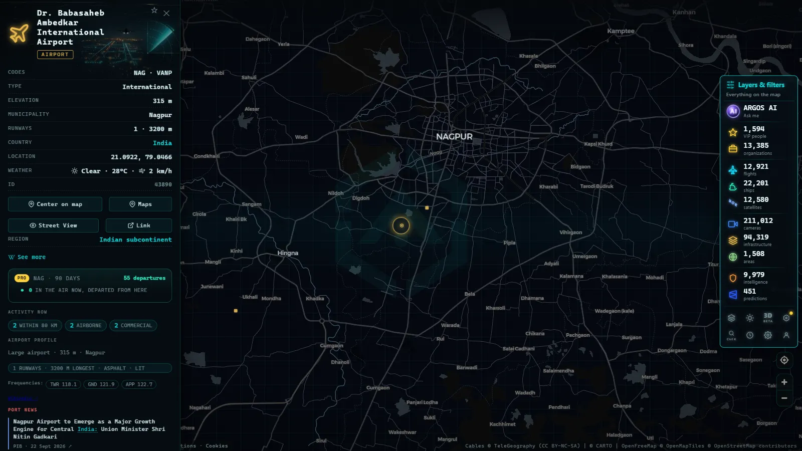
The major airports: understanding the hubs
IGIA Delhi, the northern gateway
Indira Gandhi International Airport (IATA: DEL) is India's busiest airport and one of the principal hubs for all of South Asia. Under normal conditions it processes over 70 million passengers annually and functions as the main interchange between the subcontinent and destinations in Europe, Central Asia and the Americas.
Terminal 3, opened in 2010 for the Commonwealth Games, remains one of the most modern passenger facilities in the region. In ARGOS ATLAS, DEL functions as a visual convergence point: short-haul domestic flights arrive and depart in tight sequences while long-haul widebody jets form their own slower-paced layer of traffic. The contrast between the two is clearly legible on the map during morning and evening peaks.
CSIA Mumbai, the financial hub
Chhatrapati Shivaji Maharaj International Airport (IATA: BOM) serves India's most populous city and its commercial capital. The airport has long operated under severe capacity constraints (expanding a major hub within one of the world's densest urban environments is a formidable challenge) and Mumbai has been developing the new Navi Mumbai International Airport on greenfield land to eventually relieve pressure on BOM.
The traffic mix at Mumbai is distinctive: high-frequency domestic services, extremely dense Gulf connections driven by a large diaspora of migrant workers, and European and North American long-haul flights that often route through intermediate hubs in the Middle East.
Kempegowda Bangalore, the technology engine
Kempegowda International Airport (IATA: BLR) in Bangalore is third in passenger volumes and has been the fastest-growing major airport in India for several years. Its position at the heart of India's technology sector makes it the preferred hub for business travellers and a key regional gateway for South India. Unlike Mumbai, Bangalore has had room to expand: a second runway and new terminal are at various stages of development.
On the ARGOS ATLAS map, BLR generates a steady outbound stream toward Delhi, Mumbai, Hyderabad and Chennai, along with international direct services to Singapore, Dubai and London.
---
From the ARGOS ATLAS channel.
What the live map reveals about Indian aviation
"A real-time flight map is not just a tracking board, it is a moving diagram of a country's economy and mobility."
Watching Indian airspace on ARGOS ATLAS over the course of a day surfaces patterns that aggregate statistics rarely capture:
- The Delhi-Mumbai corridor is the country's vertebral axis. With dozens of daily departures operated mainly by IndiGo and Air India, it ranks among the busiest air routes in Asia and the world.
- Northeast India (Assam, Meghalaya, Arunachal Pradesh) depends critically on air connectivity. The scarcity of viable road and rail links elevates airports like Guwahati (IATA: GAU) and Imphal (IMF) to a strategic importance out of proportion to their size.
- Gulf routes are extraordinarily dense. India is the world's largest recipient of remittances, and a significant portion of the diaspora commutes regularly between the subcontinent and the UAE, Saudi Arabia, Kuwait and Bahrain.
- Seasonality is visible in real time. During major festivals such as Diwali or summer school holidays, traffic spikes are immediately apparent as a denser layer of aircraft appears over the map compared to quieter mid-week periods.
---
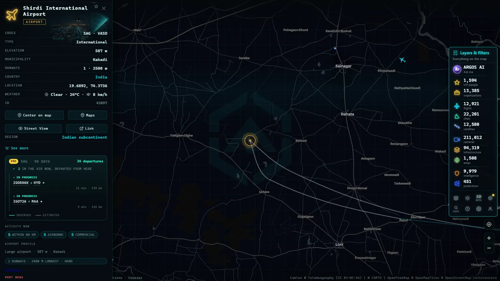
How to explore India's airspace on ARGOS ATLAS
Opening ARGOS ATLAS and navigating to the Indian subcontinent takes seconds. Each aircraft icon on the map is interactive: clicking it brings up a data panel with flight number, operating airline, origin, destination, current altitude in feet, speed in knots and heading.
Positions update in real time using ADS-B data, the automatic dependent surveillance-broadcast system that modern commercial aircraft transmit continuously. Coverage over India is strong on the main domestic and international routes, though it can be more intermittent over mountainous terrain or open ocean sectors.
Readers interested in adjacent airspaces will find additional context in the articles on flights over Asia-Pacific and the world's busiest airports, which include comparative traffic data and hub analysis.
---
Outlook: India's role in 21st-century global aviation
Indian aviation faces real structural challenges: chronic airport congestion, exposure to imported fuel costs, complex regulatory layering and a monsoon season that disrupts operations across the country every year. But the underlying trends point in one direction. India now has over 150 operational airports, the government has committed to connecting smaller cities through the UDAN regional connectivity scheme, and Indian carriers have placed aircraft orders totalling thousands of jets over the next two decades.
By some projections, India could overtake the United States as the world's second-largest aviation market within the next ten years. Watching that growth unfold from the ARGOS ATLAS map is not merely a geographic exercise, it is a front-row view of one of the most consequential mobility stories of the century.
Frequently asked questions
Which airline has the most domestic flights in India?
IndiGo dominates the Indian domestic market with over 55% market share, operating hundreds of daily flights between major and secondary cities across the country.
How can I track an Air India flight in real time?
With ARGOS ATLAS you can see the live position of any Air India flight on the map, including altitude, speed and estimated route.
What is the busiest airport in India?
Indira Gandhi International Airport (IGIA) in Delhi is the busiest, followed closely by Chhatrapati Shivaji Maharaj International Airport in Mumbai.
- Live Flights Over Canada: Air Canada, WestJet and the Routes of the Great North
- Flightradar24 Alternatives: Free Flight Trackers Compared
- Live Flight and Ship Tracker: Planes and Ships on One Map
- How to Track Planes in Real Time: A Guide to Online Flight Radar
- What is ADS-B: the technology that makes flight tracking possible
- Why Some Aircraft Don't Appear on Online Flight Trackers