Blog · Critical infrastructure
Iraq Airports Live Map: Baghdad, Erbil, Kirkuk and Basra
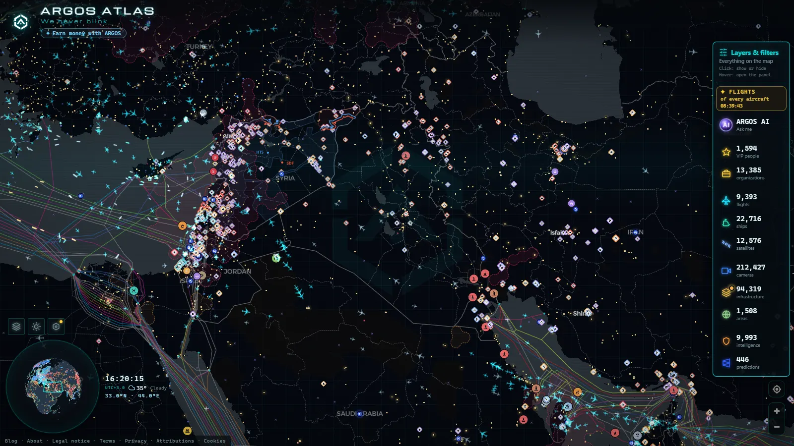
Iraq's airspace is free to watch live on ARGOS ATLAS with no registration: Baghdad International Airport (ORBI / BGW) and Erbil International Airport (ORER / EBL) have their own cards, Al Najaf adds the pilgrimage traffic, and the flight layer carries 10,398 flights at the last count, 68 of them flagged as military. What you will not find is a camera pointed at a Baghdad taxiway, because no public feed offers one.
This is not a ranking of the country's biggest airports. It is a guide to what is worth opening: which cards carry real data, which cities you follow by aircraft instead of by card, when something actually moves, and where ADS-B reception thins out over the western desert until a flight seems to vanish in mid route.
The essentials, in 20 seconds
- Baghdad International Airport (ORBI / BGW) shares its field with New Al Muthana Air Base, so civil and military movements live on the same card, free to open without an account.
- Erbil International Airport (ORER / EBL) is the northern gateway, and the card most people open first when news breaks in Kurdistan.
- 47,927 airports sit in the worldwide layer, which is why Kirkuk, Basra and the desert strips exist as points even with nothing flying.
- 3,008 of the 10,398 tracked flights carry an estimated position instead of a received one: that is the coverage gap, made visible.
- 56 GPS interference zones are mapped, and jamming in this region is what makes a track stutter, jump or freeze with no diversion behind it.
What the Iraq airports live view actually gives you
The map draws two different things and it pays to keep them apart. The first is the airport point: a card with the official name, the ICAO and IATA codes, the position and the basic geography of the field. Those come from a layer of 47,927 airports worldwide, so every strip in the country is there whether or not anything lands on it. The second is live aircraft, built from ADS-B broadcasts, with altitude, heading and, when it can be worked out, a destination.
What follows matters: a busy card is not a busy airport, it is an airport with aircraft transmitting nearby. In Iraq that distinction counts for more than in Europe, because reception is uneven and much of the military traffic stays silent. If you want the mechanics of how the aircraft layer is assembled, the guide to watching planes in real time walks through it.
Baghdad International Airport: one field, two identities
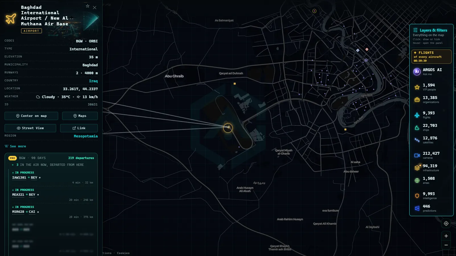
The card is named Baghdad International Airport / New Al Muthana Air Base, and that is the single most useful fact about it. The civil terminal west of the city and the air base share the same field, so what looks like an ordinary international airport is also a military one. Civil movements are what you will see drawn: Iraqi Airways as the home carrier, the recurring Gulf and Turkish names, and night freight.
Open it and read the approach tracks rather than the airport itself. Arrivals tend to line up from the south and southeast, while departures towards Europe climb out to the northwest across Anbar, which is exactly where reception starts to thin. When the region escalates and Iraqi airspace closes, this card empties within minutes, and that emptiness is the story.
From the ARGOS ATLAS channel.
Erbil International Airport: the northern gateway
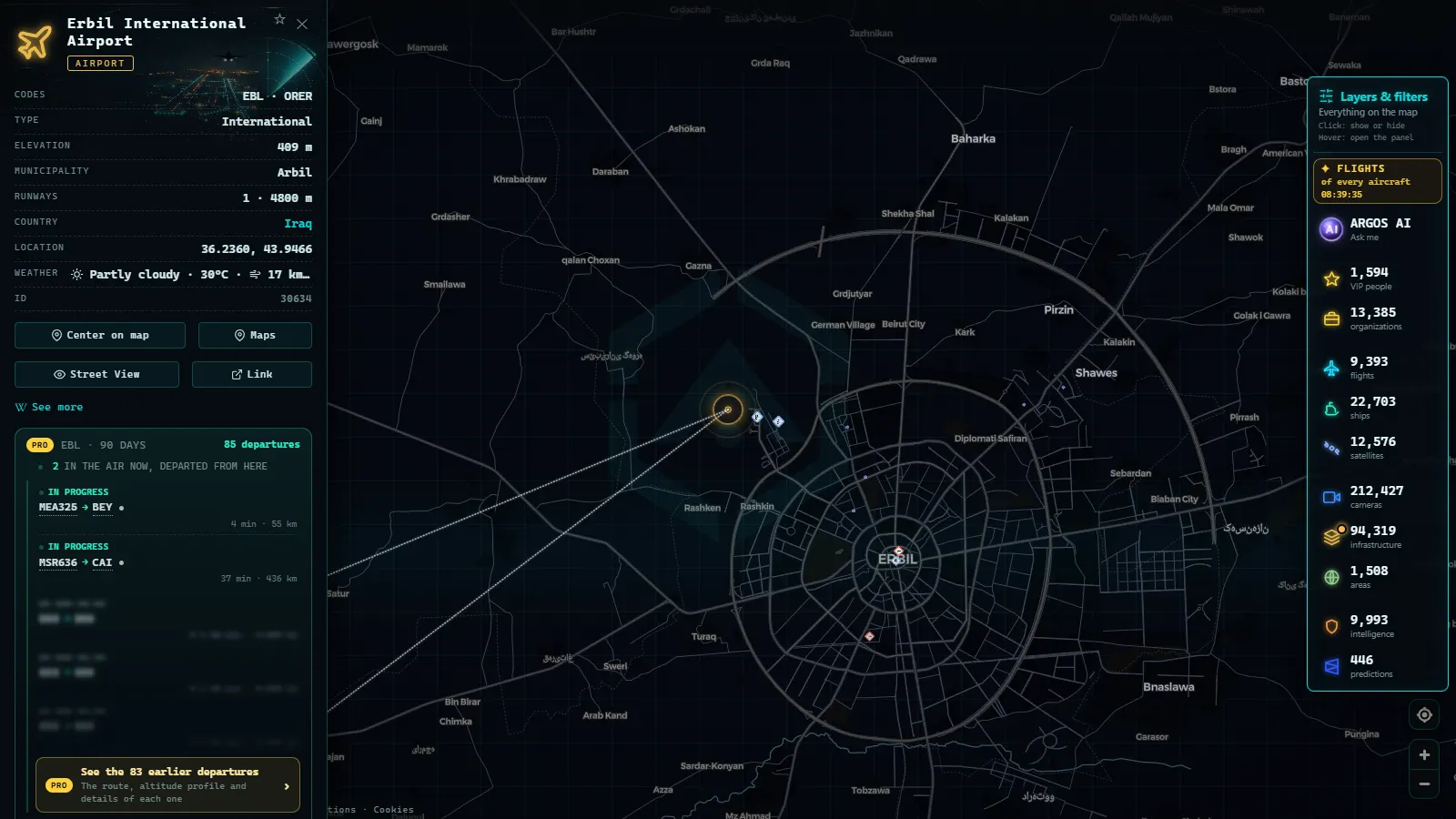
Erbil International Airport (ORER / EBL) is the card people open when something happens in Kurdistan, and it is also the most legible one. Its runway takes wide-body freighters, its traffic leans on regional carriers and charters, and the field sits close enough to coalition activity that what shows up here usually reflects what the region is doing.
Two habits pay off. First, look for cargo outside schedule hours: a freighter on the ground at Erbil in the small hours says more about a humanitarian or governmental push than a headline does. Second, compare it against Baghdad in the same session, because when one card thins out and the other does not, you are looking at a local restriction rather than a national one. The gas-fired plants beside the city are on the same map if you want ground context.
Najaf, Kirkuk and Basra: follow the aircraft, not the card
Al Najaf International Airport is the pilgrimage airport, and it behaves like nothing else in the country: quiet for long stretches, then a burst of near-identical charters from Iran and the Gulf around the religious calendar. A cluster of short hops arriving at odd hours is almost always that.
Kirkuk International Airport (ORKK) and Basra International Airport (ORMM) work differently. The points exist, scheduled service is thin, and the honest advice is to follow the aircraft track instead of waiting for a card to tell you something. In the south the surrounding activity is often maritime: Khorramshahr, the port card at the top of this guide, sits on the Iranian bank of the Shatt al-Arab facing Basra, and the ship layer around it (21,289 ships drawn at the last count) reports on the corridor better than the airport does.
Everything named so far
50 km
Who flies over Iraq: civil, cargo and military
Three populations share this sky and they behave differently. Civil scheduled traffic is the visible majority, concentrated on Gulf and Turkish connections. Cargo is thinner but more revealing, because freighters fly when passenger aircraft do not. Overflight is the biggest group by count and the least local: Europe to Gulf transits cross at cruise level without touching an Iraqi field, and they are the first thing to go when restrictions come in.
Military is where honesty matters. Only aircraft that broadcast ADS-B are drawn, and the map flags 68 military flights worldwide at the last count, typically tankers and transports. Fighters and drones transmit nothing. The map also flags 342 sanctioned aircraft and 1,540 sanctioned vessels, which is the layer to check when a routing towards Iran looks odd. The country card carries World Bank series too, useful as structural background.
Iraq · Military spending
Iraq · Internet users
The hours when something actually moves
Traffic here is not spread evenly across the day. Early morning and late evening local time are the dense windows, because that is when the connections to Dubai, Doha, Istanbul and Amman are timed. The small hours belong to freight. Midday is genuinely quiet at both Baghdad and Erbil, so a first visit at 13:00 local can leave you convinced the map is broken when it is simply the flat part of the day.
Two more patterns are worth knowing. Pilgrimage charters at Najaf ignore all of the above and follow the religious calendar instead. And overflight is steadier than local traffic: at 03:00 local, most of the dots crossing the west of the country are long-haul transits that never touch Iraqi soil, which is why an empty western corridor at that hour is a signal rather than a lull.
Where ADS-B coverage falls apart over the desert
ADS-B reception needs a ground receiver within line of sight, and receivers follow people. Around Baghdad, Erbil and the southern oil belt there are enough. Over the western desert towards the Syrian and Jordanian borders, and at low altitude anywhere outside the cities, there are not. The numbers make it concrete: of 10,398 tracked flights, 3,008 carry an estimated position instead of a received one. A track that jumps, freezes or vanishes in mid route is usually that, not a diversion.
Interference is the second cause. The map keeps 56 GPS interference zones, and this is one of the regions where jamming and spoofing are routine, which means an aircraft can report a position that is wrong rather than missing. Treat one strange track as noise and only a pattern across several aircraft as a finding. The same caution applies next door, where the guide to what the map shows of Iran goes into detail.
Card by card, and what each one is good for
Four cards and one corridor cover most of what is worth watching in Iraqi airspace. The last column is the point of the table: what to actually look for once the card is open.
| Card | Codes | What flies there | What to look for |
|---|---|---|---|
| Baghdad International Airport | ORBI / BGW | Iraqi Airways, Gulf and Turkish carriers, night freight, a co-located air base | Approach tracks from the south, and sudden emptiness when airspace closes |
| Erbil International Airport | ORER / EBL | Regional carriers, wide-body freighters, government and relief charters | Cargo outside schedule hours, the clearest military-adjacent movement |
| Al Najaf International Airport | ORNI / NJF | Pilgrimage charters from Iran and the Gulf | Bursts of near-identical routings around religious calendar peaks |
| Kirkuk and Basra | ORKK / ORMM | Thin scheduled service, oilfield and state flights | Follow the aircraft track, not the card, to see if anything moves |
| Western overflight corridor | not applicable | Europe to Gulf transits at cruise level | An empty corridor is the finding: closure or mass diversion |
What you won't see
- No live cameras in Iraq. There is no public street or airport feed in the country, and the camera layer (200,000+ cameras catalogued, count as of September 2026) is concentrated elsewhere.
- No ground movements. No taxiways, stands or aprons: an aircraft appears when it broadcasts, not when it pushes back from a gate.
- No silent military traffic. Fighters, drones and most special mission flights transmit nothing, so an empty sky on screen is not an empty sky.
- No people. The map identifies aircraft, ships and places, never passengers, crew or faces.
- No timeline to rewind. You are watching now, alongside a conflict archive of 1,956 OSINT events over 90 days; there is no scrubber for an airport's past week.
- No official flight status. Gates, delays and cancellations come from the airline, not from a receiver on a rooftop.
A two-minute routine
Open the live map, search Baghdad, and read the card before the sky: codes, position, and the fact that it shares its field with an air base. Then zoom out until Erbil and Basra are both on screen and give it a minute, watching whether tracks are crossing the country or only sitting at the hubs. Finally look west: if the desert is empty and the corridor is empty too, something is closed.
If you came for a ranking instead, the round-up of the biggest airports in the Middle East covers the regional hubs, and what critical infrastructure means explains why airports, ports and power plants end up on the same public map.
Frequently asked questions
Is it free to watch Iraq airports live, and do I need an account?
Yes, free and with no registration. You open the map, find Baghdad or Erbil, and the card loads with its codes, position and the aircraft around it. No trial, no card, no login wall. The real limits are in the data, not in a paywall: what the receivers do not hear simply is not drawn.
Which Iraqi airports have their own card on the map?
Baghdad International Airport (ORBI), Erbil International Airport (ORER) and Al Najaf International Airport (ORNI) are the ones people actually open. Kirkuk International Airport and Basra International Airport exist as points inside a worldwide layer of 47,927 airports, but the useful signal there is the aircraft track rather than the card itself.
Why do flights disappear over the Iraqi desert?
Because ADS-B is line of sight and ground receivers cluster near cities. Over the western desert and towards the Syrian border there are few of them, so a position turns estimated or drops. Of 10,398 tracked flights, 3,008 carry an estimated position. Jamming adds its own stutter, with 56 interference zones mapped.
Can I see military aircraft over Iraq?
Sometimes, and rarely the interesting ones. Military flights that broadcast ADS-B appear flagged, 68 of them worldwide at the last count, usually tankers and transports. Fighters, drones and special mission aircraft normally transmit nothing at all, so an empty patch of sky is never proof that nothing is flying there.
What are the best hours to watch Iraqi airports?
Early morning and late evening local time, when the Gulf and Turkish connections cluster, plus the small hours for freight. Midday is genuinely quiet at both Baghdad and Erbil. During religious calendar peaks, Najaf fills with charters at odd hours, and that is the clearest seasonal pattern in the country.
- Colombia Airports Live Map: What El Dorado, MDE and CLO Show
- Data Center Map: 4,072 Sites and What You Can Actually See
- South America Airports Live Map: Bogotá, Lima, Buenos Aires
- Data centers in Mexico: the 4 cities and what you can check
- Data Centers in South America: Caracas, Lima, Buenos Aires
- Copper mines Chile Peru map: 4 live layers, and the blind spots