Blog · Live flights
How to Track Planes in Real Time: A Guide to Online Flight Radar
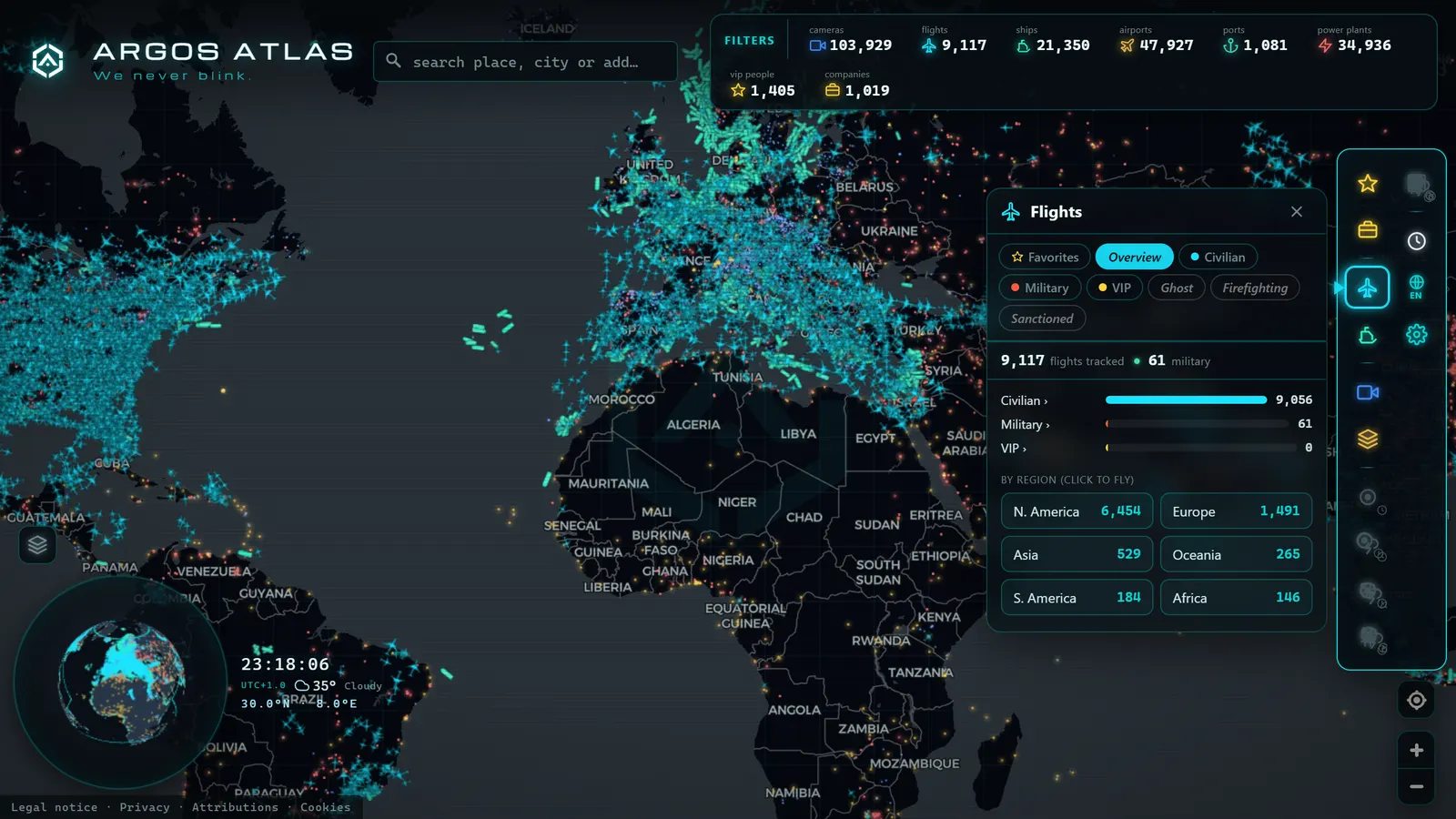
You look up, spot a contrail, and wonder where that plane is headed. The answer is one click away: anyone can now track planes in real time from a browser, complete with route, altitude, speed, and destination, thanks to what are commonly called online flight radars. They are free, require no aviation knowledge, and once you get the taste for it, they turn the sky into a readable map. This guide explains exactly what one of these viewers is, what information each aircraft shows, how to find a specific flight, and how to read the map the way an enthusiastic hobbyist would.
A "Radar" That Is Not Actually a Radar
Start by setting aside the name. Online flight viewers do not use radar: they listen to the signals aircraft broadcast themselves. Most commercial aircraft transmit their identity, position, and altitude by radio several times per second, in the clear. A worldwide network of receivers (many set up by hobbyists on balconies and rooftops in London, Chicago, Tokyo, and hundreds of other cities) captures those transmissions and forwards them to aggregators that plot them on a map.
The system behind that magic is called ADS-B, and understanding its basics will help you interpret everything else. You will find the full explanation in what ADS-B is and how it enables flight tracking. For now, hold on to the key idea: nobody is "illuminating" the sky with a radar beam. The aircraft announce themselves, and anyone with a receiver can hear them.
That distinction explains nearly every quirk you will encounter: why coverage is uneven, why some aircraft do not appear, and why data arrives with a slight delay.
What Information You See for Each Aircraft
Tap or click any icon on the map and a data card opens. These are the fields you will almost always find, and how to read them:
- Callsign: the identifier the flight uses when communicating with air traffic control. On commercial services it typically derives from the airline's ICAO code plus a number, and it often resembles the marketed flight number, though not always.
- Origin and destination: the departure and arrival airports, usually shown as three-letter IATA or four-letter ICAO codes.
- Altitude: aviation uses feet. A commercial aircraft in cruise is typically at 30,000-40,000 ft, roughly six to eight miles above the ground.
- Speed: ground speed, which in cruise generally sits between 460 and 590 mph depending on wind conditions.
- Heading: the direction the nose is pointing, in degrees.
- Aircraft type: the model, expressed in codes you will quickly recognise, narrowbodies for short-haul, wide-body twin-engine jets crossing oceans, regional turboprops.
After checking four or five flights you will start reading patterns: at this time of day, over this corridor, at this altitude, this can only be a transatlantic service or a feeder route into a major hub.
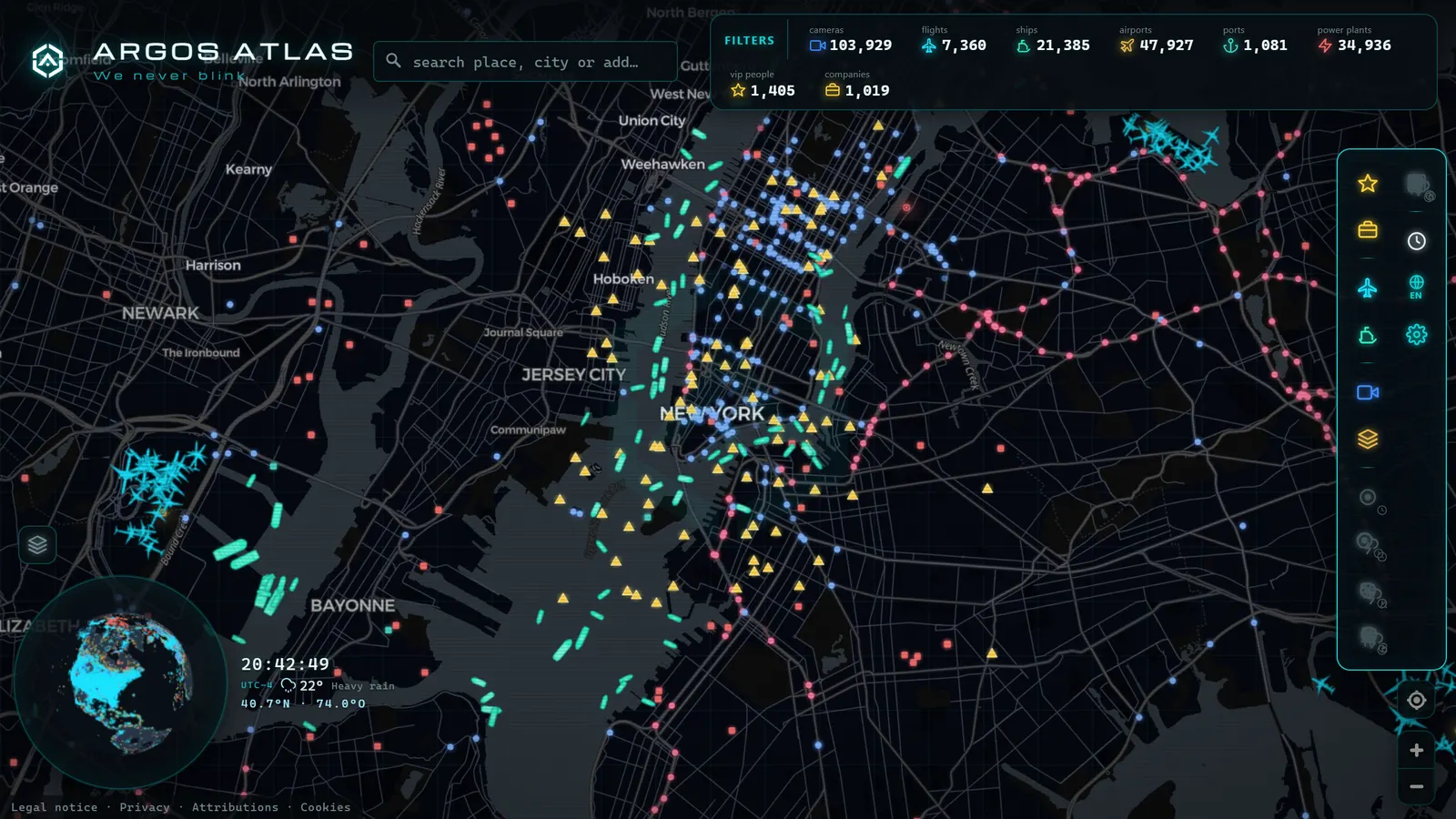
How to Find a Specific Flight
There are three ways to locate an aircraft on the map, depending on what data you start with.
By flight number. The typical case: you are meeting someone at the airport and want to see where their aircraft is. Enter the flight number in the viewer's search bar and the map centres on it, showing the route and estimated arrival time.
By registration. Every aircraft has a unique registration (visible on the fuselage) that identifies it for its entire operational life regardless of which flight it is operating. If you photograph an aircraft and read its tail number, you can look up which flight it is currently operating and exactly what type of plane it is.
By airport. Centre the map on an airport and watch the flows of arrivals and departures. This is the best way to understand how a major hub breathes: waves of arrivals, banks of departures, runways switching direction with the wind. Heathrow, JFK, Dubai, Frankfurt, each has its own rhythm once you learn to read it.
The difference between flight number, callsign, and registration confuses newcomers at first, but it follows a clear logic. We break it down fully in how to identify an aircraft by registration and callsign.
From the ARGOS ATLAS channel.
Reading the Map Like an Enthusiast
Once you have mastered individual data cards, the next level is reading the map as a whole. A live flight map tells stories if you know what to look for.
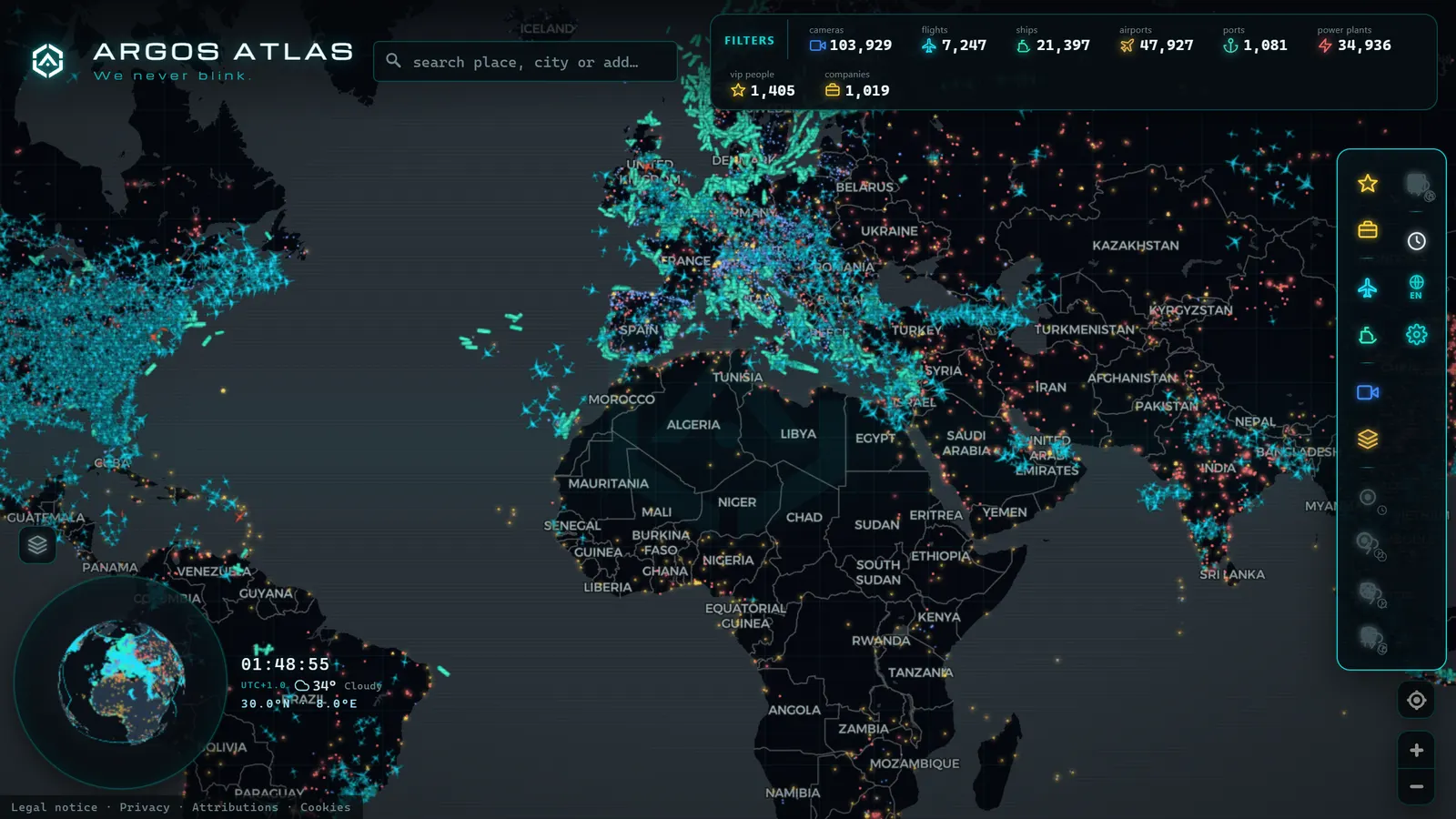
The rivers of the sky. Traffic does not spread evenly, it flows in corridors. You can see the main North Atlantic tracks between Europe and North America, chains of aircraft aligned toward major hubs, and densely packed lanes above strategic choke points like the Strait of Gibraltar or the English Channel. These are the permanent airways, drawn live.
Holding stacks. When an airport cannot absorb arriving traffic (due to weather, congestion, or an incident) aircraft circle in oval racetrack patterns called holds. On the map they are unmistakable: perfect ovals stacked near the airport. If you see several simultaneously above Heathrow, O'Hare, or Amsterdam Schiphol, something is disrupting flow at that field.
Unusual trajectories. An aircraft that turns around mid-route is probably diverting due to a technical or medical issue. One drawing circles over the ocean may be burning fuel before a precautionary landing. One making parallel methodical lines is likely a calibration flight, aerial survey, or search operation.
Aircraft that "disappear." Sometimes a flight vanishes from the map mid-ocean and reappears hours later near a coastline. This is almost never dramatic: it is usually a coverage gap, because there are no ground-based receivers over open ocean. The full picture (coverage limits, equipment requirements, filtering, military operations) is covered in why some aircraft do not appear on online radars.
The Pleasure of Plane Spotting with the Map Open
One use case hooks people more than any other: having the map open when an aircraft passes overhead. You hear the engines, glance at the viewer, and within seconds you know that the plane crossing your patch of sky departed from Singapore eight hours ago and lands in fifteen minutes.
This is the modern version of traditional spotting. Enthusiasts who used to stand by runway fences with binoculars and a radio scanner now add a live map on their phone: they identify the aircraft before it comes into view, know which arrival is worth waiting for, and spot rare visitors, an unusual freighter, a head-of-state aircraft, a type on its last routes before retirement.
You do not need to live near an airport. Under any airway, the game works perfectly: every contrail has a name, an origin, and a destination, and finding them takes ten seconds.
Live Flights in Argos Atlas
In Argos Atlas, live flights are one layer of the global map, alongside public traffic cameras and vessel tracking. The layer shows civil aviation, military aircraft, and the private jets of VIP individuals currently in the air, with regional dashboards that let you see at a glance how much traffic is over any given area. Everything is free, requires no registration, and works in the browser on mobile and desktop alike.
The value is in the context: you can follow a flight and, on the same map, open a traffic camera from a motorway the aircraft is flying over, or check which vessels are crossing the strait below it. Sky, road, and sea in a single view, the same approach that makes the world's busiest air routes compelling to explore alongside live data.
What Not to Expect from an Online Flight Viewer
To close, an honest assessment of limitations. These tools are powerful, but they have structural constraints worth knowing.
Coverage is not universal. It depends on receivers being within range. Over oceans, deserts, and sparsely populated regions there are gaps; satellite-based receivers partially fill them but do not eliminate them entirely. At low altitude, terrain blocks signals: a helicopter in a mountain valley may be invisible to the network even with all equipment active.
General aviation is inconsistent. Light aircraft, ultralights, and many helicopters do not always carry the equipment that broadcasts position, or carry versions that not all receivers decode. If a light aircraft near you does not appear on the map, that is the most likely explanation, not a system fault.
None of this diminishes the overall picture: the vast majority of the world's commercial traffic is there, live, accessible to anyone with a browser.
Frequently Asked Questions
Is it free to track planes in real time?
Yes. The signals aircraft broadcast are open by design, and free viewers display them without charge. In Argos Atlas, the live flight layer is free and requires no account. Some services sell paid tiers, but what they add is typically flight history, alerts, and professional-grade data feeds; basic live tracking is free everywhere.
Why does the plane on the map appear behind the one I see in the sky?
Because of accumulated system latency: the signal is transmitted, a receiver captures it, an aggregator processes it, and your viewer refreshes the map every few seconds. That chain adds up to a small lag which, at cruise speeds of 500-560 mph, translates into several miles of difference between where the aircraft actually is and where the map draws it. This is normal system behaviour, not an error.
Can I see every flight?
No, and knowing this helps you interpret the map correctly. Missing aircraft include those flying over areas without receivers (oceans, remote regions, valleys at low altitude), much of general aviation that lacks the required transponder equipment, and military or state flights operating with the transponder off or in limited modes. What you see is the great majority of commercial traffic, which is already an enormous amount.
Can I find out which plane just flew over my house?
Yes, and this is the entry point for almost every new enthusiast. Open the map, centre it on your location, and find the icon whose heading matches the aircraft you just saw. Allow for the small delay: the icon will be a few miles behind the actual position. Within seconds you will have the callsign, origin, destination, altitude, and aircraft model of whatever just crossed your piece of sky.
Start Reading the Sky
Tracking planes in real time is no longer the preserve of controllers or hobbyists with expensive equipment: it is opening a map. Behind it lies an elegant system (aircraft announcing themselves openly, receivers listening, aggregators drawing the picture) and in front of it, a pastime that blends geography, technology, and the quiet satisfaction of naming every contrail.
Start with the simplest thing: the next time you hear an aircraft, open the map and find out where it came from and where it is going. After that, the sky stops being background noise and becomes something you can read.
Frequently asked questions
Is it free to track planes in real time?
Yes. The signals aircraft broadcast are open by design, and free viewers display them on a map at no cost. Argos Atlas, for example, shows its live flight layer for free with no sign-up required. Paid tiers on some services add flight history and alerts, not the basic live view.
Why does the plane on the map appear behind the one I see in the sky?
Because several seconds elapse between signal transmission, reception, data aggregation, and map refresh. At 500-560 mph, that small delay translates into several miles of difference between the aircraft's true position and the one drawn on screen. This is normal and does not indicate an error.
Can I see every flight?
No. Coverage depends on receivers being present in the area, part of general aviation does not carry the required equipment, and some military or state flights limit their broadcast. What you see is the vast majority of commercial traffic, not every aircraft in the sky.
Can I find out which plane just flew over my house?
Yes, and this is one of the great pleasures of flight tracking. Open the map, centre it on your location, and find the icon whose heading matches the aircraft you saw. Within seconds you will know its callsign, origin, destination, altitude, and aircraft type.
- Why Some Aircraft Don't Appear on Online Flight Trackers
- Military Aircraft in Real Time: What You Can See in Open Sources, and What You Cannot
- Track Flights in Real Time Over Mexico: A Complete Airspace Guide
- Live Flights Over Argentina: Ezeiza, Aeroparque and the Patagonian Airports
- Live Flights over Australia and Oceania: Qantas, Virgin Australia and Trans-Pacific Routes
- Live Flights Over Japan: ANA, JAL and the World's Busiest Domestic Routes