Blog · Critical infrastructure
Mumbai live map: ships, flights and port data in real time
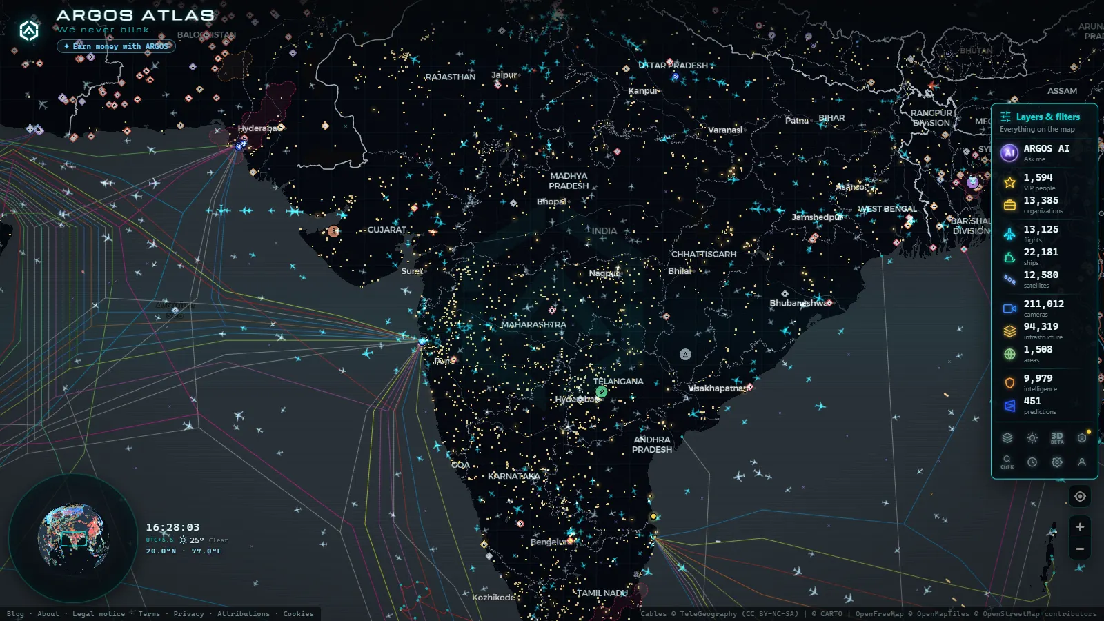
Open the map over Mumbai and you get three live layers and one honest absence. Ships are the strongest of the three: AIS positions in the harbour, in the anchorage south of Colaba and across the water at Nhava Sheva, all part of the 21,934 vessels broadcasting live worldwide at any given moment. Flights over the city come from ADS-B. Ports, airports and power stations come from a records layer you can click. It is free, there is no account and there is nothing to install.
Now the absence, because it is the first thing people search for: there are no public traffic cameras in Mumbai. No live CCTV of the Bandra-Worli Sea Link, the Western Express Highway or the Eastern Freeway, on this map or on any other, because the municipal and traffic police feeds are not open. Two public camera feeds do exist in the wider area and both are on the map. Everything below is what you can actually watch.
The essentials, in 20 seconds
- Jawaharlal Nehru Port (Nhava Sheva) anchors the ship traffic east of the island and is the busiest container gateway in India.
- 21,934 ships are broadcasting live positions worldwide, out of 41,607 tracked over recent days.
- Chhatrapati Shivaji Maharaj International (VABB / BOM) is the reference point of the flight layer over the city.
- No public traffic cameras cover Mumbai streets: only two public feeds sit in the wider area (count as of September 2026).
- Free, no sign-up: the map opens in the browser with every layer already on.
What a Mumbai live map actually shows
Three feeds and one archive, and they behave differently. AIS is a radio signal that commercial ships transmit with their own identity and position, so the water fills up on its own. ADS-B does the same job for aircraft. The third layer is not live at all: it holds 1,081 ports, 47,927 airports and 34,936 power facilities worldwide, and around Mumbai that means the two ports, the two airports and the generating stations on the eastern shore.
Open the live map of ships, flights and infrastructure and zoom on the bay: ships move, aircraft move, the records sit still until you click them. Knowing which is which saves you waiting for a refresh that is never coming. The camera layer, the loud one in Europe and North America (200,000+ cameras catalogued worldwide), is almost empty here, and that is a property of Indian road operators, not of the map.
Ships in the harbour and at Nhava Sheva
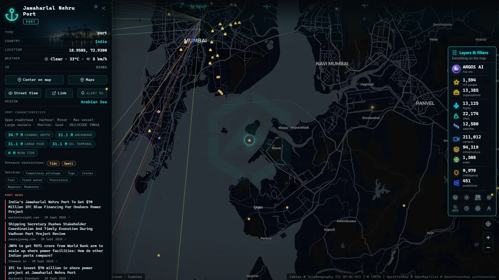
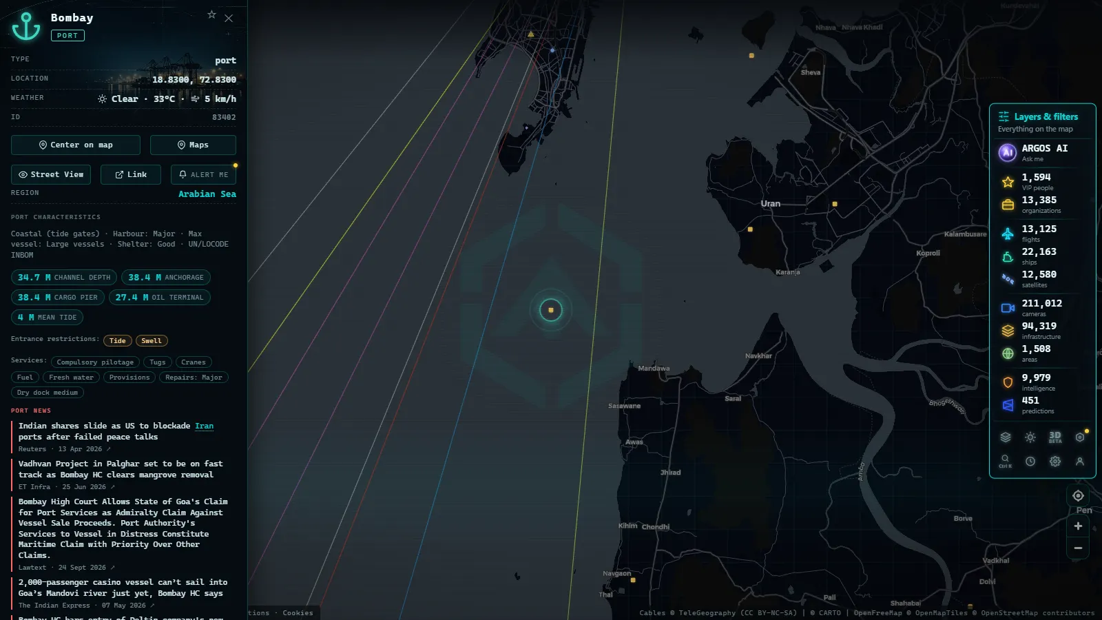
Two ports face each other across the bay and they do different jobs. Bombay (the older docks on the island side) handles a mixed traffic of coastal vessels, tankers and passenger movements. Jawaharlal Nehru Port on the mainland is the container terminal: box ships waiting offshore, a queue that thickens and thins with the berth schedule, tugs shuttling between them.
The anchorage is usually the most readable part of the picture. A ship sitting still for days with INNSA in its destination field is a ship waiting for a slot, and when a dozen of them pile up you are watching congestion happen in real time. Tankers heading north toward the refineries and gas carriers on the Uran side are the other recurring pattern. For scale against the rest of the world, our rundown of the biggest ports on the planet, live puts Nhava Sheva next to Shanghai and Rotterdam.
From the ARGOS ATLAS channel.
What a ship's card tells you
Click any vessel and you get name, MMSI, IMO, type, flag, speed, course and the last position report with its timestamp. The MMSI is the radio identity and it can change when a ship changes flag; the IMO is the hull number and stays with the ship for life, which makes it the one to write down if you are following a specific vessel over weeks.
Two habits worth building: read the timestamp before concluding anything, and treat the destination field as what the crew typed, not as a fact. Speed near zero with a heading that drifts means anchored, not stopped. Our guide to following a ship live by name, MMSI or IMO goes deeper, and what AIS is and how vessels are located explains the signal itself. Sanctioned vessels are flagged separately, 1,540 of them.
Flights over Mumbai: BOM now, NMI next
Aircraft over the city come from ADS-B, the same transponder signal air traffic control uses, with 18,155 flights airborne worldwide at a typical moment. Approaches and departures over the bay are the easiest thing to read: click a target and you get callsign, type, altitude, speed and the route when the aircraft publishes it.
Chhatrapati Shivaji Maharaj International (VABB / BOM) works two intersecting runways on a cramped site, which is why traffic is dense and spacing tight even at moderate volumes. Navi Mumbai International (VANM / NMI) already has its own record near Ulwe, so you can watch its traffic build up from the first movements. For the carriers you will see most often on the approach, live flights over India covers IndiGo, Air India and SpiceJet.
Power and the bay: Trombay and Uran
The eastern shore is where the infrastructure layer earns its place. TROMBAY is the oil-fired station on the Trombay peninsula, with a coal block recorded alongside it, and URAN GT is the gas turbine plant on the mainland next to the port. Each opens a record with its fuel, and that record is static: no live output, no load curve, no outage alert.
Worth spelling out, because this layer is easy to over-read. It tells you what is there and what it burns, which is the useful half when you are staring at a coastline trying to work out why a gas carrier is heading somewhere specific. If the category itself is new to you, what critical infrastructure is and why it appears on public maps is the background piece.
India in context, when the numbers help
World Bank figures sit behind the country record, which is the quickest way to frame what you are looking at without opening a statistics portal.
India · GDP (nominal)
India · GDP growth
Container throughput at Nhava Sheva and air traffic at BOM track that curve closely, which is the short answer to why the anchorage off the terminal rarely empties out.
Cameras: the two feeds that exist
Here is the honest part. There is no municipal camera grid to plug into, so the camera layer over Mumbai is not a grid at all: it is two public feeds, both verified live before publishing (count as of September 2026).
One sits in the old city near Mumbadevi, the other at Kopra on the Navi Mumbai side. Both are still frames refreshed on a cycle, not video streams. For comparison, the catalogue holds 200,000+ cameras worldwide, 10,848 of them in Spain and 1,459 in the London area (count as of September 2026). The gap is not effort: it is which road authorities publish their feeds and which keep them internal.
The points on this page
50 km
The Mumbai live map, layer by layer
| Layer | What Mumbai looks like on it | What to look for |
|---|---|---|
| Ships (AIS) | Dense: harbour, anchorage, Nhava Sheva approach | A vessel stopped for days with INNSA as destination: the berth queue |
| Flights (ADS-B) | Steady, concentrated on the BOM approaches | Callsign and altitude on the bay turn: who is landing and from where |
| Ports | Two records, Bombay and Jawaharlal Nehru Port | The role of each dock, before you try to read the ship traffic |
| Power | Trombay (oil and coal) and Uran (gas) | What the coastline burns, to explain tanker and gas carrier routes |
| Cameras | Two public feeds only | A still frame of local conditions, never a traffic overview |
What you won't see
- No live traffic cameras on the Sea Link, the Western Express Highway, the Eastern Freeway or any Mumbai street: those feeds are not public.
- Still frames, not video. The two cameras in the area refresh on a cycle. No stream, no sound, no rewind.
- No people, no plates. The frames are low resolution by design and nothing on the map identifies an individual or a vehicle.
- Ships that go quiet. AIS can be switched off, and fishing boats, small craft and naval vessels often never transmit.
- Aircraft without ADS-B. Military and some private flights do not broadcast, so a blank patch of sky proves nothing.
- No live power output. The station records list fuel, not load, and they do not report outages.
- Gaps at night and in monsoon. Camera frames go dark or blur out, and receiver coverage dips with the weather.
Setting up your Mumbai live map view
Centre the view so both ports fit on screen, then work from the water up. Start with the anchorage, because it carries the most information per pixel: count how many ships are stopped and check their destination fields. Then click the airport record to fix your reference point before reading the aircraft around it. Turn off the layers you do not need, since a clean map is a readable map.
Last trick: the URL carries the position and zoom, so bookmark it once and your Mumbai live map reopens exactly where you left it, ships and flights refreshed, no login in between.
Frequently asked questions
Is the Mumbai live map free and live?
Yes. The map opens in a browser with no account, no app and no trial, and the ship and flight layers are live: positions come from AIS and ADS-B broadcasts and refresh on their own. The port, airport and power records are static reference data, so those do not update while you watch.
Are there live traffic cameras in Mumbai?
No. Mumbai has no public traffic camera feed: the municipal and police networks exist but are not published, so no map can show them. Only two public cameras sit in the wider area, one near Mumbadevi and one at Kopra in Navi Mumbai, and both deliver still frames rather than video.
Can I watch ships arriving at Nhava Sheva?
Yes, in near real time. Container ships broadcasting AIS appear on the approach, in the anchorage and alongside the terminal, and clicking one opens its name, MMSI, IMO, speed and last position report. A vessel sitting still for days is usually waiting for a berth, not broken down.
Why do some aircraft over Mumbai not appear?
Because ADS-B is a broadcast the aircraft itself sends, and not every aircraft sends it. Military flights, some state aircraft and older private planes stay invisible, and coverage depends on ground receivers, so low altitude targets can drop out. An empty patch of sky on the map is not proof of an empty sky.
What is the difference between Bombay port and Nhava Sheva?
They are two separate ports facing each other. Bombay port covers the older docks on the island side, with mixed coastal, tanker and passenger traffic. Jawaharlal Nehru Port, on the mainland at Nhava Sheva, is the container terminal and the reason for the queue of box ships offshore. Both have their own record on the map.
- Philippines Airports Live Map: Manila, Clark, Cebu, Davao
- Poland Airports Live Map: Chopin, Gdansk, Krakow and More
- India Airports Live Map: Delhi, Mumbai, Hyderabad, Chennai
- Iraq Airports Live Map: Baghdad, Erbil, Kirkuk and Basra
- Colombia Airports Live Map: What El Dorado, MDE and CLO Show
- Data Center Map: 4,072 Sites and What You Can Actually See