Blog · Traffic cameras
Taiwan Traffic Cameras: Who Operates Them and How to Read One
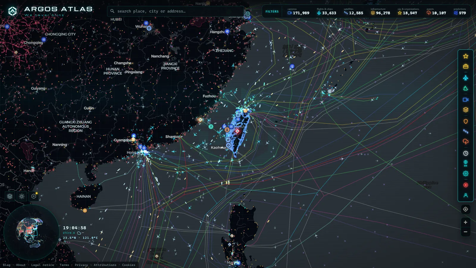
Taiwan fits a dense, modern highway network onto an island about the size of the Netherlands, and almost every kilometre of it is on camera. The feeds are public, they cost nothing, and the only real barrier for a foreign reader is that the labels are written in Chinese, with a kilometre-post grammar that nobody bothers to explain.
This is the largest camera catalogue on our map that we had never written up. Below: who actually operates the cameras (two national agencies plus a long tail of city and county governments), which corridors are genuinely covered, how to read a Taiwanese camera label without a word of Chinese, and what these feeds will never give you.
Who operates Taiwan traffic cameras
There are three layers, and knowing which one you are looking at tells you what to expect from the image.
The Freeway Bureau (高速公路局), part of the Ministry of Transportation and Communications, runs everything numbered 國道, the national freeways. Its public traffic service is usually referred to by the hotline number the whole island knows, 1968, and the same imagery feeds the roadside variable message signs. This is the most uniform layer: identical still-image format, identical naming, identical behaviour from Keelung to Pingtung.
The Highway Bureau (公路局, the agency long known in English as the Directorate General of Highways) covers the provincial system: the 台 series of highways and expressways that carry everything the freeways do not, plus the mountain crossings and the east coast. Its cameras also feed a highway disaster-response information system, which is why the coastal and mountain views stay up through typhoon season when the roads themselves are shut.
City and county traffic bureaus handle urban arterials. Taipei's Traffic Engineering Office (臺北市交通管制工程處) is the most generous publisher; New Taipei, Taoyuan, Taichung, Tainan and Kaohsiung each publish their own municipal cameras with their own naming and their own quirks. Rural counties publish little, and a few publish nothing.
That three-way split is the single most useful thing to know, because a road changes operator mid-route. Drive 台9 out of Taipei and the camera style, the label language and the image quality all change the moment you cross the city boundary.
The corridors that are actually covered
Taiwan's traffic is a spine and two ribs. The west coast plain holds almost all of the population and almost all of the cameras.
National Freeway 1 (國道1號, the Sun Yat-sen Freeway, universally called 中山高) runs Keelung (基隆) to Kaohsiung (高雄) and is the most densely watched road on the island. National Freeway 3 (國道3號, the Formosa Freeway, 福爾摩沙高速公路) shadows it inland from the north down to Pingtung (屏東) and is the release valve when Freeway 1 seizes up.
National Freeway 5 (國道5號, the Chiang Wei-shui Freeway) is the one people actually check before travelling. It leaves Nangang (南港) in Taipei and reaches Yilan (宜蘭) through the Hsuehshan Tunnel (雪山隧道), and on a holiday weekend the tunnel approach cameras are the difference between leaving now and leaving in three hours.
The shorter freeways matter locally: 國道2號 is the airport spur into Taoyuan (桃園), 國道4號 and 國道8號 are east-west links serving Taichung (臺中) and Tainan (臺南), 國道6號 climbs towards Puli (埔里), and 國道10號 connects Kaohsiung with Qishan (旗山).
Off the freeway network, the Highway Bureau's cameras cover the West Coast Expressway (台61線, 西濱快速公路), the old trunk road 台1線, the north coast 台2線, and the two roads where a camera is worth more than anywhere else in Taiwan: 台9線 through the Suhua section (蘇花) and 台11線 down the Pacific coast. Coverage there is thinner, but there is no alternative route, so a single working camera answers the whole question.
How to read Taiwan traffic cameras without Chinese
Every Freeway Bureau camera name follows the same three-part grammar: road, then direction, then kilometre post. A label reading 國道1號 南向 100K means National Freeway 1, southbound, kilometre 100. Once you see that pattern you can place any camera on the island without translating a thing.
| Characters | Reading | What it means on the label |
|---|---|---|
| 國道 | guódào | National freeway (the 國道1號 to 國道10號 network) |
| 台◯線 | Tái ... xiàn | Provincial highway or expressway, for example 台9線 |
| 快速公路 | kuàisù gōnglù | Expressway (grade separated, not a freeway) |
| 北向 / 南向 | běixiàng / nánxiàng | Northbound / southbound |
| 東向 / 西向 | dōngxiàng / xīxiàng | Eastbound / westbound |
| K or 里程 | lǐchéng | Kilometre post along the route |
| 交流道 | jiāoliúdào | Interchange |
| 匝道 | zādào | Ramp |
| 隧道 | suìdào | Tunnel |
| 路口 | lùkǒu | Intersection (common in city feeds) |
| 施工 | shīgōng | Roadworks |
Two more habits worth picking up. Kilometre posts on the freeways run north to south, so a rising number means you are heading towards Kaohsiung. And the timestamp burned into the corner of the frame is Taiwan time, UTC+8, which is the fastest way to tell a fresh image from one that froze hours ago.
From the ARGOS ATLAS channel.
Region by region: what each part of Taiwan publishes
| Region | Who operates the cameras | Main corridors on camera | What the feed looks like |
|---|---|---|---|
| North (Taipei, New Taipei, Keelung) | Freeway Bureau + Taipei Traffic Engineering Office + New Taipei | 國道1, 國道3, 國道5, 台2線, city arterials | Densest coverage on the island, mixed freeway and urban intersection views |
| Taoyuan and Hsinchu | Freeway Bureau + county bureaus | 國道1, 國道2 (airport), 國道3, 台61線 | Good freeway coverage, patchier on local roads |
| Central (Taichung, Changhua, Nantou) | Freeway Bureau + Highway Bureau + Taichung | 國道1, 國道3, 國道4, 國道6, 台61線, mountain routes | Freeway stills plus mountain cameras that close with the road |
| South (Tainan, Kaohsiung, Pingtung) | Freeway Bureau + city bureaus | 國道1, 國道3, 國道8, 國道10, 台1線 | Solid freeway coverage, urban feeds vary by city |
| East (Yilan, Hualien, Taitung) | Highway Bureau, mostly | 國道5 and the Hsuehshan Tunnel, 台9線 (Suhua), 台11線 | Sparse but high value, weather and landslide oriented |
| Offshore (Penghu, Kinmen, Matsu) | County governments | Island roads and harbour approaches | Minimal, and often the first to disappear |
![Detail card of 台中市道路 [03274]向上路/民權路 (右側車流往環中路) Xiangshang Rd./Minquan Rd.(Right side Traffic flow to Huanzhong Rd.) (Urban) on the ARGOS ATLAS map](/img/blog/ctx-camaras-trafico-taiwan-3-03274-xiangshang-rd-minq.en.webp)
What Taiwan traffic cameras will not show you
This is the part most guides skip. Almost none of these feeds are live video: they are stills on a refresh cycle, so you see a frame, not a stream. At night, the freeway images become a smear of headlights that tells you traffic exists and little else.
During a typhoon, the moment you most want a camera is the moment it is least likely to work. Power and network drops take feeds offline, and mountain and east coast roads are usually closed by order before the weather peaks. An image that has not changed in an hour is not good news, it is no news. If a feed looks stuck, there are ordinary reasons a traffic camera stops working and none of them mean the road is clear.
No public Taiwanese feed publishes plate reading, speed enforcement output or any identification data: these are wide traffic views by design, which is how public traffic cameras work almost everywhere. County portals also get redesigned without warning, and when they do, camera URLs break. And there is no archive: you get the current frame, never the one from ten minutes ago.
Watching Taiwan traffic cameras on a single map
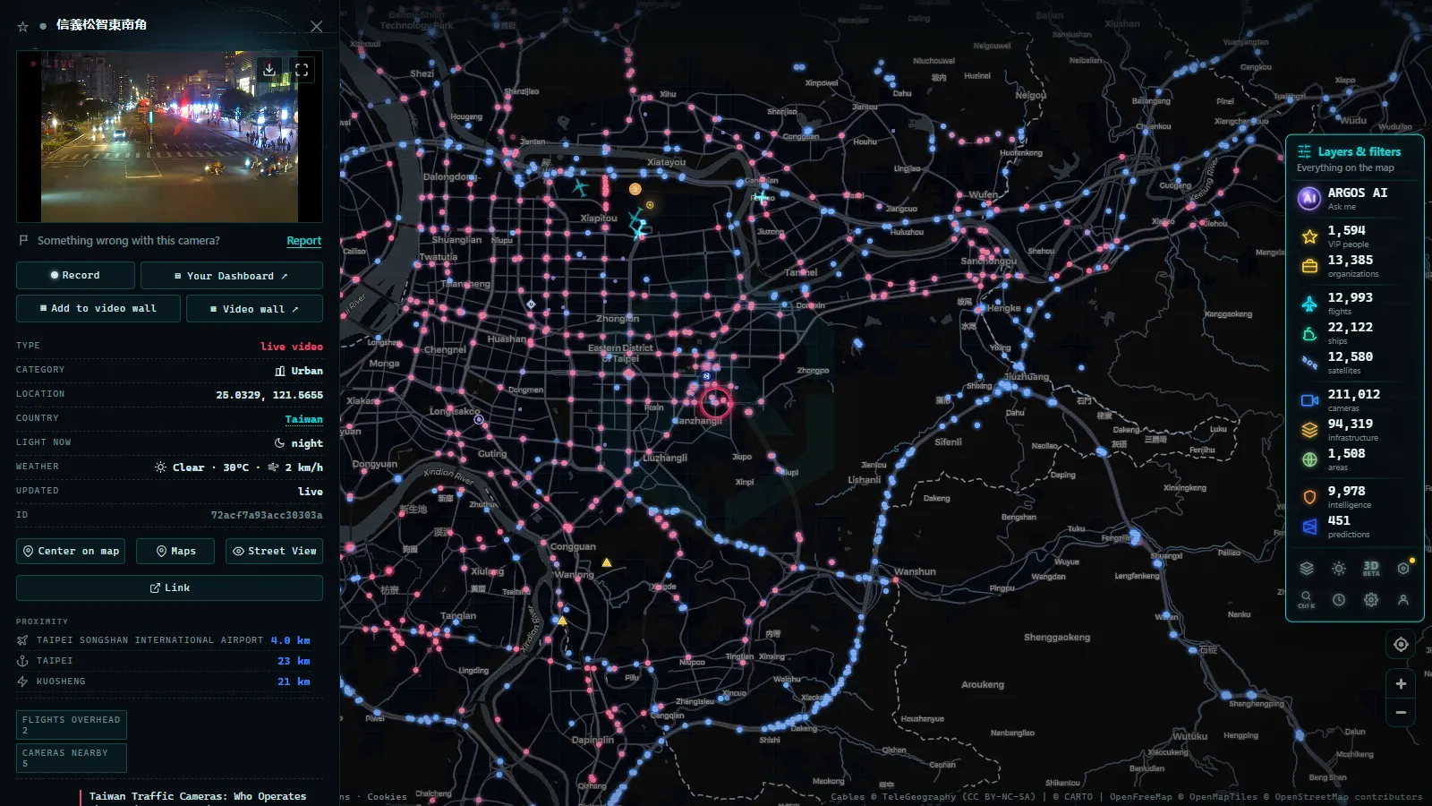
The practical problem with Taiwan is fragmentation: the freeways on one portal, the provincial highways on another, and each city on its own. Pulling them onto one surface is the entire point of our catalogue, which holds 200,000+ cameras worldwide (count as of September 2026).
Open the live map, zoom into the west coast between Taipei and Kaohsiung and the corridor lights up along Freeway 1 and Freeway 3. Click any marker and you get the current frame plus the operator it came from, so you always know whether you are looking at a national agency feed or a municipal one. Checking that provenance is a habit worth keeping, since knowing whether a webcam is official changes how much you should trust it.
If you want a comparison, the setup in Japan, where NEXCO and the National Police Agency split the network, follows a similar logic with a very different publishing culture. Taiwan is more centralised on the freeways and more uneven off them, which is exactly what you would expect from an island where one agency owns the spine and twenty-odd local governments own everything that branches off it.
Frequently asked questions
Are Taiwan traffic cameras free to watch, and do I need an account?
Yes, they are free, and no account is needed. Both the Freeway Bureau and the Highway Bureau publish their camera images as open traffic information, and city governments do the same for urban arterials. On our map you open the camera layer over Taiwan and click a marker: no registration, no trial, no card.
Are the images live video or still photographs?
Almost all of the public Taiwanese feeds are still images that refresh on a fixed cycle, not continuous video. You get a fresh frame rather than a stream, which is enough to judge whether a corridor is moving or stopped but not enough to follow an individual vehicle.
Do I need to read Chinese to use them?
No. The labels follow a fixed grammar: road name, then direction, then kilometre post. Learn six characters (國道 for national freeway, 台 for provincial highway, and 北南東西 for the four directions, each followed by 向 for bound) and you can locate any camera on the island.
Which corridor is worth checking before a trip?
National Freeway 5 through the Hsuehshan Tunnel (雪山隧道) towards Yilan, because it is the only fast route from Taipei to the northeast coast and it saturates on holiday weekends. On the east coast, the 台9 cameras through Suhua matter because there is no parallel road to fall back on.
Do the cameras keep working during a typhoon?
Not reliably. Power and network drops take feeds offline exactly when the weather is worst, images go dark or freeze on an old frame, and mountain and east coast roads are usually closed by order before conditions peak. Treat a stale frame as no information, not as an all clear.
- Florence traffic cameras: ZTL gates, A1, A11 and Peretola
- Ireland Traffic Cameras Live: Motorways, Tunnels, Cities
- Trieste Traffic Cameras Live: 4 Zones From Port to Border
- Venice traffic cameras live: causeway, Mestre and Marghera
- Georgia 511 Traffic Cameras: Watch I-285 and I-16 Live
- Sicily traffic cameras: the A19, the A18 and the Messina run