Blog · Traffic cameras
Ireland Traffic Cameras Live: Motorways, Tunnels, Cities
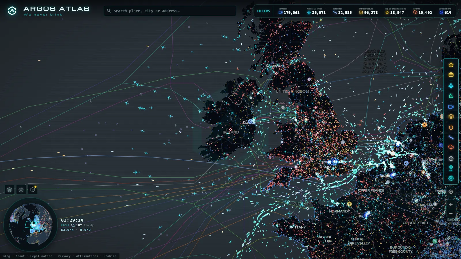
If you want to see an Irish road right now, the honest answer depends entirely on which road. Public camera coverage in Ireland is concentrated in three places: the motorway network watched from a single control room, the tunnels under Dublin, Cork and Limerick, and a handful of city centre junctions in the capital. Everything else is dark. Open the live traffic camera map, zoom into the island, and you get those feeds in one place instead of jumping between an operator site, a council page and a separate Northern Ireland service.
What you will not get is a country blanketed in lenses. Outside the M and N corridors most of Ireland has no public camera, and the ones that exist are mostly still frames refreshed on a cycle rather than video you can sit and watch. Knowing which is which before you leave is the difference between a useful check and a wasted five minutes.
The essentials, in 20 seconds
- 200,000+ cameras: the map's worldwide catalogue as of September 2026, of which Ireland is a small, precise slice
- Seven operators: national motorways, three tunnels, Dublin City Council and Northern Ireland's Department for Infrastructure each publish separately, with no single Irish authority
- M50 Dublin: the densest coverage in the country, with both carriageways watched at most interchanges plus the western toll section
- Three tunnels (Dublin, Jack Lynch in Cork, Limerick): show portals and approaches only, never the interior bores
- R roads and the Atlantic routes: regional and local roads, plus most of Donegal, Mayo, Kerry and the west, have essentially no public camera coverage
Ireland traffic cameras live: what you see when you open the map
The map holds 200,000+ public cameras worldwide (count as of September 2026), and Ireland is a small, precise slice of that. Click any marker on the island and you get the current frame, the time it was captured, the road it looks at and the operator that publishes it. That last field matters more than it sounds: in Ireland the operator tells you how often the image changes and how much you can trust the framing.
Most Irish units are fixed wide shots aimed down a carriageway, mounted on gantries or at junctions. They show whether traffic is flowing, stopped or crawling, whether the surface looks wet, and roughly how far a queue extends. They do not show speeds, vehicle counts or anything at plate level. If you want the mechanics of why these feeds look the way they do, how traffic cameras work covers the hardware and the reason so many of them are public in the first place.
Scale is worth being blunt about. The London area alone carries 1,398 cameras in the catalogue (count as of September 2026). Ireland is nowhere near that density, and no amount of zooming will change it. The Irish network is narrow but well placed: it covers the points where the country's traffic actually breaks.
Who runs each stretch of road in Ireland
There is no single Irish traffic camera authority. The motorways are managed nationally, the tunnels are run under concession arrangements with their own control rooms, the capital's streets belong to the city council, and the six counties in the north are a different jurisdiction with a different operator. That fragmentation is why a country map is more useful here than any single official page.
| Network | Who operates it | What the cameras show | What they miss |
|---|---|---|---|
| National motorways (M1, M4/M6, M7, M8, M9, M11, M17/M18) | Transport Infrastructure Ireland, from the motorway traffic control centre | Mainline flow at junctions and gantries, queues, incident scenes | Slip roads, service areas, the N roads that continue past the motorway end |
| M50 Dublin orbital | Same national operator, densest coverage in the country | Both carriageways at most interchanges, the western toll section | Local approach roads feeding each junction |
| Dublin Tunnel | Tunnel control room under national contract | Portals and approaches at both the port and M50 ends | Full interior views of the bores, height and HGV restriction status |
| Jack Lynch Tunnel and N40, Cork | National operator with the Cork control room | Tunnel approaches, the Dunkettle side, the south ring | Cork city streets inside the ring |
| Limerick Tunnel and N18 | Concession operator, national oversight | Portals and mainline approach either side of the Shannon | Limerick city centre and the older bridge crossings |
| Dublin city streets and quays | Dublin City Council | Quays, main bridges, city centre junctions, N11 approach | Suburban routes and anything outside the council boundary |
| Northern Ireland (M1, M2, M3, A12 Westlink) | Department for Infrastructure | Belfast approaches and motorway mainline | Cross-border continuity with the Republic's network |
The practical consequence of that table is simple: a journey across Ireland usually crosses two or three camera regimes, and each one refreshes on its own schedule. A frame from a Dublin council camera and a frame from a motorway gantry are not necessarily from the same minute.
From the ARGOS ATLAS channel.
Dublin: the M50, the tunnel and the quays
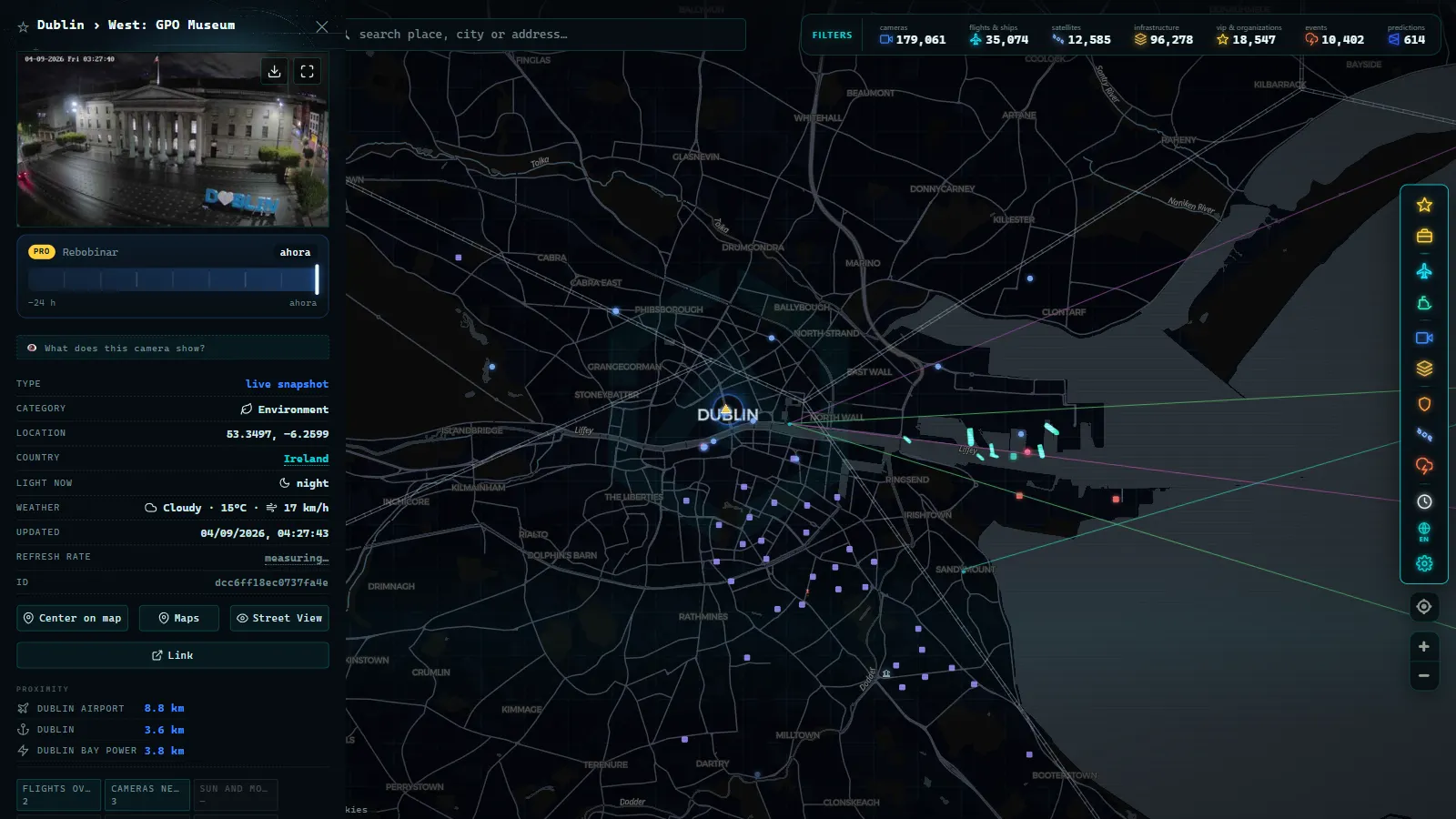
The M50 is where the country's traffic problem is most visible and best photographed. It carries the heaviest flows in the state, and the camera density reflects that: the interchanges with the radial motorways are covered on both carriageways, and so is the barrier-free toll section on the western side. When something goes wrong on the orbital, the queue is normally visible across several consecutive cameras before any traffic bulletin catches up.
The Dublin Tunnel is the other choke point worth checking. It links the port to the M50 and takes the heavy goods traffic that would otherwise grind through the city. What is published is the approach and the portal, not a full walk through the bores, and that is deliberate: interior coverage is an operational tool for the control room rather than a public feed. For most decisions the portal view is enough, because a queue at the mouth is the thing that costs you time.
In the city itself, the council cameras look at the quays, the main bridges and a set of central junctions. They are framed for junction management, which means tight shots, occasional odd angles, and a refresh cycle you should confirm from the timestamp rather than assume. They are genuinely useful for the north and south quays at rush hour and for the N11 approach from the south.
Cork, Limerick and Galway: the approaches that matter
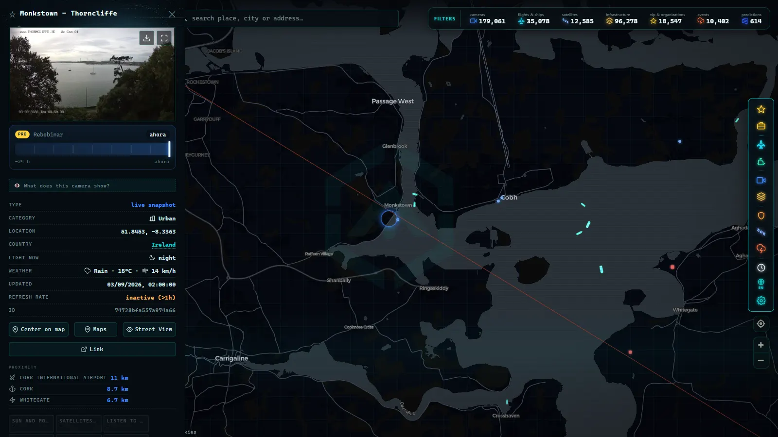
Cork's coverage sits on the N40 south ring and the Jack Lynch Tunnel under the Lee. The Dunkettle interchange, where the motorway from Dublin meets the ring and the road east, is the single most informative view in the city: if it is backed up, everything downstream is too. What you will not find is meaningful coverage inside the city centre. Cork's streets are not part of the published network the way Dublin's are.
Limerick follows the same pattern in miniature. The tunnel under the Shannon and the N18 mainline either side of it are covered because they are national infrastructure. The older river crossings and the city core are not. If you are trying to judge whether to take the tunnel or the bridges, the cameras answer half the question and local knowledge answers the other half.
Galway is the thinnest of the three, and it is worth saying so plainly. The city has a long standing bottleneck where traffic funnels toward the Corrib crossing, and public camera coverage of it is sparse compared to the size of the problem. The approach roads from the motorway are better served than the city itself. Anyone expecting to watch the Galway crawl in detail will be disappointed.
Northern Ireland is a separate network
The island has two road authorities, and the cameras follow the border. Northern Ireland's motorway and Belfast coverage is published by the Department for Infrastructure, on its own platform, with its own image format and refresh behaviour. The Dublin to Belfast corridor is covered on both sides, but there is no continuity: the feeds stop being one network and start being another somewhere around the crossing.
On a single map that seam disappears, which is exactly the point of putting them together. If you are looking north rather than south, the UK traffic camera network guide explains how the British operators are organised, and the country by country guide to traffic cameras in Europe puts Ireland in context against the continental networks, which are far denser.
What Ireland traffic cameras live coverage does not include
This is the part most guides skip. Being precise about the gaps is more useful than pretending the map is complete:
- Regional and local roads. The R network and everything below it has essentially no public camera coverage anywhere in the country.
- The west and northwest away from the motorways. Long stretches of Donegal, Mayo, Kerry and the Atlantic routes are unwatched. Scenic road webcams exist, but they belong to tourism and weather operators, not traffic control.
- Enforcement. Speed enforcement and tolling systems read vehicles, but those images are never published. Nothing on a public map identifies a driver or a plate.
- Tunnel interiors. Portals yes, full internal coverage no.
- Night on unlit roads. A camera can be perfectly functional and still show you nothing usable at two in the morning on a rural dual carriageway.
- Guaranteed uptime. Feeds drop, units get repositioned during incidents, and some cameras stay stale for days. Why a traffic camera stops working goes through the usual causes and what to do instead.
Using Ireland traffic cameras live without wasting your time
The average person looks at a camera panel for about as long as it takes to answer one question, so make the question a good one. A few habits that pay off on Irish roads:
- Read the timestamp first. Before interpreting anything, confirm how old the frame is. Irish operators do not all refresh at the same rate, and a stale image looks identical to a fresh one.
- Compare two cameras on the same corridor. One queue tells you nothing. A queue at one gantry and free flow at the next tells you where the problem ends and roughly how long it will take to clear.
- Check the direction. Motorway cameras on the M50 and the radials often cover both carriageways separately. Make sure you are looking at the one you will be driving.
- Check the tunnel portal before committing. For the Dublin, Jack Lynch and Limerick tunnels, the approach view is the decision point. Once you are in the approach lanes there is no useful alternative.
- Treat weather as a bonus, not a service. Traffic cameras show wet tarmac and low visibility incidentally. They are not weather instruments and should not be used as one.
Used that way, the Irish network is small but honest: it watches the places where the country's traffic actually fails, tells you when it is failing, and says nothing at all about the rest. That is a fair trade, as long as nobody pretends otherwise.
Frequently asked questions
Is the Ireland traffic camera map free, live and without registration?
Yes. The map is open in a browser with no account, no app and no payment. The images come from the public feeds published by the road operators themselves, so what you see is what they publish, refreshed on their own cycle. Most Irish cameras deliver a still frame rather than continuous video, so \"live\" means a recent snapshot, not a stream you can sit and watch.
Which roads in Ireland actually have public cameras?
Coverage follows the motorway network and the tunnels. The M50 ring around Dublin, the radial motorways out of the capital, the Dublin Tunnel, the Jack Lynch Tunnel in Cork and the Limerick Tunnel are the best served. Dublin city adds its own junction and quay cameras. National secondary roads, regional roads and most of the west and midlands have no public camera at all.
Can I see the Dublin Tunnel and the M50 in real time?
You can see the approaches and portals, which is what matters for deciding whether to use them. Interior views of the bores are limited and are managed from the control room rather than published in full. For the M50, the useful trick is comparing two cameras on the same carriageway a few junctions apart: one queue tells you little, two in sequence tell you whether it is moving.
Do the cameras identify vehicles or read number plates?
No. Public traffic camera images are low resolution wide shots framed for flow, not for identification. Plates are not legible and faces are not visible. The systems that do read plates in Ireland, tolling and enforcement, are separate, are not published, and never appear on a public map.
Why is a camera showing an old image or nothing at all?
Three usual causes: the feed is down at the operator end, the camera has been repositioned for an incident, or the timestamp is simply older than you assume because that unit refreshes slowly. Always read the time on the frame before trusting it. At night, an unlit rural stretch can produce a technically working camera with nothing usable in it.
- Trieste Traffic Cameras Live: 4 Zones From Port to Border
- Venice traffic cameras live: causeway, Mestre and Marghera
- Georgia 511 Traffic Cameras: Watch I-285 and I-16 Live
- Sicily traffic cameras: the A19, the A18 and the Messina run
- Verona traffic cameras: the A4, A22 and the Garda exits live
- Tokyo Traffic Cameras: What Each Corridor Really Shows