Blog · Traffic cameras
How Traffic Cameras Work (And Why They Are Public)
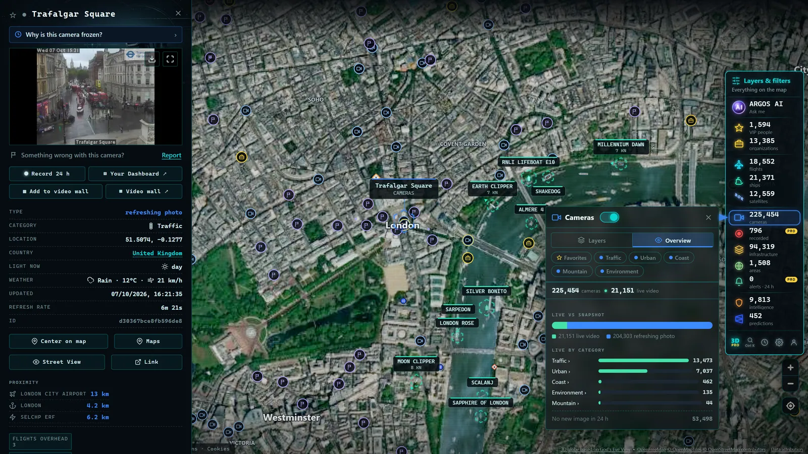
Whenever a major highway incident makes the news, the footage is almost always the same: a wide-angle view of stopped vehicles, a variable-message sign lit up in amber, a rain-slicked interchange at night. Those images come from cameras that have been watching the world's roads for decades. Yet most people never stop to wonder how they work, who operates them, or why anyone can watch them for free from a browser. This article answers all three questions, and explains where to find them.
What Traffic Cameras Are (And What They Are Not)
Traffic cameras are image-capture devices installed by public bodies (departments of transportation, highway agencies, traffic police) for a single operational purpose: to know the real-time state of a road so that traffic flow can be managed more effectively.
That operational purpose is what sets them apart from other forms of video surveillance. A security camera in a bank is calibrated to identify individuals. A traffic camera is calibrated to assess a stretch of road: is there a queue forming? Is visibility reduced by fog? Has a vehicle broken down on the shoulder? The resolution and angle are chosen for road-state assessment, not personal identification.
In practice, several distinct camera types exist on the road network:
- Fixed traffic monitoring cameras. The most common type. Mounted on gantries, bridges or poles, they point at a fixed section of road and transmit a continuous feed to a traffic management center.
- PTZ cameras (pan-tilt-zoom). Operators can rotate, tilt and zoom these remotely. They are common at complex interchanges, in tunnels and on major urban arterials where a controller needs to direct the view toward a specific incident.
- Counting and detection cameras. These combine image capture with sensors that measure vehicle volumes and average speeds. Their output is primarily statistical rather than visual.
- Automated enforcement cameras (average-speed cameras, red-light cameras). Technically cameras, but their purpose is law enforcement rather than traffic management. They are almost never published in open data portals.
When people talk about traffic cameras on the internet (on apps, in news broadcasts, or on interactive maps) they mean the first and second types: the management cameras whose purpose is operational awareness rather than enforcement.
How the Image Works: Still Frames vs. Live Video
A common question is why many online traffic cameras show a static image that refreshes every few seconds rather than smooth, continuous video. The answer is almost entirely about infrastructure cost and bandwidth.
The periodic still-frame model is by far the most widespread. The camera captures a photograph at a set interval (every 30, 60 or 120 seconds) and uploads it to the agency's server, which makes it available at a public URL. When a user reloads the page, or when an application sends a new request, it downloads the latest image. The bandwidth footprint is minimal: a 100 KB photograph once per minute is nothing compared to a 1 Mbps continuous stream.
The live streaming model (genuine continuous video, like a television channel) does exist but is far less common in public portals. Some agencies use it for strategically important locations: high-density tunnels, capital city approaches, known blackspots. The CDN and bandwidth costs make it impractical for fleets of thousands of cameras.
Between the two extremes sits a middle ground: images that refresh every 5 to 10 seconds, creating an impression of movement without being a true stream. Many cameras run by the US DOT's 511 network, the UK's National Highways, and France's ASFA operate this way on their public web portals.
The technical chain is broadly consistent across countries: an IP camera on the roadside connects via a private fiber or radio network to the agency's servers, which then publish the images through a web portal or open API. The camera itself does not have a public IP address; the image reaches the public only after passing through the agency's systems.
Why Road Agencies Publish Their Cameras Openly
The public availability of traffic camera images is not accidental, and it is not a recent development. It results from several forces that have been building for decades.
Open data policy. Since the mid-2010s, governments in the US, EU and elsewhere have pushed agencies to publish data that taxpayers fund. Traffic camera images are an almost perfect candidate: they are produced with public money, they do not contain identifiable personal data in normal operating conditions, and their release benefits road users directly.
Reduced load on call centers and emergency lines. Every driver who checks a camera feed before leaving home is a driver who does not call the traffic information hotline. Agencies that publish camera images report measurable reductions in non-emergency calls to their operations centers.
Partnerships with navigation and media. Road agencies have formal or informal data-sharing arrangements with navigation providers (Google Maps, Waze, HERE Technologies, Apple Maps) and broadcasters. Publishing images openly simplifies those relationships and reduces negotiation overhead.
Favorable legal framework. In most jurisdictions, images of public roads captured by public bodies are considered public domain or freely accessible information. There is no privacy right in a public carriageway that would justify restricting the broadcast of the road surface, provided, as is generally the case, that individual people and vehicles cannot be identified at operational distances.
From the ARGOS ATLAS channel.
Where to Find Traffic Cameras by Country
The central practical obstacle for anyone who wants to watch road cameras is fragmentation. Every country (and often every region or state within a country) maintains a separate portal. Here is a brief tour of the major systems.
United States. The 511 system is the national reference point. Created by the Federal Highway Administration, it establishes a common phone number and, progressively, a common data standard. Each state, however, runs its own implementation. California's Caltrans QuickMap, Florida's FL511, Texas's DriveTexas and Washington State's WSDOT Traffic all offer extensive camera networks accessible through public web portals and APIs. The quality and density of coverage varies considerably between states.
United Kingdom. National Highways publishes images for its motorway and major A-road network via an open data portal and direct image URLs. Transport for London operates a separate, dense network covering Greater London. Scotland (Transport Scotland) and Wales (Traffic Wales) run their own systems with their own portals, meaning a complete picture of the UK requires consulting at least four sources.
France. The national network is divided between state roads managed by the Direction des Routes and the concession autoroutes managed by private operators grouped under ASFA. Each concessionaire (Vinci Autoroutes, APRR, SANEF) operates its own portal. The Île-de-France regional authority runs SYTADIN, one of Europe's more sophisticated metropolitan traffic monitoring platforms.
Germany. The Bundesamt fur Strassenwesen (BASt) serves as the federal reference for traffic data, but camera images have historically been distributed across the sixteen Lander. The creation of Autobahn GmbH des Bundes in 2021, which took over management of federal motorways from the states, is gradually moving the system toward greater centralization, though the process is ongoing.
Japan. The Japan Road Traffic Information Center (JARTIC) provides a centralized national platform with thousands of cameras covering the expressway and national road network. Japan's system is among the more coherent internationally, with a single portal covering most of the country's major roads.
Australia. Each state and territory manages its own road network and camera system. New South Wales has Live Traffic NSW, Victoria has VicTraffic, Queensland has Queensland Traffic, and so on. As with the US, a national view requires consulting multiple separate state portals.
From Hundreds of Portals to a Single Map
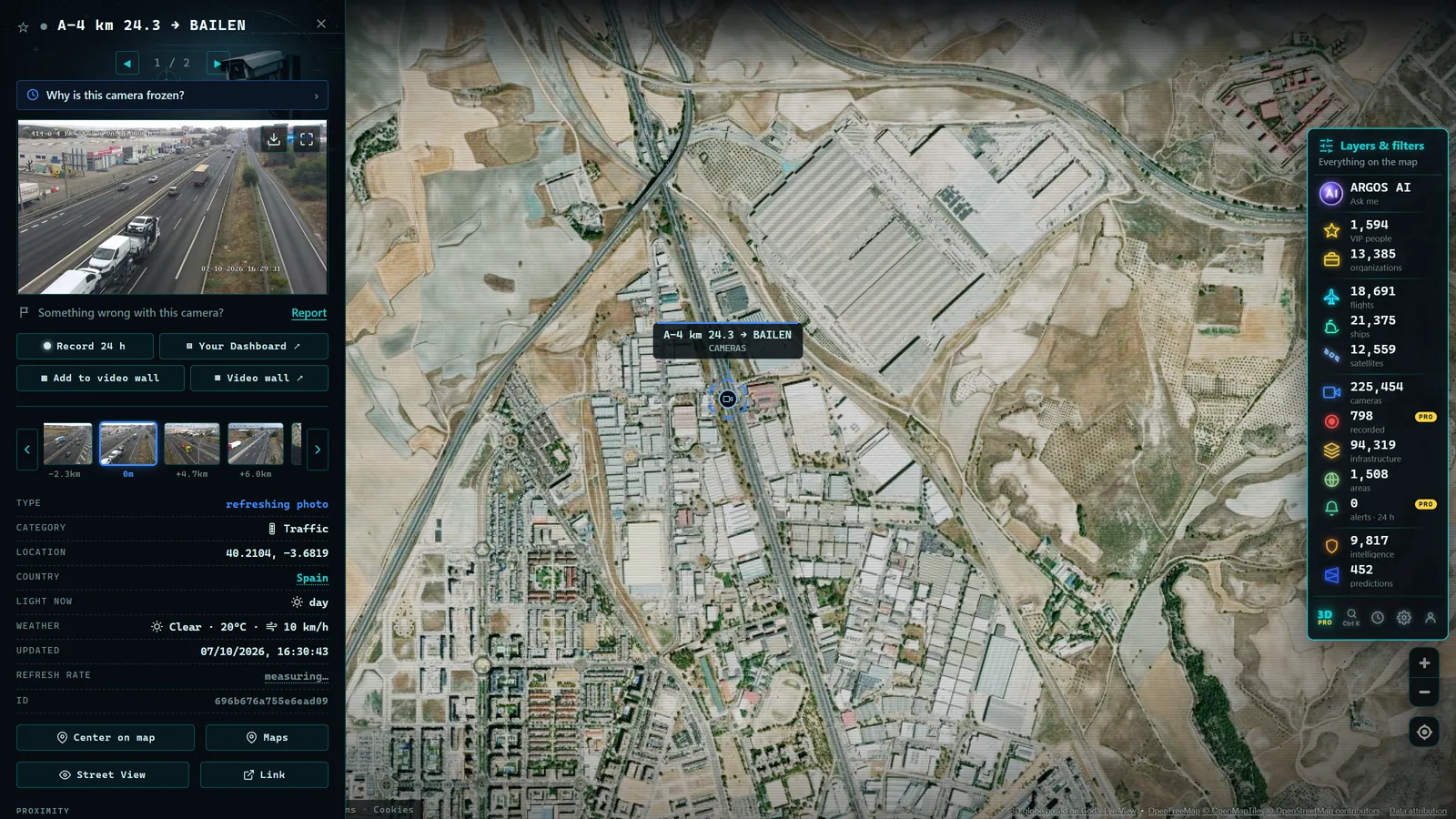
The fragmentation described above is precisely the problem that aggregation tools solve. Rather than visiting National Highways, then Caltrans, then ASFA, then BASt, then JARTIC in sequence to assemble a global picture, a unified map brings all those sources together in one place.
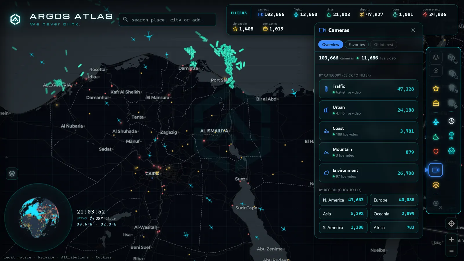
Argos Atlas indexes thousands of public traffic cameras from multiple countries and places them on an interactive, geolocated map. The underlying process combines several layers: integration with official open APIs where they exist, ingestion of publicly published image feeds, and normalization of geographic coordinates to a consistent format. The result is a single interface where a user can pan across the map and see the road state in different countries (each camera refreshing at the interval set by its source agency) without switching tabs or creating an account.
The practical use cases are wide: a driver planning an international road trip, a logistics coordinator monitoring distribution routes, a journalist covering a snowstorm in the Alps, or a researcher studying traffic patterns across time zones. All of them previously needed to consult dozens of separate portals. An aggregated map reduces that to a single view.
On ARGOS ATLAS, the traffic camera layer sits alongside other public infrastructure layers: real-time flight positions, vessel tracking, power stations and airports. For more on how to track road conditions beyond fixed cameras, see our companion article on live traffic monitoring in real time.
Conclusion
Traffic cameras are public infrastructure built to manage road flow, not to surveil individuals. Their images are available openly because they are funded by taxpayers, do not contain personally identifiable data under normal operating conditions, and their release benefits drivers, media organizations and navigation platforms alike. The main practical barrier for the end user is not data availability (that exists) but data fragmentation across hundreds of national, regional and local portals.
Aggregated maps like Argos Atlas address that fragmentation by combining thousands of sources into a single geolocated interface, accessible without registration or payment. Understanding how traffic cameras work (what they capture, how they transmit images, and why public agencies make them freely available) is the foundation for using them effectively as a road information tool.
For a closer look at the privacy and legal dimensions of public traffic cameras, see Traffic cameras, privacy and legality.
Frequently asked questions
Are traffic cameras the same as surveillance cameras?
No. Traffic management cameras are designed to assess road conditions, not to identify people or vehicles. Their purpose is operational: detecting congestion, incidents and weather-related hazards.
Why do some cameras show still images and others live video?
Most public road agencies publish periodic still frames (images that refresh every few seconds or minutes) because streaming continuous video for thousands of cameras simultaneously would be enormously expensive in bandwidth.
Where can I watch traffic cameras worldwide for free?
ARGOS ATLAS gathers thousands of public traffic cameras worldwide on an interactive map. No sign-up or payment required, just open the map and explore.
- Mountain pass cameras: how to check road snow conditions before you travel
- Traffic cameras in Europe: where to see the roads in each country
- Why Is a Traffic Camera Not Working? Outages, Maintenance, and Alternatives
- Live Traffic Mexico City: 15,000+ CDMX Cameras In Real Time
- Live Traffic Cameras in Buenos Aires: Urban Autopistas, Metrobus, and the North-South Corridor
- Live Traffic Cameras in Bogota, Colombia: IDU, Movilidad, TransMilenio and Pico y Placa