Blog · Traffic cameras
Trieste Traffic Cameras Live: 4 Zones From Port to Border
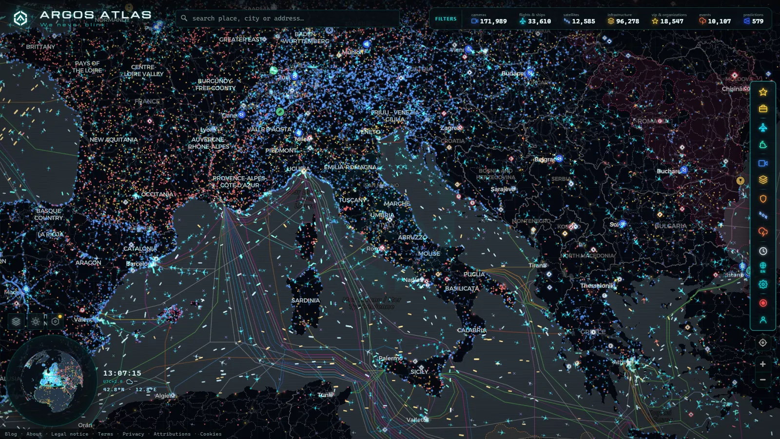
If you are heading into Trieste, the cameras worth opening sit in four places: the SS14 Costiera between Sistiana and Barcola, the ANAS link roads that climb to the Fernetti and Rabuiese crossings with Slovenia, the A4 corridor arriving from Venice, and the streets along the Rive beside the port gates. Open the live map of public traffic cameras, zoom into the top right corner of the Adriatic, and the pins load one at a time, each with the feed its own operator publishes.
Two things are worth knowing before you click anything. Most Italian road cameras are still frames refreshed every few minutes, not streaming video, so you read a queue and the weather rather than a number plate. And Trieste's public coverage follows freight, not tourism: the ring roads, the motorway and the coast road are watched, while the old town is covered mostly by scenic webcams that happen to include a street.
The essentials, in 20 seconds
- Fernetti and Rabuiese: the two border crossings whose approach ramps carry Trieste's heaviest freight traffic into Slovenia.
- SS14 Costiera: the coast road between Sistiana and Barcola, the stretch to check first when the bora wind picks up.
- 21,858 ships: visible at once on the map's AIS layer out of 36,214 tracked, covering the Gulf of Trieste's anchorage and berths continuously.
- 1,081 ports: mapped worldwide on the same live map alongside the traffic cameras.
- Zero cameras: published from inside the port terminals or the border crossing facilities, only the roads that approach them.
Trieste traffic cameras live: the four zones plus the water
Trieste is small enough to hold in your head. The city sits on a shelf between the Karst plateau and the Gulf, Slovenia is a few kilometres uphill in three directions, and every road in or out passes through one of four corridors. That is why a Trieste check takes about a minute if you know where to look.
| Zone | Roads | Who publishes the cameras | What you actually see | Refresh |
|---|---|---|---|---|
| Coast road | SS14 Costiera, Sistiana to Barcola and Miramare | ANAS and regional road operators | Lane occupancy, sea state, wind conditions on the cliff stretch | Still frame, minutes |
| Border ring | RA13 towards Fernetti, RA14 towards Rabuiese | ANAS | Truck build up on the approach ramps, not the crossings themselves | Still frame, minutes, uneven coverage |
| Motorway corridor | A4 from Venice, Lisert and Sistiana junctions | Motorway concession (Autovie Venete) | Lanes, toll plaza approaches, exposed viaducts | Still frame, minutes |
| City and port edge | Rive, Piazza Unità, Barcola, industrial road to the gates | Institutional and tourist webcams | Seafront and weather; traffic only incidentally | Varies, some daytime only |
| The water | Gulf of Trieste, berths and anchorage | AIS, no camera involved | Ship positions, names, movements at the terminals | Continuous |
The last row is the one people forget. Around a port city, the layer that answers most questions is not a camera at all. Positions from AIS transmitters cover the anchorage and the berths continuously, and the map currently carries 21,858 ships visible at once out of 36,214 tracked (count as of September 2026), plus 1,081 mapped ports worldwide.
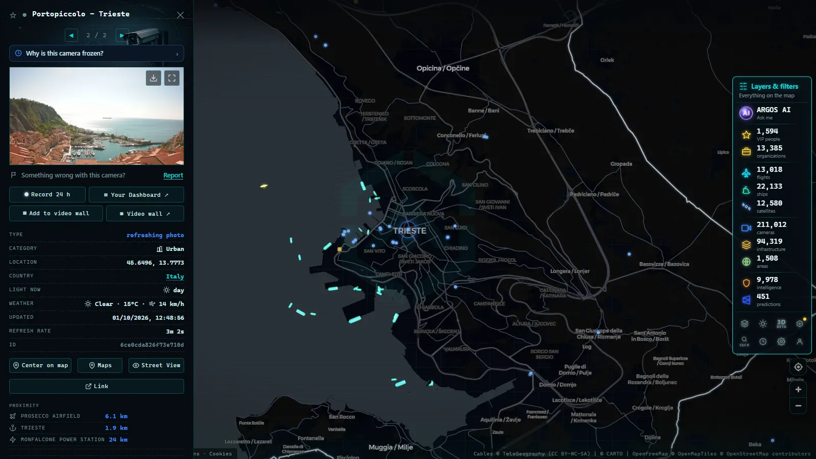
The Costiera and the bora: the stretch to check first
The SS14 between Sistiana and Barcola is the postcard road and the fragile one. It runs along the base of the cliffs with the sea on one side and rock on the other, it has no realistic diversion, and it takes the full force of the bora, the east northeast wind that defines winter here.
When the bora blows hard, two things happen in sequence: high-sided vehicles get restricted or banned on the exposed stretches, and the traffic that would have used them piles onto the alternatives inland. A camera on the Costiera tells you both at once. You can see whether the lanes are moving, and you can usually see the sea being torn white, which is the honest local indicator that restrictions are coming even before any sign changes.
In summer the same road fails for the opposite reason. Barcola is the city's swimming strip, the parking along it fills from mid morning, and the queue that forms is people looking for a space rather than through traffic. A camera reads that instantly, where a routing app just shows you a delay without telling you it will not clear until evening.
From the ARGOS ATLAS channel.
Fernetti, Rabuiese and Pesek: the crossings that make this a freight city
This is what separates Trieste from every other Italian coastal city on this blog. The heavy flow here is transfrontier: trucks moving between the port, the Slovenian motorway network and central Europe. Three crossings carry most of it.
Fernetti, reached by the RA13 link road that climbs from the city onto the Karst, is the freight crossing, with a large lorry park on the Italian side and the road onward towards Sežana and the Slovenian motorway. Rabuiese, at the end of the RA14, is the coastal crossing towards Škofije and Koper, the one that matters if your route continues down the Istrian coast. Pesek, on the high road above Basovizza towards Kozina, is the third, and smaller crossings such as Basovizza and Gropada handle local traffic that barely registers on any camera.
What the public cameras give you is the approach, not the crossing. A stationary right-hand lane on the RA13 is a queue at Fernetti, and that is a real, usable signal. What no public feed gives you is a waiting time, a lane count at the booths, or anything at all from the Slovenian side of the line. If you need a number of minutes, no camera in this area will produce one, and anyone who tells you otherwise is guessing.
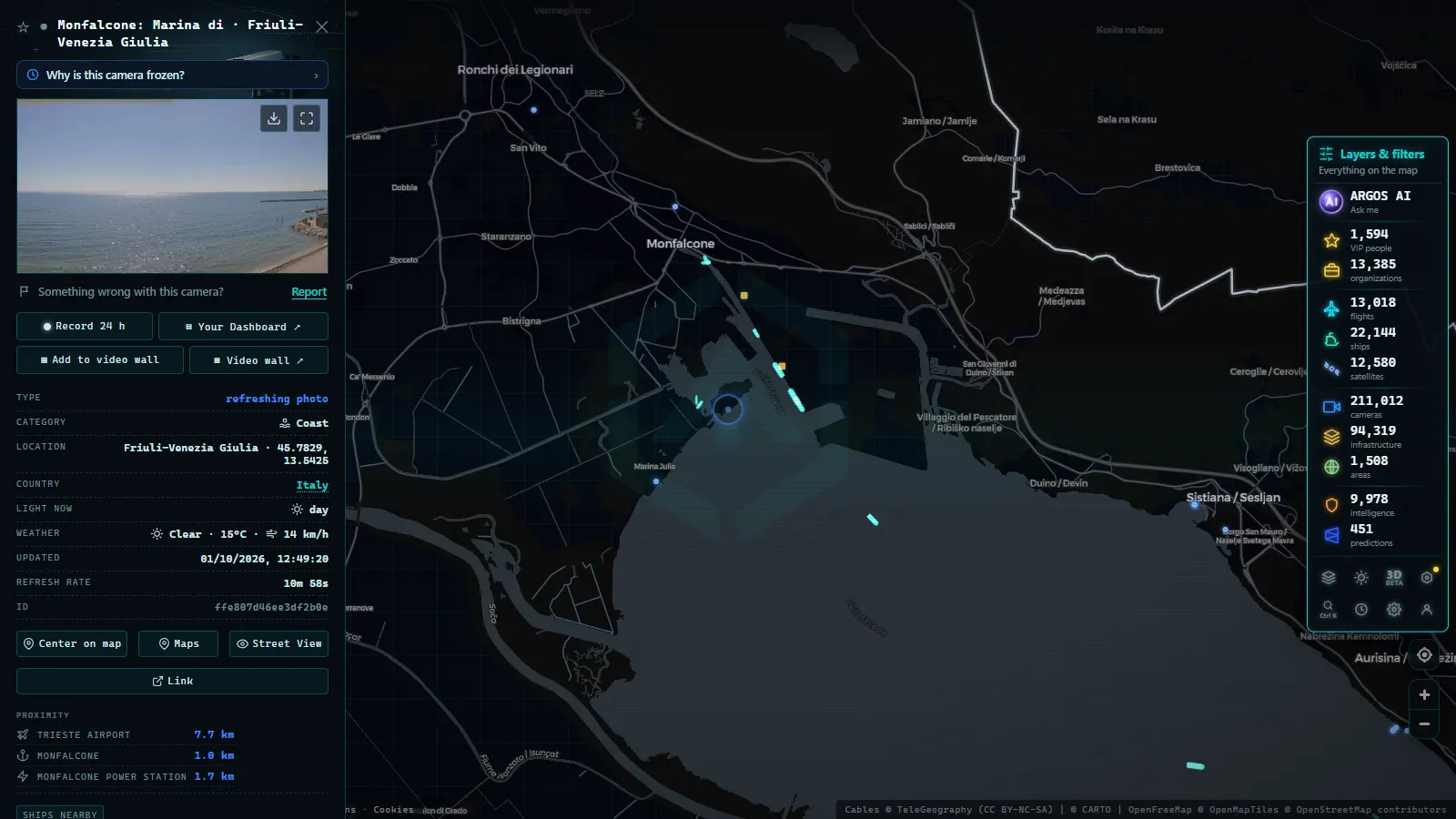
The port of Trieste: cameras watch the roads, AIS watches the ships
The port is the reason the freight exists. Container operations, ro-ro services towards Turkey, general cargo, rail connections inland and the free port zones all sit inside a perimeter that is, correctly, not filmed for the public. There are no public cameras inside the terminals, and there will not be.
So the port splits into two observable halves. On land you watch the roads that feed the gates: the industrial corridor, the ring road ramps and the Rive, where port traffic meets city traffic in the least elegant way possible. On the water you switch layers entirely and read AIS, which is a radio signal each ship broadcasts with its identity, position and course. If you have not used it before, our explainer on how AIS tracks ships in real time covers what the signal contains and what it deliberately leaves out.
The practical trick: if the Rive and the gate approaches look congested and the anchorage in the gulf is unusually full, those two facts are related. A camera alone would leave you guessing why.
What these Trieste traffic cameras live feeds will not show you
The honest list, because it saves you time:
- No number plates, no faces. These are traffic monitoring cameras at low resolution, positioned for flow. Enforcement systems are a separate network and are not published.
- Nothing inside the port terminals or the border facilities. Restricted areas, private security systems.
- Thin coverage of the old town. The centre has a limited access zone and a small historic street grid, but the cameras there are mostly scenic webcams pointed at the sea or the main square, not traffic feeds.
- No sound, no video in most cases. A frame every few minutes means you can miss an incident that clears between refreshes.
- Dead pins. Cameras break, hosts go down, operators retire a unit without removing the URL. A frozen image means a broken camera, not an empty road, and our guide on why a traffic camera stops working explains how to tell the difference in a couple of seconds.
Trieste is not Genoa and it is not Venice
The three cities look comparable on paper, all Italian ports with camera networks, and they behave nothing alike.
Genoa is a motorway problem. The A10, A7 and A12 meet in a mountain city with viaducts and tunnels, congestion is structural, and the cameras you want are the ones on the motorway junctions, as covered in the guide to traffic cameras in Genoa. Venice is a tourist and access problem, concentrated on the causeway and the mainland approaches. Trieste is a border problem. The peak here is not August holiday traffic on a bridge, it is lorries queuing uphill for a crossing, and it responds to customs, weather on the Karst and port calls rather than to the calendar.
That difference changes which camera you open. In Genoa you check the junction. In Trieste you check the ramp before the border, then the coast road, and only then the city. For the wider picture, our overview of traffic cameras across Italy explains how ANAS, the motorway concessions and the regional operators divide the country between them, because the split is not obvious from a map.
A routine that takes one minute before driving into Trieste
- Wind first, in winter. Open a Costiera camera. If the sea is white and the lanes look thin, assume restrictions for vans and caravans and plan the inland route.
- Border second, if you are crossing. Check the RA13 ramp for Fernetti or the RA14 for Rabuiese. Stationary trucks on the approach mean you should leave earlier or pick the other crossing.
- Corridor third. The A4 from Venice and the Lisert and Sistiana junctions tell you whether the delay is regional or local.
- City last. The Rive and Barcola. This is where a port city's freight and its seafront share the same asphalt.
- Water, if the port matters to you. Switch to the ship layer and look at the anchorage.
The global map behind all this carries 200,000+ public cameras (count as of September 2026), and the Trieste corner of it is a good example of why raw totals mean little on their own. What matters is whether the specific stretch you are about to drive has a working camera on it, who runs it, and how recently the frame was taken. In Trieste the answer is usually yes on the ring roads and the coast, and usually no in the old town, which is exactly the shape of a city that lives off a border and a port.
Frequently asked questions
Is the Trieste camera map free, live and does it need an account?
It is free, it needs no registration and no app. The cameras are public feeds published by the road operators themselves, and the map only puts them on one screen. \"Live\" needs a caveat: most Italian road cameras are still images refreshed every few minutes, so what you get is a fresh frame rather than moving video. The ship layer around the port is genuinely continuous, because it comes from AIS transmissions and not from a camera.
Which Trieste road should I check first if the bora is blowing?
The SS14 Costiera between Sistiana and Barcola. It is the cliffside stretch, it is exposed to the east northeast wind along its whole length, and it is the first road in the area to get restrictions for high-sided vehicles. If the Costiera looks bad, the A4 viaducts inland and the elevated sections of the ring roads are usually the next to suffer. The city streets down at sea level in the old town are the least affected.
Can I see the queue at the Fernetti or Rabuiese border crossing?
You can see the approach roads, which is normally enough. The public cameras sit on the RA13 and RA14 link roads before the crossings, so a build up of trucks shows as stationary lanes on those feeds. What you cannot see is the border area itself: the lanes, the truck park and the checks are not covered by public traffic cameras on either side, and no public feed gives you a waiting time in minutes.
Are there cameras inside the port of Trieste?
Not public ones. The container, ro-ro and general cargo terminals are restricted areas with their own security systems, and none of that is published. What is public is the road side: the approaches to the gates, the industrial road corridor and the seafront. For the water itself, the map uses AIS positions instead of cameras, which shows you the ships at berth and at anchor in the gulf without any camera being involved.
Why do some Trieste camera pins show an old image or nothing at all?
Because the feed is coming straight from the operator and operators break things. A camera can be down for maintenance, its host can be slow, a winter storm can knock out power on an exposed stretch, or the operator can quietly retire the unit and leave the URL alive. The honest reading of a frozen frame is that the camera is broken, not that the road is empty. Check the timestamp on the image and, if it looks stale, use a neighbouring camera on the same road.
- Venice traffic cameras live: causeway, Mestre and Marghera
- Georgia 511 Traffic Cameras: Watch I-285 and I-16 Live
- Sicily traffic cameras: the A19, the A18 and the Messina run
- Verona traffic cameras: the A4, A22 and the Garda exits live
- Tokyo Traffic Cameras: What Each Corridor Really Shows
- Alberta 511 Traffic Cameras: Calgary, Edmonton and the Passes