Blog · World webcams
Live Webcams from Around the World: How to Find and Watch Them on One Map
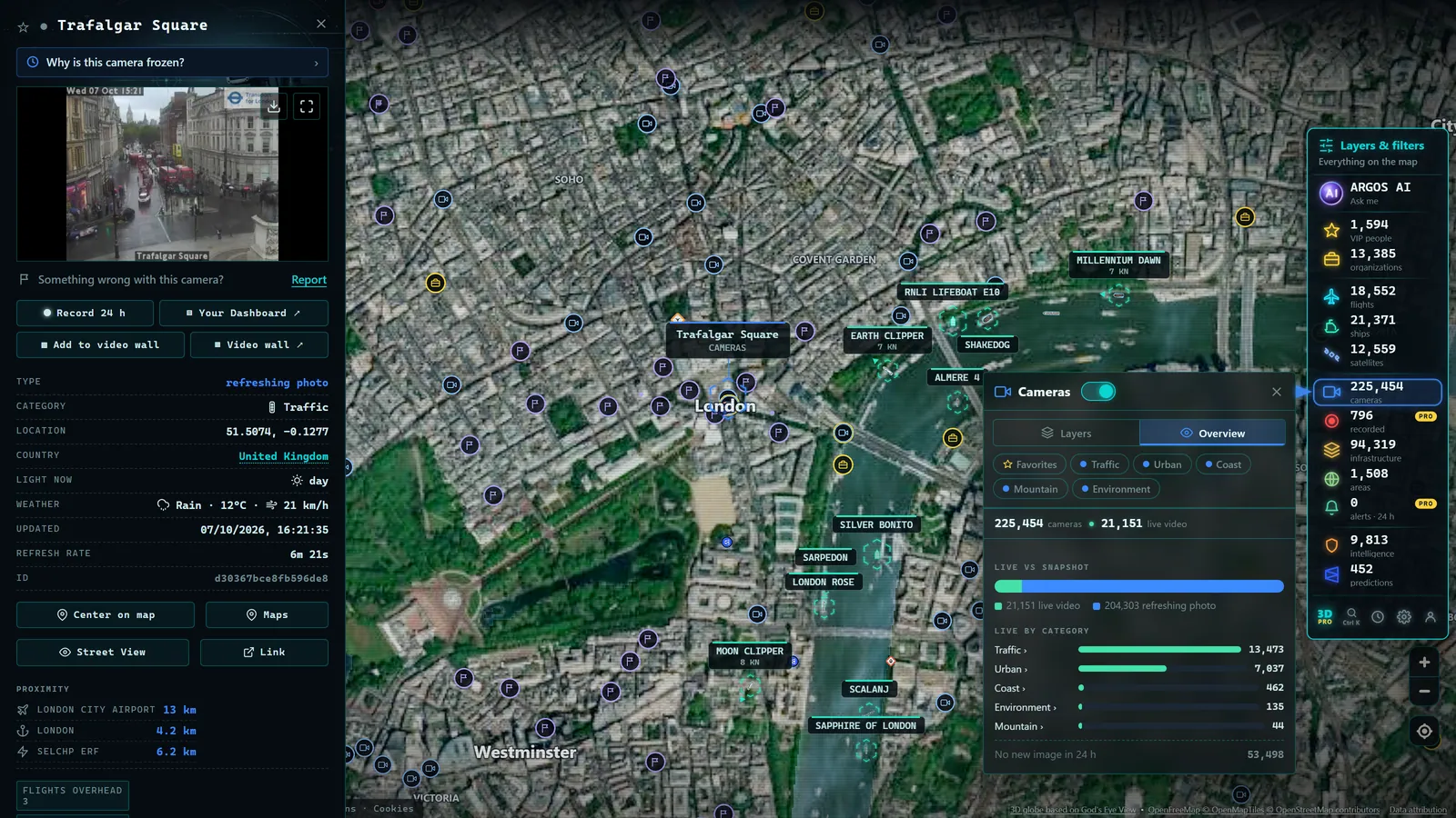
Right now, as you read this, thousands of public cameras are broadcasting images from snow-covered mountain roads, busy harbour entrances, rush-hour boulevards, and summits where the sun is just rising. Live webcams from around the world exist, they are free, and almost all of them are published by some official body. The problem has never been a shortage of cameras: it is that they are scattered across hundreds of different websites, each in its own language, its own format, and its own corner of the internet. This guide explains where those cameras live, why they are so hard to find, and what changes when someone gathers them onto a single map.
The essentials, in 20 seconds
- Four families: traffic, weather and mountain, port and coastal, and urban and panoramic cameras make up the public camera landscape.
- Norwegian Public Roads Administration: operates hundreds of cameras focused on mountain passes and Arctic roads.
- Rotterdam, Singapore, and Los Angeles: among the major ports maintaining live public camera feeds.
- ARGOS ATLAS: aggregates thousands of official public cameras on one worldwide map, free and without registration.
- Still frames: most official traffic and weather cameras refresh a fixed image every few minutes instead of streaming continuous video.
A planet full of cameras broadcasting right now
Most people have no idea how many public cameras are running at any given moment. These are not private surveillance feeds or closed-circuit systems, but cameras that their owners, almost always public agencies and official bodies, deliberately publish in the open so that anyone can view them.
The main families are four:
Traffic cameras. Road agencies in dozens of countries publish cameras covering their motorways, tunnels, and mountain passes. The US supports state-level 511 traveller information systems; the UK National Highways publishes feeds across its strategic road network; similar bodies operate throughout Europe, Asia, Australasia, and the Americas.
Weather and mountain cameras. Meteorological services, ski resorts, and environmental bodies maintain cameras pointed at the sky, valleys, and peaks to document real conditions. The Norwegian Public Roads Administration alone operates hundreds of cameras focused on mountain passes and Arctic roads.
Port and coastal cameras. Harbour authorities and maritime bodies publish views of docks, harbour entrances, and beaches, useful to maritime professionals and curious observers alike. Major ports from Rotterdam to Singapore to Los Angeles maintain live feeds visible to the public.
Urban and panoramic cameras. City transportation agencies and tourism bodies offer views of squares, intersections, and city skylines, sometimes as a traffic management tool, sometimes as a public showcase. Times Square in New York, the Tower Bridge area in London, and Tokyo Shibuya crossing all have public feeds associated with them.
Taken together, these networks form a visual nervous system for the planet that operates twenty-four hours a day. And almost all of it is freely accessible.
Where those cameras live: the archipelago of official portals
Every public camera lives on the website of the body that operates it. That is both its guarantee of reliability and its great practical inconvenience.
A traffic agency publishes its cameras on its own portal, organised according to its administrative logic: by state or province, by road number, by management district. A meteorological service publishes its cameras on a completely different website, ordered by observation station. A harbour authority publishes on its own site, inside a section that might be called operational information or something equally non-intuitive.
Multiply that across dozens of countries and hundreds of bodies and you have the real picture: an archipelago of portals, each with its own language, its own design, its own naming conventions, its own technology. Some are modern and easy to use; others look untouched since the early 2000s. Some offer their own maps; many offer only lists of local place names that mean nothing unless you already know the area.
This fragmentation has a straightforward explanation: each body publishes its cameras for its own audience and its own purpose, managing its road network or informing its citizens, not to form part of a global catalogue. Nobody designed the whole, because the whole was never anyone's goal.
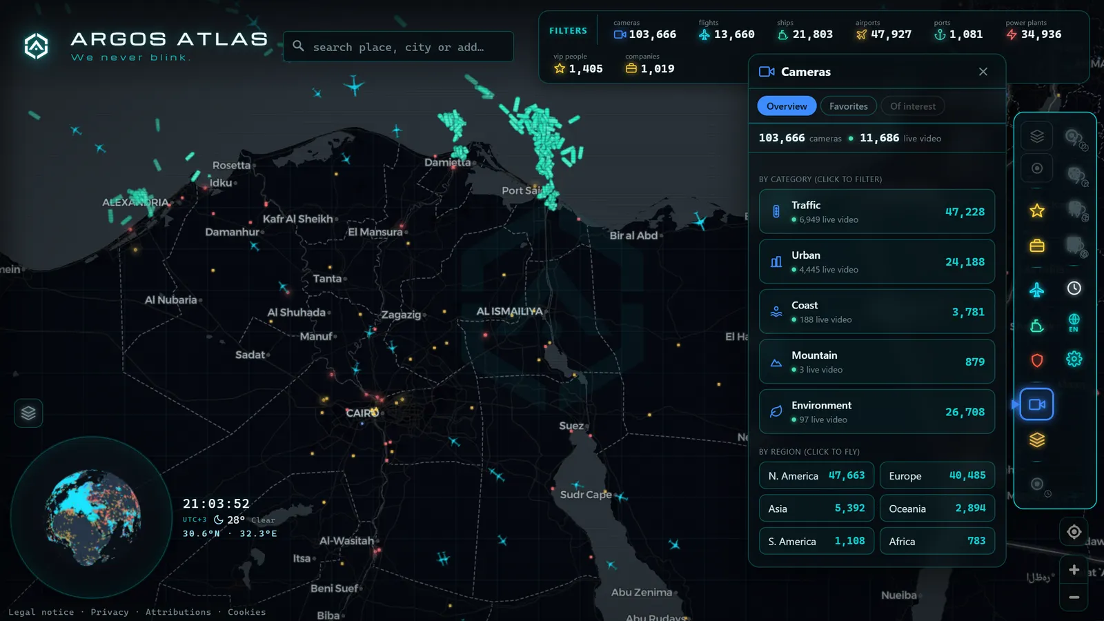
From the ARGOS ATLAS channel.
Why finding them is so difficult
If you have ever tried to locate live cameras for a specific area in a foreign country, say a mountain pass you plan to drive or a port city you are arriving at by sea, you know the experience: a search engine, results in another language, official websites that are hard to navigate, lists of local place names, and if you are lucky, a small image at the end of a long journey.
The barriers are always the same.
Dispersal. There is no central index. Each country, and within each country each body, publishes independently. Just knowing which bodies publish cameras in a given territory requires research of its own.
Outdated websites. Many official portals prioritise function over form. Maps that do not load on mobile, cascading menus, images served at cryptic URLs. The information is there, but reaching it takes effort.
Local naming conventions. Cameras are identified by administrative labels: road codes, kilometre markers, local place names. If you do not know the local geography, a list of a hundred cameras is unreadable. Which one of them points at the place you care about?
Language. Every country's traffic portal is in its own language. That is entirely logical, but it turns international exploration into a constant translation exercise.
The result is paradoxical: an enormous quantity of free, public visual information that most people never use, simply because they do not know it exists or how to reach it.
What changes when someone aggregates them on a map
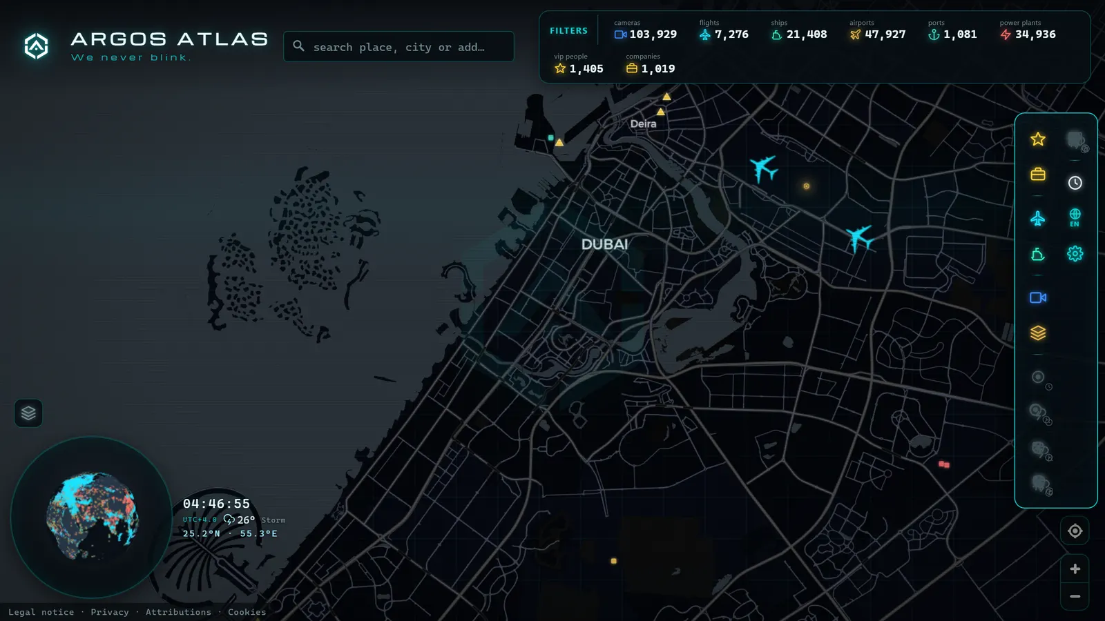
The solution to dispersal is aggregation: gathering cameras from many official sources, geolocating them, and placing them on a single map. The change in experience is radical, because you move from exploring by bureaucracy to exploring by geography.
Instead of asking yourself which body manages the roads in a particular region and where it publishes its cameras, you simply navigate the map to the area you are interested in and see what cameras are there. The question shifts from who publishes this to what do I want to look at, which is the natural question.
That is precisely what ARGOS ATLAS does: it brings together thousands of official public cameras, geolocated on a worldwide map, freely accessible and without registration. Each camera shows the latest frame published by its source, with attribution to the originating body, so you always know where the image comes from. And because the map also includes context layers including live flights, ships, airports, and ports, each camera stops being an isolated image and becomes a window into a broader scene.
Aggregation does not create the cameras: it makes them findable. The value is in turning a hundred scattered websites into a single zoom gesture.
For how this philosophy of exploration applies specifically to cities, the article on watching the world's cities in real time is a good starting point.
What to expect realistically: frames, resolution, and refresh rates
It is worth calibrating expectations, because live webcam does not mean the same thing everywhere, and honesty about limits prevents disappointment.
Still frames versus streaming. Some public cameras, especially tourist and urban ones, do stream continuous video. But the majority of official traffic and weather cameras publish a still frame at regular intervals: a fixed image that refreshes every few minutes. This is not a flaw but a deliberate design choice: streaming video from hundreds of cameras is expensive, and for checking whether a road is icy or a harbour entrance is clear, a recent still frame is entirely sufficient.
Moderate resolution. Public images are typically published at lower resolutions. Their purpose is informational, to see conditions rather than fine detail, and that also protects the incidental privacy of people who appear in the frame.
Different cadences per source. Each body decides how often to refresh its images. Some cameras update every few seconds; most, every few minutes; a handful at longer intervals. The timestamp embedded in or attached to the frame is your reliable reference for how current the image is. For a deeper breakdown of formats and camera families, the guide on types of public cameras online covers each one in turn.
With those caveats in place, what you have in front of you is still remarkable: a real, recent, verifiable view of thousands of points on the planet, at no cost and without asking anyone's permission.
What live cameras are actually used for
The uses of free online webcams are more varied than they first appear.
Pure curiosity. Watching a sunrise on another continent, seeing snow fall on a remote mountain pass, observing rush-hour traffic in a megacity during your own lunch hour. It is the modern version of looking out of a window, except the window opens anywhere.
Travel planning. Before a trip, a camera shows you the actual weather at your destination, how people are dressed this week, whether the beach is crowded or deserted. No promotional photograph competes with a frame captured five minutes ago. Checking the approach roads to Heathrow, the current conditions on the Gotthard Pass, or the state of the harbour at your cruise port becomes a two-minute task.
Professional use. Trucking companies checking mountain passes before dispatch, maritime professionals assessing harbour conditions, mobility analysts observing traffic patterns, operations teams monitoring conditions in remote areas. For these users a camera is not a curiosity but a working tool.
Verification. For journalists and researchers, an official camera with a cited source and a timestamp is a first-order verification tool: it makes it possible to check whether what is circulating on social media matches what is actually visible on the ground. This use is covered in depth in the article on live cameras for journalistic verification. And for distinguishing a reliable source from a dubious one, the key is knowing whether a webcam is official and who publishes it.
FAQ
Are there free worldwide webcams with no sign-up required?
Yes, and that is the norm, not the exception. Official bodies publish their cameras in the open, at no cost and without requiring a user account, because their purpose is to inform the public. Responsible aggregators maintain that spirit: Argos Atlas offers its worldwide map with thousands of public cameras for free, with no registration, always citing the source of each image.
Why do some cameras stream video while others only show still images?
It is a decision made by each operating body, driven largely by cost. Streaming continuous video from hundreds of cameras consumes significant bandwidth, so most official traffic and weather sources publish a still frame every few minutes: enough to assess real conditions. Cameras with continuous streaming tend to be tourist panoramas or urban overviews where the visual experience is itself part of the purpose.
Can I watch cameras from any country?
From many countries yes, but not all, and coverage is uneven. It depends on how many official bodies in each country publish open camera feeds. Dozens of countries have dense public networks, especially in traffic and weather, while others have almost no open feeds at all. An aggregated map shows you at a glance where real coverage exists and where it does not.
How often do the images update?
There is no single answer: refresh cadence depends on each source. Some cameras update every few seconds, most every few minutes, and some at longer intervals. The reliable reference is always the frame timestamp, which shows the exact moment of capture. If the light in the image matches the local time at that location, you are reading it correctly.
What actually makes a live cam "the best"
When people search for the best live cams, they usually mean one of three different things: the busiest feed (a camera pointed at somewhere always full of movement, like a coastal road or a city square), the most reliable feed (one that stays online and updates on schedule instead of freezing or going dark), or the most relevant feed (a camera that happens to show the exact place they care about right now, a hometown, a border crossing, an airport runway). None of these is objectively better than the others; the best camera is the one that matches what someone is trying to see.
That's also why ranking live cams in the abstract doesn't work well. A camera on a quiet residential street is technically identical to one overlooking a major traffic interchange (same protocol, same refresh rate), but only one of them will ever show something worth watching twice. Density helps as a rough proxy: regions with more official traffic and public cameras tend to have a higher chance of catching something interesting live, simply because there are more vantage points to check.
| Region | Public cameras tracked |
|---|---|
| Madrid (metro area) | 1,469 |
| London (metro area) | 1,461 |
| Chicago (metro area) | 1,120 |
| Miami (metro area) | 980 |
| New York (metro area) | 767 |
None of these numbers mean every camera in that area is worth watching on its own; they mean there's more raw coverage to filter through, which is exactly the job an aggregator does. Instead of hunting for "the one good live cam" for a city, it's more useful to filter by what actually matters (airports, coastlines, city centers, borders) and let the map surface the feeds that are active and well positioned. For airport-specific feeds, see the guide to live airport webcams; for a broader country-by-country tour, see watching cities around the world in real time.
In practice, what counts as "best" also changes by the hour: a beach cam is best at sunset, a ski resort cam is best after fresh snowfall, an airport cam is best during a delay or a storm. A fixed top-ten list goes stale the moment conditions change somewhere else; a live map doesn't, because the ranking is time-dependent, not fixed. That's the real argument for browsing by location and category rather than by someone else's list of favorites.
Conclusion
The world has been broadcasting openly for years; what was missing was a reasonable way to watch it. Live webcams from around the world are not hidden, they are scattered: thousands of official cameras spread across hundreds of portals that nobody designed to be explored together. Aggregation on a map solves exactly that: it turns bureaucracy into geography and searching into exploration. If you want to see it for yourself, open the map, zoom in on any corner of the planet that sparks your curiosity, and see what is happening there right now. The window is already open.
Frequently asked questions
Are there free worldwide webcams with no sign-up required?
Yes, and that is the norm rather than the exception. Official bodies publish their cameras openly, at no cost and without requiring a user account, because their purpose is to inform the public. Responsible aggregators maintain that same spirit: Argos Atlas offers its worldwide map with thousands of public cameras for free, with no registration, always citing the source of each image.
Why do some cameras stream video while others only show still images?
It is a choice made by each operating body, driven largely by cost. Streaming continuous video from hundreds of cameras consumes significant bandwidth, so most official traffic and weather sources publish a still frame every few minutes. Continuous-stream cameras tend to be tourist panoramas or urban overviews where the visual experience is itself the point.
Can I watch cameras from any country?
From many countries, yes, but not all, and coverage is uneven. It depends on how many official bodies in each country publish open camera feeds. Dozens of countries have very dense public networks, especially for traffic and weather, while others have almost no open feeds at all. An aggregated map shows you at a glance where real coverage exists.
How often do the images update?
There is no single answer: refresh cadence depends on each source. Some cameras update every few seconds, most every few minutes, and a handful at longer intervals. The reliable reference is always the timestamp on the frame, which tells you exactly when the image was captured.
- Weather Webcams: See Real Conditions Before You Go
- Live Webcams from Latin American Cities: Buenos Aires, Mexico City, Bogota, Lima and Santiago
- Live Webcams from European Cities: Paris, Rome, Berlin, Amsterdam, Vienna, Prague and Brussels
- Live Webcams from Caribbean Coasts: Cuba, Dominican Republic, Jamaica, Puerto Rico, Aruba and Barbados
- APRR Webcam Live: Every Camera, One Live Map
- Spain Eclipse Traffic Measures Aug 12: Path & Live Webcams