Blog · Traffic cameras
Sweden Traffic Cameras: Trafikverket Roads, Corridor by Corridor
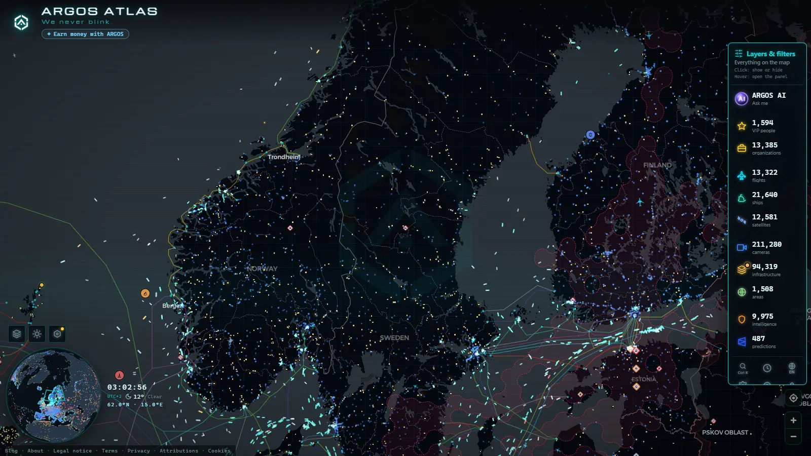
Sweden's road network is watched by a few hundred cameras that almost nobody describes correctly. They are not video. They are still photographs, taken from a mast beside the E4 or the E6, refreshed every few minutes and published by Trafikverket (the Swedish Transport Administration) so drivers can see whether the asphalt ahead is wet, white or clear. Understand that single design decision and the rest of the system stops being confusing.
This guide goes corridor by corridor: the Stockholm to Gothenburg to Malmo triangle where most of the cameras live, the run down to the Oresund crossing where Swedish and Danish operators hand over to each other, and the long northern roads where the gaps between masts are measured in tens of kilometres. It also says plainly what you will not see, which in Sweden means most of the winter evening.
What Sweden traffic cameras actually show
A Trafikverket road camera (vagkamera in Swedish) is usually part of a road weather station, the network known internally as VViS. The same mast carries an air thermometer, a road surface sensor and the camera. The picture exists to confirm what the sensors are claiming: the station reports a surface temperature just below zero, and the image tells you whether that has become a black film of ice or nothing at all.
That purpose shapes the framing. Most cameras point along the carriageway rather than across it, so you get the road surface running away into the distance. It is excellent for judging grip, spray and the snow banks piled at the verge. It is poor for counting cars, and it was never meant for that.
Refresh rates are in minutes. There is no continuous stream, no audio, and no public pan or zoom: you see whatever direction the mast is fixed on, at whatever moment the last frame was captured. Check the timestamp before you act on it. A picture fifteen minutes old during a snow squall is a historical document, not a traffic report. The underlying mechanics are the same across the continent, and we took them apart in our piece on how traffic cameras work and why they are public.
Sweden traffic cameras at night: the honest version
This is the part every other guide leaves out. Sweden is a high-latitude country. In Stockholm, at roughly 59 degrees north, the sun sets before four in the afternoon in December, so the entire evening peak happens in darkness. Go north of the Arctic Circle, to the E10 near Kiruna, and there are weeks in midwinter when the sun does not clear the horizon at all.
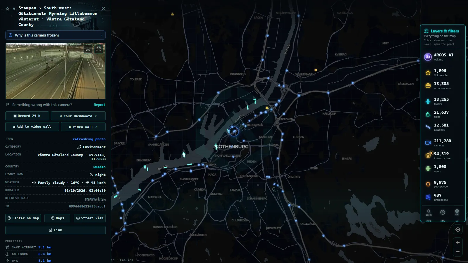
Road cameras have no meaningful low-light capability. On a lit motorway section around Stockholm, Gothenburg or Malmo you still get a usable frame: the lighting picks out the lane markings and you can tell wet from dry. On an unlit rural stretch of the E45 or the E12, the same camera returns a black rectangle with a couple of white smears where headlights passed. That is not a malfunction. That is the hardware doing everything it can do.
Add the seasonal failures on top: snow packed onto the housing, frost on the glass, a lens sprayed grey with salt and road grime, and masts taken out of service while roadworks move them. If a camera you rely on has been dark for days rather than hours, the causes are usually mundane, and we listed them in why a traffic camera stops working.
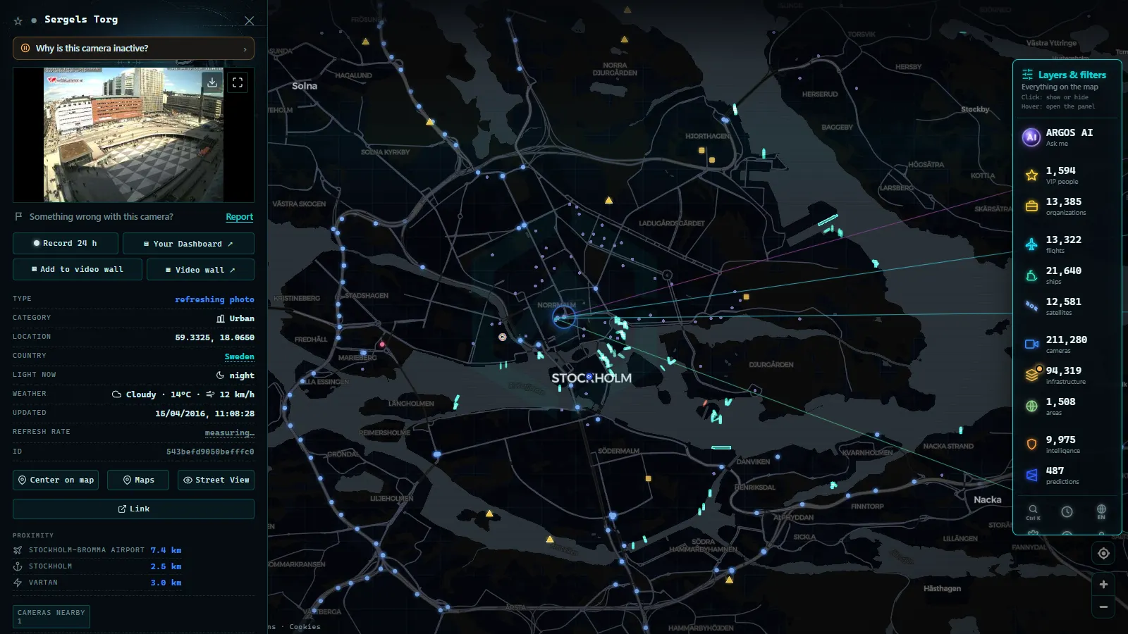
The E4, E20 and E6: the Stockholm to Gothenburg to Malmo triangle
Camera density in Sweden follows population, and population follows the southern third of the country.
The E4 is the spine. It runs from Helsingborg up through Jonkoping and Linkoping to Stockholm, then continues north along the Gulf of Bothnia. The Stockholm section carries the heaviest coverage in the country, reinforced by the city's own operations: Essingeleden and the Sodra lanken and Norra lanken tunnels are watched from Trafik Stockholm, the joint control room run by Trafikverket and the City of Stockholm. Worth knowing: tunnel interiors are monitored for incident response, and not all of those views are published to the public.
The E20 links Stockholm to Gothenburg via Orebro and Skovde, a mix of full motorway and 2+1 road with wire rope barriers. Those 2+1 sections are exactly where winter conditions bite, and where a single frame tells you whether overtaking is happening at all.
The E6 runs the west coast from the Norwegian border at Svinesund down through Gothenburg, Halmstad and Helsingborg into Malmo. Around Gothenburg the pressure points are the Gota river crossings: Tingstadstunneln, Marieholmstunneln and Alvsborgsbron. Around Malmo it is the Yttre Ringvagen and the junction complex feeding the bridge.
Two more corridors deserve a place on your list: the E18 from Stockholm through Vasteras and Karlstad toward Oslo, and the E22 along the southeast coast from Malmo through Kalmar to Norrkoping.
From the ARGOS ATLAS channel.
The Oresund crossing, where two countries hand over
The drive from Malmo to Copenhagen passes through three sets of hands in about twenty minutes. Trafikverket covers the Swedish motorway as far as the Lernacken interchange. The bridge itself, the artificial island of Peberholm and the immersed tunnel belong to the Oresund Bridge Consortium, a Swedish-Danish company with its own control room and its own cameras. On the far side, the Vejdirektoratet takes over.
What matters practically: the crossing is closed by wind, not by congestion. When a westerly gale comes through, restrictions start with high-sided vehicles and can escalate to a full closure. Approach cameras on the Swedish side are the best early read on whether traffic is still moving. The consortium's own views are not always published in the same place as Trafikverket's, so a gap in coverage over the water is the normal state of things rather than a broken feed.
The north: E4 to Haparanda, E10 to Kiruna, E45 inland
North of Gavle the pattern changes completely. The E4 continues through Sundsvall, Umea and Lulea to Haparanda on the Finnish border. The E10 branches inland up to Gallivare, Kiruna and Riksgransen, where it crosses into Norway toward Narvik. The E45, the Inlandsvagen, runs almost the length of the country away from the coast, and the E12 cuts across from Umea through Storuman to the Norwegian border.
Here the masts are sparse and the distance between them is long. That is not neglect, it reflects a different job. You are not checking a queue, you are checking whether the surface is snow-covered, whether there is drifting across an exposed section, and whether visibility has collapsed. Read the image together with the road weather station at the same site and you have something genuinely useful. The same logic governs alpine routes elsewhere, which we covered in mountain pass cameras and checking snow before you travel.
Sweden's corridors at a glance
| Corridor | Route | Who operates the cameras | Typical image | Useful after dark? |
|---|---|---|---|---|
| E4 south | Helsingborg to Stockholm | Trafikverket, plus Trafik Stockholm in the capital | Still frame along the carriageway | Yes on lit sections |
| E20 | Stockholm to Gothenburg | Trafikverket | Still frame, many 2+1 sections | Partly, lighting is patchy |
| E6 | Svinesund to Malmo | Trafikverket, city operators in Gothenburg | Still frame, bridge and tunnel approaches | Yes near the cities |
| Oresund crossing | Malmo to Copenhagen | Trafikverket, Oresund Bridge Consortium, Vejdirektoratet | Approach and structure views, split between operators | Yes, the crossing is lit |
| E4 north, E10, E45 | Gavle to Haparanda, Kiruna, Inlandsvagen | Trafikverket | Road surface and weather, long gaps between masts | Rarely, most stretches unlit |
Watching Sweden traffic cameras on one map
Every Swedish camera we list points back to the operator's own image. We do not re-host the frames and we do not alter them. On the ARGOS ATLAS live map the Swedish masts sit alongside the rest of the continent, inside a catalogue of 200,000+ public cameras (count as of September 2026). Zoom into the E6 corridor, click a marker, and you get the current frame with its timestamp attached.
Three habits make the difference. Check the timestamp before anything else. Compare two consecutive masts instead of trusting a single frame, because one dirty lens can misrepresent forty kilometres of clear road. And in winter, read the camera next to the weather station at the same site: the number tells you the surface temperature, the picture tells you what that temperature did.
One clarification, because it comes up constantly: the grey enforcement boxes along Swedish roads, the trafiksakerhetskameror operated jointly with the police, are a completely separate system. They are not published as public images and nothing on a live map is fed by them. What you can watch is the operational road-condition network, and only that.
For the wider picture, our country by country guide to traffic cameras in Europe shows how Sweden's weather-first approach compares with Rijkswaterstaat in the Netherlands or the regional Autobahn portals in Germany. Sweden gives you fewer cameras than either, positioned with more thought, and honest about the fact that half the year they are pointing into the dark.
Frequently asked questions
Are Sweden traffic cameras free to view, live, and do I need an account?
They are free, and no registration is needed on our map or on Trafikverket's own service. Live needs a caveat: the frames are current but they are still photographs refreshed every few minutes, not a continuous video feed. Always read the timestamp printed on the image before you trust it.
Are Trafikverket cameras video or still images?
Still images. Each mast captures a frame and republishes it on an interval measured in minutes. There is no audio, no continuous stream, and no public control over where the camera points. The design goal is road surface condition, not traffic surveillance, which is why the pictures look the way they do.
Do Swedish traffic cameras work at night?
Partly. On lit motorway sections around Stockholm, Gothenburg and Malmo you get a usable frame all night. On unlit rural stretches, and across the north in midwinter, the image is essentially black with headlight smears. That is the sensor's limit, not a fault, and it affects a large share of the country for months at a time.
Can you watch the Oresund Bridge on a traffic camera?
You can see the Swedish approach through Trafikverket and parts of the structure through the Oresund Bridge Consortium, with the Danish side handled by the Vejdirektoratet. Because three operators share the crossing, coverage over the water is split and a gap between feeds is normal. The crossing closes for wind rather than congestion, so approach views are the earliest useful signal.
Do Trafikverket road cameras read number plates or catch speeding?
No. The public road cameras are low-resolution condition cameras aimed along the carriageway. Speed enforcement in Sweden runs on a separate system, the trafiksakerhetskameror operated jointly with the police, and those are never published as public images. Nothing you see on a live map comes from them.
- Austria Traffic Cameras: Alpine Passes, Tunnels and Vienna
- Iowa 511 Traffic Cameras Live: I-80, I-35 and I-380 in One Map
- Iceland road cameras live: Ring Road, passes and black ice
- Bergamo Traffic Cameras: A4, Tangenziale Sud and Orio al Serio
- Taiwan Traffic Cameras: Who Operates Them and How to Read One
- Florence traffic cameras: ZTL gates, A1, A11 and Peretola