Blog · Traffic cameras
Bergamo Traffic Cameras: A4, Tangenziale Sud and Orio al Serio
Orio al Serio is the reason most people look up Bergamo on a map at all. It is the cheap door into Milan and the lakes, and almost everything that can go wrong on the way there happens on two short pieces of tarmac: the A4 between Dalmine and Seriate, and the Tangenziale Sud that peels off it and drops you at the terminal. If your flight leaves at 06:40 and you are standing in Città Alta at 04:50 wondering whether to order the taxi now or in twenty minutes, those two stretches are the only ones worth checking.
Bergamo is not the edge of Milan, and that changes what you can see. It is a province with its own motorway junctions, its own state roads climbing into three valleys, and its own airport company. Camera coverage follows that geography exactly: solid on the motorway, thinner on the provincial network, and effectively absent inside the airport fence. This page is about which images exist, which of them are real video, and which parts of the journey nobody films.
What Bergamo traffic cameras actually show
Almost every public camera around Bergamo is a still frame, not a live stream. The operator grabs an image on a cycle and republishes it, so what you get is the road as it looked a few minutes ago. That is a real limitation, but for the only question that matters before a flight (is the carriageway moving, or is it a wall of brake lights?) a recent still answers it just as well as video would.
Resolution is deliberately modest. You can count lanes, see whether a queue reaches back past a junction, and tell rain from fog. You cannot read a number plate, identify a driver or see inside a vehicle, and the operators frame them that way on purpose. The background on why these feeds are public at all is in our piece on how traffic cameras work and why they are public.
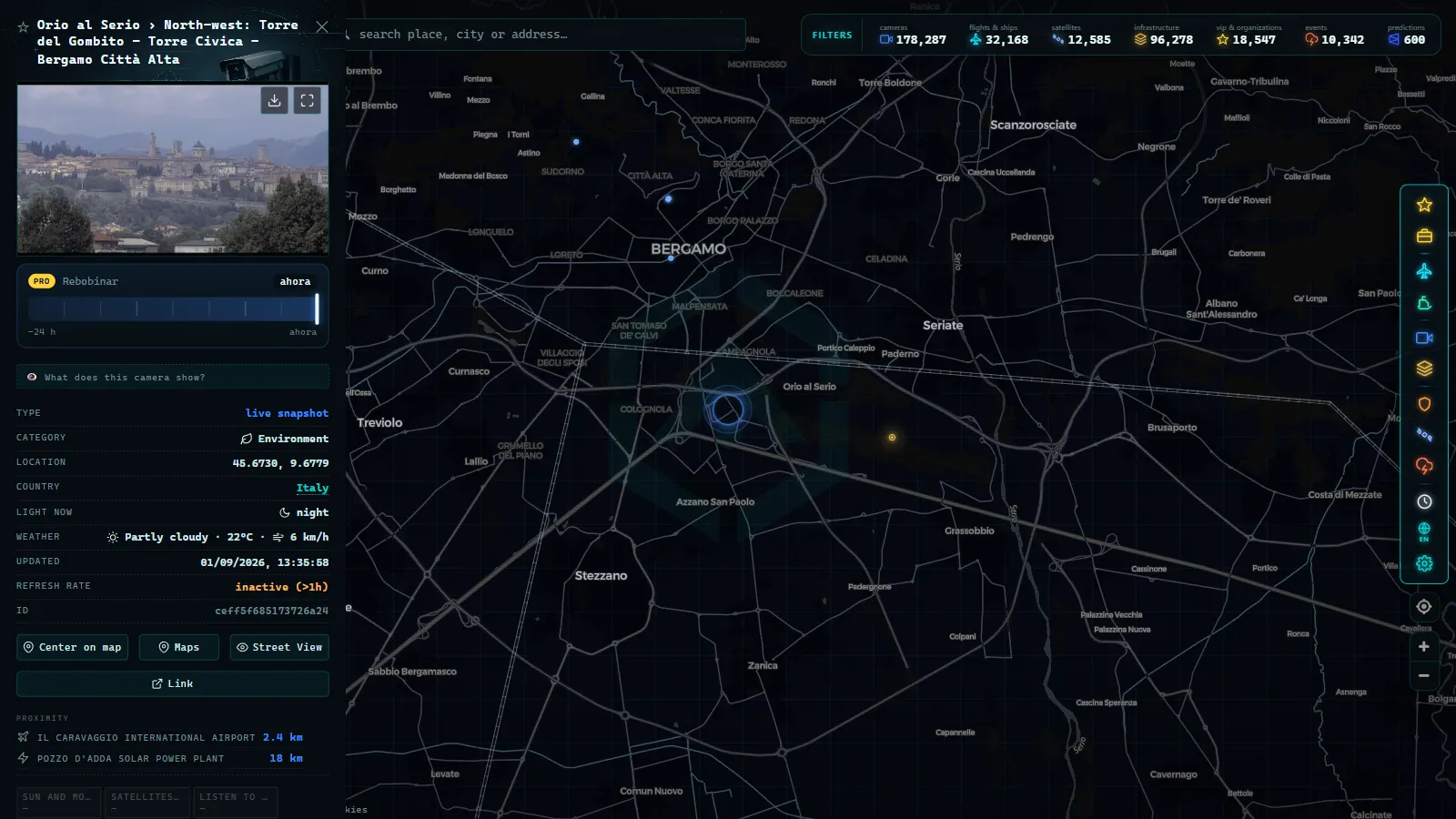
The second thing to know: individual cameras go dark, and in the province of Bergamo they do it more often than in central Milan. A dead link on a valley road, a maintenance window, a frame frozen since yesterday afternoon. If the light in the image does not match the light outside, the camera is not working.
The A4 between Dalmine and Seriate decides your flight
The A4 Milano-Brescia is the spine of everything here, and the Bergamo section of it is one of the busiest pieces of motorway in Italy. Three exits matter for the airport: Dalmine if you are coming from Milan, Bergamo as the standard approach, and Seriate if you are arriving from Brescia or the Garda side. Traffic on this stretch is not tourist traffic. It is the logistics and manufacturing belt of the Bassa Bergamasca commuting at industrial hours, which is why the worst congestion lands on a Tuesday morning rather than a Sunday.
Autostrade per l'Italia publishes camera frames along its own network, and the pattern to look for is not the density of vehicles in one frame but the sequence: if the camera before the exit and the camera at the exit both show stationary traffic, the queue has reached the slip road and you are adding time. If only the exit camera is loaded, it will clear.
The same corridor continues east into the province of Brescia, where we mapped six A4 and Lake Garda camera points, and west towards the Milanese ring roads, covered in what Milan's traffic cameras actually show. Bergamo sits between the two and behaves like neither.
Bergamo traffic cameras road by road
This is the honest inventory of what is available around the city and the airport, and what each type of feed is good for.
| Road or stretch | Who publishes the images | What the frame shows | Still or video | Best used for |
|---|---|---|---|---|
| A4 Milano-Brescia (Dalmine, Bergamo, Seriate) | Autostrade per l'Italia | Carriageway, toll areas, queues at slip roads | Still frames on a loop | Deciding when to leave for a flight |
| Asse Interurbano and Tangenziale Sud | ANAS on the state road sections | Junction approaches and main carriageway | Still frames | The A4 exit to airport run |
| SS 42 towards the Val Cavallina and Lecco | ANAS | Single carriageway, roundabouts, junctions | Still frames | Summer weekend lake traffic |
| SS 470 Val Brembana | ANAS | Valley road, tunnel approaches | Still frames | Winter conditions north of the city |
| Bergamo city streets and Città Alta | Municipal and private webcams | Squares and panoramas, rarely junctions | Mixed | Weather and light, not congestion |
| Airport apron, runway and car parks | Not published publicly | Nothing | None | Use flight tracking instead |
The pattern in that table is the point. Motorway and state road coverage is genuinely useful. Urban coverage in Bergamo is thin compared with Milan, because the municipal cameras that do exist are mostly enforcement and ZTL equipment, which is never published as a public feed. Anyone promising you live views of Bergamo's city centre junctions is showing you tourist webcams pointed at a view.
From the ARGOS ATLAS channel.
The Tangenziale Sud and the last two kilometres into Orio al Serio
The segment that catches people out is the short one. You leave the A4 at Bergamo, join the Tangenziale Sud, and the airport junction arrives quickly. On paper it is a few minutes. In practice this is where traffic from the A4, traffic from the Asse Interurbano, city traffic and every taxi, hotel shuttle and rental return in the province converge on the same set of roundabouts.
The useful reading is simple. If the Tangenziale cameras look normal but the A4 is queuing, you have a motorway problem and leaving earlier solves it. If the Tangenziale itself is stationary, leaving earlier does not solve it, and the bus lanes and the train station at the airport become the better option. Cameras cannot tell you which of the two it is unless you look at both, which is exactly why checking a single frame in isolation is worse than useless.
What no camera in Bergamo shows you
This is the part most guides skip. There is no public camera pointing at the Orio al Serio kerbside, the check in hall, the security queue or the short stay car park. There is no public camera on the runway. The airport company operates its own systems and does not publish them, which is normal for European airports and unlikely to change.
What does exist is the aircraft side of the picture. Arrivals and departures at BGY are visible through ADS-B rather than through any lens, and our catalogue currently tracks 12,633 flights in the air across 47,927 airports worldwide. If your question is really "has the inbound aircraft landed yet", the flight layer answers it and no camera ever will. For the cases where a camera does point at an apron somewhere in the world, we listed them in the guide to airport webcams and watching aircraft live.
Also absent: any camera that will tell you about the bus to Milano Centrale. Road conditions on the A4 are a decent proxy for how the coach will do, and that is as close as public imagery gets.
Getting out: Milan, Como, Iseo and Garda
Most people landing at BGY are leaving the province within the hour, and each direction has a different failure mode. Towards Milan it is the A4 westbound and the Milanese ring roads. Towards Lake Iseo and Sarnico the pressure is on the provincial roads on summer weekends, where camera coverage genuinely thins out. Towards Lake Como you cross to the Lecco side and the SS 36 rules everything. Towards Lake Garda you stay on the A4 east through Brescia, the best covered of the four.
Be realistic about which of those the cameras help with. Motorway directions, yes. Provincial roads through the Franciacorta or the Val Cavallina on a hot Saturday, only partially. The wider picture of which Italian operators publish what is in our overview of traffic cameras in Italy, from Autostrade to ANAS and the Alpine passes.
How to watch Bergamo traffic cameras on the map
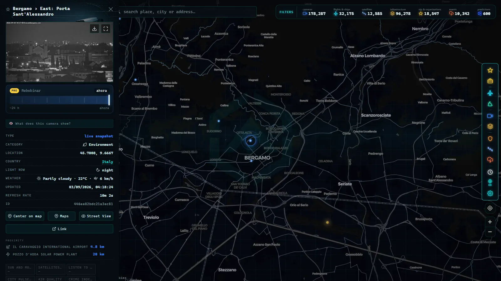
Open the live map of public cameras and flights and search for Bergamo. The cameras layer will show the points that exist around the city, the A4 and the state roads (200,000+ cameras in the catalogue, count as of September 2026). Click one and you get the frame plus the operator name, which is the field that tells you how much to trust it.
Two practical habits. First, always open two cameras on the same corridor rather than one, because a single frozen frame is indistinguishable from empty tarmac. Second, turn on the flights layer if you are meeting someone: the road view and the aircraft view together answer the actual question, which is when to leave the house. If a camera you rely on stops updating, our note on why a traffic camera stops working explains the usual causes and what to use instead.
The one thing worth remembering about Bergamo: the airport is close to the motorway, which is a blessing until the motorway is the problem. Check the A4 first, the Tangenziale second, and never assume the last two kilometres are the easy part.
Frequently asked questions
Is it free to watch Bergamo traffic cameras, and do I need to register?
Yes, it is free and there is no account, no email and no app. The cameras are published by the road operators themselves (Autostrade per l'Italia on the A4, ANAS on the state roads), and our map simply gathers them in one place alongside the rest of the catalogue (200,000+ cameras, count as of September 2026). Open the map, search Bergamo, and click a dot.
Are the Bergamo cameras live video or still images?
Almost all of them are still frames refreshed on a cycle, not continuous video. You see the carriageway as it looked a few minutes ago. For deciding whether the A4 is moving before you leave for a flight, that is enough. For anything that needs second by second detail, it is not, and no public Italian traffic camera will give you that.
Can I see the queue at Orio al Serio departures or the car park?
No. Camera coverage stops at the public road network. The apron, the runway, the terminal kerbside and the car parks belong to the airport operator and are not published as public feeds. The closest useful signal is road traffic on the approach plus live flight tracking for arrivals and departures.
Which road should I check before an early flight from BGY?
Two: the A4 between the Dalmine and Seriate exits, and the short Tangenziale Sud run from the Bergamo exit to the airport junction. Before 06:00 both are usually clear and the cameras confirm it in ten seconds. The pinch points appear from roughly 07:00 on weekdays and on summer weekends heading towards the lakes.
Why does a Bergamo camera sometimes show the same frame all day?
Because it has failed and the operator is still serving the last good image. This happens more often on the provincial and valley roads than on the motorway. If the light in the frame does not match the light outside your window, treat that camera as dead and use a neighbouring one.
- Taiwan Traffic Cameras: Who Operates Them and How to Read One
- Florence traffic cameras: ZTL gates, A1, A11 and Peretola
- Ireland Traffic Cameras Live: Motorways, Tunnels, Cities
- Trieste Traffic Cameras Live: 4 Zones From Port to Border
- Venice traffic cameras live: causeway, Mestre and Marghera
- Georgia 511 Traffic Cameras: Watch I-285 and I-16 Live