Blog · Traffic cameras
Mountain pass cameras: how to check road snow conditions before you travel
The forecast says "possible snowfall above 3,000 feet." Your drive crosses a pass at 4,500. Do you go or do you stay? Do you put snow chains in the car or are you overreacting? Mountain pass cameras exist to remove that uncertainty: instead of interpreting probabilities, you look at the road surface as it actually is right now. This guide shows you how to use them properly, where to find critical-point cameras, how to read the image the way a traffic operator would, what winter road-status levels mean, and how to combine camera, forecast, and official road status to make a confident, evidence-based decision.
Why the camera is the best snow report
All winter road information divides into two categories: information that predicts and information that shows. The weather forecast (essential, never abandon it) works in probabilities: "snow possible," "snow level descending," "accumulations of up to several inches." It is a map of possible futures.
The camera belongs to the other category: it shows the present reality. If the frame shows the road surface black and wet, it is black and wet. If it shows two inches of settled snow across both lanes, that snow is there. No model, no interpolation, no margin of error: it is the road seen with your own eyes from your living room.
This distinction matters especially in mountain terrain, where conditions are notoriously capricious: the snow line rises and falls within hours, one slope can be white while the other is dry, and the critical difference between "it is snowing" and "snow is settling on the road surface" (the one that actually affects your drive) is resolved by no forecast. It is resolved by an image. Within the system of sources we describe in all the ways to watch traffic live, the camera is the essential winter tool.
Mountain passes: the critical points of any road network
Road authorities have known this for generations: when a storm arrives, the road network does not fail just anywhere, it fails at mountain passes. These are the points where altitude raises the probability of snow and ice, where gradients punish heavy vehicles, and where a single jackknifed lorry can block the connection between two regions for hours.
Well-known examples from the world's major mountain ranges illustrate the universal pattern:
- Rocky Mountains, United States: Interstate 70 through the Eisenhower Tunnel and Vail Pass (Colorado), US-40 over Berthoud Pass, US-6 over Loveland Pass. Colorado DOT and its counterparts maintain dense camera networks at these crossings, updating conditions in near real time.
- Alps: the Great St Bernard Pass on the Switzerland-Italy border, the Brenner on the Austria-Italy corridor, the Fréjus linking France and Italy. ASTRA in Switzerland, ASFINAG in Austria, and ANAS in Italy each maintain camera-and-status pages for all major alpine crossings.
- Sierra Nevada, California: US-50 over Echo Summit, I-80 through Donner Pass. Caltrans maintains one of the most visited mountain-pass camera networks in the US, with mandatory chain control zones that can be checked in real time.
- Pacific Northwest and Canada: I-90 over Snoqualmie Pass (Washington), the Trans-Canada through Rogers Pass (British Columbia). These routes can close with little notice during heavy snowfall events.
- Scandinavia: E6 through northern Norway and E45 (Inlandsvägen) in Sweden. Statens vegvesen and Trafikverket publish some of the most detailed mountain road data in the world, with cameras built to operate in extreme cold.
- United Kingdom: the A9 through Drumochter Pass and the A93 over Glenshee in Scotland, managed by Transport Scotland with camera feeds and live condition updates.
Each region has its own critical crossings, and all share the same pattern: when it snows, these are the first to become difficult and the last to be cleared. Precisely because of this, they tend to be the stretches best covered by cameras, traffic control centres want to watch them just as much as you do. If your winter route crosses one of these passes, consulting the camera is not a precaution but the single most useful thing you can do before setting off.
How to read a mountain pass camera image
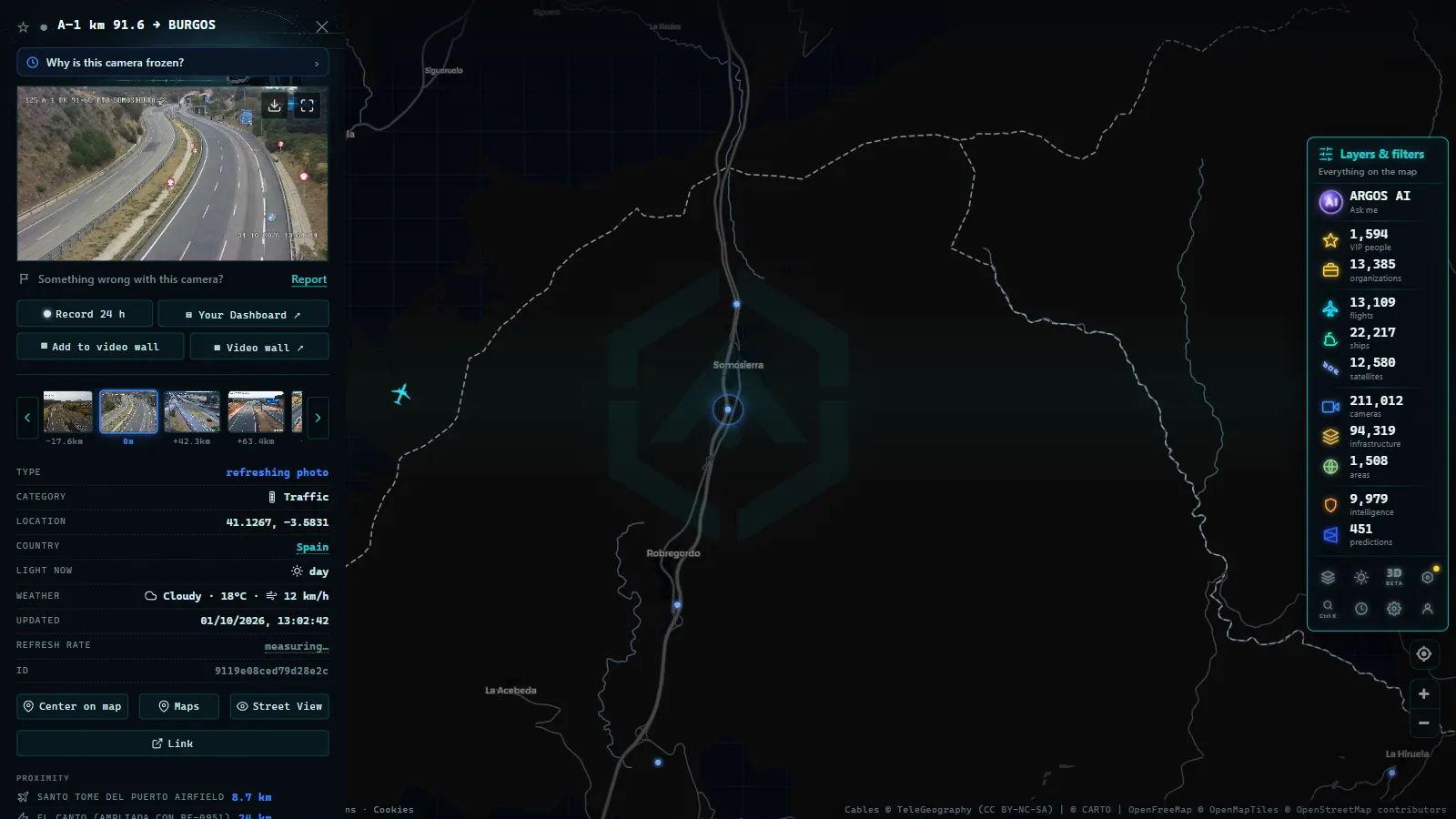
Opening the camera is the first step; reading it well is the second. These are the details a trained eye focuses on:
- Road surface, shoulder, and ditch tell different stories. Snow accumulates first in the ditch and on the shoulder, where no traffic runs, and only later conquers the carriageway. White shoulders with black lanes means snow is falling but the driving surface is still holding, for now. White lanes mean the snow is winning.
- Look for tyre tracks. Two dark strips on a white background show that vehicles are still passing and keeping the lanes open. If the tracks disappear, either no traffic is getting through or snow is falling faster than it is being compacted down. Neither reading is encouraging.
- Timestamp and light both matter. Always check the frame's timestamp: in an active snowstorm, an image from one hour ago is ancient history. Factor in light conditions too: at dawn and dusk, long shadows mislead, and wet tarmac can look like ice, or vice versa.
- A snowplough in view is double information. Seeing a plough working in the frame confirms that snow is falling seriously and that winter maintenance crews are active. After a plough pass, expect a cleaner surface, but one likely covered in salt or brine that may refreeze overnight.
One realistic note: in a full blizzard, the camera lens itself can become blocked by adhering snow, and in extreme conditions some equipment fails entirely. If you encounter a frozen or black image, draw no conclusions from it: our article on why a traffic camera stops working explains the usual causes and what to do.
From the ARGOS ATLAS channel.
Winter road-status levels: how the colour-code system works
The camera tells you what the road looks like; the official status levels tell you what is permitted on it. Systems differ in their exact naming across countries, but the logic is universal and worth understanding:
- Advisory level (Green in many systems): conditions are deteriorating; caution required; initial restrictions may apply to heavy vehicles, speed limits reduced, overtaking bans for trucks beginning.
- Warning level (Yellow or Amber): snow is beginning to cover the carriageway; speed limits apply to all vehicles; lorries may be held at designated waiting areas or prohibited from overtaking.
- Serious level (Red or Orange): all passenger vehicles must carry fitted snow chains or approved winter tyres; heavy vehicles are prohibited from the pass entirely.
- Closed (Black or Red in some systems): no traffic permitted in either direction; any vehicles caught on the pass must wait for emergency service guidance.
Specific implementations: Colorado DOT uses a Traction Law / Traction Law Enhanced / Chain Law scale with specific vehicle exemption categories. Transport Scotland uses a Green / Yellow / Red system for its high-altitude routes. Swiss ASTRA publishes a numbered advisory scale for each alpine crossing. In every case, the underlying severity ladder is the same.
The most effective approach is to read the camera image and the official status level simultaneously. A road that looks white in the image but whose official status is still advisory warns you that conditions are moving faster than the status updates. An official closure with an image showing freshly cleared lanes suggests the critical section is further along the pass than the camera position covers. Each source corrects the blind spots of the other.
Camera + forecast + official status: the winter travel triangle
No single source is sufficient on its own, but all three together create an almost fail-safe system. The method unfolds in three steps:
1. The forecast, the evening before. This tells you whether the scenario carries real risk: the forecast snow level, intensity, critical hours, and weather warnings in force. With this you decide whether the trip needs close monitoring or whether you can set off without concern.
2. The official road status, before you leave. Check the pass status level and any active restrictions on official transport sources, your state DOT website, 511.org, the relevant national highway authority. This is the regulatory fact: what is currently permitted and what is not.
3. The camera, at the last moment. Just before you set off (and, on a long drive, at each stop) open the cameras at the pass and its approaches. This is your visual verification: the step that converts "amber level forecast" into "I can see the lanes are clear and the ploughs have been through, let's go" or "this looks worse than announced, I'll wait two hours."
The forecast tells you whether to be concerned; the official status tells you what you are allowed to do; the camera tells you what is actually happening.
And always, whatever the triangle's verdict: in winter mountain driving, keep chains or appropriate traction devices in the vehicle, leave with a full tank, carry warm clothing, and keep your phone charged. The best information in the world does not replace prudent preparation.
All passes on a mountain range, in a single view
There remains a practical problem: mountain pass cameras are distributed across different agency portals, and locating them one by one (which road was that, what was the reference marker?) wastes precious time precisely when you most need it. If your route allows alternatives (do I cross this pass or the one further east?), the research multiplies.
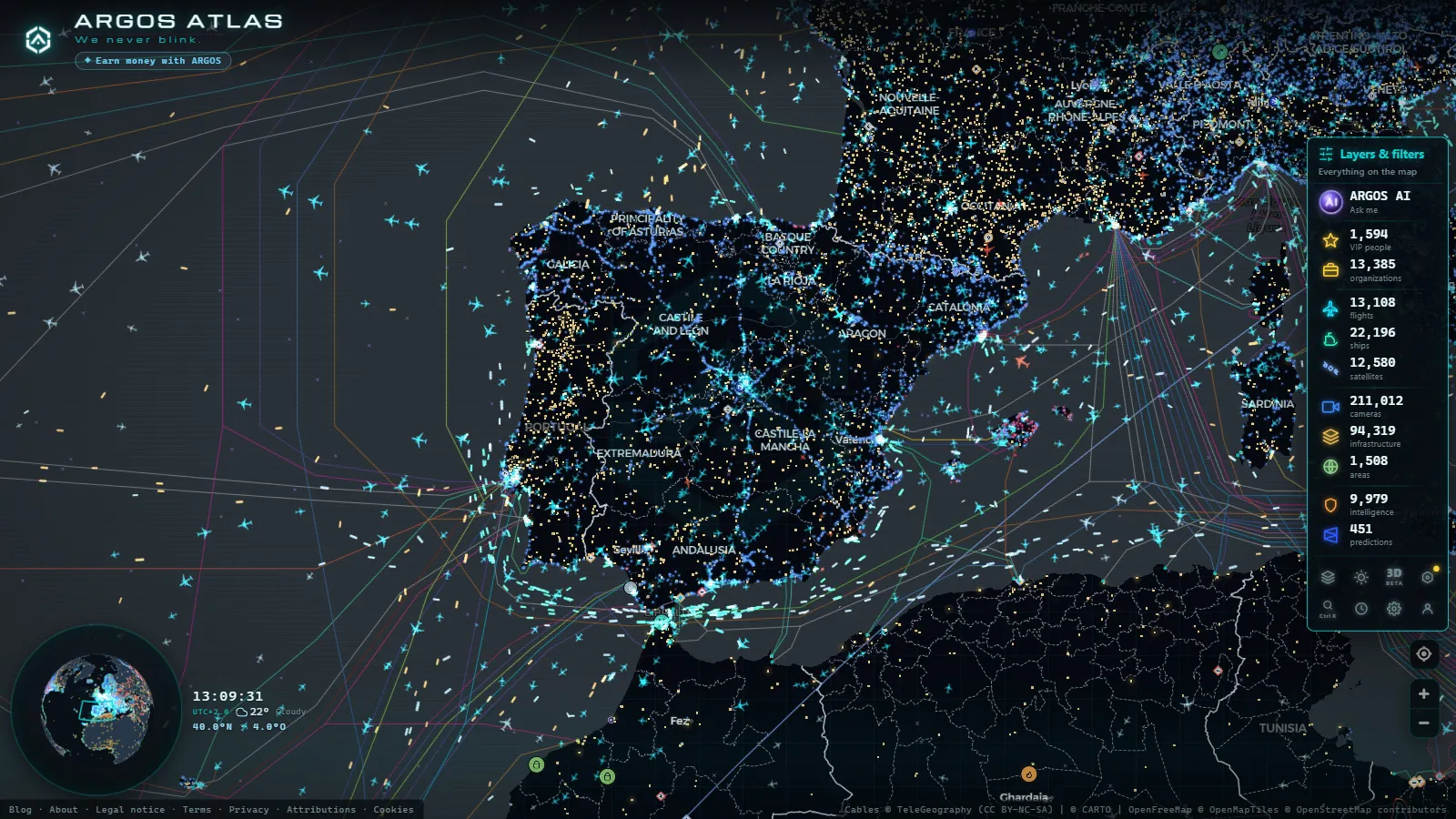
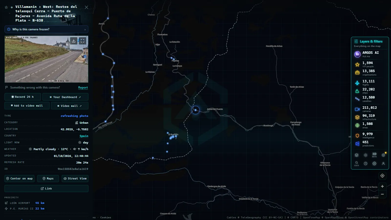
The map format resolves this at a stroke. On Argos Atlas the thousands of aggregated official cameras appear geolocated on the terrain: zoom in on a mountain range and you see at a glance every available camera point at each pass and each approach, showing the latest frame published by each source. Comparing two alternative crossings takes a minute of moving the map rather than fifteen minutes of navigating separate portals, free and without registration. And if your interest goes beyond road conditions, many of these mountain views function equally well as windows onto the landscape: we cover that in weather webcams for watching conditions live.
Frequently asked questions
Where do I check if a mountain pass has snow?
On official traffic cameras installed at the pass and its approaches, published by road authorities (state DOTs in the US, National Highways in England, ASTRA in Switzerland, Trafikverket in Sweden, and their equivalents worldwide) and gathered on aggregators like Argos Atlas where they appear geolocated on a map. For a complete decision, combine cameras with the official road status (what is permitted) and the weather forecast (what is coming).
How often do these cameras update?
Refresh rate depends on each source: most publish a still frame that refreshes every few minutes, but there is no single guaranteed interval. In storm conditions, where everything changes quickly, always verify the timestamp before basing a decision on the image, and reload after a short interval to confirm the trend.
What do winter road-status levels mean?
National systems vary in their exact labels, but the logic is identical everywhere: the first level signals caution and begins restricting heavy vehicles; the second restricts speeds for all traffic and may hold lorries at waiting areas; the third requires all passenger vehicles to fit snow chains or approved winter tyres and prohibits heavy vehicles; the final level closes the road entirely to all traffic.
Is there anything to see at night?
It depends on the camera and road lighting, but often more than you might expect: snow reflects whatever light is available and its contrast with the tarmac can be useful. Night images are still less conclusive than daylight shots; if you cannot see clearly, weight the official road status more heavily and re-check at first light, which typically also coincides with the overnight snowplough run.
Conclusion
Crossing a mountain pass in winter stops being an unknown once you know how to look: the camera shows you the actual road surface, the status levels tell you what conditions require of you, and the forecast warns you of what is on its way. With the full triangle, the decision to go, wait, or take an alternative route is made on evidence, not instinct. The next time a forecast mentions snow at lower elevations, do not sit with the uncertainty: open the map, zoom in on your mountain range, and see with your own eyes how the pass looks right now.
Frequently asked questions
Where can I see whether there is snow on a mountain pass?
On the official traffic cameras installed at the pass itself, published by highway authorities such as US state DOTs via 511, UK National Highways, or French ASFA, and in aggregators like Argos Atlas, which gather them geolocated on a map. Always supplement with the official road status and a current weather forecast.
How often are these cameras updated?
It depends on the source: most publish a still frame that refreshes every few minutes, but there is no single guaranteed interval. Always check the timestamp on the image before relying on it, especially when conditions are changing rapidly.
What do the green, yellow, red, and black winter levels mean?
They are the winter road circulation levels used by highway authorities. Green indicates caution with initial restrictions on heavy vehicles. Yellow limits speed and bans trucks from overtaking. Red requires passenger cars to use chains or winter tyres, and prohibits trucks from travelling. Black means the road is closed.
Can you see anything at night?
Less, but often enough. Many cameras benefit from road lighting and the natural reflectivity of snow. If a night-time image is inconclusive, rely on the official pass status and check again at first light, which usually coincides with snowplough activity.
- Traffic cameras in Europe: where to see the roads in each country
- Live Traffic Mexico City: 15,000+ CDMX Cameras In Real Time
- Live Traffic Cameras in Buenos Aires: Urban Autopistas, Metrobus, and the North-South Corridor
- Live Traffic Cameras in Bogota, Colombia: IDU, Movilidad, TransMilenio and Pico y Placa
- Santiago Traffic Cameras: Local Traffic Updates Live from Chile
- Live Traffic Lima, Peru: Watch Real-Time Cameras Now