Blog · Traffic cameras
Iceland road cameras live: Ring Road, passes and black ice
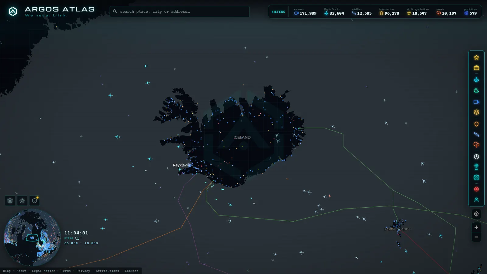
In most countries a traffic camera answers a question about time: am I going to sit in a queue? In Iceland it answers a question about safety: is that road driveable at all right now? The Icelandic Road and Coastal Administration (Vegagerðin) runs both the camera network and the road status map, and the two are designed to be read together. The camera gives you a frame of tarmac. The status map tells you what the maintenance crews have classified that whole stretch as, which is the part that actually decides whether you go.
This guide walks the Ring Road (Route 1) section by section, points at the passes that close and why, and is blunt about the limits: there are things that kill drivers in Iceland that a road camera physically cannot show you. That last part matters more here than anywhere else in Europe.
What Iceland road cameras live actually show
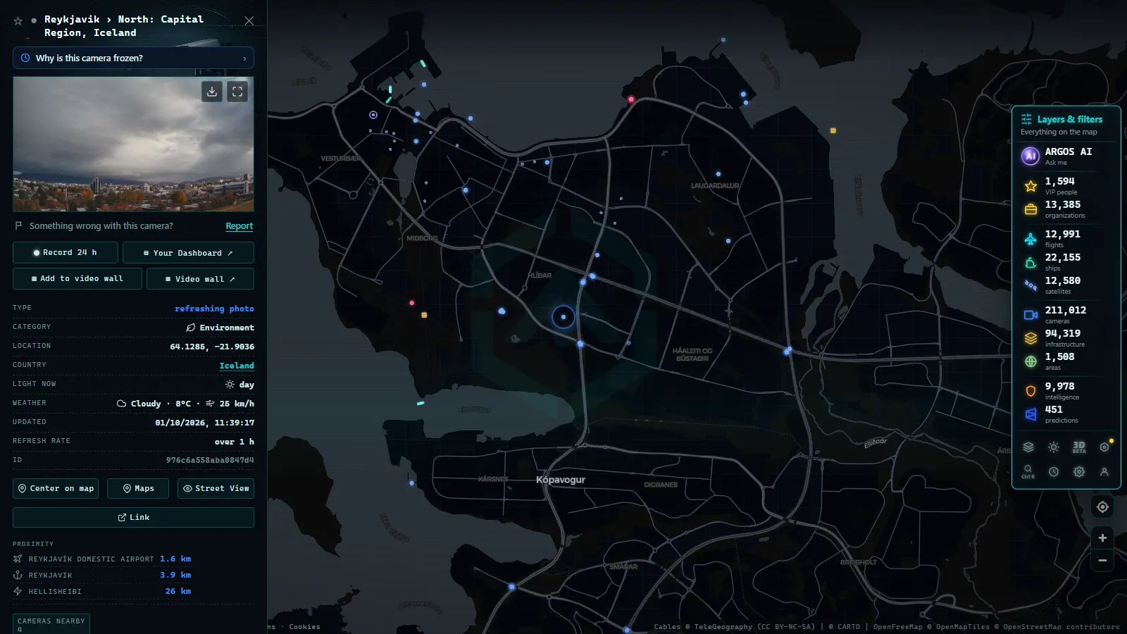
A Vegagerðin camera site is usually a mast carrying two or three fixed views (one per direction of travel, sometimes one looking at the surface) plus an automatic weather station. That pairing is the useful bit: the same page tends to carry wind speed, gust speed, air temperature and often road surface temperature. A frame showing wet-looking asphalt at minus two degrees is not wet asphalt.
Three habits before you read anything into the picture:
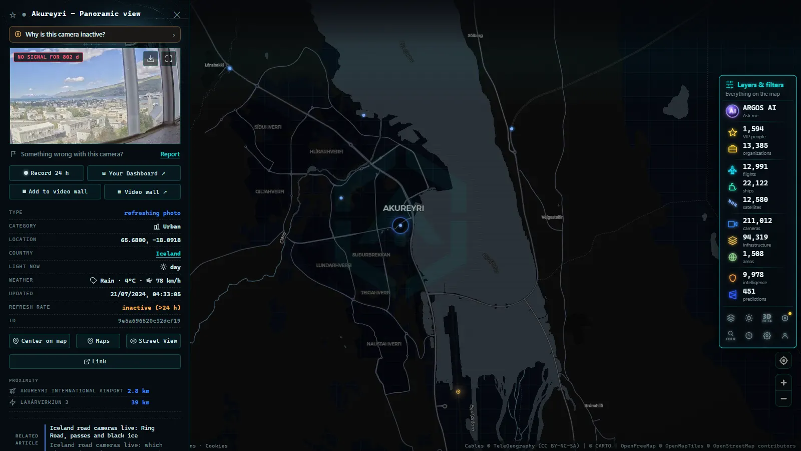
- Read the timestamp first. In winter, exposed sites lose power or connectivity and keep serving the last frame they managed to send. An old image of a clean road is the most dangerous thing on the network.
- Read the wind figure, not the trees. Iceland has almost no trees to tell you what the wind is doing. The number from the weather station is the signal.
- Do not expect detail. These are low resolution stills, enough to see snow cover, drifting, standing water or a plough working. Not enough to read a plate or count vehicles, which is by design. If you want to know how a public camera feed is put together and why the resolution stays low, how traffic cameras work and why they are public covers the mechanics.
The Ring Road section by section
Route 1 is a loop, and its risk is not evenly distributed. The coastal stretches near Reykjavík stay open most of the year. The inland heaths and the high desert crossing in the northeast are a different road in January than in July. This is how the loop breaks down for camera-checking purposes.
| Section | What the cameras mostly cover | Main winter risk |
|---|---|---|
| Reykjavík to Borgarnes | Kjalarnes coast, Hvalfjörður tunnel approaches | Severe crosswind on the exposed coastal run |
| Borgarnes to Blönduós | Holtavörðuheiði heath | Drifting snow, whiteout, closures |
| Blönduós to Akureyri | Vatnsskarð and Öxnadalsheiði passes | Ice, snow, wind-driven drifting |
| Akureyri to Mývatn | Víkurskarð and the Vaðlaheiði tunnel approaches | Snow on the old pass when the tunnel is avoided |
| Mývatn to Egilsstaðir | Möðrudalsöræfi and the high inland desert | Highest, most exposed stretch of Route 1 |
| Egilsstaðir to Höfn | East Fjord roads, Fjarðarheiði on the Seyðisfjörður spur | Avalanche risk, steep pass closures |
| Höfn to Vík | South coast glacial outwash plains | Sandstorms, gale-force crosswind |
| Vík to Selfoss | Mýrdalssandur, Hellisheiði and Þrengsli | Snow and wind closures near the capital |
The pattern to notice: the two stretches that close most often are not the ones tourists worry about. Holtavörðuheiði in the northwest and the inland desert crossing east of Mývatn are where a summer road becomes a genuinely serious winter road, and both have long camera-free gaps between sites.
Iceland road cameras live and the road status vocabulary
Vegagerðin classifies every section with a short list of terms, colour-coded on its map. The vocabulary matters more than the colour, because the wording is precise and the colours are easy to misread on a phone in daylight. In rough order of severity you will see: easily passable, slippery, slippery patches, spots of ice, ice, snow, extremely slippery, impassable, and closed.
Two distinctions people get wrong:
- Impassable is not closed. Impassable means the road has not been cleared and a normal vehicle will not get through. Closed means a gate or a legal closure. Both mean you do not go, but only one of them will have a physical barrier.
- Closed due to wind is its own category. The surface can be perfectly dry. This closure exists because of what the wind does to vehicles, not to the tarmac.
When the classification and the camera disagree, believe the classification. The classification covers the section; the camera covers one mast.
From the ARGOS ATLAS channel.
Mountain passes: why they close and how fast they reopen
Icelandic pass closures are fast in both directions. A pass can go from open to closed in under an hour when a front arrives, and reopen the same afternoon once a plough has run. That is why a check done the night before is worth almost nothing, and why the useful check is the one you do fifteen minutes before you turn the key.
The closure drivers, roughly in order of frequency:
- Wind alone. Sustained gale plus gusts, no precipitation needed. Campervans and high-sided vehicles are the reason.
- Drifting snow. A modest snowfall plus wind fills a cutting faster than a plough can clear it. This is what shuts the heaths.
- Ice. Freeze after thaw, or freezing rain, which produces the worst surface Iceland has.
- Avalanche risk on the steep fjord passes, which closes roads that are otherwise clear.
- Clearing schedules. Outside the Ring Road, and especially in the Westfjords, some roads are only ploughed on set days in winter. Nothing is wrong with the road; nobody is coming to clear it today.
If you want the general method for reading a snowed-in pass from a still image, the guide on how to check mountain pass cameras before travelling applies directly here, and the Nordic comparison in the Finland traffic camera guide shows how a similar network behaves at similar latitudes with more sites and denser coverage.
What the camera does not tell you
This is the honest part, and in Iceland it is the important part.
- Crosswind is invisible. The classic Iceland incident is a door torn off its hinges in a car park, or a vehicle pushed across the centre line on an exposed plain. The frame will look calm and empty.
- Black ice looks like wet tarmac at this resolution, particularly in flat light. If the surface temperature reading is near or below zero and the road looks wet, assume ice.
- Winter darkness kills the camera. Most sites have no illumination. For a large part of the winter day you get black, or headlights on black.
- Blowing sand and ash on the southern outwash plains strips paint and cracks windscreens in wind that does not close the road.
- The lens itself lies. Snow, frost or salt spray on the housing produces a blurred grey frame that reads as fog when the road is fine, or as fine when it is not.
- A camera is a point. Between two sites on a heath there can be tens of kilometres with nothing watching them.
On top of that, cameras go down and stay down for days at remote sites, which is normal rather than a fault. If a marker is dead when you open it, why a traffic camera stops working explains the usual causes and what to check instead.
How to watch Iceland road cameras live on one map
On the ARGOS ATLAS live map you can turn on the camera layer, zoom to Iceland and click any marker to get the latest published frame with its source and timestamp. The map aggregates 200,000+ public cameras worldwide (count as of September 2026), which makes it convenient for comparing a route across borders in one place.
Be realistic about the coverage, though. Iceland is one of the thinnest camera patches in Europe on any aggregate map, ours included. A single Spanish region or a US state carries thousands of sites; a whole Icelandic pass may carry one. The aggregate view is good for finding what exists along a route and terrible as a substitute for the official status page, which is where the classification, the closures and the plough information live. Use both, and if you want to verify which feed you are actually looking at, how to tell whether a webcam is official is the short version.
A five minute routine before you drive
- Open the road status map for the entire route, not just your starting point. Conditions in Reykjavík say nothing about Holtavörðuheiði.
- Check the wind forecast at pass level, not at sea level, and check gusts rather than the average.
- Open two or three cameras spread along the route and confirm their timestamps are recent.
- Decide your turn-back point before you leave, and name it out loud. This is the step everyone skips.
- Re-check immediately before departure. Anything checked the previous evening is stale.
Done properly this takes about five minutes and it is the cheapest safety margin available in Icelandic winter driving. The cameras will not make the decision for you, but combined with the status classification and the wind readings they turn a guess into an informed call, which is all you can honestly ask of a public camera network.
Frequently asked questions
Are Iceland road cameras live and free to watch?
Yes. The Icelandic Road and Coastal Administration publishes its road cameras and weather stations openly, and you can also open them from our map with no account, no signup and no payment. What you get is a recent still image, refreshed every few minutes, not a continuous video stream.
How often do the Icelandic road cameras refresh?
Most sites publish a new frame every few minutes rather than streaming. In winter that gap stretches at exposed sites that lose power or connectivity, so always read the timestamp on the frame before you trust it. A picture of clear tarmac taken three hours ago tells you nothing about the pass right now.
Can a road camera tell me if a mountain pass is closed?
Not on its own. A camera shows one point of the road, while a pass can be twenty or more kilometres long with drifting snow only on the leeward side. Use the official road status classification for the whole section and treat the camera as confirmation, not as the decision.
Why do Icelandic roads close for wind when the surface looks dry?
Crosswind and gusts do not appear in a still image. Sustained wind lifts gravel and sand, rips open doors and pushes high-sided vehicles and campervans off the line, which is why sections such as the exposed inland stretches and the south coast sand plains close in conditions that look harmless on camera.
Do the cameras work at night in the Icelandic winter?
Barely. Most road cameras have no illumination of their own, so during the long winter nights you get a black frame with headlights or nothing at all. For a good part of the winter day the camera is useless and you have to fall back on the road status classification and the wind readings from the nearby weather station.
- Bergamo Traffic Cameras: A4, Tangenziale Sud and Orio al Serio
- Taiwan Traffic Cameras: Who Operates Them and How to Read One
- Florence traffic cameras: ZTL gates, A1, A11 and Peretola
- Ireland Traffic Cameras Live: Motorways, Tunnels, Cities
- Trieste Traffic Cameras Live: 4 Zones From Port to Border
- Venice traffic cameras live: causeway, Mestre and Marghera