Blog · Traffic cameras
Iowa 511 Traffic Cameras Live: I-80, I-35 and I-380 in One Map
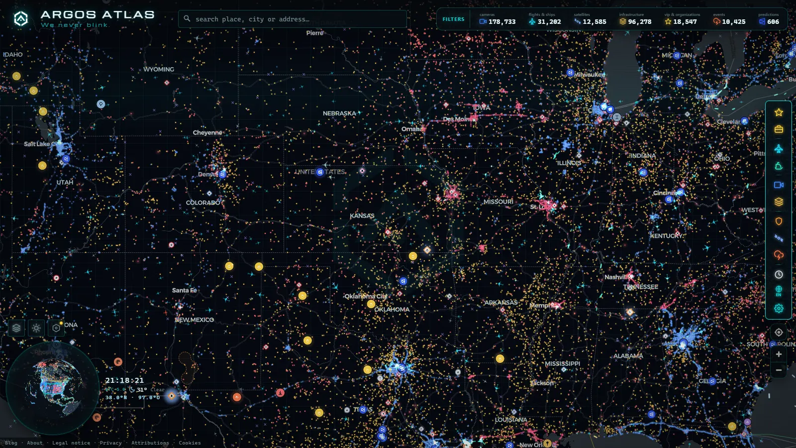
Iowa is a state most drivers cross rather than visit, and from December to March that crossing is the whole problem. The Iowa DOT publishes its highway cameras through the 511ia system, and in a bad week they are the difference between a five hour run to Omaha and an unplanned night in a motel in Newton. This guide covers what those cameras actually show along I-80, I-35 and I-380, how the snowplow cameras differ from the fixed ones, and where the coverage thins out to nothing.
Two things are worth knowing before you open anything. Nearly every Iowa DOT feed is a still image on a refresh cycle, not a video stream: what you get is a photo taken a few minutes ago. And the official viewer shows you one camera at a time on a map you have to keep clicking, which is exactly the wrong interface on the day a front is crossing the state and you want six points along I-80 side by side.
The essentials, in 20 seconds
- 511ia: is the Iowa DOT system that publishes the state's highway cameras as refreshed still images, not live video.
- I-80: runs roughly 300 miles from Council Bluffs to the Quad Cities and carries most of the through freight.
- I-35: crosses Iowa from the Missouri line to the Minnesota line, sharing pavement with I-80 through Des Moines.
- I-380: links Iowa City, Cedar Rapids and Waterloo as a commuter corridor rather than a freight one.
- 200,000+ cameras: is the worldwide count in the ARGOS ATLAS catalogue that the Iowa feeds sit alongside (September 2026).
What the Iowa 511 traffic cameras live network covers
The Iowa DOT network is built around the interstate system, not around city grids. Cameras sit at interchanges, at rural mileposts on the long empty stretches, at the river bridges, and in the urban cores of Des Moines, Cedar Rapids, Davenport, Council Bluffs, Iowa City, Waterloo, Ames, Dubuque and Sioux City. Many share a site with a road weather station, which is why an image and a pavement temperature reading often appear together.
That layout tells you what to expect. On the interstates you can usually find a camera within a sensible distance of wherever you are. On US and state highways the spacing gets long. On county roads there is nothing at all. If your route leaves I-80 at Williamsburg and heads north on a two lane, the interchange camera is the last real information you get, and everything after it is a forecast.
The Iowa DOT feeds sit alongside the rest of the American state networks in our catalogue, which holds 200,000+ cameras worldwide (count as of September 2026). The practical value of pooling them is not the total; it is that a Midwest storm does not respect a state line, and neither should the window you are watching it through. Our guide to traffic cameras in the United States covers how the state DOT feeds fit together.
I-80, I-35 and I-380: the three corridors that matter
I-80 is the main haul, roughly 300 miles from Council Bluffs on the Missouri River to the Quad Cities on the Mississippi, carrying most of the through freight. Its winter weakness is the open farmland west of Des Moines, where there is nothing to stop wind from moving snow across the lanes long after the snow stopped falling.
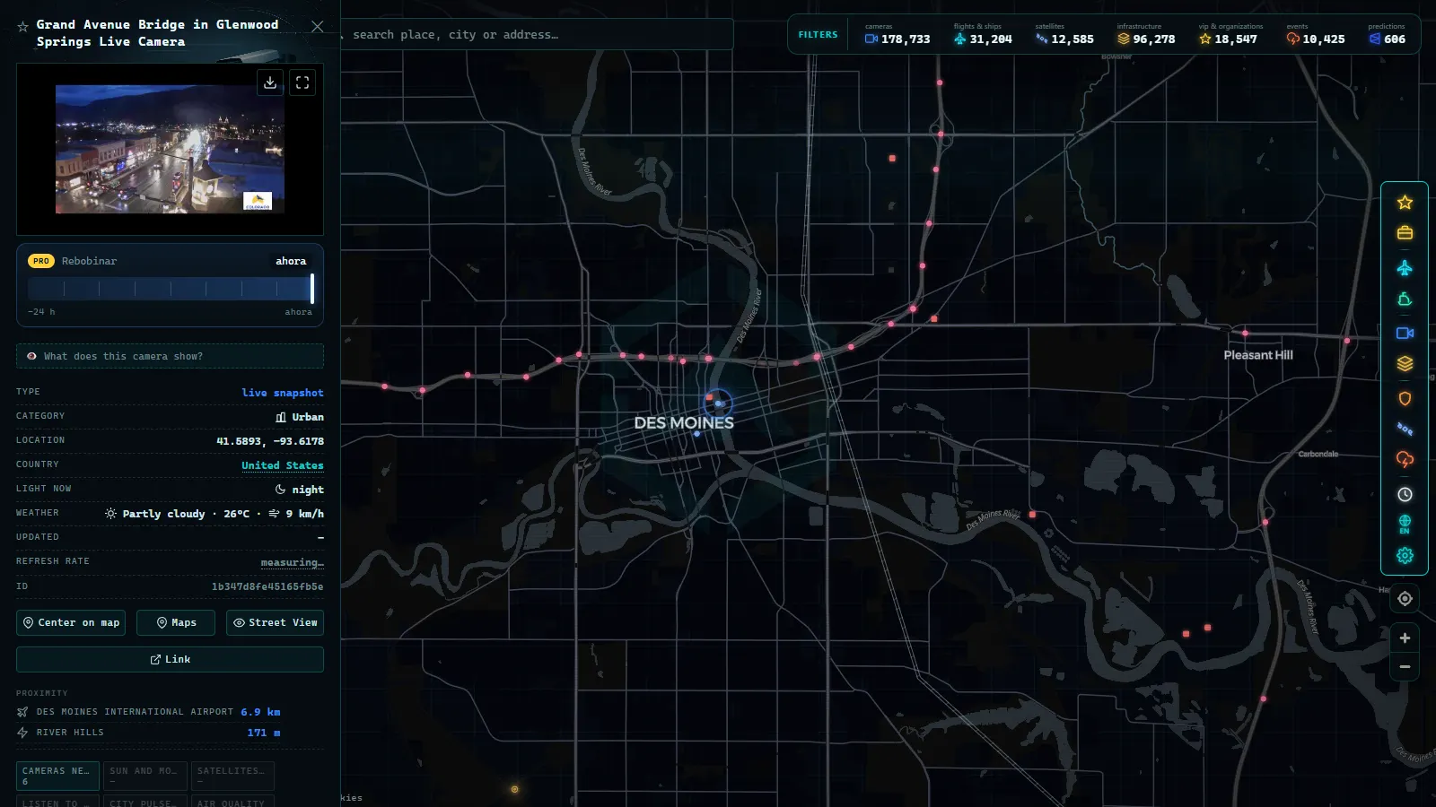
I-35 runs north to south, from the Missouri line up through Des Moines and Ames to the Minnesota border, and shares pavement with I-80 around the Des Moines metro. That shared section is the densest camera cluster in the state and the one that tells you least about the rest of it.
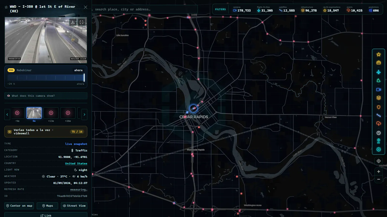
I-380 links Iowa City to Cedar Rapids and on to Waterloo. It is a commuter corridor rather than a freight one, so its cameras show you a rush hour problem in the morning and a weather problem in the afternoon.
| Corridor | Route | Camera density | What winter tests |
|---|---|---|---|
| I-80 | Council Bluffs to Davenport | High at metros, moderate on the rural miles | Ground blizzards on exposed farmland west of Des Moines |
| I-35 | Missouri line to Minnesota line | Highest on the Des Moines concurrency | Drifting north of Ames, early closures near the state line |
| I-380 | Iowa City to Cedar Rapids to Waterloo | Good through the urban stretch | Freezing rain on the elevated sections |
| I-29 | Sioux City to Council Bluffs | Moderate | Wind off the Missouri River valley |
| US-20 | West to east across the north | Thin outside towns | The first corridor to lose visibility, the last to be reported |
For comparison across the Mississippi, the Illinois DOT network contributes 2,149 cameras to the catalogue (count as of September 2026), of which 1,119 are in the Chicago area. That density is a metro effect, not a better agency, and it is a useful reminder that rural Iowa mileposts will never be watched as closely as an urban expressway. Our piece on Illinois traffic cameras breaks that network down.
From the ARGOS ATLAS channel.
What the Iowa DOT cameras show when the state closes
Iowa's winter problem is frequently not falling snow but wind moving snow that fell days ago. A ground blizzard can shut a corridor under a clear sky, and it is the one condition that a text bulletin describes badly and a camera describes perfectly.
Read the frames like this. If you can see the centre line and the tyre tracks, the lane is workable. If the frame is uniform grey with a guardrail faintly visible and no markings at all, visibility at that point is down to a few car lengths, whatever the forecast says. If half the frame is dark pavement and half is a white sheet, you are looking at the edge of a drift crossing the road, which is the classic Iowa pattern and the reason closures often start with a single segment rather than a whole route.
The official colour coded road condition classification and the travel not advised designation are the authoritative statements, and you should treat them as such. But they are applied to whole segments and they are updated by people who are also managing an actual storm, so they lag. The camera is the faster signal for one specific point; the classification is the one that matters when you decide whether to be on the road at all. The same logic applies anywhere weather closes a route, which we covered in the guide to mountain pass cameras and checking snow before you travel.
Fixed highway cameras and snowplow cameras: the real difference
Iowa is one of the states that mounts cameras on its snowplows and publishes what they see. Those images answer a different question from the fixed poles, and confusing the two is the most common mistake people make with this network.
| Fixed highway camera | Snowplow camera | |
|---|---|---|
| Where the image comes from | A pole at a known milepost | The windscreen of a moving truck |
| Available when | All year, day and night | Winter operations only, while trucks are out |
| Position | Fixed, so you can compare today with last week | Changes constantly along the plow route |
| Update pattern | A regular refresh cycle | Whenever the truck uploads |
| Best question it answers | Is this interchange moving right now | Is there pavement under the snow on this stretch |
| Main weakness | Ice on the lens, glare at dawn and dusk, operator may have panned it elsewhere | Nothing at all when the trucks are parked |
The practical read: a fixed camera gives you the state of one point continuously, a plow camera gives you the surface where a truck happens to be, at driver eye level, which is the only view that shows whether a lane has been cleared to pavement or merely packed down. One caveat that trips up first time viewers: a plow camera frame filled with a wall of white directly ahead is often the truck's own snow cloud, not the weather. Look at the shoulder and the sky, not the centre of the frame.
What you cannot see with the Iowa 511 traffic cameras
No audio, no continuous video, and no control. Some cameras are pan and tilt units moved by operators for their own purposes, so a camera can be pointed at the ramp when you need the mainline, and there is nothing you can do about it. Resolution is deliberately low: these are operational tools for traffic management, not identification devices, and you will not read a plate or recognise a face on one.
Outages cluster at the worst moment. Ice on the housing, a power cut at a rural site, a communications link that drops in the same storm you are trying to watch. Expect a share of dead thumbnails during a blizzard and do not read a frozen image as good news. Our guide on why a traffic camera stops working covers the usual causes and what to check instead.
And there are simple geographic gaps. City streets outside DOT jurisdiction, county roads, most of the secondary network. Iowa's grid of gravel and farm to market roads is enormous and almost entirely unwatched, which matters because those are the roads that drift shut first.
How to watch several Iowa cameras at once
The official site is fine for a single lookup and painful for a corridor. On the ARGOS ATLAS live map you can zoom to a stretch of I-80 and see the cameras along it as points you can open in sequence, then move east to the Quad Cities and compare, without losing the view you already had. The useful habit in winter is to sample a corridor at three or four spaced points rather than staring at one: a single clear image means one milepost is clear, nothing more.
A five minute check before crossing Iowa in bad weather:
- Open the official Iowa DOT road condition classification first and note which segments carry a warning.
- Sample three cameras along your corridor, one near your origin, one at the halfway point, one near the exit you plan to take.
- Check every timestamp before you believe any frame.
- If plow images are available on that route, look at them for surface condition and at the fixed cameras for visibility.
- Decide on the worst of the images, not the best one. Iowa closures are local, and the twenty miles you cannot see are the ones that will stop you.
Frequently asked questions
Are Iowa 511 traffic cameras free to watch, and do I need an account?
Yes, they are free, and no account is needed. The Iowa DOT publishes its highway camera images as public information, and our map shows them along with the rest of the catalogue without registration, payment or an app install. You open a page and the images are there.
Are the Iowa DOT cameras live video or still images?
Almost all of them are still images on a refresh cycle, not continuous video. You are seeing a photo taken a short time ago, and the interval varies by site and by how the network is behaving that day. Always read the timestamp: during a storm, a picture that is twenty minutes old can look far calmer than the road actually is.
Why do the Iowa snowplow cameras disappear in summer?
Because they are mounted on trucks, not poles. Plow camera images exist only while the trucks are out on winter operations. When a storm ends, or when the DOT pulls its plows off the road because conditions are too bad to work in, the images stop arriving. Fixed highway cameras keep publishing all year.
What does a road marked travel not advised look like on the cameras?
Usually a uniform grey or white frame with a guardrail or a delineator post barely visible and no lane markings at all. That is blowing snow rather than a lens fault. The official classification is the one that matters legally, but it is applied to whole segments and it lags; the camera is the faster signal for one specific point.
Why is a camera on I-80 showing a black, white or frozen frame?
The most common causes are ice or wet snow on the housing, a power or communications cut at a rural site during the same storm you are trying to check, or a night scene with no headlights in it. Rural Iowa cameras are lit by passing vehicles only, so between dusk and dawn many of them show almost nothing.
- Iceland road cameras live: Ring Road, passes and black ice
- Bergamo Traffic Cameras: A4, Tangenziale Sud and Orio al Serio
- Taiwan Traffic Cameras: Who Operates Them and How to Read One
- Florence traffic cameras: ZTL gates, A1, A11 and Peretola
- Ireland Traffic Cameras Live: Motorways, Tunnels, Cities
- Trieste Traffic Cameras Live: 4 Zones From Port to Border