Blog · Traffic cameras
Live Traffic Cameras in Germany: BASt, Autobahn Monitoring and State Portals
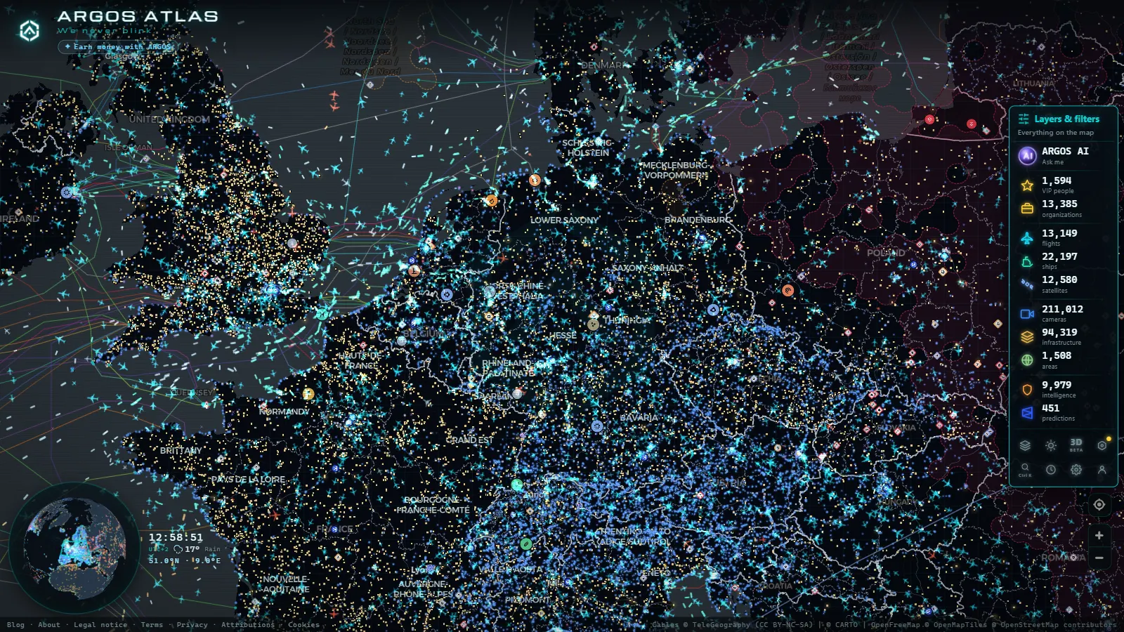
Germany operates one of the most sophisticated road monitoring networks in Europe. The Autobahn is globally recognised for its no-speed-limit sections, but what is less well known is the dense layer of cameras, sensors and digital portals that keep watch over every major corridor, interchange and border crossing. Understanding that infrastructure matters whether you are a long-haul driver planning a route, a data journalist covering European logistics or simply curious about how a country manages hundreds of billions of vehicle kilometres each year.
The federal backbone: BASt and verkehr.bund.de
The institutional foundation of German traffic monitoring is the Bundesanstalt für Straßenwesen, universally abbreviated to BASt. Subordinate to the Federal Ministry for Digital and Transport, BASt is responsible for road safety research, technical standards and the operation of a nationwide network of automatic traffic counting stations on federal motorways (Autobahnen) and federal roads (Bundesstraßen).
BASt stations capture data every minute: vehicle counts, average speeds and a breakdown by vehicle class (cars, lorries, motorcycles, buses). That data flows into verkehr.bund.de, the federal traffic information portal, which aggregates it alongside incident reports, roadworks and weather-related restrictions from all sixteen Bundesländer.
verkehr.bund.de functions as the single federal point of access, consolidating information from all Bundesländer into a common interface, but each state retains full operational control of its own camera and incident management systems.
It is worth clarifying a common misconception: BASt itself relies primarily on inductive loop counters and radar sensors embedded in the road surface, not on publicly accessible video cameras. The live video feeds that reach public portals originate from each Land's own traffic management centre.
The unlimited speed corridor: monitored precisely because of its freedom
The sections of the Autobahn without a statutory speed limit are among the most instrumented roads on the planet. Because speed differentials between vehicles can be extreme (a lorry travelling at 90 km/h sharing a lane with a sports car at 230 km/h) the sensor infrastructure is necessarily dense.
Streckenbeeinflusungssysteme (variable speed limit systems) are gantry-mounted electronic signs that adjust posted limits in real time based on traffic density, weather and incident data detected by cameras and road sensors. When the system detects fog, heavy rain or congestion ahead, it drops the displayed limit automatically. Compliance is voluntary in the sense that there is no automatic enforcement by the variable signs themselves, but adjacent fixed cameras may enforce the dynamically set limits in some Länder.
All of this is managed from Verkehrsleitzentralen, regional traffic management centres staffed around the clock. Their internal video feeds are generally not made public in full resolution, but reduced-quality snapshots are republished on state portals with delays of 60 to 300 seconds.
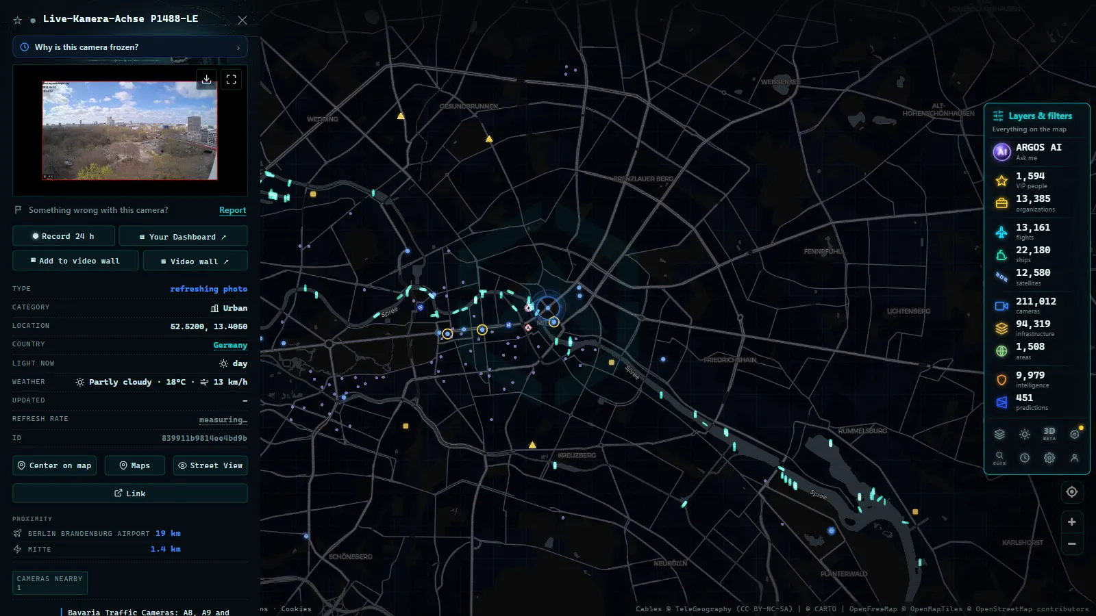
State traffic portals by Bundesland
Germany's federal structure means that camera networks are administered at the state level. These are the most significant systems:
Bayern (Bavaria)
Bavaria's portal, operated jointly by the Autobahn GmbH des Bundes for the federal network and the Bayerische Straßenbauverwaltung for state roads, covers the major corridors into Munich, the A9 Berlin-Munich axis and the Alpine passes towards Austria. The Bayern Navigator app draws on the same data feeds.
Nordrhein-Westfalen (North Rhine-Westphalia)
NRW is the most congested state in Germany. Its monitoring system covers the Cologne, Dusseldorf and Ruhr conurbations where the A1, A3 and A40 form some of the most consistently busy junctions in continental Europe. The nrwlokal.de portal and the Autobahn GmbH regional feeds are the primary public sources.
Baden-Württemberg
The Verkehrsinformationssystem of Baden-Württemberg, accessible through vm.baden-wuerttemberg.de, gives particular coverage to the A8 Stuttgart-Munich corridor and the approaches to the Swiss border at Basel.
Hessen
Hessische Straßen- und Verkehrsverwaltung publishes cameras along the Frankfurt-Kassel axis and, crucially, around Frankfurt Airport, one of the most complex traffic nodes in Europe, where road, rail and air freight converge.
Northern and eastern states
Hamburg, Bremen and Niedersachsen maintain portals covering North Sea port access routes, while Sachsen, Thüringen and Brandenburg have invested significantly in their systems since motorway expansion in the 1990s. All of their data feeds into the federal verkehr.bund.de layer.
From the ARGOS ATLAS channel.
The technical standard making it all interoperable
The protocol that allows this federated system to function as a coherent whole is DATEX II, a European standard for road traffic data exchange. Germany was among its earliest and most active adopters. DATEX II defines how incident records, camera snapshots, speed data and roadworks notifications are structured, transmitted and consumed across different administrative systems.
Thanks to DATEX II, navigation providers such as HERE Maps and TomTom, mapping platforms, logistics dashboards and citizen-facing monitoring tools can all ingest German traffic data without building bespoke integrations for each of the sixteen Länder. The same standard is used by France, Spain, the Netherlands and most other EU member states, enabling cross-border trip planning with consistent data quality.
Most public cameras in Germany publish static JPEG images updated every 60 to 120 seconds rather than continuous video streams. This reduces bandwidth load on public servers and is consistent with Germany's data protection framework, which limits the exposure of real-time footage that could identify individuals.
Using ARGOS ATLAS to explore German traffic cameras
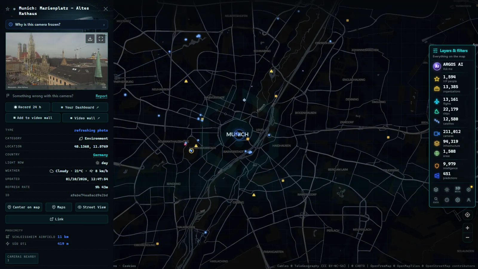
ARGOS ATLAS aggregates publicly available traffic camera feeds from multiple European countries, including Germany, into a single interactive map. Instead of navigating between the portals of Bayern, NRW, Baden-Württemberg, Hessen and the Autobahn GmbH, you can see the full picture of an intercity corridor at a glance.
This is particularly useful for long routes. Following the A7 from the Danish border at Flensburg to the Bavarian Alps at Füssen means passing through Schleswig-Holstein, Hamburg, Niedersachsen, Hessen and Bayern. In ARGOS ATLAS, all available cameras along that route appear on a single map view, with live snapshots accessible by clicking each marker.
You can explore German traffic cameras on ARGOS ATLAS or go directly to the main map. The platform also lets you layer other live data (flight traffic, maritime AIS signals, power infrastructure) giving a broader picture of how Germany's transport networks interconnect.
Privacy constraints and image quality
Germany applies the Datenschutz-Grundverordnung (DSGVO, the German implementation of GDPR) strictly to road camera systems. Public feeds are designed so that licence plates and faces are not legible, either through low resolution, deliberate blurring or temporal delays that prevent real-time identification.
This is a considered trade-off. The primary purpose of the camera network is traffic flow management and incident response, not surveillance. The publicly accessible images are sufficient to assess road conditions, congestion levels and weather visibility without compromising individual privacy. For drivers, logistics planners and transport researchers, that level of detail is generally adequate.
Infrastructure photographers and data journalists should note that access to high-resolution archival footage from the traffic management centres is subject to official request procedures and is not available through public portals.
Why this system matters beyond Germany
Germany's Autobahn carries a disproportionate share of European long-distance freight. Goods moving from Rotterdam to Munich, from Hamburg to Milan or from the Polish border to Paris all pass through the German motorway network. Disruptions (a lorry fire on the A3, a bridge weight restriction on the A61, heavy snowfall on the A8 through the Alps) ripple through supply chains across the continent.
The combination of BASt data, state-level camera networks and the DATEX II standard makes Germany's traffic situation one of the most transparently documented in the world. Tools like ARGOS ATLAS make that documentation accessible without requiring users to navigate a landscape of sixteen different state portals and a federal system on top.
Conclusion
Germany's live traffic camera ecosystem reflects the country's federal structure: each Bundesland maintains operational independence while converging on shared technical standards and a federal aggregation portal. BASt provides the scientific and data foundation, the Verkehrsleitzentralen operate the cameras, and portals at both state and federal level bring that data to the public. ARGOS ATLAS sits on top of that ecosystem, offering a unified map view that makes the German road network as readable as a single dashboard.
Frequently asked questions
Where can I watch live traffic cameras in Germany?
The federal portal verkehr.bund.de is the central hub, but each Bundesland also runs its own system. ARGOS ATLAS aggregates multiple German sources into a single interactive map.
Does the Autobahn really have no speed limit?
Only on certain sections. Roughly 30% of the Autobahn network has no statutory speed limit. The rest has fixed or variable limits enforced through electronic overhead signs monitored by camera systems.
What is BASt and how does it relate to German traffic monitoring?
BASt (Bundesanstalt für Straßenwesen) is the Federal Highway Research Institute. It operates automatic traffic counters across the federal road network and publishes open data that feeds national and regional monitoring systems.
- Live Traffic Cameras in Italy: Autostrade A1 Autosole, ANAS Roads and Alpine Passes
- Live Traffic Cameras in Canada: Ontario 511, DriveBC, and Quebec 511
- Live Traffic Cameras in Australia: Transport for NSW, VicRoads, Queensland TMC and More
- Traffic Cameras in New Zealand: Waka Kotahi NZTA, Auckland, Wellington and Alpine Passes
- Live Traffic Cameras in Belgium: Wallonie, Vlaanderen and the Brussels Ring
- Live Traffic Cameras in Japan: NEXCO Expressways, National Police Agency and Road Sensors