Blog · Traffic cameras
Salerno traffic cameras: the A2, the coast road and the port
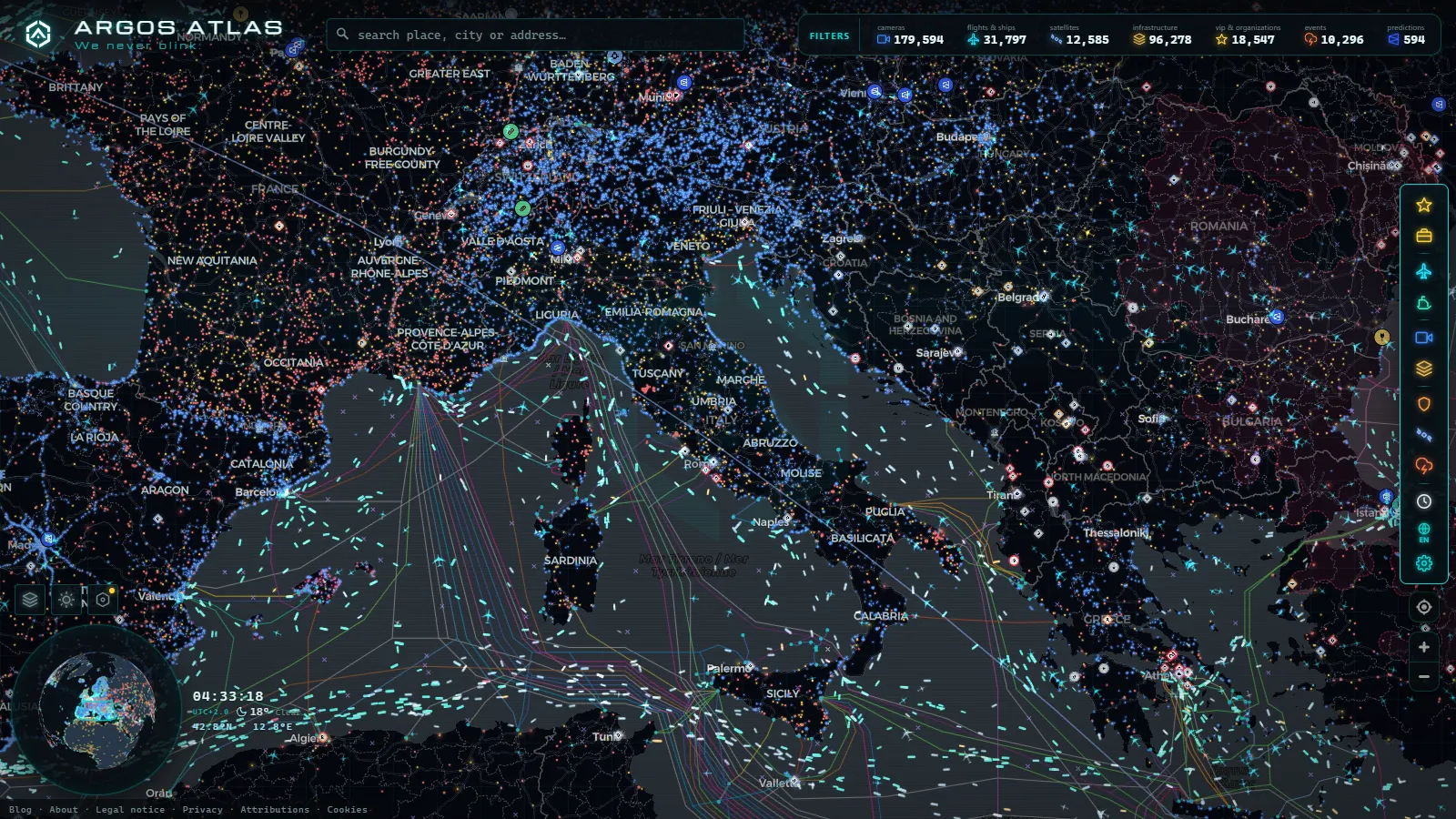
Salerno packs into about fifteen kilometres what most Italian cities never have to absorb at once: a motorway arriving from Naples, a motorway leaving for Calabria, a link road climbing towards Avellino, a working container port, and the entrance to the Amalfi Coast road. When one of those seizes up, the others take the overflow badly, and a Friday evening in July looks nothing like a Tuesday in February.
The awkward part is that there is no single Salerno camera network. What exists is three separate publishers with different image quality, different refresh rates and different silences, plus a set of cameras that are very real and never shown to the public. This page goes stretch by stretch: who puts each image online, what the picture actually contains, and where nothing is published at all.
What "Salerno traffic cameras" actually means
Three bodies account for nearly everything you can see around the Gulf of Salerno.
ANAS, the national roads operator, covers the state roads (the strade statali) and the A2 Autostrada del Mediterraneo, the motorway that used to be called the A3 Salerno to Reggio Calabria and that is toll free for its whole length. ANAS publishes stills through its own traffic service.
The motorway concessionaire of the A3 Naples to Salerno covers the tolled stretch that comes down past Pompei, Angri and Nocera and feeds into the Salerno tangenziale. Different interface, same principle: fixed cameras, fixed framing, still images.
Local and port sources: the municipality, the port authority of the central Tyrrhenian system, and a long tail of hotel and beach webcams in Vietri, Cetara, Maiori and Amalfi that are not traffic cameras at all but often answer the same question.
Then there is the fourth group, the one worth naming because its absence confuses people. The gates of the historic centre restricted zone, the tunnel CCTV and the port gate cameras all exist and all record. None of them is published. They feed control rooms and enforcement systems, which is the normal split between an operational camera and a public one, explained in more depth in the Italy traffic camera guide.
Coming down from Naples: the A3 and the Salerno tangenziale
The A3 from Naples is the stretch that fails most often and most predictably. The chokepoints are the Angri and Nocera interchanges, where the Agro Nocerino Sarnese traffic joins, and the climb through Cava de' Tirreni before the descent into Salerno. Cameras on this stretch are placed at the interchanges rather than between them, so what you get is a picture of the merge, not of the two kilometre queue building behind it.
Inside the city the motorway becomes the tangenziale, with the Fratte, Mariconda, Pastena and port exits. That is where a coast bound Saturday and a normal commute collide: through traffic heading for Vietri shares asphalt with people going to work in the centre. If you are comparing the two ends of the same corridor, the sibling piece on Naples traffic cameras in real time covers the northern half of the same problem, including the Tangenziale di Napoli and the A3 exit at Pompei.
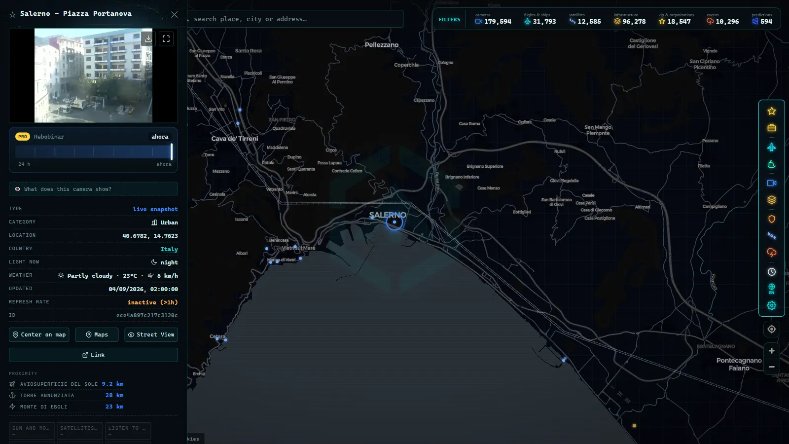
Salerno traffic cameras on the A2 south to Calabria
South of the city the character of the road changes completely. The A2 leaves Salerno through Pontecagnano, Battipaglia and Eboli across the flat Sele plain, then starts climbing. At Sicignano degli Alburni it throws off the link towards Potenza and Basilicata, then rises through Petina into the Vallo di Diano, the long inland valley of Polla, Atena Lucana, Sala Consilina, Padula and Buonabitacolo before crossing into Basilicata at Lagonegro.
This is the part of Salerno province where a camera earns its keep. The Vallo di Diano sits high enough that winter fog forms in the valley on clear nights and snow closes lanes on the climbs on either side, while the coast forty kilometres away stays mild. A camera at Polla and a camera at Battipaglia on the same morning can look like two different countries. The same logic applies to any high road in Italy, and the guide to cameras on mountain passes and snow explains how to read a still image for road surface rather than for traffic.
The honest limit: coverage thins out the further south you go. The tunnels and viaducts on the climbs are the places where an incident hurts most, and they are also the places where you are least likely to find a public camera pointed at the right spot.
From the ARGOS ATLAS channel.
Who publishes each camera and how often it refreshes
This is the table to keep. Refresh rates on Italian public feeds are not advertised and are not uniform, so the column below describes what you observe in practice, not a published specification.
| Stretch | Who publishes it | What the image shows | Refresh in practice |
|---|---|---|---|
| A3 Naples to Salerno (Angri, Nocera, Cava de' Tirreni) | Motorway concessionaire | Fixed still of the carriageway at the interchange | A new frame every few minutes |
| Salerno tangenziale and city exits | Concessionaire plus municipal sources | Partial, mostly at the motorway end | Minutes, often without a timestamp |
| A2 Salerno to Lagonegro (Eboli, Sicignano, Polla, Sala Consilina) | ANAS | Wide shots of the carriageway and junctions | Minutes, slower at night |
| Link road Salerno to Avellino (Baronissi, Mercato San Severino) | ANAS | Sparse, junction level | Minutes |
| SS163 Amalfitana (Vietri to Positano) | Mostly private and tourist webcams | Sea fronts, squares, beaches | Varies wildly, some near live |
| SS18 and the Cilento coast (Agropoli southwards) | ANAS | Junction shots on the state road | Minutes |
| Port of Salerno and Molo Manfredi | Port sources plus AIS vessel data | Quay views, plus ship positions | Positions update continuously |
Two practical consequences. First, nothing here is video, so a camera showing an empty lane means the lane was empty when the frame was taken, not now. Second, when a feed carries no timestamp, the only reliable staleness test is comparison: open two cameras on the same road and reload. If one changes and the other does not, you have found a dead camera, a failure mode worth understanding before you trust any single image, and one covered in why a traffic camera stops working.
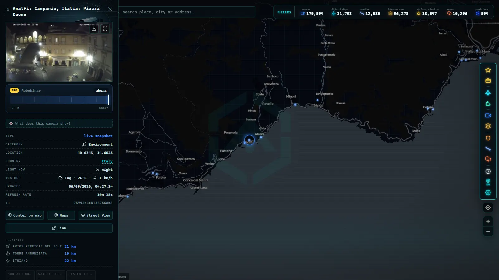
Vietri sul Mare and the road to Amalfi
Vietri sul Mare is the last motorway exit before the coast, and functionally it is a valve. Everything heading for Cetara, Maiori, Minori, the Ravello turnoff at Castiglione, Amalfi, Praiano and Positano funnels through it onto the SS163, a single carriageway cut into the cliff where two buses meeting at a bend stop everything behind them for twenty minutes.
Public traffic camera coverage of that road is close to nonexistent, and pretending otherwise would be dishonest. What you can do instead is read the valve rather than the pipe: if the approach to Vietri is already backed up mid morning, the coast road behind it is worse. In summer the SS163 also runs under alternating plate restrictions on the busiest days, and the sea route from the Salerno waterfront to Amalfi and Positano is frequently the faster option, which is where vessel tracking beats any camera.
The port of Salerno: what cameras miss and ships report
Salerno is a serious commercial port, not a marina: container terminal, ro-ro ferries running to Sicily, Spain and North Africa, a cruise terminal at Molo Manfredi, and seasonal fast ferries leaving from the Piazza della Concordia waterfront. A camera pointed at a quay tells you almost nothing about any of that.
AIS does. Vessels broadcast their identity, position, course and speed, and those signals are aggregated worldwide (tens of thousands of vessels tracked across all mapped ports, count as of September 2026, with more than a thousand ports on the map). That means you can watch a Grimaldi ro-ro line up for the harbour entrance, or see whether the cruise ship berthed this morning has already left, without a single camera being involved. The mechanics are explained in the piece on how AIS tracks ships in real time, and the same combination of camera plus AIS is what makes the smaller Adriatic ports readable too.
The honest caveat: AIS is a cooperative system. A vessel that switches off its transponder disappears, and small craft are often not equipped at all. Along the Amalfi coast in August, a good part of what is on the water simply is not reporting.
What the Salerno traffic cameras will not show you
- Anything useful after dark on unlit stretches. The A2 climbs and the Cilento state roads go black. Tunnel portals and lit interchanges keep working.
- Faces or number plates. The resolution of a public feed is deliberately too low for that, and the legal purpose of a published camera is traffic information, not identification.
- The inside of tunnels. Tunnel CCTV exists everywhere on the A2 and is not published.
- Provincial and municipal roads. The inland routes towards the Alburni, the Picentini and the Cilento villages have effectively no public coverage.
- The moment of an incident. With a frame every few minutes, you see the consequence, not the event.
None of this makes the cameras useless. It makes them one input among several, which is the correct way to use them.
A five minute check before you drive out of Salerno
Open the live map of public cameras and vessels and centre it on the Gulf of Salerno. The camera layer covers the motorway corridors from Naples down to the Cilento; the ship layer covers the port and the coastal ferry routes. Three habits make the difference.
First, check the direction of travel before you trust the image: a camera showing a clear northbound carriageway says nothing about the southbound one beside it. Second, always open two cameras on the same stretch, one ahead and one behind your route, so a frozen feed reveals itself immediately. Third, if you are going to the coast, look at Vietri and at the water, not at the SS163, because the valve and the ferries carry more information than the road itself.
The camera catalogue keeps growing (more than 200,000 public cameras worldwide, count as of September 2026), and coverage around Salerno is uneven by nature, dense on the motorways and thin the moment you leave them. Knowing exactly where that line falls is worth more than any single live image.
Frequently asked questions
Is it free to watch Salerno traffic cameras, and do I need to register?
Yes, it is free and there is no sign up. The feeds around Salerno are published by public bodies (ANAS for the state roads and the A2, the motorway concessionaire for the A3 from Naples), and ARGOS ATLAS puts them on one map alongside the ships in the gulf. No account, no app, no trial.
Are these live video streams or still images?
Almost all of them are stills. An Italian road camera typically publishes a fresh JPEG every few minutes rather than a continuous stream, so you see a snapshot of the carriageway, not moving traffic. That is enough to tell a moving lane from a stopped one, and not enough to judge speed.
Is there a camera on the SS163 Amalfi Coast road itself?
Public traffic coverage of the SS163 between Vietri sul Mare and Positano is thin. Most of what you find pointed at that stretch are tourist webcams on hotels and beach fronts, useful for weather and for seeing whether the seafront in Amalfi or Maiori is packed, but not placed to show a queue behind a bus.
Can I see the port of Salerno and the ferries?
You can see the port area and, more usefully, the ships themselves. Ferries, ro-ro vessels and container ships broadcast AIS positions, so the quay traffic at Molo Manfredi and the movements in and out of the gulf are visible in near real time even when no camera is pointing that way.
Why does a Salerno camera show the same picture for a long time?
Usually because the feed has frozen rather than because the road is empty. Italian road cameras often publish without a burned in timestamp, so the safest check is to open two cameras on the same stretch: if one changes between reloads and the other never does, the static one is stale.
- Greece Traffic Cameras: Live Roads From Athens to Crete
- North Carolina Traffic Cameras: I-40, Charlotte and NC-12
- Sichuan traffic cameras: what the map shows and what it doesn't
- Missouri traffic cameras: MoDOT, KC Scout and Gateway Guide
- Croatia Traffic Cameras: the A1, Pelješac and the Adriatic
- Arizona Traffic Cameras: ADOT Live Views on I-10, I-17, I-40