Blog · Traffic cameras
Missouri traffic cameras: MoDOT, KC Scout and Gateway Guide
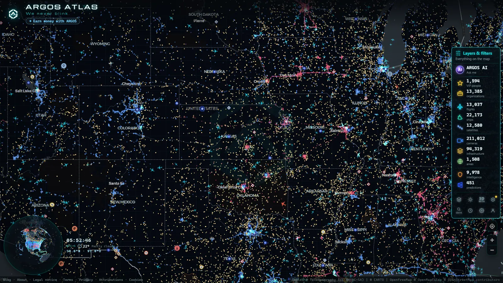
Missouri is where two of North America's busiest freight corridors run into each other. I-70 crosses the state west to east, Kansas City to St. Louis. I-44 comes up diagonally from the Oklahoma line through Springfield and Rolla and finishes in the same tangle of bridges next to the Mississippi. Add I-35, I-29, I-55 and I-49 and you get a state most of the country's trucks pass through rather than stop in.
All of it is watched, and almost all of what watches it is public. The confusing part is that there is no single Missouri camera system. There are three, run by different desks, with different image formats and very different reliability. Knowing which one you are looking at is the difference between a picture that is thirty seconds old and one that is closer to half an hour.
Who actually operates the Missouri traffic cameras
MoDOT, the Missouri Department of Transportation, is the owner of record for the statewide network and publishes it on its Traveler Information Map. Underneath that single map, three very different operations do the work.
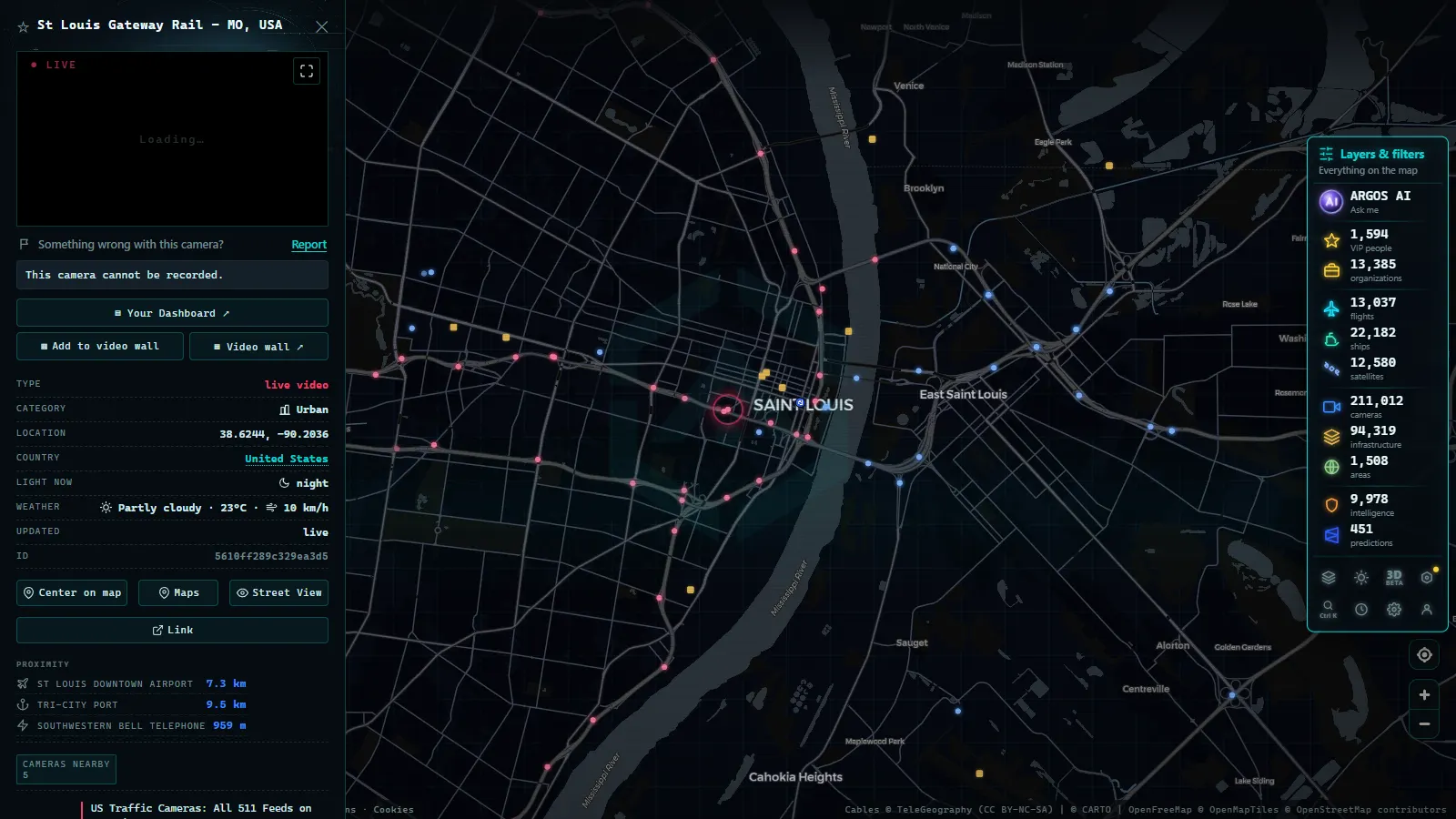
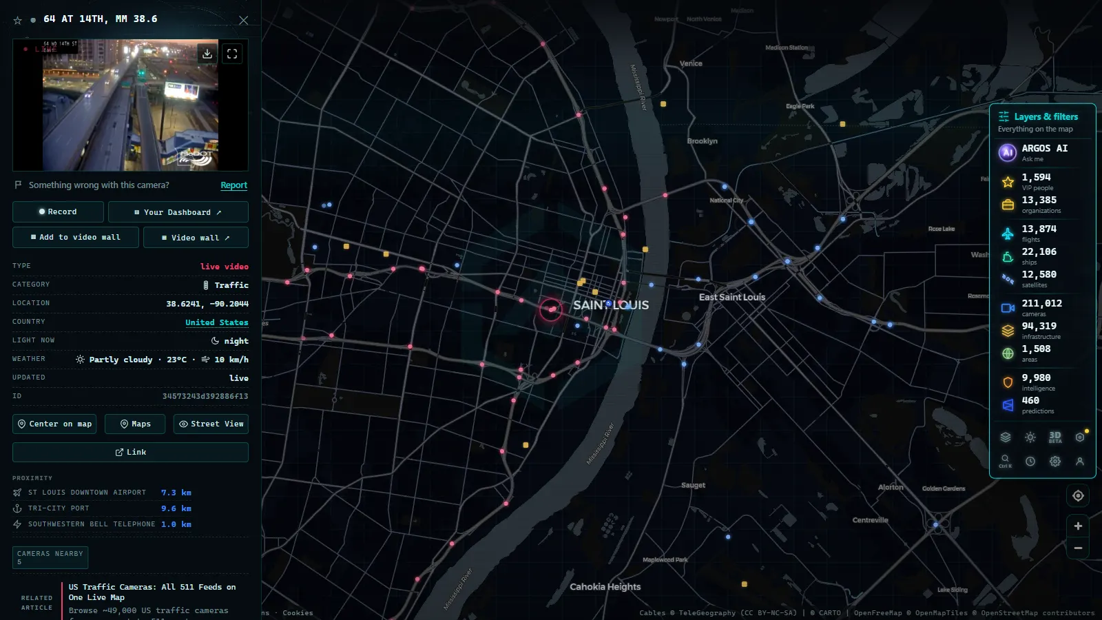
Gateway Guide is the St. Louis side, MoDOT's metro traffic management center. It runs the pan-tilt-zoom cameras on I-64, I-44, I-55, I-70, I-170, I-270, I-255 and the Missouri River crossings out west. These are the good ones: real video, operator steerable, dense enough that on the inner corridors you get a camera roughly every mile.
KC Scout is the Kansas City side, and it is not purely a Missouri agency. It is a bi-state partnership between MoDOT and the Kansas Department of Transportation, one control room for a metro with a state line down the middle. Same product as Gateway Guide: PTZ cameras, live video, tight spacing on the freeway loops.
The outstate districts cover everything else, and this is where expectations need adjusting. Cameras on rural I-70 between Columbia and Kingdom City, on I-44 around Rolla and Lebanon, on US-65 south of Springfield, on I-29 toward St. Joseph. Many of these are not video at all. They are snapshot cameras that push a single still frame on a timer.
One thing MoDOT does not publish and never has: enforcement. A run of Missouri Supreme Court rulings gutted municipal red light camera programs, and the DOT network was never built for ticketing in the first place. If the legal side interests you, how traffic cameras work and why they are public covers the split between traffic management and enforcement.
Where I-70 and I-44 really meet (and where they do not)
Worth clearing up, because a lot of searches assume a single interchange. I-70 and I-44 do not cross anywhere in Missouri. I-44's eastern terminus is at I-55 just south of downtown St. Louis, and I-55, I-64 and I-70 all share the Poplar Street Bridge over the Mississippi a few blocks north of it. The two corridors connect, through about a mile of the most photographed pavement in the state, but they never actually intersect.
That mile is the densest camera coverage in Missouri. Gateway Guide points cameras at the bridge approaches, the I-44 and I-55 split, the I-64 ramps through downtown and the Stan Musial Veterans Memorial Bridge carrying I-70 traffic north of the core. When downtown St. Louis backs up it usually backs up here, and you can watch the queue form from four or five angles at once.
The other pressure points worth bookmarking:
- Blanchette Bridge, I-70 over the Missouri River at St. Charles, the commuter chokepoint west of the city.
- Daniel Boone Bridge, I-64 at Chesterfield.
- I-270 at I-70 in Bridgeton, the northern ring interchange.
- I-44 at I-270 in Kirkwood, where the southwest corridor meets the loop.
- Rocheport, where I-70 crosses the Missouri River mid-state. Rural coverage, but the corridor's weather bellwether.
Kansas City: one metro, two states, one camera desk
KC Scout covers both sides of State Line Road, which means a fair share of the cameras you open while looking for Missouri traffic are physically in Kansas and operated by KDOT. Nobody labels this loudly. The feeds sit in the same map.
Coverage is heaviest on the loops: I-435 all the way around, I-470 across the south, I-635 on the Kansas side, plus I-35, I-29, I-70 and I-49 radiating out. The single busiest thing to watch is the Three Trails interchange, which older locals still call the Grandview Triangle, where I-435, I-470 and US-71/I-49 come together south of the city. North of the river, cameras on I-29 and I-435 cover the run to the airport.
From the ARGOS ATLAS channel.
Still image or video: what each Missouri traffic camera gives you
This is the part that saves the most time. Not every feed is the same product, and the difference matters when there is weather on the way.
| Network | Corridors covered | What you get | Practical refresh | Operated by |
|---|---|---|---|---|
| Gateway Guide (St. Louis) | I-64, I-44, I-55, I-70, I-170, I-270, I-255 | PTZ video, operator steerable | Live, seconds | MoDOT metro TMC |
| KC Scout (Kansas City) | I-435, I-470, I-635, I-35, I-29, I-70, I-49 | PTZ video, operator steerable | Live, seconds | MoDOT and KDOT jointly |
| Outstate MoDOT | Rural I-70, I-44, I-55, US-65, I-29 | Still snapshots | Minutes, uneven | District offices |
| Seasonal plow cameras | Wherever the plow is | Stills from a moving truck | Winter operations only | MoDOT maintenance |
| Municipal and bridge cameras | Local arterials, river crossings | Mixed, mostly stills | Varies | Cities, bridge authorities |
Two consequences. If a metro camera is not moving, it is broken, because those are video. If an outstate camera is not moving, that is simply what it is. And a PTZ camera points wherever an operator last left it, so an odd angle is not a fault: it is a human who was looking at something else ten minutes ago.
Why so many Missouri traffic cameras go dark in winter
The complaint is real and the explanation is boring, which is the usual combination.
Rural Missouri sites are frequently solar powered with a cellular modem. In December the days are short, the panels pick up a film of road salt and snow, and the battery stops recovering between charges. The camera does not fail loudly. It just stops sending, and the map shows a gap where a pin used to be.
Then there is the hardware. PTZ housings ice up, domes fog, and lenses collect the salt spray thrown by every truck that passes. Metro cameras get cleaned quickly. A snapshot camera on a pole outside Lebanon waits for the next maintenance run.
The cruel part is the timing: outages cluster exactly when you want the cameras. A statewide ice event is when rural feeds are most likely to be down and when the most people are trying to look at them. If one specific camera is stuck on the same frame, why a traffic camera stops working explains how to tell an outage from a maintenance freeze.
The opposite effect is worth knowing too. MoDOT mounts cameras on snowplows during winter operations, and those images only exist in winter. They show the road surface from a truck's windshield, which no fixed camera can do. The network does not simply shrink in January. It changes shape.
How to watch the Missouri corridors on a single live map
The reason to use a third-party map at all is that MoDOT's own tools stop at the state line and Missouri traffic almost never does. An I-70 trip becomes an Illinois problem the moment you cross the Mississippi, and an I-35 run is in Iowa before you have finished your coffee.
On the ARGOS ATLAS live camera map the Missouri feeds sit in the same layer as everything else (200,000+ public cameras worldwide, count as of September 2026). Zoom to St. Louis and the Gateway Guide cluster appears; keep panning east and the Illinois DOT network takes over without you doing anything (2,127 Illinois cameras, count as of September 2026). Practical method: pick your corridor, zoom until the pins separate, open the two or three that bracket the section you care about, and leave them running.
For the wider context there is traffic cameras across the United States, the Illinois camera network next door and Iowa's I-80 and I-35 coverage, which is the other half of any Kansas City to Chicago run.
What the cameras will not show you
The honest list, because it is shorter than people expect and it changes how you use the map.
You will not see license plates. Public traffic feeds are deliberately low resolution and framed wide; that is a design choice, not a compression accident. You will not see faces. You will not get history, because these are live views and nobody publishes an archive you can scrub backwards through. Miss it and it is gone.
You also will not get coverage of Missouri's two-lane state routes, which is most of the state's road mileage. The network exists for corridors where somebody makes traffic management decisions, not for every county road. And clear pavement at a camera means clear pavement at that camera, not for the next forty miles. On a state this wide, the gap between one frame and the whole corridor is the mistake people actually make.
St. Louis: where Gateway Guide actually covers you (and where it stops)
Gateway Guide is MoDOT's traffic management program for the St. Louis metro, the counterpart to the Kansas City desk covered above. It is the "Gateway" in this article's title, and its territory is the tangle of interstates that converge a few miles from the Gateway Arch: I-70, I-64, I-44 and I-55 all meet within a short stretch of downtown, funneling onto the Poplar Street Bridge over the Mississippi. Around the core, I-270 and I-255 form a beltway rather than a through route, so a camera tagged to "the 270 loop" belongs to that ring, not to the corridors that cross the city center.
The wrinkle St. Louis has that Kansas City does not is the state line itself. The metro spills across the Mississippi into Illinois (East St. Louis, Collinsville, the approaches to the Poplar Street and Martin Luther King bridges), and those cameras are not part of Gateway Guide at all: they belong to IDOT's own network, on the far side of a border that runs through the middle of a single urban area. If a camera near the river or the Arch grounds shows nothing on the Missouri feed, that is usually why, and the Illinois side of that same interchange is covered separately on the Illinois traffic cameras page.
Coverage density mirrors what happens elsewhere in the state: cameras cluster tightly around the downtown interchanges and thin out fast once you head southwest on I-44 toward Springfield or south on I-55 past the outer loop. That is not a St. Louis quirk, it is the same interchange-first placement logic that governs I-70 and I-44 further west, just applied to a different knot of highways. Anyone watching St. Louis traffic on the live map should expect dense coverage inside the 270/255 loop and gaps beyond it, exactly as Kansas City thins out past its own metro edge.
Frequently asked questions
Are the Missouri traffic cameras free to watch, and live?
Yes. MoDOT publishes its network as public traveler information, and the feeds on our map are live, free and need no account or registration. The metro cameras run by Gateway Guide and KC Scout are true video; many rural cameras are still images refreshed on a timer, so \"live\" means a recent frame rather than continuous motion.
Do I-70 and I-44 actually cross in Missouri?
No. I-44 ends at I-55 just south of downtown St. Louis, and I-55, I-64 and I-70 share the Poplar Street Bridge over the Mississippi a short distance north. The two corridors connect through that downtown complex but never intersect directly. It is also the densest stretch of camera coverage in the state.
Who runs the traffic cameras in Kansas City?
KC Scout, a joint operation between MoDOT and the Kansas Department of Transportation. Because the state line runs through the metro, some of the cameras you open while looking at Kansas City traffic are physically in Kansas and operated by KDOT. They appear in the same map without any obvious label.
Why does a Missouri traffic camera show the same frozen image?
Two different causes. On a metro PTZ camera it means an outage, because those are video feeds. On a rural camera it usually means the snapshot timer is slow or the site has lost power, which is common in winter when solar panels are covered in snow and road salt.
Can these cameras be used to identify a vehicle or a driver?
No. Public traffic management cameras are deliberately low resolution and framed wide, so plates and faces are not readable. They are also not enforcement cameras and there is no public archive to rewind: what you see is the current view and nothing older.
- Croatia Traffic Cameras: the A1, Pelješac and the Adriatic
- Arizona Traffic Cameras: ADOT Live Views on I-10, I-17, I-40
- Czech Republic Traffic Cameras: D1, D5 and D8 Live in Winter
- Ho Chi Minh traffic cameras: reading a city on two wheels
- Idaho Traffic Cameras: I-84, I-90 and US-95 on One Live Map
- Morocco live map: 42 cameras, ships and flights in real time