Blog · Traffic cameras
Sichuan traffic cameras: what the map shows and what it doesn't
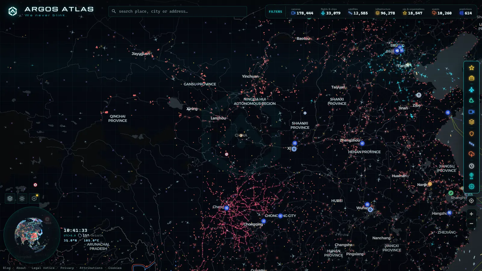
Sichuan is the biggest cluster of cameras in our catalogue that had never had a page of its own. This is that page. It is not an article about China, which is a longer and more political conversation, but about one provincial road network: which corridors it actually covers, which institutions sit behind it, and the fairly long list of things it will not show you.
Start with the honest part, because in China it is half the story. There is no Sichuan equivalent of the DGT feed in Spain or a 511 system in North America, meaning no single provincial portal that publishes every camera with a stable identifier, a documented refresh rate and an open licence. What circulates publicly is a patchwork, mostly still frames on a timer rather than continuous video, published by different bodies with different ideas about what belongs in public. Once you accept that, the network becomes readable. And it covers some of the most dramatic road geography anywhere: a flat, crowded basin that stops dead against the eastern rim of the Tibetan plateau, with expressways that climb from rice paddies to snow gates in a couple of hours of driving.
What the Sichuan traffic cameras network actually covers
The province splits into three road environments, and coverage behaves differently in each. The Chengdu plain is the dense one: ring roads, radials and the toll plazas where the feeds concentrate. The wider basin, running east and south toward Chongqing, Zigong, Neijiang and Yibin, gives you regular but thinner spacing along the expressways and almost nothing off them. Then there are the western prefectures, Ganzi and Aba, where the road count collapses to a handful of routes and the few cameras that exist are worth more than a hundred urban ones, because up there the question is not how slow the traffic is, it is whether the road is open at all.
| Corridor | Main roads | What it connects | Coverage to expect | What limits it |
|---|---|---|---|---|
| Chengdu ring and approaches | Second ring expressway, G93 ring | Chengdu with every radial | The densest cluster in the province | Wide angle framing, slow refresh, no surface streets |
| Chengdu to Mianyang and Guangyuan | G5 Jingkun, G108 | Chengdu, Deyang, Mianyang, Guangyuan | Regular spacing along the expressway | Feeds cluster at toll plazas and service areas |
| West to Ya'an and Kangding | G5 Chengya, G4218 Yakang, G318 | Basin floor to plateau edge | Thin, but the highest value per camera | Tunnels, fog, snow closures, altitude |
| South to Leshan and Emeishan | Chengdu to Leshan expressway, G213 | Chengdu with Leshan, Emeishan, Yibin | Moderate, very holiday driven | Tourist peaks distort what normal looks like |
| East to Suining, Nanchong, Chongqing | G42 Hurong, G76, G93 | Chengdu with the eastern basin | Moderate along expressways only | Coverage logic changes at the provincial line |
| Northwest to Songpan and Jiuzhaigou | G213 and provincial roads | Chengdu with northern Aba | Sparse, with long gaps | Landslides and seasonal closures |
The Chengdu to Mianyang spine
This is the corridor to watch if you only watch one. It runs northeast out of Chengdu through Deyang and Mianyang and on toward Guangyuan and the Shaanxi border, carrying the traffic of an industrial belt: heavy electrical equipment around Deyang, electronics and research institutes around Mianyang, and the freight that moves between them. The expressway carries the through traffic and the old national road G108 shadows it, absorbing local trips and the trucks avoiding tolls.
What the public frames give you is honest but partial. Cameras sit disproportionately at toll plaza approaches, service areas and long viaduct sections, which means you see the pinch points rather than an even sample of the road. That is fine if you know it. A queue building at a plaza approach on a Friday afternoon is the earliest signal you will get that the corridor is loading up, and the pattern repeats hard around Spring Festival and the October holiday, when this road becomes one of the busiest in western China.
The other thing to internalise here is the light. The basin sits under cloud for much of the year, and a flat grey image at noon is usually the weather doing exactly what it always does, not a broken device. If you want the full diagnostic checklist for telling a dead feed from a dull day, we wrote it up in the guide on why a traffic camera stops working.
West of Ya'an: the mountain expressways
Drive southwest from Chengdu and the ground changes character in a way no map colour really conveys. The expressway reaches Ya'an on flat land, and then the Yakang route starts climbing toward Kangding through the Erlang Mountain massif, a sequence of very long tunnels and very high bridges over the Dadu river gorge. Beyond it, the G318 national road continues west toward Litang and eventually Tibet, and G317 takes the northern line through Ganzi.
This is where cameras stop being a curiosity and start being useful. Conditions on these sections change within a single afternoon: fog in the gorges, ice on the shaded side of a pass, snow above a certain altitude while it rains in Ya'an. A driver deciding whether to leave Chengdu is really asking one question, which is what the road looks like at height, and one frame answers it better than any forecast.
Now the caveat, and it is a real one. Coverage out here is thin, and it is thinnest exactly where you want it most. When conditions are genuinely bad, the camera is often the least reliable: lens iced over, whiteout, or the feed simply stops updating for hours. Add that travel into the Tibet Autonomous Region along G318 involves permits and checkpoints that have nothing to do with road conditions, and you have a corridor where the map informs a decision but never makes it for you.
From the ARGOS ATLAS channel.
South to Leshan, Emeishan and the basin cities
The run south from Chengdu to Leshan is the leisure corridor. At the end of it sit the Leshan Giant Buddha, carved where the Min and Dadu rivers meet, and the temple mountain of Emeishan, which between them pull a very large weekend flow out of Chengdu and dump it back the same evening. Watching this corridor teaches you something the Chengdu ring cannot: traffic here is not a commuter curve, it is a holiday curve, with a sharp outbound morning and a compressed return.
The same rivers make this the flood corridor. During the summer rain season, water levels at the confluence are a recurring local story, and road cameras near the approaches are one of the few public views of what the ground looks like when it happens. Further south and east, toward Yibin, Zigong and Luzhou, expressway coverage continues at moderate density and then thins fast once you leave the tolled network.
Who operates the Sichuan traffic cameras
The institutional layer is stacked, and it matters for what ends up visible. Provincial roads answer to the Sichuan transport administration, but the expressways themselves are built and run by state owned operating groups, with the province's road investment and construction vehicles consolidated in recent years into a single large group. Individual tolled sections may be run by a listed expressway operator with its own control centre. Inside cities, the cameras belong to municipal traffic police, a completely separate chain of command with a completely different disclosure culture.
Here is where we have to be straight with you. In Spain or the United Kingdom we can tie a camera to DGT or to Transport for London because the feed itself says so. In Sichuan, attribution is looser: a camera on an expressway is plausibly operated by the concession that runs that section rather than by the province, and the public frame rarely tells you which. So we do not print an operator badge we cannot stand behind. If you want a comparison with networks that do publish clean attribution, the write ups on traffic cameras in Taiwan and who runs them and on Japan's NEXCO and National Police camera networks show what a fully documented provincial system looks like.
What you can see and what you cannot
| You can see | You cannot see |
|---|---|
| Whether lanes are moving or queued | Licence plates, faces or any identifying detail |
| Weather on the road surface, fog, snow line | Continuous video, and never any audio |
| Whether a mountain section looks open or gated | Any control of the camera: no pan, tilt or zoom |
| Rough truck against car mix on expressways | An archive of earlier frames to compare against |
| Holiday and rush hour loading on the main corridors | City surface streets inside Chengdu |
Two more limits worth stating plainly. Refresh intervals are not published, so you cannot assume a frame is thirty seconds old rather than thirty minutes old. And feeds in this part of the catalogue disappear without notice more often than European ones do, which is why a camera that worked last month may be gone today. That is the sources changing, not the map failing.
How to read Sichuan traffic cameras on a live map
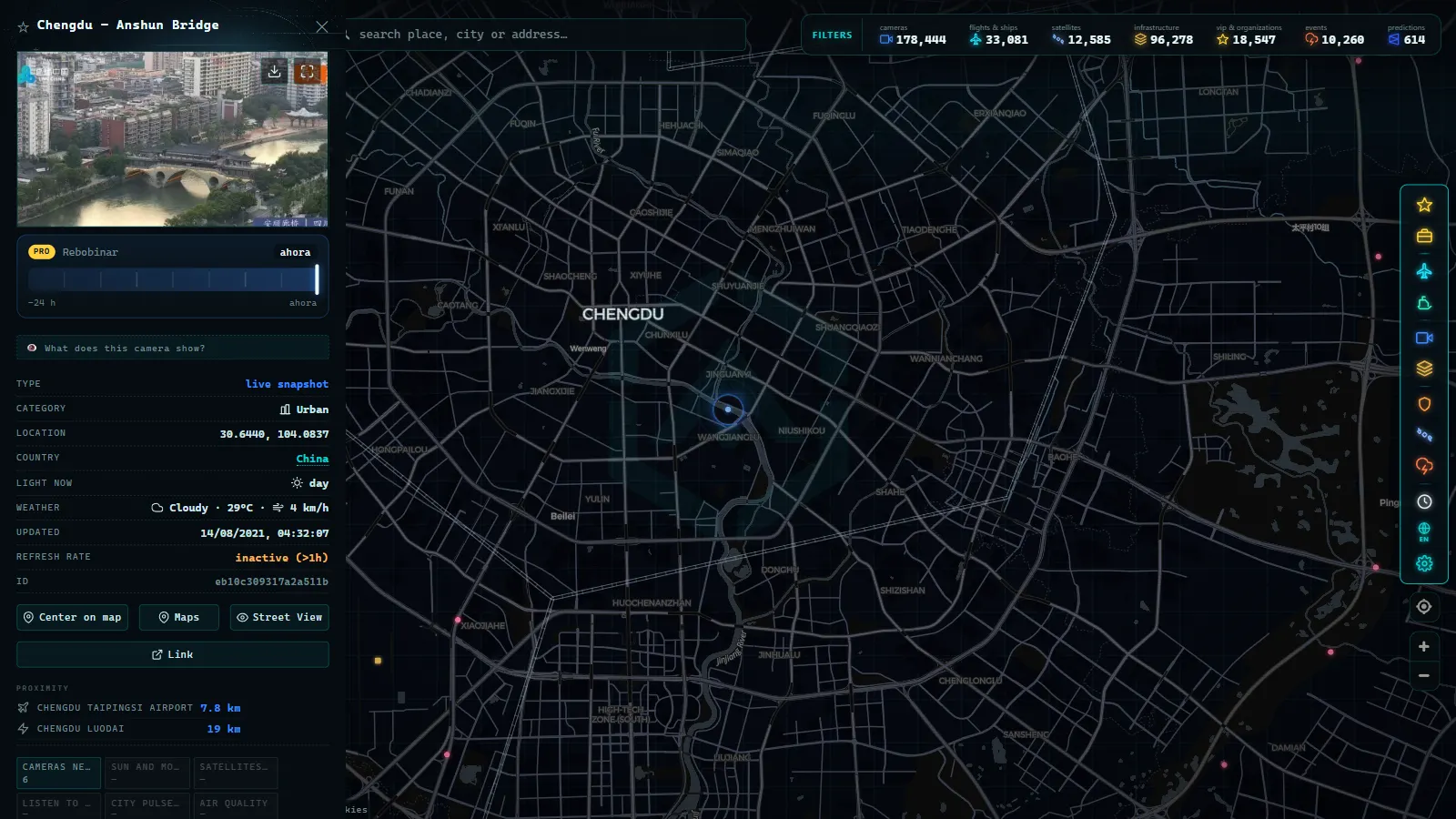
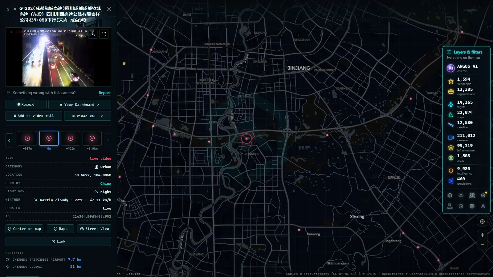
Open the live map of public traffic cameras, zoom to Chengdu with the camera layer on, and the shape of the province appears immediately: a bright knot on the plain, threads running along the expressways, and near darkness west of Ya'an. Click any marker and the panel gives you the frame plus where it came from and when it last changed, which is the field that actually tells you whether to trust it. The catalogue behind that view holds 200,000+ cameras worldwide (count as of September 2026), so Sichuan is one cluster inside a much larger set you can compare against.
The trick worth learning is paired viewing. Open one camera on the basin floor and one on the climb west, and read the difference rather than either image alone. That gradient, flat and grey below, something else entirely above, is the single most useful thing this network tells you, and no traffic app reports it. If you want to see the same province through a different layer, the piece on what the map shows of China's power plants covers the hydropower corridors that follow the very same river gorges these roads climb through.
Frequently asked questions
Is watching Sichuan traffic cameras free, live and without registration?
It is free and there is no account to create, on our map or anywhere else in this piece. \"Live\" needs a caveat, though: most Chinese road feeds publish still frames that refresh on a timer, not continuous video. So you get a recent picture of the road rather than a moving stream, and the gap between frames is not documented by the sources themselves.
Can I see Chengdu city streets or only the expressways?
The coverage that reaches public feeds leans heavily toward expressways, ring roads and their approaches. Urban surface streets inside Chengdu are watched by municipal traffic police systems that are not published as an open feed, so the dense grid of city cameras you might expect simply is not there to look at. Treat Chengdu as a ring plus radials, not a street grid.
Why do so many Sichuan cameras show a flat grey or black image?
Two reasons, and only one of them is a fault. The Sichuan basin is one of the cloudiest places in China, so a washed out grey frame in the middle of the day is usually the actual weather. At night, most of these cameras have no useful illumination and go effectively blind. A frame that never changes across several checks is the real symptom of a dead feed.
Do these cameras read licence plates or identify drivers?
Not the ones you can see. The published frames are low resolution and wide angle, sized to show whether a lane is moving, and plates or faces are not legible in them. Enforcement systems in China do exist and do read plates, but they are a separate, closed set of devices. Nothing in a public feed gives you access to them or to their readings.
Which corridor should I watch to judge mountain weather before driving west?
The Ya'an to Kangding stretch, because it is where the road climbs off the basin floor and where conditions actually decide your trip. Check a camera near Ya'an and one on the higher section at the same time: the difference between them tells you where the snow or fog line sits that day, which a single camera never does.
- Missouri traffic cameras: MoDOT, KC Scout and Gateway Guide
- Croatia Traffic Cameras: the A1, Pelješac and the Adriatic
- Arizona Traffic Cameras: ADOT Live Views on I-10, I-17, I-40
- Czech Republic Traffic Cameras: D1, D5 and D8 Live in Winter
- Ho Chi Minh traffic cameras: reading a city on two wheels
- Idaho Traffic Cameras: I-84, I-90 and US-95 on One Live Map