Blog · Traffic cameras
Czech Republic Traffic Cameras: D1, D5 and D8 Live in Winter
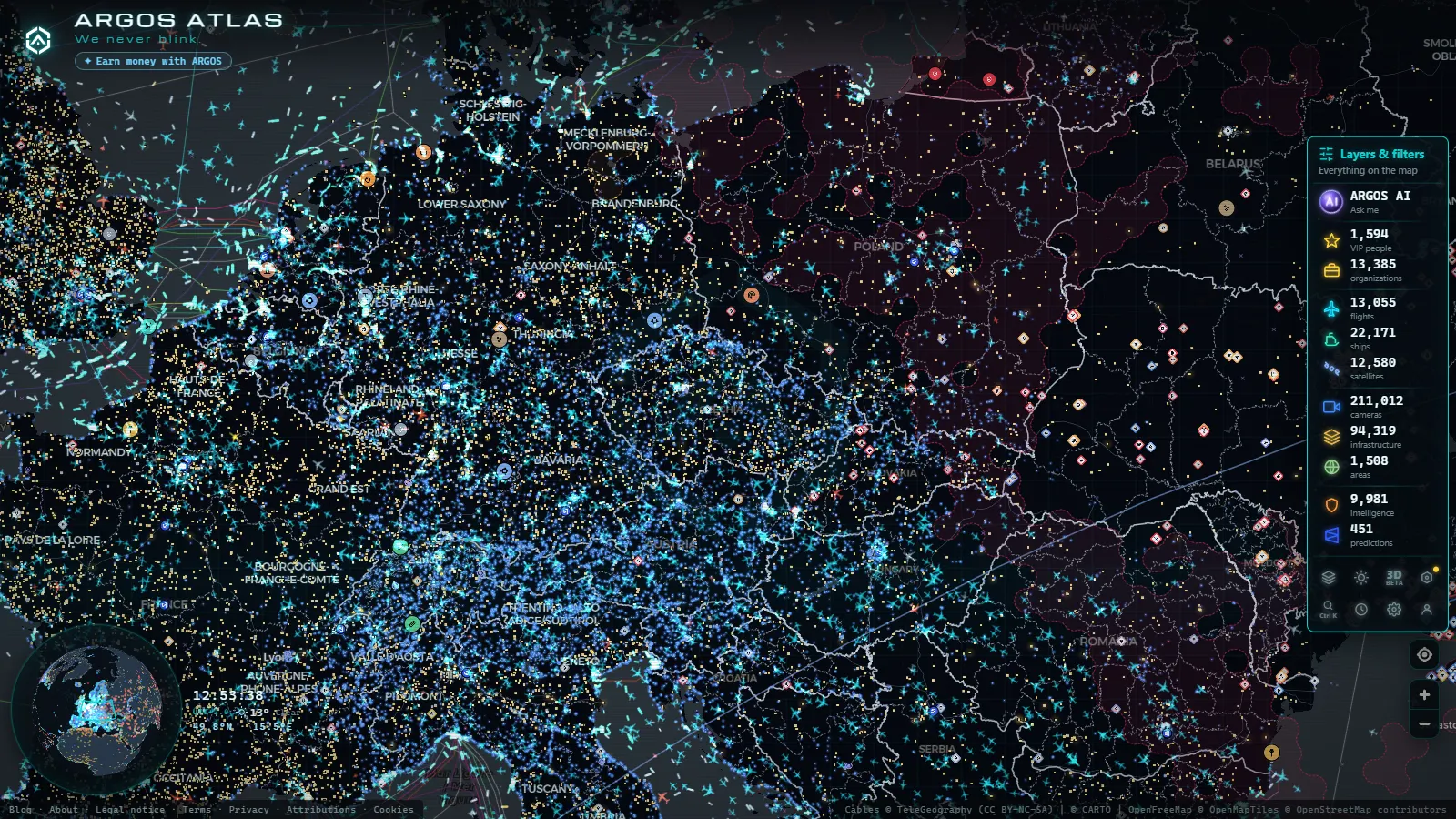
Nobody looks up a Czech camera in July. The traffic that matters in this country is winter traffic: the D1 crossing the Vysočina highlands on the Prague to Brno run, the D8 climbing out of the Labe valley into the České středohoří, and the first class roads over the Jeseníky and the Krkonoše that shut for hours when the ploughs lose the fight. A queue on the D1 in a blizzard is not a routing inconvenience, it is a stopped road with lorries sideways across two lanes.
This is a guide to what is actually watchable: who operates the cameras on the Czech network, which corridors have coverage worth opening, what the images look like when it snows, and what the feeds will never tell you. It closes with the thing that makes Czechia unusual in our catalogue, because it is one of the few countries where a dense road layer and a very dense power infrastructure layer sit almost on top of each other.
Who operates the Czech Republic traffic cameras
The operator decides whether a camera exists at all, so start there.
ŘSD (Ředitelství silnic a dálnic ČR), the Road and Motorway Directorate, owns the motorway (dálnice) and first class network. Its cameras hang from gantries, sit at interchanges and line the tunnel portals. They are the backbone of any motorway view in the country.
NDIC, the National Traffic Information Centre in Ostrava, is the aggregator. It runs the Jednotný systém dopravních informací (JSDI), the national traffic information system that merges police closures, roadworks, weather warnings and camera images into a single stream. If a Czech road event is public, it went through Ostrava first.
TSK Praha (Technická správa komunikací) looks after the capital's own streets, its tunnel complexes and the radials feeding them. Prague is a separate operator from the motorway network even where the two physically meet, which is why the picture quality changes as you cross the ring.
Regional road administrations (SÚS), one per kraj, cover the second and third class roads, and that is where most mountain passes live. Coverage here is uneven by design: a well funded region puts a camera on its pass, the next one does not.
Municipal and ski resort webcams fill the rest of the mountains. They are not traffic cameras, they are not maintained to a road standard and some disappear out of season, but on a pass road they are frequently the only lens pointed at tarmac. That layering of national, regional and improvised sources repeats across the continent, as the country by country guide to traffic cameras in Europe sets out.
D1, D5 and D8: the three corridors worth opening
| Corridor | Route | Typical operator | What it shows in winter |
|---|---|---|---|
| D1 | Prague, Brno, Ostrava | ŘSD, distributed via NDIC | The Vysočina section: the highest, coldest stretch and the first to queue |
| D5 | Prague, Plzeň, Rozvadov (German border) | ŘSD | Freight density towards Bavaria and the tunnels near Plzeň |
| D8 | Prague, Ústí nad Labem, Dresden (German border) | ŘSD | Valley fog and the climb through the České středohoří |
| D0 (Prague ring) | Orbital around the capital | ŘSD outside, TSK Praha inside | Where a motorway closure becomes a city jam |
| D11 and D35 | Prague to Hradec Králové, Olomouc axis | ŘSD | Open, exposed farmland: crosswind and drifting snow |
| First class passes (I/44 and similar) | Jeseníky, Beskydy, Šumava | Regional SÚS, municipal webcams | Whether the pass is passable at all |
D1 is the road people actually check. It carries the Prague to Brno flow plus a large share of the country's freight, and the Vysočina section between the two cities is where altitude, snow and lorry traffic meet. When the D1 stops, the parallel first class roads fill within minutes, so watching only the motorway gives you half the picture.
D5 matters to anyone crossing into Bavaria. It ends at Rozvadov and continues as the German A6, which means a Czech queue and a German queue are one event watched by two different agencies with different camera conventions. The guide to Germany's Autobahn and Land traffic cameras covers the other side of that border.
D8 is the shortest link between Prague and Dresden and the most geologically awkward motorway in the country, cut through the hills of the České středohoří and over the Krušné hory approach. Fog in the Labe valley and black ice on the climb are its two winter signatures, and they are visible on camera long before any warning is issued.
Prague: the ring, the tunnels and the radials
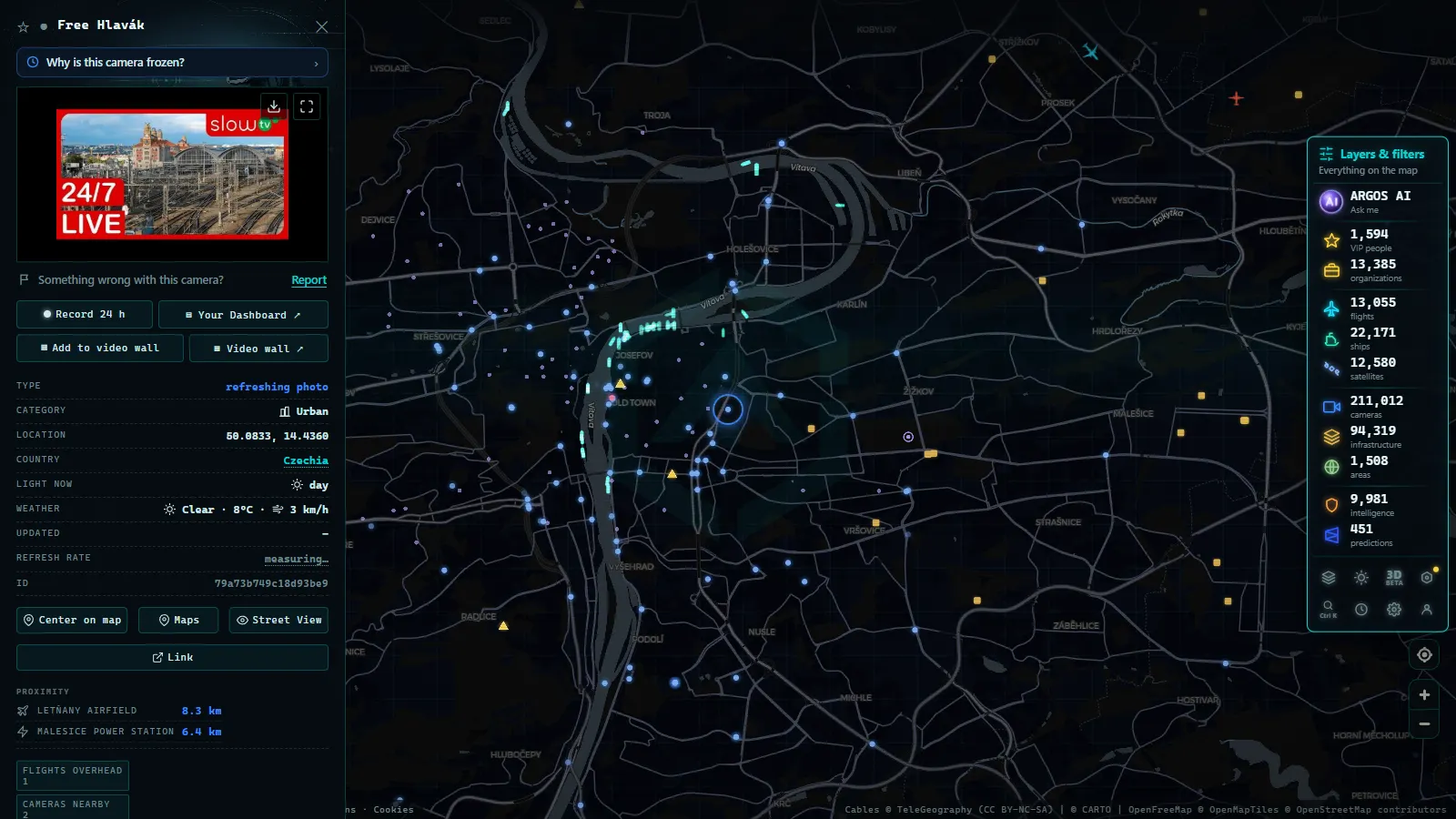
Prague concentrates its cameras where the money is: the tunnel portals of the Blanka complex, Strahov and Mrázovka, the Barrandov bridge, the Jižní spojka expressway and the junctions where the D1, D5, D8 and D11 hand traffic to the city. This is the densest urban camera coverage in the country and the one that stays legible at night, because tunnel approaches are lit for the cameras rather than for the drivers.
Two caveats. Tunnel interiors are almost never public: the operator watches them continuously, you do not. And the handover between operators is visible in the feeds, since a TSK view and an ŘSD view of the same interchange can refresh at different rates and look like two different days.
From the ARGOS ATLAS channel.
Mountain passes: the roads that actually close
Czech passes are not Alpine in scale, but they close in the same way and for the same reasons. Červenohorské sedlo on the I/44 in the Jeseníky is the classic case, a road that carries normal regional traffic in summer and turns into a chain and plough problem in January. The Krkonoše roads above Špindlerův Mlýn, the Šumava routes near the Bavarian border and the Beskydy roads towards Slovakia behave the same way.
On these roads the useful camera is often a village or ski resort webcam rather than a road authority feed, and the closure decision belongs to the police and the regional administration, not to the picture. The general method for reading a snowy pass image, including how to tell fresh snow from a compacted, treated surface, is in the guide to mountain pass cameras and snow on the road.
What Czech Republic traffic cameras will not show you
This is the honest part, and it is longer than most guides admit.
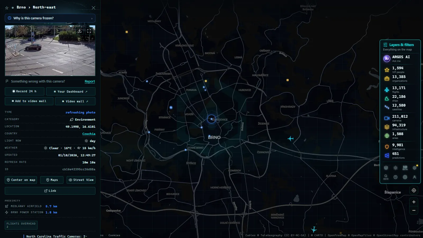
Almost nothing here is live video. Public feeds are still images refreshed on an interval, so a clear frame can be several minutes old, which is exactly the interval in which a lorry jackknifes. There is no public archive: what you missed, you missed.
Winter attacks the hardware. Snow packs onto the dome, ice glazes it, road salt spray films it over, and the result is a milky frame that looks like fog but is dirt. Cameras without dedicated lighting go effectively blind after dark and return headlight smear. A camera that failed weeks ago often keeps serving its last good frame or a grey placeholder instead of an error, so an image that looks calm may simply be stale. The catalogue of failure modes is set out in why a traffic camera stops working.
Coverage is also thinner than the motorway map suggests. Off the dálnice network, whole districts have no public camera at all, tunnel interiors are operator only, and no public Czech feed offers plate level detail or speed data. If you need to know whether a specific village road is clear, the camera will not answer that question and no amount of zooming will change it.
How to watch Czech Republic traffic cameras on one map
Open the live world map of public cameras, enable the camera layer and zoom to Czechia. Markers cluster over the motorway corridors and Prague, and clicking one loads the latest published frame from its operator, without leaving the map or opening a regional portal per region. The camera layer holds 200,000+ public cameras worldwide (count as of September 2026), aggregated from official road authority and municipal sources.
One deliberate omission: we do not publish a Czech camera total. The catalogue is organised by source and by geography, not by country, so any national figure would be an estimate dressed as a measurement. Zoom in and count what you see instead, which is the only number that is true at the moment you look.
A practical trick for winter: open the D1 in the Vysočina and the parallel regional road at the same zoom level. If the motorway is crawling and the side road is empty, the closure is recent and drivers have not diverted yet. If both are loaded, you are looking at a region wide problem and no detour will save you.
From the D8 to the grid: Czech power infrastructure on the same map
Czechia is one of the few places in our catalogue where the second layer is as interesting as the first. Switch on the power infrastructure layer (34,936 elements worldwide, count as of September 2026) and the country lights up, because a compact territory carries a full generation and transmission stack.
The pattern follows the roads more closely than you would expect. The lignite basin under the Krušné hory, with its large thermal plants, sits alongside the D8 corridor towards Dresden, which is why that motorway carries so much industrial traffic. Temelín anchors the south of the country near the Budějovice axis and Dukovany sits in the Vysočina, south of the same highlands the D1 crosses. Above the Jeseníky pass roads is Dlouhé stráně, the pumped storage plant whose upper reservoir was cut into a mountain top, meaning the icy road you were watching on camera is also the access road to a power station. ČEPS runs the high voltage transmission network, while ČEZ Distribuce, EG.D and PRE Distribuce handle the regional grids underneath it.
If the difference between those plant types is not obvious from the icons, the explainer on how each type of power station generates electricity covers what a lignite unit, a nuclear block and a pumped storage reservoir each do to the grid. Seen together, road and grid on one screen, Czechia stops being a transit corridor on a map and starts looking like what it is: a small, heavily engineered country where the same mountain decides both your journey time and the shape of the electricity network.
Frequently asked questions
Is it free to watch Czech Republic traffic cameras, and do I need an account?
Yes, it is free and there is no registration. The camera layer on our map opens in the browser with no login, no trial and no app install, and the same is true of the official Czech portals, which publish their images as a public service.
Which Czech motorways have the most useful camera coverage?
The D1 between Prague, Brno and Ostrava, the D5 towards the German border at Rozvadov and the D8 towards Dresden are the best covered, along with the D0 ring around Prague. Coverage thins fast once you leave the dálnice network for regional roads.
Do Czech traffic cameras work at night?
They keep publishing, but the image is often useless. Motorway cameras without dedicated lighting return a dark frame with headlight streaks, and only tunnel portals and lit interchanges stay readable after dark. In snow, the dome itself can ice over and freeze the view.
Can I tell from a camera whether a mountain pass is closed?
Sometimes, and never officially. A pass webcam shows you the surface and whether traffic is moving, but the legal closure is declared by the police and the regional road administration, and their notice can arrive before or after the picture changes. Treat the image as evidence, not as authority.
Do these cameras record, or can they read number plates?
The public feeds do not. What you see is a low resolution snapshot refreshed on an interval, with no archive available to visitors and no plate legible at that quality. Enforcement and tolling in Czechia run on separate systems that never publish their images.
- Ho Chi Minh traffic cameras: reading a city on two wheels
- Idaho Traffic Cameras: I-84, I-90 and US-95 on One Live Map
- Morocco live map: 42 cameras, ships and flights in real time
- Tennessee traffic cameras: I-40, I-24 and I-75 corridors
- Alabama Traffic Cameras: I-65, I-20 and I-10 on One Map
- Perugia Traffic Cameras: The E45 and Ponte San Giovanni