Blog · Traffic cameras
Morocco live map: 42 cameras, ships and flights in real time
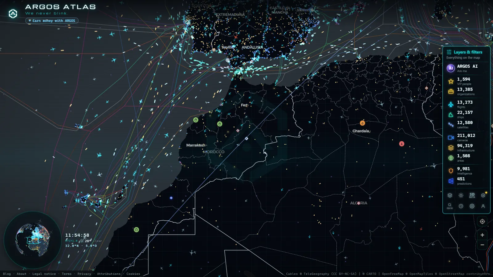
Morocco is one of the countries people open most often on our map, and until today it had no page of its own. Part of the reason is worth saying out loud before anything else: Morocco does not publish a national roadside camera network the way Spain's DGT or Transport for London do, so there is no wall of Moroccan traffic cameras waiting for you here. What there is, and there is a lot, lives in the other layers: the ships funnelling through the Strait into Tanger Med, the aircraft crossing between Europe and Africa, the ports and airfields on the base map, and the Spanish cameras pointed at exactly the same stretch of water.
This is a guide to what you can genuinely watch in and around Morocco right now, who publishes each piece of it, how fresh it arrives and where the map goes dark. Everything described here is open in the live map while you read, free and without an account.
What the Morocco live map actually shows today
Four layers reach Morocco and they are not equally strong. Ships are the best of them by a wide margin: the Strait is one of the busiest shipping corridors on the planet and it sits inside a dense ring of European AIS receivers, so vessel coverage there is close to complete. Aircraft come second, solid over the north and the big cities, thinner over the Atlantic and the south. Static infrastructure (ports, airports, power sites) is mapped everywhere, Morocco included. Traffic cameras are the weak layer, and every single camera you will find near Morocco stands on the Spanish side of the water.
Here is the honest inventory, with only the counts we can stand behind:
| Layer | What reaches Morocco | Verified count |
|---|---|---|
| Cameras, Strait of Gibraltar | The Spanish shore, facing the shipping lane | 42 cameras (count as of September 2026) |
| Cameras, Ceuta | The Spanish enclave on the Moroccan coast | 7 cameras (count as of September 2026) |
| Cameras, Andalusia | The whole southern Spanish region across the water | 1,256 cameras (count as of September 2026) |
| Cameras, Morocco | Nothing. No public Moroccan feed we have been able to ingest | 0 |
| Ships (AIS) | Global layer, dense across the Strait and Tanger Med | 21,257 plotted, 41,009 tracked |
| Flights (ADS-B) | Global layer, good over northern Morocco | 13,213 in the air |
| Ports | Global layer, Tanger Med and Casablanca included | 1,081 mapped |
| Airports and airfields | Global layer, Moroccan fields included | 47,927 mapped |
For scale: Spain alone contributes 10,794 cameras (count as of September 2026) to the 173,156 on the map worldwide. Morocco contributes none of them. Pretending otherwise would be the easiest lie to tell on this page, and it is the one thing you would notice within thirty seconds of opening the map.
The Strait: 42 cameras, all of them on the Spanish shore
Those 42 cameras (count as of September 2026) belong to Spanish road operators, mostly the national traffic authority and the Andalusian regional network. They sit along the coastal roads between Tarifa, Algeciras and the Bay, and their job is to watch asphalt, not water. That matters for expectations: a good number of them frame a motorway with the Strait as a backdrop, which on a clear morning means the Moroccan coast is genuinely in shot, and on a grey afternoon means you are looking at drizzle and lorries.
The second expectation to reset is the word live. Most public traffic cameras publish a still image on a refresh cycle, not a video stream. You get a new frame every few minutes, which is perfect for reading weather, queue length and whether the port approach roads are moving, and useless for following an individual vehicle. A camera that has not updated in hours is almost always a maintenance outage rather than censorship, and the map will show you the timestamp so you can tell.
The seven cameras in Ceuta (count as of September 2026) work the same way and are worth a separate look, because the enclave is where the road network, the port and the border all compress into a few kilometres. We covered that corner in detail in the piece on Ceuta and the Strait of Gibraltar live.
Tanger Med and Casablanca: reading the ports through AIS
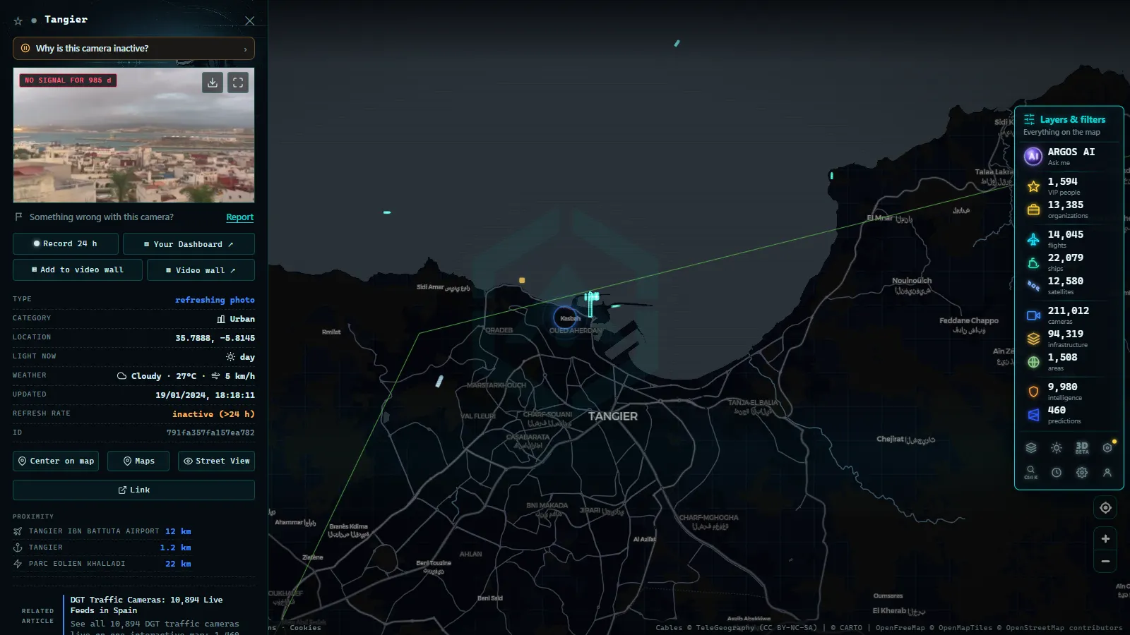
This is where the Morocco live map earns its keep. Every large merchant vessel carries an AIS transponder that broadcasts identity, position, course, speed and destination several times a minute, and the Strait is ringed with receivers picking that up. Zoom onto Tanger Med and you are effectively reading the port's order book: container ships at the terminals, the queue waiting offshore, car carriers running to European plants, and the ferry shuttle to Algeciras and Tarifa crossing back and forth all day.
Casablanca reads differently. It is an Atlantic port with a broader mix (bulk carriers, phosphate traffic, general cargo) and slower turnover, so the picture changes over hours rather than minutes. Further south along the Atlantic coast the receiver density drops and vessels update less often, which looks like ships teleporting between positions. That is a coverage artefact, not a data error. If you want the mechanics of why that happens, the explainer on how AIS locates ships in real time covers transponder classes and receiver range, and the regional view sits in ships in real time across the Mediterranean.
The honest limits: AIS is self reported. A transponder can be switched off, and positions can be falsified. Small fishing boats often carry nothing at all, so an apparently empty patch of sea can be busy. Treat AIS as an excellent census of commercial traffic and a poor census of everything else.
From the ARGOS ATLAS channel.
Moroccan airspace: strong over the north, thin over the south
The flight layer is fed by ADS-B, which is the aircraft broadcasting its own GPS position, collected by ground receivers. Around Casablanca Mohammed V, Tangier, Rabat, Marrakech Menara and Agadir there is enough receiver coverage to give you a continuous picture: European short haul arrivals, the Gulf and West African connections, and the constant stream of traffic that merely overflies Morocco on its way between Europe and sub-Saharan Africa or South America.
Coverage degrades in two predictable places. Out over the Atlantic, including much of the corridor towards the Canary Islands, there are no ground receivers, so aircraft fade out mid route and reappear when they come back within range. The same happens over the sparsely populated south. A plane disappearing there is a receiver gap, and the map says so rather than inventing a position for it.
One more thing to expect: not every aircraft broadcasts a full identity. Some transmit a position with no callsign, and state aircraft frequently transmit nothing at all. The absence of military traffic on the map is a limit of the data, never evidence that the sky is empty.
What the Morocco live map cannot show you
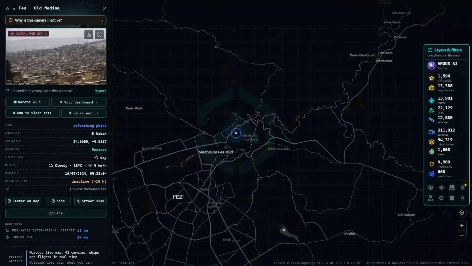
Worth stating plainly, because this is the part most sites skip. There is no live public camera anywhere inside Morocco on this map. There is no feed of the Ceuta or Melilla border crossings, and no authority publishes one. There is no imagery of the Algerian land border, which has been closed for decades. Western Sahara appears in the base geography and in the shipping and aviation layers like anywhere else, with no additional live sourcing.
What you can do is triangulate. The summer ferry season, when Moroccan families living in Europe cross home in enormous numbers, is visible as a measurable surge in AIS traffic between Algeciras, Tarifa and Tanger Med, and it is legible on the Spanish port cameras as queue length. We tracked that pattern in the guide to following the Strait crossing operation by AIS. A strong levante wind closing the Strait shows up the same way: ferries stop moving, the anchorage fills, the port roads on camera back up.
Using the Morocco live map in three minutes
Open the map and centre it on the Strait rather than on the country, because that is where the density is. Turn off the layers you do not need, since the ship and flight layers together are heavy and hiding one makes the other far easier to read. Click any vessel for its name, type, speed, heading and reported destination. Click any aircraft for callsign, altitude and track. Click a camera for its latest frame and, crucially, for the timestamp telling you how old that frame is.
Then check back at different hours. A single snapshot of the Strait tells you almost nothing, while the same view at dawn, midday and late evening shows you the ferry rhythm, the container arrivals and the overnight freight run. That contrast, not any individual image, is what the map is actually for.
Frequently asked questions
Is the Morocco live map free, and do I need an account?
It is free and it needs no registration. Open the map, zoom to Morocco and every layer described here (ships, flights, ports, airports, the cameras on the Spanish side of the Strait) is already live. There is no trial, no email wall and no limit on how long you keep it open.
Are there live traffic cameras inside Morocco?
Not on our map. We have not found a Moroccan road authority that publishes its camera images as an open, machine readable feed, so the Moroccan camera count is zero. The 42 cameras (count as of September 2026) you see around the Strait are all on the Spanish shore. If a public Moroccan feed appears, ingesting it is a day of work and we will.
Can I watch Tanger Med port in real time?
You can watch the ships, not the quays. AIS gives you every transponder equipped vessel approaching, waiting off the breakwater or berthed, with its name, type, speed and heading, refreshed continuously. What you will not get is a camera pointing at the terminal, because no public one exists.
Why do some ships vanish off the Moroccan coast?
Three usual reasons. The vessel left the range of the terrestrial receivers that feed the layer, which happens sooner on the Atlantic side than in the Strait. It carries a low power Class B transponder, common on fishing boats and small craft. Or the crew switched the transponder off, which is legal in some circumstances and suspicious in others.
Does the map show the Ceuta and Melilla land borders?
It shows the roads that lead to them through seven public cameras in Ceuta (count as of September 2026), and it shows the ferry traffic that crosses to Algeciras. It does not show the crossing points themselves. No authority publishes a live feed of a border post, and we would not host one if they did.
- Tennessee traffic cameras: I-40, I-24 and I-75 corridors
- Alabama Traffic Cameras: I-65, I-20 and I-10 on One Map
- Perugia Traffic Cameras: The E45 and Ponte San Giovanni
- Alaska Traffic Cameras: Ice, Polar Night and Mountain Passes
- Cagliari Traffic Cameras: SS131, Elmas Airport and the Port
- Treviso traffic cameras: the A27, the A4 and the passes north