Blog · Traffic cameras
Perugia Traffic Cameras: The E45 and Ponte San Giovanni
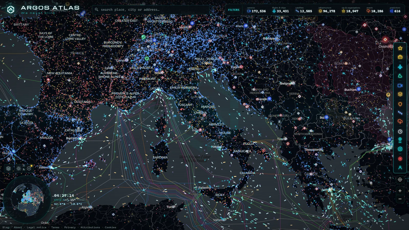
Perugia does not behave like the other Italian cities on this blog. There is no tolled motorway crossing it, no orbital ring in the Bolognese sense, and the historic centre sits on top of a hill that private cars mostly cannot enter. The traffic that matters happens underneath, down in the Tiber valley, and it piles up in one place above all others: the Ponte San Giovanni junction, where the E45 meets the roads towards Assisi, Foligno and the A1.
That geography decides what a live camera can and cannot tell you here. In Florence you watch the viali and the airport approach. In Bologna you watch two motorways crossing. In Perugia you watch a free dual carriageway in a valley, a handful of ramps, and then a system of escalators and an automated metro that move people uphill without a single car involved. Here is what is actually visible in real time, what is missing, and how to read the difference.
Why Perugia is a hill city, not a motorway city
Umbria has no tolled motorway at all. Perugia is connected instead by two free trunk roads run by ANAS: the E45, the Orte to Cesena axis that runs north to south along the Tiber valley, and the Raccordo Perugia to Bettolle (the RA6), which heads west to join the A1 at Valdichiana. Add the SS75 Centrale Umbra towards Assisi, Foligno and Spoleto, plus the SS3 Flaminia, and you have the whole skeleton of the province.
Toll free changes the traffic, and it changes the cameras. There are no toll plazas to queue at, so congestion does not build where it builds on the A1 or the A14. It builds at grade separated junctions and on two lane viaducts, and the E45 has plenty of both. That road was built with a long chain of viaducts that have needed heavy maintenance, and a single carriageway diversion on a road carrying that volume is the most reliable way to lose an hour in Umbria.
The other half of the story is vertical. The centre of Perugia sits high above the valley floor, and the connection between the two is the real local commute. Almost everyone who works up there parks below and comes up by machine.
What the Perugia traffic cameras actually show
Camera coverage in Umbria is thinner than in Lombardy or Emilia-Romagna, and there is no point pretending otherwise. What exists falls into three families, and they behave very differently.
| Layer | What it covers | Refresh behaviour | What it is good for |
|---|---|---|---|
| ANAS trunk road cameras | E45 in the Tiber valley, RA6, SS75, SS3 | Still images on a refresh cycle, not video | Seeing whether a viaduct section is moving or stopped |
| Regional and municipal feeds | Valley approaches and some urban axes | Irregular, several go dark for long periods | Confirming an incident already reported elsewhere |
| Tourist and weather webcams | Piazza IV Novembre, panoramas over the valley | Often the freshest of the three | Weather, valley fog, how busy the centre looks |
The practical consequence: on the E45 you are usually reading still frames, not a stream. A frame a few minutes old still answers the only question that matters (is the carriageway flowing or is it a wall of brake lights), but it will not show you a vehicle moving. Treat every timestamp as the real content of the image.
The panoramic webcams over the centre are the underrated ones here. Perugia gets valley fog that sits below the city, so the old town can be in clear sun while the E45 underneath is in thick mist. A camera pointed down from the hill tells you that in one glance, and no traffic map will.
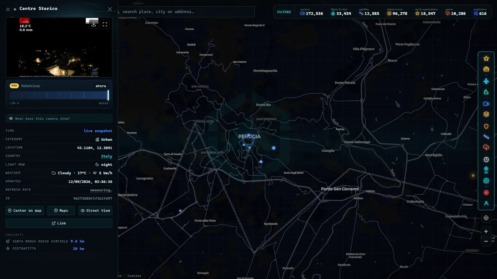
Ponte San Giovanni: the one junction worth watching
If you only look at one place, look here. Ponte San Giovanni is the district in the valley east of the city where the E45 crosses the Tiber and where the exits for the SS75, for Assisi and for the industrial and retail belt all land within a short stretch. It carries commuters into Perugia, freight running north and south, and the entire weekend flow towards Assisi.
It fails in predictable ways. Weekday mornings inbound, late afternoons outbound, and any roadworks on the viaducts to the north turn this junction into the bottleneck for the whole province, because there is no parallel motorway to absorb the overflow. When the E45 drops to one lane, the alternative is the old valley roads through Torgiano and Bastia Umbra, which were never built for that job.
The second spot worth a look is the Madonna Alta and Pian di Massiano side, west of the centre, where the RA6 arrives and where the large park and ride sits next to the stadium. That is the doorway for anyone coming from Tuscany or off the A1.
From the ARGOS ATLAS channel.
What Perugia traffic cameras cannot show you
This is the part most pages skip. Being clear about the gaps is more useful than a long list of links that turn out to be dead.
- There is no dense urban camera grid. Perugia is not Madrid or London. You will not find a feed for every roundabout, and the streets inside the walls are essentially uncovered, because they are largely closed to traffic anyway.
- ZTL enforcement cameras are not public. The access control cameras at the gates of the restricted zone exist and they will fine you, but they are enforcement equipment, not a viewing service. Nobody publishes those frames.
- The minimetro and the escalators have no public live feed. You can check whether the service is running, not how full it is.
- Night coverage is weak. Trunk road cameras without good lighting give you a dark rectangle with headlight smears: enough to know vehicles exist, useless for judging a queue.
- Feeds disappear. A camera that worked last winter may be gone by autumn, and in a region with fewer devices each loss is felt more. The guide on why a traffic camera stops working covers the usual causes and what to check before assuming the map is broken.
- The airport is small. Perugia San Francesco d'Assisi, at Sant'Egidio, runs a modest schedule, so there is no constant stream of arrivals and its apron is not covered the way a major hub's is.
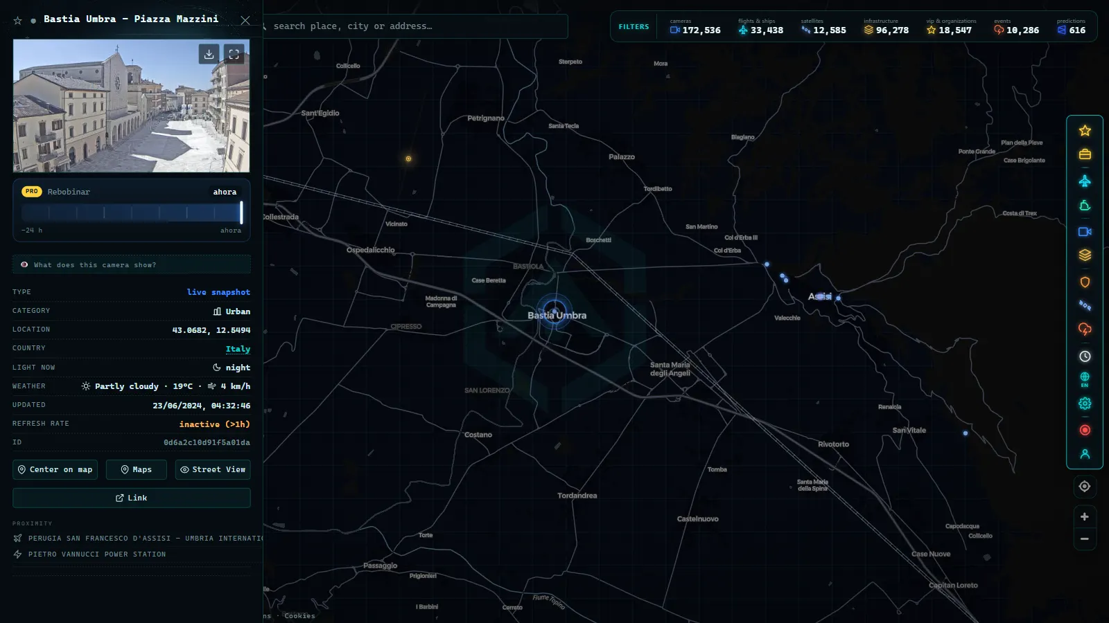
The centre is pedestrian: minimetro, escalators and park and ride
Understanding this is what separates a useful Perugia plan from a frustrating one. The historic centre is a restricted traffic zone with very limited access, so the standard approach is to leave the car below and climb mechanically.
The minimetro is a small automated line that runs from Pian di Massiano, next to the main car park, up to Pincetto at the eastern edge of the centre. The cars are driverless and tiny and they come often. From the south, the Piazza Partigiani car park connects to Piazza Italia through the escalators inside the Rocca Paolina, the buried Renaissance fortress, which is one of the strangest commutes in Italy: you ride up through entombed sixteenth century streets. Other escalator chains serve Via dei Priori, the Cupa and Pellini.
For traffic purposes this means the congestion worth checking is on the valley approaches and at the entrances to those car parks, never inside the walls. When Piazza Partigiani fills up during Umbria Jazz or on a market day, the queue forms on the road below, and that is where a camera earns its keep.
How Perugia traffic cameras differ from Florence and Bologna
The three cities sit in the same series on this blog and they need completely different reading.
Florence is a viali city: a ring of boulevards around the centre, plus the A1 and the airport approach, with solid camera coverage on the arteries. The detail is in the Florence traffic cameras guide. Bologna is a junction: the A1 and the A14 meet there, the tangenziale runs parallel to the motorway with its own numbered exits, and reading those two roads together is the whole skill, which is what the Bologna traffic cameras page is for.
Perugia is neither. No tangenziale, no toll road, no dense urban grid. One valley corridor with a knot in the middle and a vertical transport system stacked on top. Anyone arriving expecting Bologna's level of detail will be disappointed; anyone who checks the E45 and the valley weather before setting off gets almost everything the data can give.
For the national picture, including the Autostrade and ANAS networks and the Alpine passes, the Italy traffic cameras overview is the parent page for all of these.
Reading the rest of Umbria around Perugia
Perugia is rarely the only stop. Assisi sits a short run east along the SS75, and its approach roads clog on religious holidays and at weekends in a way that has nothing to do with commuting. Foligno and Spoleto continue down the same axis. Terni, in the south, is the industrial counterweight, on the E45 heading towards Orte and Rome.
For all of them the rule is the same: check the trunk road first, then the weather, then the calendar. Outside Perugia itself, Umbrian traffic is event driven rather than commuter driven, and an event fills a road that is normally empty.
How to set up the map for a Perugia trip
Open the live map and centre it on the Tiber valley rather than on the hill, because the hill is where the city is and the valley is where the traffic is. The camera layer holds a global catalogue of public feeds (200,000+ cameras, count as of September 2026), and Italy is one of the better covered countries in it, even if Umbria is thinner than the north.
A workflow that works here: frame the view so that Ponte San Giovanni and the Pian di Massiano side are both on screen, check the E45 first, then look at a panoramic webcam over the centre for fog and light, then decide which car park you are aiming for. If the valley is stopped, the old roads through Torgiano and Bastia Umbra are the fallback. They are slow, but they move.
One last honest note: on a normal Tuesday, Perugia has no traffic problem worth a live camera. The value of checking is concentrated in a handful of situations, roadworks on the E45 viaducts, fog in the valley, festival weekends and holiday returns. Knowing when not to bother is part of using this properly.
Frequently asked questions
Is it free to watch Perugia traffic cameras, and are they live?
Yes, and there is no account and no registration. The feeds are public sources published by road operators and local webcam providers, and our map just gathers them in one place. Live is the right word with a caveat: most trunk road cameras publish still images on a refresh cycle rather than continuous video, so you see a frame that is minutes old, not a moving stream.
Which road should I check before driving to Perugia?
The E45, the free Orte to Cesena axis that runs through the Tiber valley, and specifically the stretch around Ponte San Giovanni. Umbria has no tolled motorway, so when the E45 loses a lane to viaduct works there is no parallel road to absorb the traffic, and the only fallback is the old valley roads through Torgiano and Bastia Umbra.
Can I see the ZTL cameras at the entrances to the historic centre?
No. The access control cameras at the gates of the restricted zone are enforcement equipment, not a public viewing service, and their images are not published. You can see the approaches and the car park entrances below the city, but nothing from inside the gates.
Is there a live camera for the minimetro or the Rocca Paolina escalators?
Not a public one. You can check whether the service is running through the operator's information, but there is no feed showing how busy a car or an escalator is. For crowd levels in the centre, the panoramic webcams over Piazza IV Novembre are the closest thing available.
Why does Perugia have fewer cameras than Florence or Bologna?
Because there is less road to instrument. Florence has a ring of boulevards plus a motorway and an airport, Bologna has two motorways crossing plus a tangenziale, and both sit on networks that operators cover densely. Perugia has one valley corridor, a link road to the A1 and a pedestrian centre reached by escalators, so the useful camera count is naturally smaller.
- Alaska Traffic Cameras: Ice, Polar Night and Mountain Passes
- Cagliari Traffic Cameras: SS131, Elmas Airport and the Port
- Treviso traffic cameras: the A27, the A4 and the passes north
- Padua Traffic Cameras: the Tangenziale, the A4 and the A13
- Louisiana Traffic Cameras: 545 on a Live Map, I-10 and Bridges
- Bavaria Traffic Cameras: A8, A9 and 6 Alpine Border Routes