Blog · Traffic cameras
Idaho Traffic Cameras: I-84, I-90 and US-95 on One Live Map
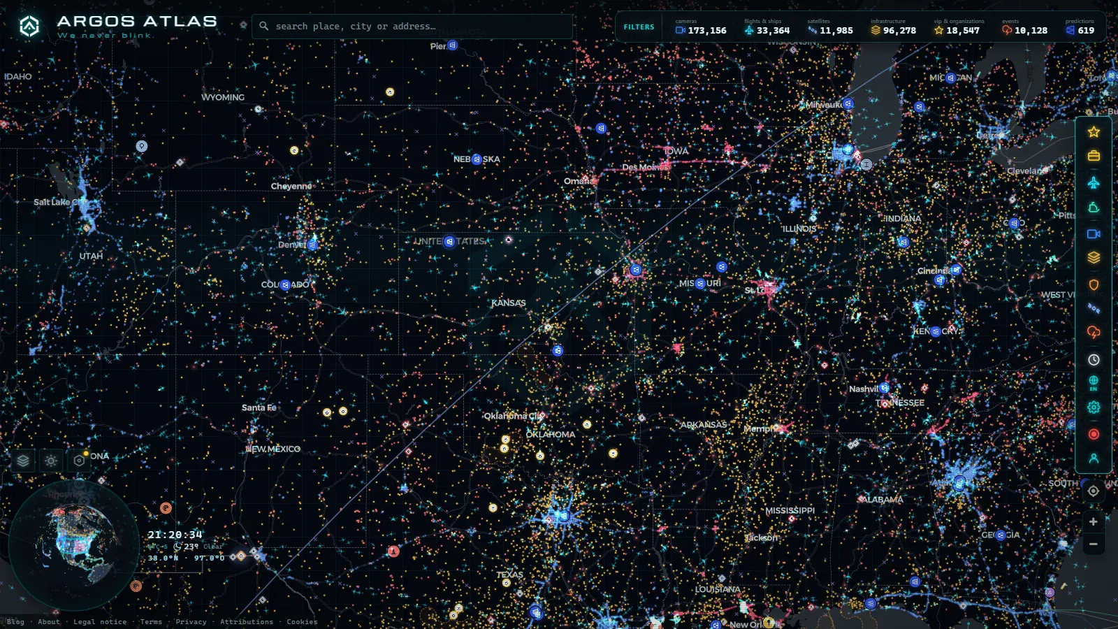
Idaho is one of the few states where checking a camera before you leave is planning rather than paranoia. The state is long, most of its population sits along a single interstate, and the roads that link the north to the south climb passes and thread river canyons that can change character within an hour. A clear afternoon in Boise tells you nothing at all about what Lookout Pass is doing on the Montana line.
The Idaho Transportation Department publishes its roadside cameras through the state 511 system, and access is genuinely open: no account, no app, no paywall. What guides rarely explain is that the dots on that map are not all the same object. Some are cameras with a real picture of the pavement. Others are weather stations that report a condition in words and show nothing. On the mountain corridors, that difference is the whole value of the exercise.
What Idaho traffic cameras actually are
Nearly every ITD site is a still image refreshed on an interval, not a video stream. You are looking at a photograph taken a minute or a few minutes ago and republished at a fixed address. That is why a frame sometimes looks frozen: it is frozen, until the next refresh lands. A small number of urban sites are steerable, so an operator can swing one during an incident and the camera you knew as northbound now faces a ramp.
Running alongside the cameras is a separate network of road weather stations. They report surface condition, pavement temperature and wind speed, and a good number of them sit exactly where you want a picture and do not provide one. When a corridor report reads snow covered or ice with no thumbnail beside it, that is a weather station talking. The distinction matters because a camera that has stopped working and a site that never had an image look almost identical on a phone screen at six in the morning.
Cameras from neighboring agencies fill the state line gaps: Oregon DOT at the western end of I-84, Washington DOT across the river from Lewiston, Montana DOT at the top of Lookout Pass, Utah DOT below the border on I-15. If you are driving through Idaho, those sites belong to your trip even though a different agency owns them. It is the main argument for looking at traffic cameras across the United States in one view instead of opening five state portals in five browser tabs.
I-84: dense coverage, and the two ends that bite
I-84 carries the Treasure Valley, and the stretch from Caldwell through Nampa and Boise to Mountain Home is the densest camera coverage in Idaho. It behaves like any urban network: interchanges, ramp meters, backups. Useful at commute hours, honestly a bit dull the rest of the time, because navigation apps already tell you there is congestion.
The two ends are where the cameras earn their keep. West of Caldwell, toward Fruitland and the Oregon line, the lower Snake River valley produces fog and crosswind. East of Twin Falls, through Burley toward the Utah line, the interstate crosses flat, wind exposed farmland, and the classic failure mode is a ground blizzard: clear sky overhead, loose snow lifted off the fields, visibility gone at road level. Cameras read that situation unusually well because there is nothing between the lens and the horizon, and it is a condition that no traffic speed data describes until vehicles have already stopped.
I-90 and the Panhandle: Fourth of July and Lookout
I-90 enters at Post Falls, runs past Coeur d'Alene, climbs Fourth of July Pass, drops into the Silver Valley through Kellogg and Wallace, and tops out at Lookout Pass on the Montana state line. Fourth of July is not a high pass by western standards, but it sits in a snow belt and it is usually the first place the Panhandle goes bad.
Lookout is the real gate. Chain controls, traction restrictions and closure decisions there are coordinated with Montana, and the detour when it shuts is not a detour in any normal sense of the word. Per site, this is the most valuable camera coverage in Idaho, because the question being answered (can I get through, and with what tyres) has no alternative source at four in the morning when there is no other traffic on the hill to generate speed data.
From the ARGOS ATLAS channel.
US-95: the only road that runs the length of the state
US-95 is the spine. It comes up from the southwest through Weiser and Council, climbs to New Meadows, then drops into the Little Salmon and Salmon river canyons at Riggins, grinds up White Bird Hill to the Camas Prairie and Grangeville, crosses the Lewiston Hill grade into the valley, and continues through Moscow, Coeur d'Alene, Sandpoint and Bonners Ferry to the Canadian border at Eastport.
It is also the corridor where the honest answer is uncomfortable. White Bird and the Lewiston grade are winter chokepoints with real coverage at the top and bottom, but the long stretches in between (New Meadows to Council, the canyon miles around Riggins) are thin. Rockfall and slides in the canyon, fog inversions sitting in the Lewiston valley for days, black ice on the grade at dawn: those are exactly the conditions you want an image for, and exactly where the network has the fewest eyes. Plan around the text status there, not around a picture that may not exist.
Idaho traffic cameras corridor by corridor
| Corridor | Stretch that matters | What to expect | When it is worth checking |
|---|---|---|---|
| I-84 Treasure Valley | Caldwell to Mountain Home | Dense images, urban framing | Commute hours, crash backups |
| I-84 east | Twin Falls to the Utah line | Images plus station condition | Ground blizzard, crosswind |
| I-90 Panhandle | Coeur d'Alene to Lookout Pass | Images at the passes, text between | Chain controls, closures |
| US-95 south | Riggins to Grangeville, White Bird | Sparse images, mostly condition text | Snow, ice, rockfall |
| US-95 north | Lewiston Hill to Moscow | Images at top and bottom of the grade | Fog inversion, black ice |
| US-12 | Lolo Pass toward Montana | Condition reporting dominates | Winter storms, spring slides |
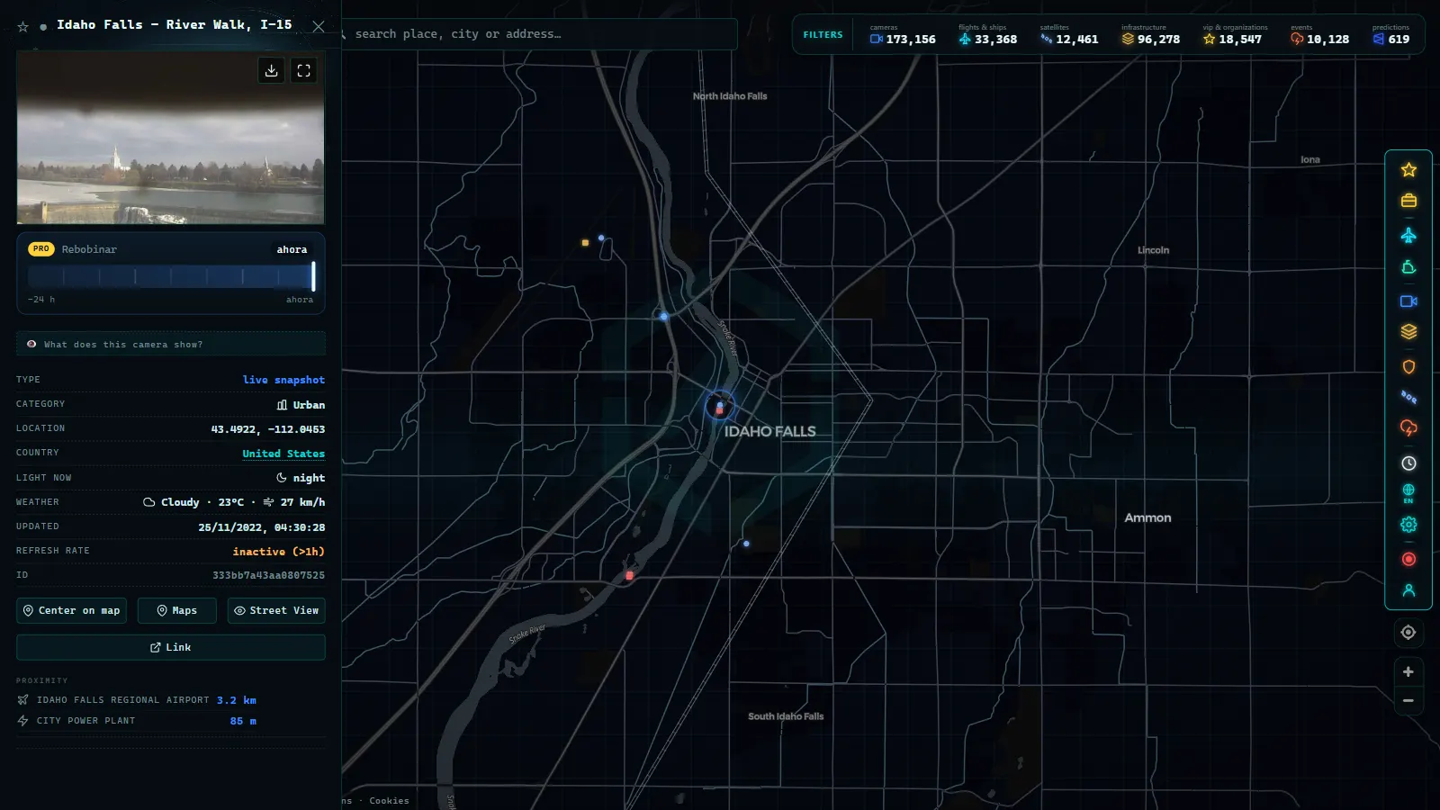
| I-15 | Idaho Falls to Monida | Images plus wind and surface data | Blowing snow on the high plain |
| ID-75 | Galena Summit to Sun Valley | Seasonal and thin | Avalanche control closures |
Treat that table as orientation rather than gospel. ITD adds and retires sites, and the only way to know what a given post offers today is to open it. That is the point of a map that shows the marker and the source together.
Why a closed pass camera beats an urban one
The value of a camera is not its picture quality, it is how much the picture changes your decision. An urban I-84 camera mostly confirms what your navigation app already said: slow here, clear there. Floating vehicle data is very good at congestion, so the image adds colour and little else.
A pass camera answers questions that no speed data can touch. Is the pavement bare, wet or packed snow. Is there a plow ahead of me. Is the gate down. Are the trucks parked in a line at the bottom. And critically, at the hours when it matters most there is barely any traffic on Lookout or White Bird, so probe data is empty and the frozen still frame is the only witness. The same logic applies anywhere the terrain does the deciding, which is why mountain pass cameras and snow are worth a routine of their own, and why anyone driving I-90 west should pair Idaho with the passes of Washington State before committing to the day.
What these cameras do not show
They are not video and they carry no audio. They are not enforcement tools: framing and resolution are chosen to show pavement and flow, and there is no public archive, because each new frame replaces the previous one. If you were not looking at the moment something happened, that moment is gone.
At night, many rural Idaho sites are unlit. You get a black rectangle, or headlight glare with a bright smear of snow in the foreground. A dark frame is not a dead camera. In storms, the lens ices or packs with snow and the picture goes white while the road underneath is perfectly passable, or the opposite. When the image and the weather station disagree during a storm, believe the station: the sensor is in the pavement, the lens is out in the weather.
And coverage simply ends. Forest routes, most secondary state highways, county roads and local streets have nothing at all. A blank area on the map means no camera, not an empty road.
Idaho traffic cameras on one live map
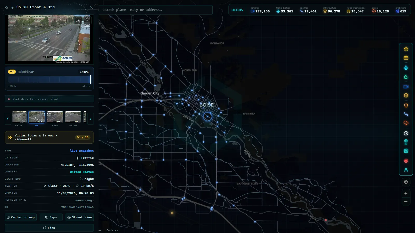
On the ARGOS ATLAS live map, Idaho's cameras sit in the same layer as public cameras from the rest of the world (200,000+ cameras in total, count as of September 2026). You zoom to the Panhandle or the Snake River Plain, click a marker, and the image opens with its publishing agency named, so you always know whether you are looking at ITD, Montana DOT or Washington DOT.
The practical trick is following a corridor across a state line without switching websites. I-90 runs from Washington through Idaho into Montana in one continuous strip of markers, and so does I-84 between Oregon and Utah. Free, no registration, nothing to install.
Lolo Pass, Fourth of July Pass, and reading a mountain camera as a conditions report
An Idaho road camera map is only useful if you know which crossing to check before you drive it, and two of the state's mountain passes get searched for their weather, not their traffic. Lolo Pass carries US-12 over the Bitterroot Range on the Idaho-Montana line, a narrow, winding two-lane road through dense forest with no easy alternate route. It is a different corridor from I-90 and from the camera list built around I-84, US-95 and the Panhandle, which is exactly why a search for "Lolo Pass road conditions camera" so often lands on a general interstate page instead of the one feed that matters: a logging-truck route where ice forms early and lingers in the shaded curves long after the valleys have cleared.
Fourth of July Pass, on I-90 between Coeur d'Alene and Cataldo, already has dense coverage on this map, but the way people search it tells you what they actually want: not "traffic", but "weather". At its summit, a few hundred feet above the lake towns on either side, black ice and sudden snow squalls show up on camera well before they show up on a forecast. Treat the feed there the same way locals do: a quick look before the climb, not after.
| Pass | Route | What the camera actually answers |
|---|---|---|
| Lolo Pass | US-12, Idaho/Montana line | Ice in the shaded curves, snowpack, whether the pass is open at all |
| Fourth of July Pass | I-90, Coeur d'Alene to Cataldo | Black ice and visibility at the summit before the descent |
| Lookout Pass | I-90, Idaho/Montana line | Snow depth and plowing status at the state line |
This is the gap a plain "I-90 traffic cameras" or "I-84 webcams" search doesn't close: those terms assume congestion and travel time, but on a mountain highway the camera's real job is telling you whether the road surface itself is safe, something a traffic report doesn't capture. The same logic applies at lower elevation too. An I-84 webcam near Boise shows you brake lights and lane closures; the same style of feed at a summit shows you whether you need chains. Reading Idaho's cameras means asking which question a given stretch of road actually raises, then picking the feed built to answer it.
Drivers continuing the same storm track west can carry on to the Washington State cameras for the rest of I-90, or south to the Oregon traffic cameras for I-84 past the state line.
Frequently asked questions
Is it free to watch Idaho traffic cameras, and do I need to register?
Yes, it is free and no account is needed. The Idaho Transportation Department publishes its roadside images as public information, and on the ARGOS ATLAS map you click a marker and the picture opens. No app, no sign up, no trial. The images are live in the sense that they refresh on a short interval, not in the sense of continuous video.
Are Idaho traffic cameras live video?
Almost never. What you get is a still photograph republished every minute or few minutes at a fixed address. If a frame looks identical to the one you saw a moment ago, that is usually normal behaviour rather than a fault. A few urban sites can be panned by operators during an incident, so the same camera may point somewhere different than it did earlier.
Why does a mountain site show a road condition but no picture?
Because it is a road weather station, not a camera. Those stations report surface state, pavement temperature and wind, and several of them sit on stretches where no camera exists. A text status with no thumbnail is a station doing its job, not a broken camera. On US-95 and US-12 this is common.
Can I see whether a pass is closed from the camera?
You can often see the evidence (a gate, stopped trucks, a plow, bare or packed snow), but the closure itself is an administrative decision posted as text by ITD and, at Lookout Pass, coordinated with Montana. Read the image as confirmation of what the status says, never as a substitute for it.
Do these cameras record, and can they identify a vehicle?
They are traffic management tools, not enforcement or surveillance. Resolution and framing are chosen to show pavement and flow, so plates and faces are not legible at normal distances, and there is no public archive: each new frame replaces the last one. If you did not look at the moment something happened, that moment is gone.
- Morocco live map: 42 cameras, ships and flights in real time
- Tennessee traffic cameras: I-40, I-24 and I-75 corridors
- Alabama Traffic Cameras: I-65, I-20 and I-10 on One Map
- Perugia Traffic Cameras: The E45 and Ponte San Giovanni
- Alaska Traffic Cameras: Ice, Polar Night and Mountain Passes
- Cagliari Traffic Cameras: SS131, Elmas Airport and the Port