Blog · Traffic cameras
Louisiana Traffic Cameras: 545 on a Live Map, I-10 and Bridges
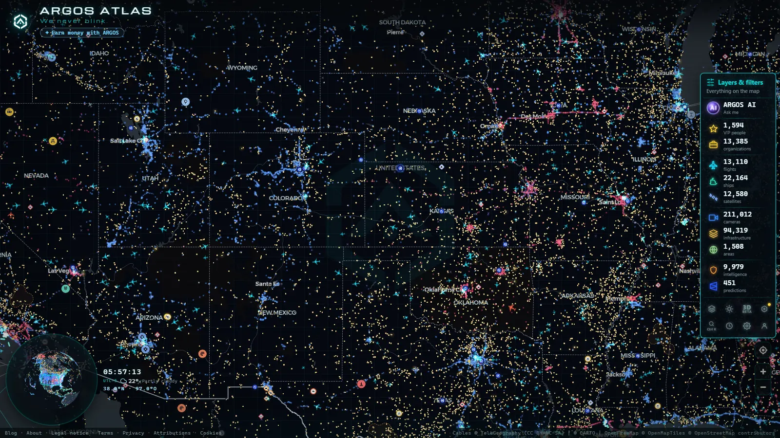
Louisiana puts an unusual share of its traffic on structures that cross water. Interstate 10 carries the populated south of the state from the Mississippi line to the Texas border, and between Slidell and Lafayette it spends much of its length on bridges, trestles and elevated roadway over lake, swamp and river. That geography is why the camera network here behaves differently from the ones next door. The feeds worth bookmarking are not the ones watching a downtown interchange, they are the ones pointed at a span with no realistic detour.
ARGOS ATLAS lists 545 public traffic cameras in Louisiana (count as of September 2026), ingested alongside the rest of the 200,000+ cameras on the map. This page covers the I-10 corridor between New Orleans, Baton Rouge and Lafayette, the water crossings hanging off it, which agency publishes each feed, and the part almost nobody writes down: what the picture does when the power goes out.
What the 545 Louisiana traffic cameras actually cover
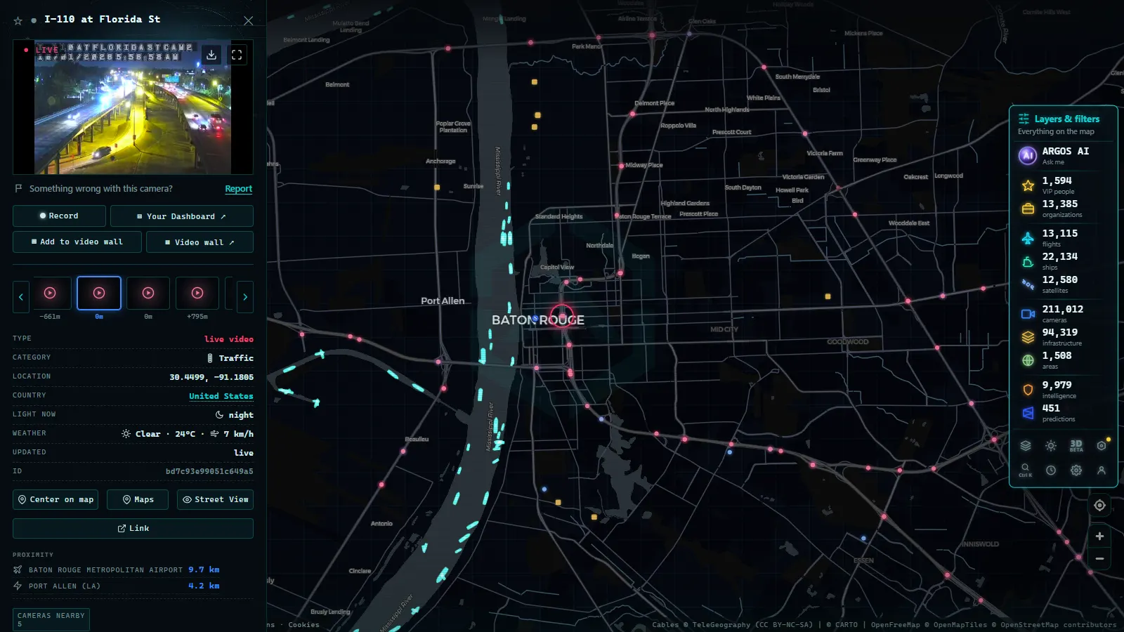
The density is not spread evenly, and it follows population and structure rather than mileage. Metro New Orleans is the thickest cluster: I-10 through the east and Mid City, I-610, I-510 toward Chalmette, the Westbank Expressway, and a set of signal mounted cameras on city arterials that are lower, tighter and framed for intersection operations rather than for the view. Baton Rouge is next, concentrated around the I-10 and I-12 split, the river bridge approaches, and arterials like Airline Highway and Florida Boulevard. Lafayette has a smaller set around the I-10 and I-49 interchange and the frontage roads.
Outside the corridor, coverage thins in a way worth knowing before you go looking: I-20 between Shreveport and Monroe has its own group, I-55 runs north from LaPlace toward Hammond, I-49 climbs to Alexandria, and there are scattered cameras along US 90 heading toward Houma and Morgan City and down LA 1 to Golden Meadow and Port Fourchon. Rural parish roads are mostly unwatched.
One expectation to reset before you click anything: the great majority of these are still image cameras. The operator publishes a frame on a cycle measured in tens of seconds to a few minutes and the page swaps it in. It is a photo from a moment ago, not a video stream, and treating it as video is how people misread a storm. The same mechanics apply across the country, and they are explained in more depth in the guide to how traffic cameras work and why they are public.
The I-10 corridor from New Orleans to Baton Rouge and Lafayette
Running east to west, the corridor reads as a chain of chokepoints. The Twin Span crosses Lake Pontchartrain between Slidell and New Orleans East, and it is the first thing to close when surge arrives from the east. The High Rise lifts I-10 over the Inner Harbor Navigation Canal, where wind and stalled vehicles on the grade cause most of the routine trouble. West of the split with I-610, the road runs through Metairie and Kenner and then out across the Bonnet Carre Spillway, a long low crossing that floods on both sides when the spillway is open.
Past LaPlace, where I-55 breaks north, the interstate runs on fill through Gramercy and Sorrento to the split with I-12. In Baton Rouge it climbs the Horace Wilkinson Bridge, the tall cantilever over the Mississippi that every local simply calls the new bridge, and that is the single most reliable congestion generator in the state. West of the city the road enters the Atchafalaya Basin and stays elevated for a long stretch past Whiskey Bay, Henderson and Breaux Bridge before dropping into Lafayette.
Two things follow from that shape. First, I-12 across the north shore is not an alternative route, it is the plan: when I-10 shuts anywhere between Slidell and Baton Rouge, everything moves to I-12, and the cameras there tell you whether the plan is working. Second, almost every failure point on the corridor is a structure, and structures are exactly where the agencies chose to put cameras.
Who publishes each Louisiana traffic camera
There is no single operator. The state department of transportation runs the backbone, and several local bodies publish their own feeds with their own habits, hardware and downtime. This is the practical breakdown of who is behind the image you are looking at:
| Operator | What it covers | Typical feed | Weak point |
|---|---|---|---|
| Louisiana DOTD (511LA) | I-10, I-12, I-49, I-20, I-55 and major state routes statewide | Still frames on a short refresh cycle, with closure and incident overlays | Field cabinets lose power long before the website does |
| Greater New Orleans Expressway Commission | The Lake Pontchartrain Causeway and both shore approaches | Fixed cameras along the span and at the toll plazas | Closes to traffic in high wind, and the view is open water in every direction |
| Crescent City Connection Division | The twin Mississippi River spans and the Westbank approaches | Fixed and pan-tilt-zoom views of the deck and ramps | Low cloud and river fog on the high span |
| City of New Orleans traffic management | CBD and arterial intersections away from the interstate | Signal mast cameras, low mounting, tight framing | A flooded intersection takes out the cabinet, not just the camera |
| Baton Rouge city-parish traffic management | Arterials around the I-10 and I-12 split | Intersection cameras used for signal operations | Coverage stops at the parish line |
| Lafayette Consolidated Government | Lafayette arterials and I-10 frontage roads | Intersection cameras | Thin coverage west of the city |
Knowing the operator matters because restoration is organised by operator. When the state comes back first and the city lags, you will see interstate cameras return while the surface street grid stays dark for days.
From the ARGOS ATLAS channel.
Bridges and water crossings are the real weak point
A bridge camera answers a question no traffic app answers well: is the deck open, and is anything on it. When sustained winds pass the posted threshold, the Causeway restricts and then closes, and the camera at the toll plaza shows it before any written notice propagates. The Twin Span closes on surge. The Sunshine Bridge, the Hale Boggs Bridge at Luling and the Huey P. Long each carry traffic that has no near substitute, and the lift and swing bridges on US 90 and around the Industrial Canal open for marine traffic on a schedule that no navigation app models.
Fog is the other seasonal reality, and it is worst exactly where the cameras are: the Atchafalaya Basin and the river crossings. A fogged camera is not a broken camera, and it also means the road is genuinely unsafe rather than merely slow.
What happens to the signal when the power goes
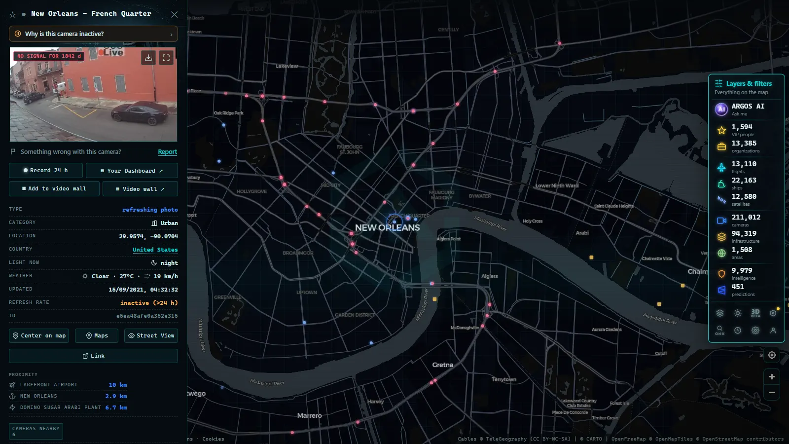
This is the part that Florida and Texas material tends to skip. The chain runs camera, roadside cabinet, backhaul over fiber or cellular, traffic management center, public website. Each link has its own power supply, and the center almost always has the best one. That asymmetry produces the single most misleading situation on a storm map: the site is up, the page loads, an image appears, and the camera has been dead for hours because the page keeps serving the last good frame.
Three failure patterns are worth recognising:
- Camera dark, host alive. One feed freezes while its neighbours keep updating. The timestamp is the only tell.
- Backhaul cut. A whole run of cameras along one segment drops at the same minute. That is a fiber or cell site problem, and it usually means the corridor lost more than cameras.
- Publisher saturation. Everyone in three states loads the same page at once and it slows to nothing. The cameras are fine.
Crews also prepare hardware before landfall. Pan-tilt-zoom units get parked facing down or away from the wind so debris does not destroy the optics, which is why you sometimes get a perfect, useless image of asphalt. Some units are physically removed. On the way back, evacuation routes are restored first, and that is a deliberate priority, not a coincidence. For the everyday version of the same problem, see why a traffic camera stops working.
How to read Louisiana traffic cameras on the map
Open the live ARGOS ATLAS map, zoom on the corridor and the cameras appear as points you can click to get the latest published frame. Three habits make the difference during bad weather: read the timestamp before you read the image, compare a suspicious camera against its two nearest neighbours, and watch whether failures are isolated or arrive in a block. A block means infrastructure.
It also helps to watch the water, since barge and vessel movement drives bridge openings and post-storm channel closures, and those show up on the map as a separate layer rather than in any traffic feed. If you are tracking a storm as it approaches the coast, the companion piece on coastal and hurricane cameras in real time covers the non-road feeds. For neighbouring states with far larger networks and different publishing habits, there are dedicated pages for Texas traffic cameras and Florida traffic cameras on FL511, and a national overview in the guide to traffic cameras across the United States.
What these cameras will not give you
No audio. No control: you see the direction the operator chose, and public pan, tilt and zoom does not exist. No archive, so if you did not look while it was happening, it is gone from the public side. Night frames are noisy and the wet ones are worse, because a drop of rain on the housing ruins a view more thoroughly than darkness does. Resolution is modest by design, which is the reason these feeds can be public at all: plates and faces are not legible at this quality.
And the count itself moves. 545 is what the catalog holds today for Louisiana, gathered from agencies that add, retire and relocate cameras as corridors get rebuilt. Treat any camera total, here or anywhere else, as a measurement with a date on it rather than a permanent fact.
Frequently asked questions
Is it free to watch Louisiana traffic cameras, and is it live without signing up?
Yes. The cameras are published by public agencies, and on ARGOS ATLAS you open the map and click a point with no account, no registration and no payment. What you get is the latest frame the operator published, which on most Louisiana feeds means an image a few seconds to a few minutes old rather than continuous video. The timestamp on the frame is the honest indicator, not the fact that the page loaded.
How many traffic cameras does Louisiana have?
The catalog holds 545 public cameras for the state (count as of September 2026), gathered from the state transportation department and the local agencies that publish their own feeds. That number moves: agencies retire units, replace poles, and add cameras when a corridor gets rebuilt. It is also smaller than what Texas or Florida publish, which is a coverage difference, not a quality one.
Can I see the I-10 bridges and the Lake Pontchartrain Causeway?
Yes, the water crossings are among the best covered structures in the state: the Twin Span between Slidell and New Orleans East, the High Rise over the Industrial Canal, the Horace Wilkinson Bridge in Baton Rouge, the Atchafalaya Basin crossing and the Causeway all have public cameras. During a closure those views are usually the fastest public confirmation that the deck is empty, ahead of any written alert.
Do the cameras keep working during a hurricane?
Some do and many do not, and the map will not always tell you which is which. The publishing site often runs on generator power at a traffic management center while the roadside cabinets in the field are dark, so a page can look healthy while serving a frozen frame from before landfall. Read the timestamp, and treat a whole cluster disappearing at once as a backhaul cut rather than a camera fault.
Can I control the cameras or watch recorded footage?
No. Public access is read only: you see whatever direction the operator has the camera pointed, with no pan, tilt or zoom control, and there is no archive. If you did not look at the moment something happened, it is gone from the public side. There is also no audio, and resolution is deliberately modest, so plates and faces are not legible.
- Bavaria Traffic Cameras: A8, A9 and 6 Alpine Border Routes
- Lugano traffic cameras: the A2, Chiasso and the lake live
- Christchurch Traffic Cameras: Live Now, Free, No Sign-up
- Yunlin Traffic Cameras: What You See on National 1 and 3
- Poland Traffic Cameras: Live Views of the A4, A2 and Gdansk
- Connecticut Traffic Cameras: Live Stills on I-91 and I-691