Blog · Traffic cameras
US Traffic Cameras: All 511 Feeds on One Live Map
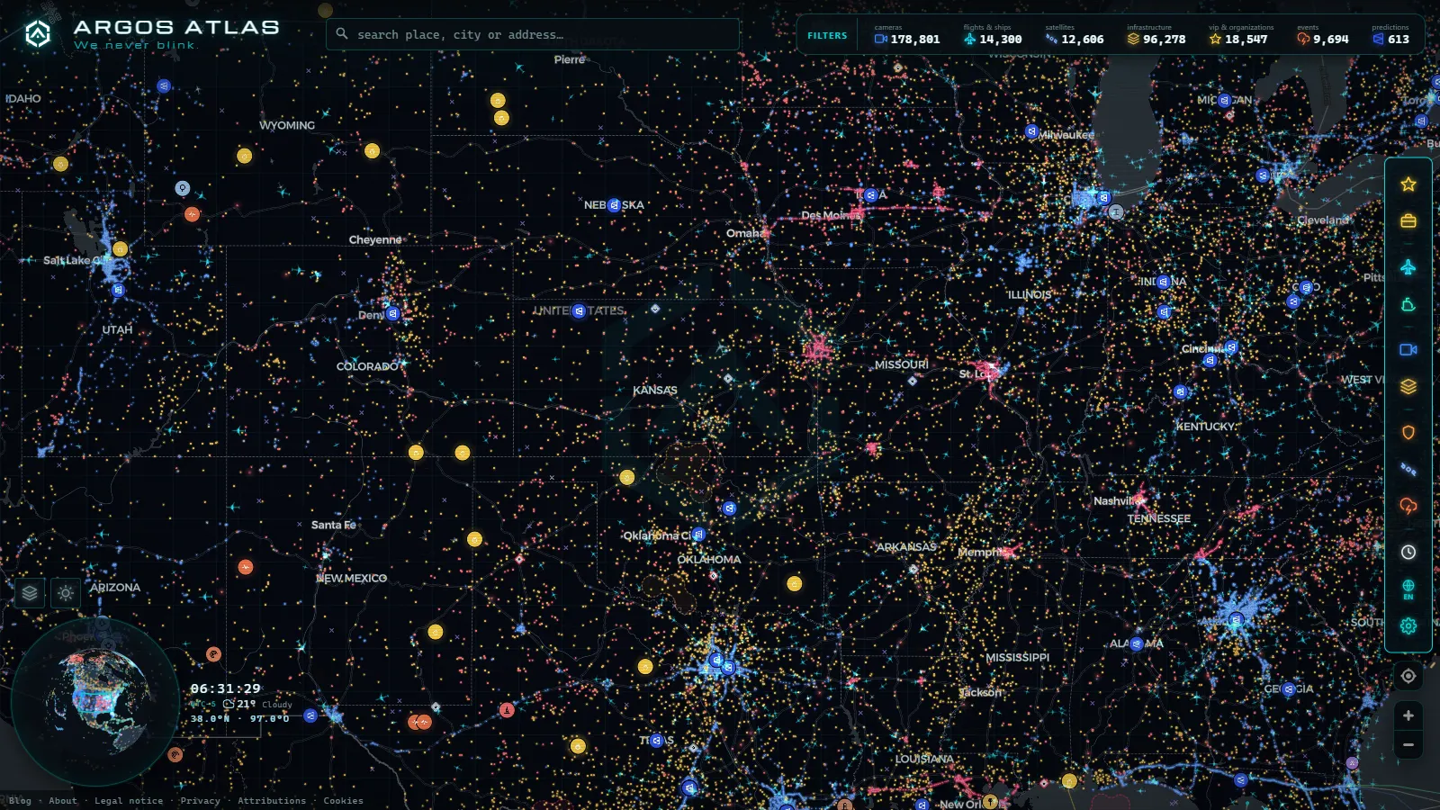
The United States runs the largest network of public traffic cameras in the world. It is not one system but the sum of dozens: every state department of transportation (DOT) operates its own cameras and publishes them through its 511 service. The ARGOS ATLAS map alone gathers around 49,000 US traffic cameras, and every one of them can be watched live, for free, with no sign-up.
That is the short answer to the search that probably brought you here. The long answer (how 511 works, which states publish the most cameras and why all of this is legal) is worth a few minutes, because understanding the system is what turns a map full of dots into a genuinely useful tool.
How the 511 system works
511 is the national traveler information phone number in the United States, reserved so drivers can check road conditions. Over the years, each state has built a full service around that number: a website with an incident map, roadwork and road-weather alerts, mobile apps and, above all, public access to its traffic cameras.
The key to understanding the system is that there is no centralized "national 511": every state runs its own. Florida has FL511, Georgia has Georgia 511, New York has 511NY, and so on. Each DOT decides how many cameras it installs, how often the images refresh and how it publishes them. That is why the experience varies so much from state to state: some offer near-continuous video, others still images that update every few minutes. If you want to understand the technology behind it all, there is a guide on how traffic cameras work.
Beyond the cameras, 511 portals usually include very valuable complementary information: winter road conditions, truck restrictions, notices for major events and emergency alerts. For a road trip crossing several states, that combination makes 511 the American equivalent of Europe's national traffic portals, with one important quirk: you have to check it state by state, because each website only covers its own territory.
The states with the most cameras, in one table
Although almost every state publishes cameras, a handful concentrate the densest networks. These are the largest state sources on the ARGOS ATLAS map, with the approximate number of cameras each one contributes and where its coverage is strongest:
| State network | Approx. cameras | Strongest coverage |
|---|---|---|
| Florida 511 (FDOT) | ~4,900 | Interstates and the Miami area |
| Georgia 511 | ~4,000 | Atlanta and its freeways |
| TxDOT (Texas) | ~3,900 | Houston, Dallas-Fort Worth, Austin and San Antonio |
| Caltrans (California) | ~3,500 | Los Angeles to the San Francisco Bay Area |
| Illinois IDOT | ~2,100 | Greater Chicago |
| Utah 511 (UDOT) | ~2,100 | Mountain roads in winter |
| New York 511 | ~1,900 | The city and the rest of the state |
| WSDOT (Washington State) | ~1,700 | Mountain passes |
The table is not an official ranking of installed cameras, but a snapshot of what each system publishes openly. Even so, the reading is clear: density follows the major urban corridors (Miami, Atlanta, Houston, Los Angeles, Chicago) and the states where weather calls the shots, which maintain networks built for winter. Florida tops the list with the largest state network in the country, and it has a dedicated guide to Florida traffic cameras; Utah is the striking case, with remarkable density for its population, explained by its mountain passes.
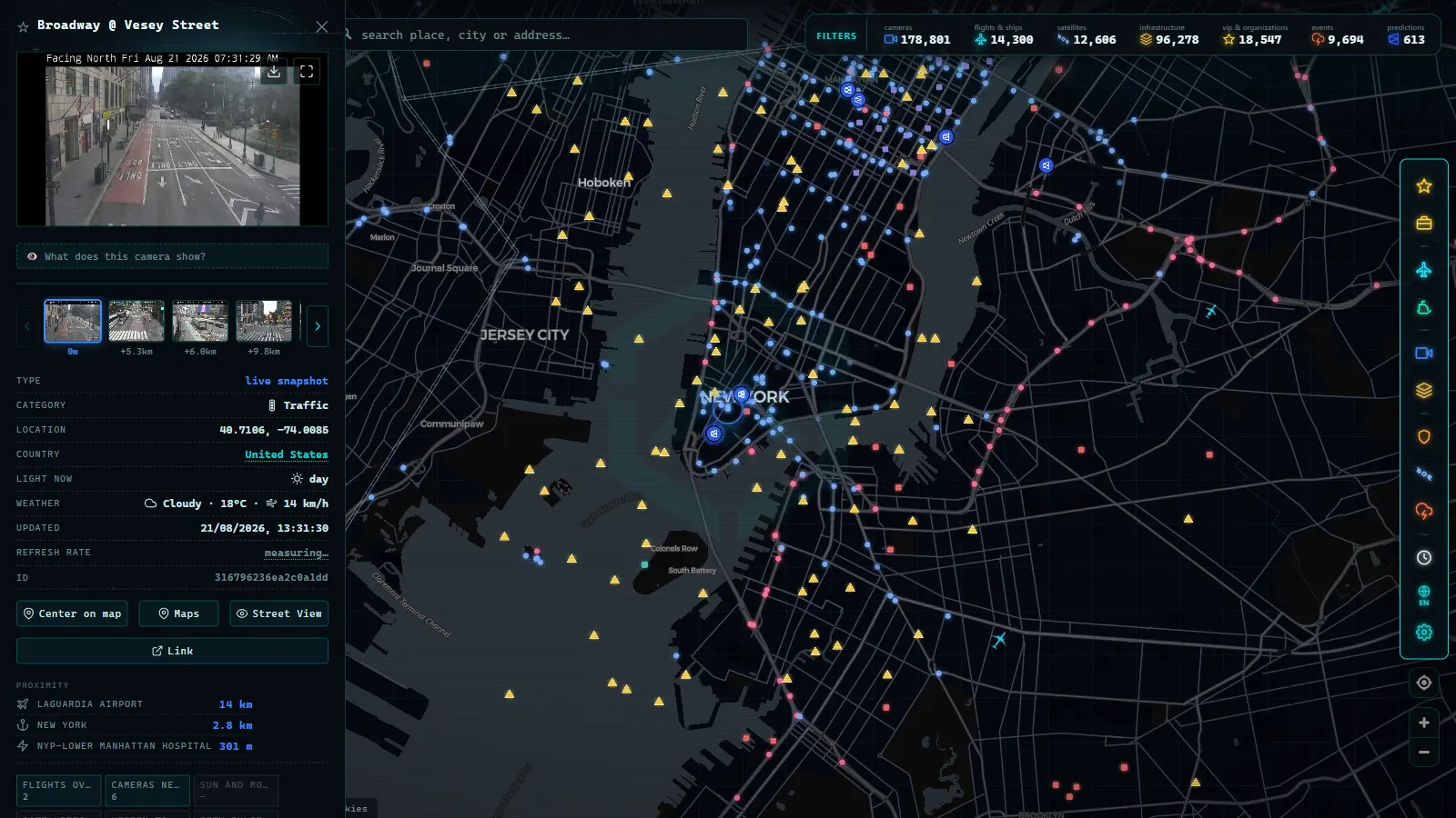
How to see every camera on a single map
The weak point of the 511 system is fragmentation: if your trip crosses three states, you would in theory need to check three different websites, each with its own map and interface. The alternative is an aggregator map that brings every state source into a single view.
That is exactly what the ARGOS ATLAS map does: it gathers more than 200,000 live public cameras from around the world, of which around 49,000 are in the United States, with 511 and DOT sources identified. You can follow an interstate from state to state without switching websites, see each camera on the map and combine it with other live layers such as flights or ships. To get the most out of this way of checking the roads, there is a general guide on watching traffic live. And if your route continues north, there is also a guide to traffic cameras in Canada.
From the ARGOS ATLAS channel.
Live cameras for the daily commute
You do not need a coast-to-coast trip to get value out of these cameras. Their most common use is far more domestic: checking the same commute every morning before leaving. The move is identical in Seattle and in Miami, find the two or three cameras that watch your trouble spot, learn where they sit on the map, and give them ten seconds before getting in the car.
That everyday use has its own technique (which camera to pick, how to read what it shows, when to distrust an image) and we cover it in our guide to local traffic updates. The core idea fits in one sentence: a live image of your route beats any congestion icon painted on a map.
Privacy and legality
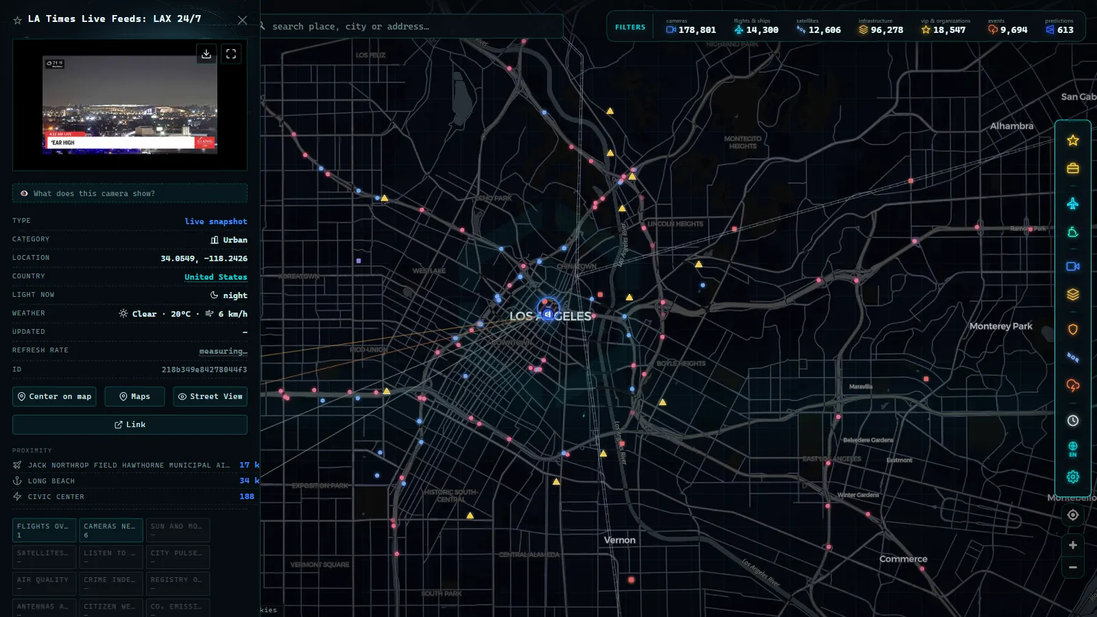
Cameras in 511 systems are public and legal because their purpose is informational: they show traffic flow and road conditions with wide shots. They are not meant to identify people, they do not allow license plates to be read, and they have no facial recognition. In fact, many DOTs deliberately limit the public resolution or framing of their cameras precisely so that nobody is identifiable.
They should not be confused with other camera-based systems: speed cameras, red-light cameras and electronic tolling are separate networks, with their own regulations and no public feed. The 511 camera you see on a map does not ticket anyone; it just shows the road. If you are interested in the full legal picture, we cover it in traffic cameras: privacy and legality.
Practical tips
A few quick guidelines to make the most of the American camera network:
- On a long trip, check by segment: review the cameras at the big urban junctions you are about to cross (the approaches to Atlanta, Houston or Chicago, for example) as you get close, not just when you leave home.
- Check the timestamp: each state refreshes its images at its own pace; an image from a few minutes ago is still useful, a frozen one is not.
- In winter, prioritize mountain passes: networks in states like Utah or Washington exist largely for this, and a camera tells you more than any forecast.
- Use cameras to verify, not just to browse: if an app flags a jam, the image confirms whether it is real and how far it stretches.
- Combine the camera with the official report: the image tells you how the road looks right now; the DOT notice tells you why and until when. Together, the two sources prevent misunderstandings and unnecessary detours.
The US traffic camera network is huge, free and public. All it lacks is a single front door, and that front door can be a good aggregator map open in your browser.
Frequently asked questions
What is the 511 system in the United States?
511 is the national traveler information number in the United States. Each state runs its own 511 service with a website, phone line and incident map, where it publishes road conditions, roadworks and, in most cases, its live traffic cameras.
How many traffic cameras are there in the USA?
There is no single official count, because each state operates its own network. As a reference, the ARGOS ATLAS map gathers around 49,000 US traffic cameras sourced from state 511 systems and departments of transportation.
Are 511 cameras used to issue tickets?
No. Cameras in 511 systems are informational: they show road conditions with wide shots and are not designed to identify people or read license plates. Speed and red-light enforcement cameras are entirely separate networks.
Can I watch US traffic cameras from another country?
Yes. Most state 511 websites are public and accessible from anywhere, and aggregator maps let you browse them all in one place. It is a handy way to plan a road trip before you even land in the country.
How can I watch US traffic cameras live on a free map?
State 511 cameras are public, and an aggregator like the ARGOS ATLAS map puts around 49,000 of them on a single live map, free and with no sign-up. Zoom in on your city or your interstate and tap any camera to see its current image.
- Spain Summer Traffic Operation 2026: Dates and Live Cameras
- UK Traffic Cameras Live: JamCams, Motorways & More
- FL511 Traffic Cameras: 5,700 Live Feeds, One Map
- NSW Traffic Cameras: Watch Sydney Live on One Map
- California Traffic Cameras: 6,900 Live, Caltrans and More
- Queensland (QLD) Traffic Cameras: Brisbane Live Map