Blog · Traffic cameras
Lugano traffic cameras: the A2, Chiasso and the lake live
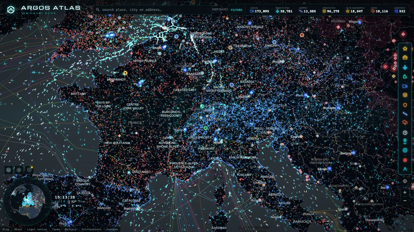
Lugano's traffic cameras are public, free and open without an account: from a single map you can watch the A2 motorway corridor that crosses Ticino from the Gotthard tunnel portal down to the Italian border at Chiasso, the approach to Lugano Airport at Bioggio, Piazza Riforma in the old town and the open water of Golfo di Agno. They are still images that refresh on a cycle, not streaming video, and most of them belong either to Swiss federal and cantonal road operators or to tourism webcams around the lake.
This page is about the corridor, not the country. The alpine passes as a set, the Gotthard, the San Bernardino and the Simplon, live in the guide to Swiss traffic cameras and alpine passes. What people type when they mean Lugano is narrower: what can I see right now between the city, the lake and the border. Open the live map of Ticino, find the corridor and the answer is on screen in seconds.
The essentials, in 20 seconds
- A2: the single motorway spine of the canton, from the Gotthard south portal at Airolo to the border at Chiasso, and the road nearly every official camera here is pointed at.
- Lugano Airport: sits at Bioggio and Agno, west of the city, so its camera doubles as a visibility check for the whole valley floor.
- Chiasso: the main road crossing between Ticino and Lombardy, where the motorway ends and the queue starts.
- Still frames, not video: cameras refresh on a cycle of minutes, nothing is recorded and there is no rewind.
- Free, no account: this corridor sits inside a public catalogue of 200,000+ cameras worldwide (count as of September 2026), all open in a browser.
The A2 corridor: from the Gotthard portal to Chiasso
Ticino has one motorway and everything hangs off it. The A2 enters the canton at the south portal of the Gotthard road tunnel at Airolo, drops through the Leventina valley to Biasca, opens out at Bellinzona, climbs the Monte Ceneri ridge and then runs down the eastern side of the lake past Lugano to Chiasso. There is no parallel motorway. One incident anywhere on that line pushes traffic onto cantonal roads that were never built for it, which is why a camera check here is worth more than in a city with a ring road.
The portal view at Airolo is the first one to open when the tunnel is metered or closed. The queue on the northern side is invisible from Ticino, and the southern approach fills quickly once the dosing system starts. If the frame shows stopped vehicles in the right lane instead of a moving stream, the corridor is already backed up and the road over the pass becomes the only alternative.
Lugano traffic cameras in the city and on the lake
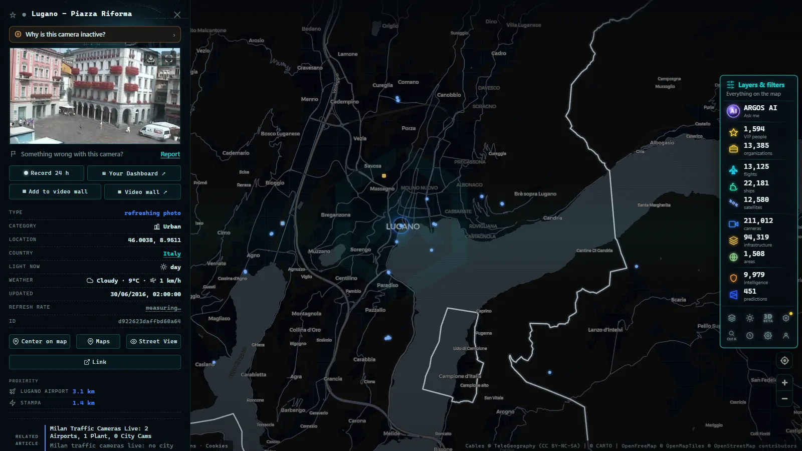
The city views are a different genre. Piazza Riforma, the main square under the arcades, tells you whether the old town is busy and what the sky is doing over the centre, which in Lugano is often the same question: fog can sit on the water while the ridge above is clear. Golfo di Agno, on the western arm of the lake, is the water check, useful before a boat and a decent proxy for wind. The camera high on Monte San Salvatore at Paradiso gives the wide shot, the one that shows whether the cloud base is above or below the city.
None of these are traffic cameras in the strict sense, and it is worth saying so plainly: they are city and tourism webcams that happen to answer traffic questions. For the road itself you want the motorway feeds, which are plainer, fixed and framed for a lane rather than for a view.
From the ARGOS ATLAS channel.
Chiasso: the border crossing and the queue behind it
Chiasso is where the A2 stops being Swiss. The crossing at Brogeda takes the through traffic and the freight terminal beside it does the customs work, so the conditions you care about start just north of town, on the last stretch of motorway before the line. Queues here are not random: they build on weekday mornings with the frontalieri, the cross border commuters coming up from Como and Varese, and again on Sunday evenings in the other direction.
A camera will tell you the density and the weather, and that is all it will tell you. It will not tell you the wait at the customs booths, which depends on how many lanes are staffed at that moment, and nobody publishes that as an image. The practical move is to read the motorway view for the approach and treat the border itself as an unknown you plan around, not one you can watch.
Where the Lugano traffic cameras come from (official and not)
Two families of source share the same map here, and telling them apart changes how much weight you give each frame.
The road views come from Swiss federal and cantonal operators. They are institutional: fixed angle, no pan or zoom, a plain timestamp, and a name that reads like an asset reference rather than a place (a portal, a direction, a marker). They are boring on purpose, and they are the ones to trust for the corridor.
The lake and town views come from tourism boards, hotels, boat operators and the occasional private site. They look better, they are often sharper, and they can be moved, rebranded or switched off without notice. When one vanishes there is no maintenance page and nobody to ask. The test for whether a webcam is official is the same everywhere: who publishes it, whether the framing serves a job or a view, and whether the name describes an asset or a postcard.
Bellinzona and the funnel north of the city
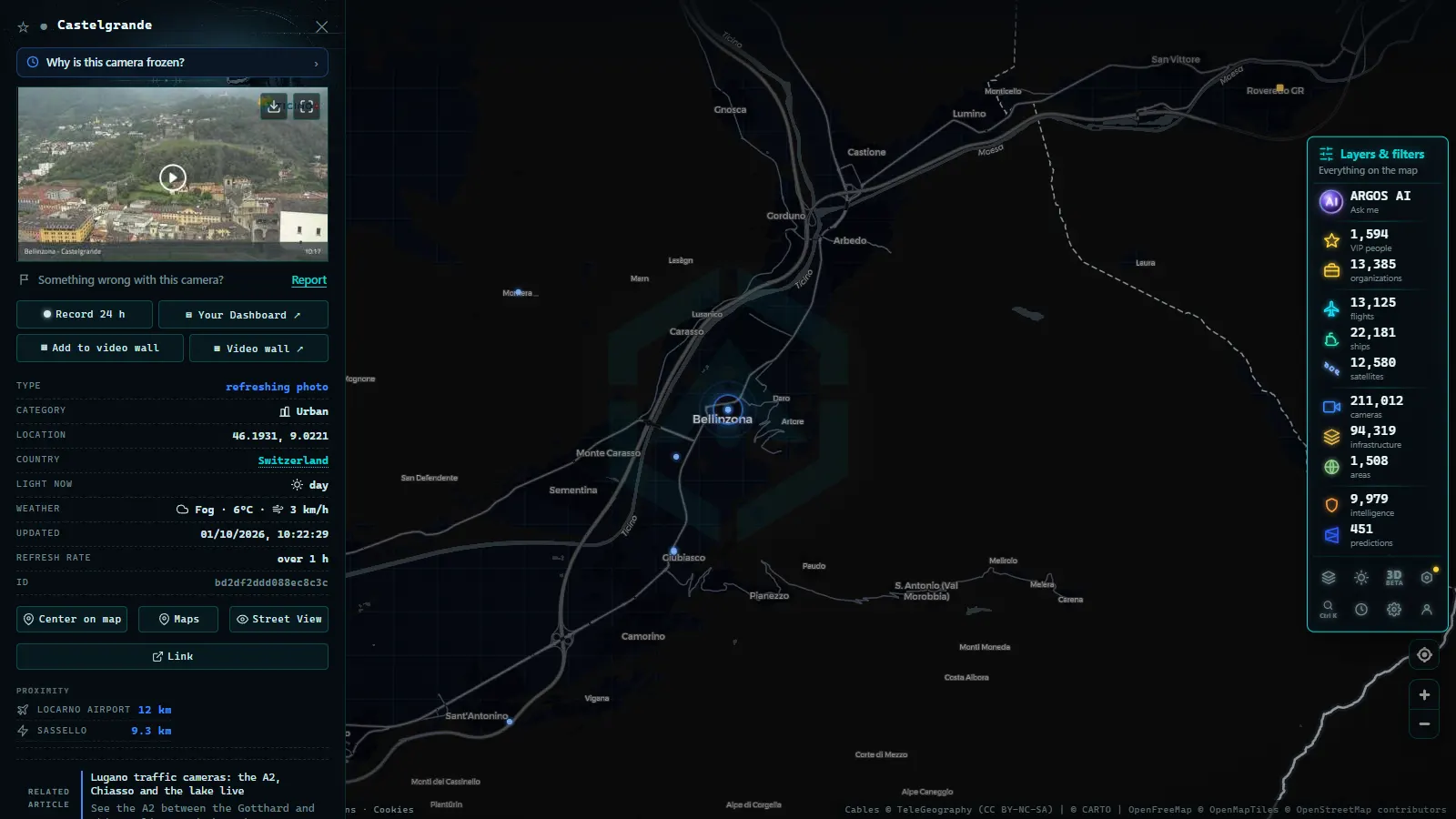
Traffic into Lugano from the north is decided further up, at Bellinzona, where the A2 and the A13 from the San Bernardino meet and the valley narrows. If that junction is slow, you feel it at the Monte Ceneri tunnel soon after. The view from Castelgrande, the castle above the town, is a landscape camera rather than a road one, but it does the job that matters on a Ticino morning: it shows whether the valley is under cloud, under rain or clear, and that weather reaches the lake shortly afterwards. Pair it with a motorway feed and you have the two halves of the same question, how much traffic and in what conditions.
When to look: a quick table for the corridor
Six views cover most of what anyone needs on this stretch. The last column is the part that matters.
| View | Source type | What it tells you | When to look |
|---|---|---|---|
| Bioggio, Lugano Airport south | Airport and road | Visibility and weather on the valley floor west of the city | Before flying in or out, and on foggy autumn mornings |
| Airolo, Gotthard south portal | Road operator | Whether the tunnel is flowing, metered or stopped | Before any crossing north to south, above all on holiday weekends |
| Piazza Riforma, Lugano | City webcam | How busy the old town is and the light over the centre | Before walking in on a market day or an event evening |
| Golfo di Agno | Tourism webcam | Water state and wind on the western arm of the lake | Before a boat trip, a swim or a lakeside run |
| Monte San Salvatore, Paradiso | Panoramic webcam | Whether the cloud base sits above or below the city | When the forecast and the street disagree |
| Castelgrande, Bellinzona | Panoramic webcam | Conditions in the valley north of the Ceneri | Before driving down from the Gotthard or the San Bernardino |
Lugano traffic cameras at night, in fog and in snow
Night halves what this corridor gives you. The lit sections near Lugano and Chiasso stay readable because the motorway lighting does the work, but the mountain views up the Leventina go dark or grainy until first light, and a panoramic webcam pointed at a valley is simply black. Autumn and winter add lake fog, which is extremely local: Agno can sit under a grey lid while the ridge at Paradiso is in full sun.
Snow rarely reaches the shore, but it decides the passes above and the cantonal roads that serve as the alternative when the tunnel closes. That is a different check, covered in the guide to mountain pass cameras and snow on the road. And if an image looks identical for hours, suspect the camera before the traffic: the reasons a traffic camera stops working are mundane and mostly seasonal.
How to work the map without getting lost
Three habits make this corridor quick to read. First, zoom to the stretch you are actually driving rather than to the city: cameras cluster at the portals, the junctions and the border, so the map is densest exactly where the decisions are. Second, open one road view and one panoramic view together, because the road tells you the density and the panorama tells you why. Third, check the timestamp before you believe the frame; an image from a while back is not a lie, but it is not now either.
If you are planning a longer run through the Alps, the A2 is only one leg of it, and the rest of the continent works the same way from the same map, country by country across Europe.
What you won't see
- No video: these are stills on a refresh cycle, so a car that passed between frames never existed as far as the camera is concerned.
- No identification: resolution and framing make plates and faces unreadable, and that is the design, not a shortcoming to work around.
- No tunnel interiors: the Gotthard bore and the Ceneri tunnels are watched by closed operator systems that publish nothing.
- No recording: there is no archive, no rewind and no way to ask for the frame from an hour ago.
- No border waiting times: the queue at the customs booths is not published as an image by anyone.
- No full coverage: side valleys, the Malcantone roads and most of the lake shore have no camera at all, and a blank area on the map means exactly that.
That list is the honest shape of the thing. Within those limits, a handful of frames answers the two questions that actually decide a Ticino drive: is the corridor moving, and what is the weather doing to it.
Frequently asked questions
Are the Lugano traffic cameras free to watch?
Yes. Every camera in the Lugano and Ticino corridor is a public feed, so the map opens without an account, without a payment and without an app. You get the same images the road operator publishes, refreshed on their own cycle. The only limit is the operator's: if they take a camera offline, it disappears for everyone.
Can I see inside the Gotthard road tunnel?
No. Tunnel interiors are not published on public camera feeds, in the Gotthard or anywhere else on the A2. Operators do watch the bore with their own closed systems for incident detection, but those images stay inside the control room. What you can see from outside is the portal at Airolo, the approach and the queue in front of it.
How do I tell an official camera from a tourism webcam?
Check the source label on each camera card. Swiss road and cantonal operators run the motorway views, and they look plain, fixed and badly framed on purpose. Tourism and hotel webcams around the lake are the pretty ones, and they can be moved, rebranded or switched off at will. Both are useful, but only the first is a road source.
Are these cameras live video?
No. Almost everything on this corridor is a still frame that refreshes on a cycle of minutes, not a video stream. That is a deliberate choice by the operators: it keeps bandwidth low and makes the feed useless for identifying a person or a plate. For traffic it is enough, because what you read is density, weather and light.
Do the cameras still work at night?
Partly. Motorway cameras keep publishing at night and the lit sections near Lugano and Chiasso stay readable, but the mountain views up the Leventina go black or grainy until first light. A frozen image with the same frame for hours usually means the camera is down, not that the road is empty.
- Christchurch Traffic Cameras: Live Now, Free, No Sign-up
- Yunlin Traffic Cameras: What You See on National 1 and 3
- Poland Traffic Cameras: Live Views of the A4, A2 and Gdansk
- Connecticut Traffic Cameras: Live Stills on I-91 and I-691
- Maine Turnpike cameras: every exit from Kittery to Augusta
- How Traffic Cameras Work (And Why They Are Public)