Blog · Traffic cameras
Live Traffic Cameras in Switzerland: Alpine Passes, ASTRA and Road Conditions
The Most Monitored Roads in the Alps
Switzerland sits at the geographical heart of Europe, and its Alpine passes are far more than scenic detours. They are critical arteries for freight and passenger traffic moving between northern and southern Europe. Every year, millions of trucks and tourists cross the Swiss Alps through tunnels and mountain roads that can be shut down within hours when weather demands it.
To manage that responsibility, Switzerland has built one of the densest road surveillance camera networks on the continent. The agency behind that infrastructure is ASTRA, Bundesamt für Strassen in German, known in French as FEDRO (Office fédéral des routes). This federal body operates, monitors and publicly streams imagery from hundreds of cameras deployed across the national road network.
"In a country where snow can accumulate to two metres at altitude within a few hours, real-time visibility is not a luxury, it is an operational necessity."
The ASTRA/FEDRO Network: Coverage, Data and Public Access
ASTRA manages approximately 1,800 kilometres of national motorways (the Nationalstrassen) and several hundred kilometres of access roads to mountain passes. Along those routes, cameras are installed at regular intervals, with particular density at:
- Tunnel entrances and exits
- High-altitude sections prone to snow accumulation
- Busy intersections and roundabouts
- Zones exposed to avalanche or rockfall risk
Camera feeds are routed into cantonal traffic control centres and into the federal road information system. A significant portion of those images (those covering points of public interest) are made openly available through ASTRA's official portal and can be integrated into monitoring platforms such as ARGOS ATLAS.
The Gotthard Pass: Central Europe's Most Critical Corridor
If there is a single point on the Swiss map that concentrates more logistical pressure than any other, it is the Gotthard (San Gottardo in Italian). Sitting at 2,106 metres above sea level, the Gotthard pass connects German-speaking Switzerland with Ticino and, beyond, with northern Italy.
The Gotthard's history as a transit route stretches back to the Middle Ages. Today three parallel infrastructures coexist:
- The mountain pass road (N2/A2), which crosses the summit and closes during winter months.
- The Gotthard Road Tunnel, 16.9 kilometres long, one of the world's longest when it opened in 1980.
- The Gotthard Base Tunnel, opened in 2016 at 57 km, currently the world's longest railway tunnel.
ASTRA cameras on this corridor monitor both tunnel approaches (where queues of several kilometres are common in peak season) and the pass road during the months it is open. Seeing in real time whether there is snow on the carriageway, whether the tunnel is saturated or whether visibility is poor can save hours of waiting.
What Gotthard Cameras Show
Publicly available imagery from the Gotthard includes:
- North portal of the tunnel (Göschenen): one of the highest-traffic points in Switzerland, particularly in summer.
- South portal (Airolo): the Ticino-side approach, prone to Friday afternoon and Sunday evening congestion.
- High-mountain road section (summer only): a winding route with spectacular views that demands a confident driver.
Great St Bernard: Gateway Between Switzerland and the Aosta Valley
To the west of the Gotthard, the Great St Bernard Pass (2,469 m) is the highest permanently inhabited mountain pass in Western Europe and the oldest of the great Alpine passes in continuous use. Its name evokes both the famous dog breed and the hospice founded in the eleventh century that still welcomes travellers today.
The pass connects the Canton of Valais in Switzerland with the Aosta Valley in Italy, making it particularly relevant for traffic between Geneva and Turin. Like the Gotthard, a mountain pass road (closed in winter) and a 5.8-kilometre road tunnel (open year-round) run in parallel.
Cameras in this corridor cover:
- The Swiss approach from Martigny and Sembrancher
- The tunnel portal at Bourg-Saint-Pierre
- The most exposed sections of the pass road during the summer season
Snow at the Great St Bernard can linger into June or return in September, making the cameras heavily consulted by cyclists, motorcyclists and low-clearance vehicle drivers who cannot use the tunnel.
From the ARGOS ATLAS channel.
The Simplon Pass: The Freight Route to the Mediterranean
East of the Great St Bernard, the Simplon Pass (2,005 m) also links Valais with Italy, this time with the Piedmont region and the town of Domodossola. Unlike the Gotthard, the Simplon has no parallel road tunnel: the mountain road is the only direct road option when the railway tunnel is not accessible to wheeled traffic.
That makes Simplon cameras especially valuable:
- For long-haul hauliers who need to confirm the road is clear before routing through.
- For motorhome or trailer drivers who cannot access certain tunnels.
- For emergency services monitoring potential closures due to avalanche.
The Simplon road is generally open between May and October, but late or early snowfall can force temporary closures. ASTRA cameras on this stretch show carriageway condition, visibility and whether snowploughs have been active.
Snow, Ice and Winter Conditions: How to Read an Alpine Pass Camera
Interpreting a mountain camera image is not always straightforward. Here are the key visual indicators to look for:
Key Visual Signals
- White or light grey carriageway: compacted snow or ice; chains likely mandatory.
- Wet road with snowy verges: active salt treatment in progress; caution advised but usually passable.
- Reduced visibility or blurred image: active fog or snowfall; check with the road authority before departing.
- Reference poles buried to the top: significant snow accumulation; possible imminent closure.
- Stationary vehicles visible: active queue or incident ahead.
Most Useful Viewing Times
Cameras provide the most actionable information during specific windows:
- Early morning (06:00–08:00): reveals whether overnight snowploughs have cleared the road.
- Midday: thaw may have improved or worsened surface conditions.
- Late afternoon (16:00–18:00): return traffic peaks and temperatures can drop rapidly.
ARGOS ATLAS: Swiss Cameras in a Global Context
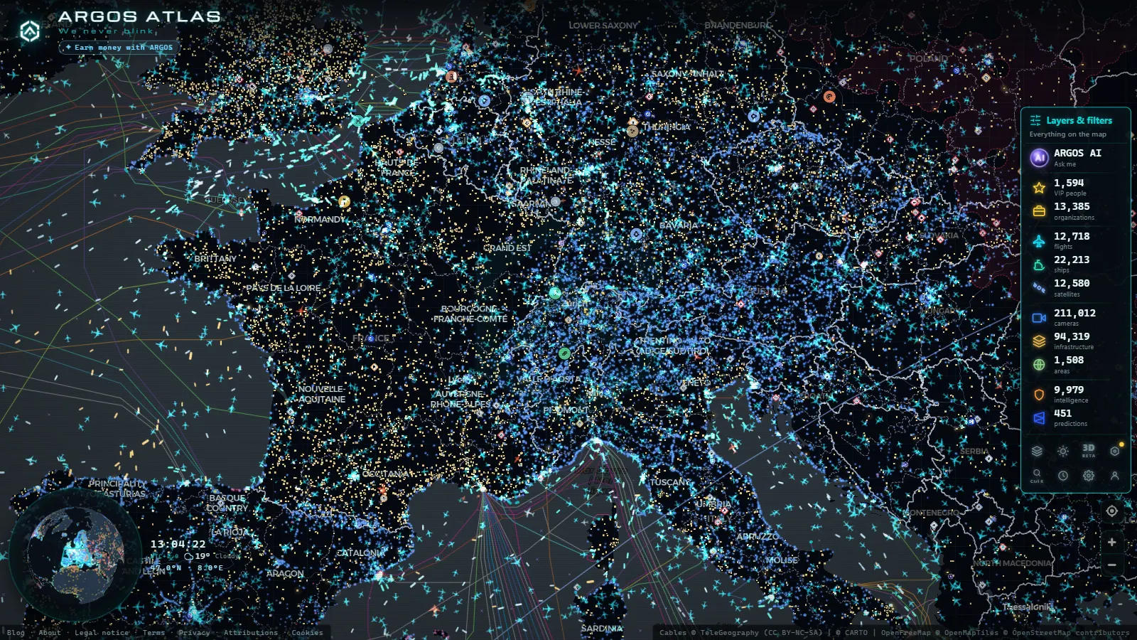
Within ARGOS ATLAS, Switzerland's cameras form part of a broader layer of public road surveillance sources. The platform lets you view simultaneously:
- Traffic cameras from Switzerland, France, Italy and Austria along the same Alpine corridors.
- Real-time flight positions over the region, useful for correlating weather conditions from above.
- Nearby critical infrastructure data, such as hydroelectric plants or emergency management facilities.
This integrated view is particularly valuable for professional hauliers, logistics operators or travellers planning an Alpine crossing who want to cross-reference multiple sources before departure.
How to Filter Cameras by Country or Region
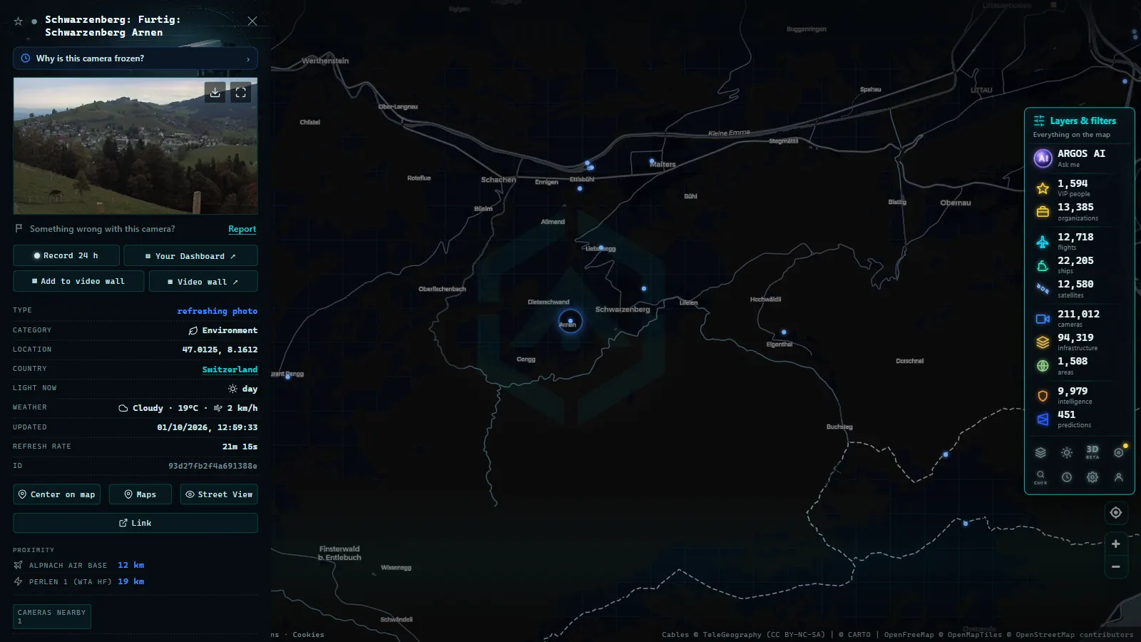
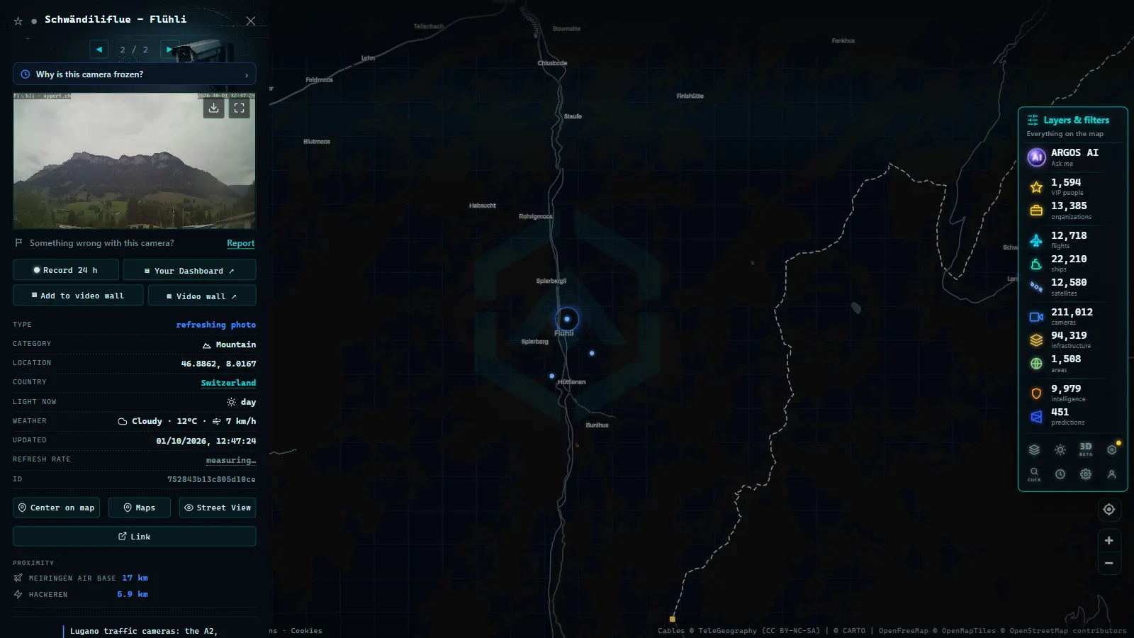
From the ARGOS ATLAS map, select the traffic cameras layer and apply the geographic filter for Switzerland or the Alps. Active cameras appear as clickable icons; clicking one opens the most recent available image alongside the source metadata.
For the Gotthard, Great St Bernard and Simplon passes, you can search directly by name in the integrated search bar, or navigate to the region on the map until cameras appear at the appropriate zoom level.
Beyond Winter: Year-Round Alpine Road Monitoring
Although snow dominates the headlines, Swiss Alpine cameras are critical tools in summer too. Maintenance works, tunnel portal congestion during the July and August tourist peak, and precautionary closures due to thunderstorms are all actively monitored situations.
In August of any recent year, the Gotthard north portal has seen queues exceeding 20 kilometres on a single weekend. Cameras allow traffic managers to activate variable message signs and, in some cases, recommend alternative routes via the Oberalp or Lukmanier passes.
Alternative Routes and the Broader Alpine Network
Switzerland's camera network does not stop at the three major passes. The Furka, Susten, Klausen, San Bernardino and Maloja passes all have surveillance coverage, and ASTRA publishes status updates that complement the visual feeds. Knowing that the Gotthard is saturated but the San Bernardino is clear (and being able to confirm that visually) is exactly the kind of decision support that live camera access provides.
Exploring Switzerland's cameras on ARGOS ATLAS requires no registration or special configuration. It is a direct window into one of Europe's most sophisticated road infrastructure systems, available to anyone who wants to see the real state of the Alps before getting behind the wheel. Whether you are planning a weekend crossing into Italy or tracking freight corridor conditions from across the continent, the feeds are there, live, open and continuously updated.
Frequently asked questions
What is ASTRA/FEDRO and what does it have to do with traffic cameras?
ASTRA (German acronym) or FEDRO (French acronym) is the Swiss Federal Roads Office. It manages the national motorway network and key mountain routes, operating hundreds of surveillance cameras (especially on critical Alpine passes) to monitor traffic and road conditions year-round.
When does the Gotthard pass close for snow?
The Gotthard road tunnel remains open year-round. The mountain pass road (over the summit) typically closes between November and May, depending on snowfall. ASTRA cameras show real-time conditions so drivers can make informed decisions before setting off.
Can I view Swiss cameras from ARGOS ATLAS?
Yes. ARGOS ATLAS integrates traffic cameras from around the world, including publicly available European feeds. You can filter by region or search directly on the map to find active cameras in Switzerland and the Alps.
- Live Traffic Cameras: How to Monitor Global Road Conditions
- Local Traffic Updates: See Any Road Live on One Map (Free)
- US Traffic Cameras: All 511 Feeds on One Live Map
- Spain Summer Traffic Operation 2026: Dates and Live Cameras
- UK Traffic Cameras Live: JamCams, Motorways & More
- FL511 Traffic Cameras: 5,700 Live Feeds, One Map