Blog · Traffic cameras
Watch Live Traffic: Every Way to Check Road Conditions in Real Time
You want to watch traffic live before setting off: to know whether the highway is moving, whether the approach to the city is gridlocked, or whether that storm has turned the road into a problem. The good news is that several free ways to do this now exist. The less good news: each one tells you a different part of the story, and relying on just one of them tends to produce surprises. This guide covers the four main ways to check road conditions in real time, what each one contributes, where each falls short, and how to combine them so you decide with the best information available.
The essentials, in 20 seconds
- Four methods exist to watch traffic live: official portals, navigation apps, live cameras, and signs or bulletins.
- Navigation apps color roads green, amber, or red from a statistical speed estimate, not a direct observation.
- Live traffic cameras show the road surface itself, with no algorithm standing between you and the image.
- Two steps (detect with an app or portal, confirm with a camera) make up the method people who check conditions regularly use.
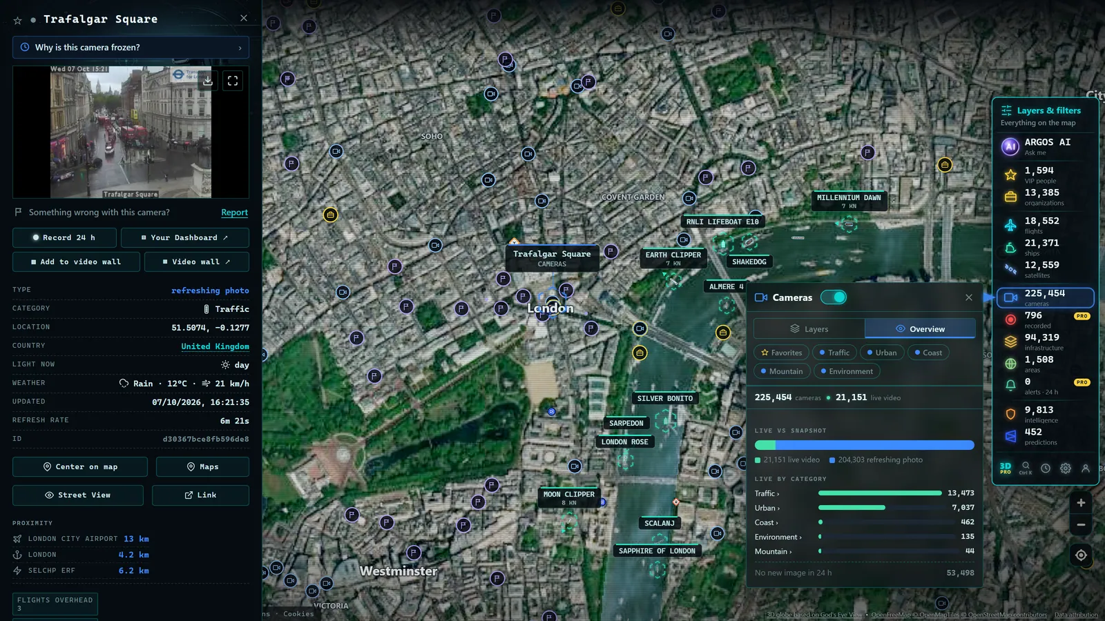
- Argos Atlas gathers thousands of official public traffic cameras from road authorities worldwide onto one free map, no registration needed.
The four ways to watch traffic in real time
Although the specific tools vary by country, every method for checking road conditions falls into one of four broad families.
1. Official traffic portals
Road authorities (the DOT in US states, National Highways in England, the Autobahndirektion in Germany, BISON FUTÉ in France) publish current conditions on their websites: active incidents, roadworks, closures, restrictions, and in many cases their own camera feeds. This is the primary source: information that comes directly from the control centers monitoring the roads.
Their strength is reliability and administrative detail: if a road is officially closed or a mountain pass requires snow chains, you will find it here before anywhere else. Their weakness is usability: most are organised as lists of incidents searchable by region or road number, which makes surveying a long multi-leg route slow and laborious.
2. Navigation apps with congestion layers
Mapping and navigation applications color roads green, amber, or red based on the speed of vehicles currently using them. The data is aggregated, anonymised, and updated almost instantly, and the major advantage is coverage: any road with enough traffic gets colored.
But it is worth understanding what that color represents: a statistical estimate, not a direct observation. The app knows that vehicles are moving at 12 mph where they should be doing 70; it does not know whether that is because of a crash, snow, a protest, or a checkpoint. It tells you that something is happening, not what is happening. On roads with sparse traffic, the estimate may not exist at all or may arrive with a significant lag.
3. Live traffic cameras
The third method is the most underestimated and, for certain decisions, the most valuable: cameras that road agencies publish openly. There is no estimate here, no algorithm: it is the road surface seen with your own eyes. If the image shows snow on the tarmac, there is snow. If it shows four lanes flowing freely, they are flowing.
The camera answers the question that no app can answer with certainty: "What does the road actually look like right now?" Its limits are equally clear: each camera covers one specific point, the refresh rate depends on the source, and at night or in dense fog the image loses value. In our complete guide to traffic cameras worldwide we explain how to find and read them, and our article on how traffic cameras work covers the technology behind them.
4. Signs, bulletins, and radio
The traditional channel is still alive: variable message signs on motorways, traffic bulletins on radio, and official social media accounts. These are broadcast channels, designed to push important information to you without your having to ask. They work very well for major events (a complete road closure, a severe weather alert) and less well for the granular detail of your specific route. Their key advantage: they reach you even while you are already driving, without your having to touch a phone.
What each source contributes and where it falls short
The most useful way to compare these four methods is to ask which type of question each answers well:
- Is a route officially closed or restricted? Official portal. The authority that declares the closure knows it first.
- Where are the hold-ups on my route right now? Navigation app. Nothing matches its real-time spatial coverage.
- What does the road physically look like, snow, flooding, visibility, depth of jam? Camera. It is the only direct observation.
- Is there something serious I should know while driving? Signs and bulletins.
One distinction is worth fixing clearly: the app estimates; the camera shows. The congestion layer is a model built on speed data, brilliant, but blind to everything that is not speed. The camera is a window. A stretch of road can appear green on the app while the camera shows it snowing heavily and the surface beginning to set: vehicles are still moving quickly, but you can already see what is coming.
From the ARGOS ATLAS channel.
How to combine them: detect with one, confirm with another
The method used by people who check road conditions regularly is a two-step funnel:
Step 1, Detect. Open the congestion layer or the incident list on the official portal and scan your entire route. Within seconds you identify the suspicious sections: the red on the app, the incident on the portal, the advisory on the radio.
Step 2, Confirm. For each suspicious section, find the nearest camera and look. The image tells you whether that red means heavy but moving traffic or a complete standstill, whether the "weather incident" is drizzle or a downpour, whether the closed lane has already reopened despite the advisory still being published.
This second step has a catch: official cameras are distributed across different portals (national, regional, municipal), and finding "the camera nearest mile marker 87 on this highway" can take longer than the jam itself. This is why a map format changes things so substantially, as we will see shortly. And if the camera you need appears frozen or offline (which happens more than you might expect) our article on why a traffic camera stops working explains the usual causes and what to do.
Three practical scenarios
Holiday weekend departure
Friday afternoon, summer bank holiday, everyone leaving at once. The app already shows the city exits in red: you knew that without looking. What determines your plan is something else: does the red thin out 15 miles out or does it run half the way to your destination? Open cameras positioned at intervals along the route and compare: where the image shows heavy but moving traffic, patience is the answer; where it shows vehicles at a complete standstill, consider the alternative route or delay your departure by a couple of hours.
Unexpected incident
You are about to leave and the official portal reports "accident, one lane closed" on your motorway. The alert does not tell you what matters most: how much of a queue has formed. The camera positioned before the incident point does. If the image shows the tail building, you still have time to take the alternative route; if it shows the stretch already clear, the advisory may simply not have been taken down yet.
Weather event
Forecast of snow at lower elevations than usual and you have a mountain pass to cross. The forecast speaks in probabilities; the camera speaks in present tense: road surface wet and black, or white and settling. This is the scenario where direct observation matters most, and we have written a dedicated guide for it: mountain pass cameras for checking snow conditions before you travel.
A single map that brings it all together
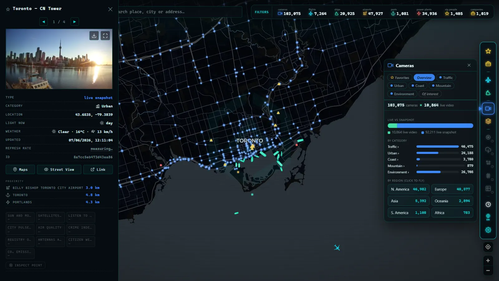
If the bottleneck of this method is fragmentation (each agency publishes its cameras on its own portal) the solution is aggregation. Argos Atlas brings together thousands of official public traffic cameras from road authorities across the world onto a single interactive map: zoom in on your route and see the available camera points, from whatever source they come, each with its latest published frame and attribution to its origin.
On top of the cameras, the map adds other layers (infrastructure such as airports and ports, live flights and ship positions) all free and without registration. For the "detect and confirm" workflow, this means the confirmation step goes from several minutes of navigating portals to a few seconds of moving the map.
The question stops being "which website will have the camera for this stretch?" and becomes simply "what does it look like?"
Frequently asked questions
Where can I watch live traffic for free?
You have three main free options: official traffic portals (the 511 system in US states, National Highways in the UK, BISON FUTÉ in France, and equivalent agencies worldwide), navigation apps with real-time congestion layers, and live camera viewers, either on individual agency portals or gathered on an aggregator like Argos Atlas, which requires no account.
What is the difference between a congestion map and a camera?
A congestion map is an estimate: it calculates traffic state from vehicle speeds and translates the result into colors. A camera is an observation: a real image of the road at that moment. The estimate covers the entire network but cannot see causes or weather conditions; the camera covers one point but shows you reality. That is why they work so well together.
Are navigation apps enough?
For everyday urban use, normally yes: they detect jams and recalculate routes effectively. They fall short when what matters is the physical state of the road surface (snow, ice, flooding, visibility) or when you need to understand the real magnitude of an incident. In those cases, cameras and official bulletins are the necessary complement.
Can I watch traffic in another city or country?
Yes, with no restrictions. Official cameras are published openly on the internet and are accessible from anywhere. The practical difficulty is knowing which portal to look for in each country and managing its language and interface, exactly the problem that disappears when cameras are already gathered onto a single international map.
Conclusion
Watching traffic live is not about choosing one tool; it is about building a small system: the official portal for administrative facts, the navigation app for detection, the camera for visual confirmation, and bulletins for what happens while you are on the road. Each source covers the blind spots of the others, and together they give you something none of them can deliver alone: reasonable certainty before you set off. When you are ready to take the confirmation step without getting lost between portals, open the map, locate your route, and let the cameras show you the road exactly as it is right now.
Frequently asked questions
Where can I watch live traffic for free?
On official traffic portals for each country, on navigation apps with congestion layers, and on camera aggregators like Argos Atlas. All of these are free, and most require no registration.
What is the difference between a congestion map and a camera?
A congestion map is an estimate calculated from vehicle speed data; a camera is a real image of the road surface. The map tells you where to look; the camera lets you see it with your own eyes.
Are navigation apps enough?
For everyday urban driving, usually yes. But they do not show the cause of a hold-up or the physical state of the road surface (snow, ice, flooding, fog). For that you need a camera or an official bulletin.
Can I watch traffic in another city or country?
Yes. Official cameras are published openly and accessible from anywhere. An international aggregator removes the need to hunt for each country's local portal: open the map, zoom in, and you are there.
- Traffic cameras and privacy: what they capture, what they don't, and what the law says
- Traffic cameras in Europe: where to see the roads in each country
- Live Traffic Mexico City: 15,000+ CDMX Cameras In Real Time
- Live Traffic Cameras in Buenos Aires: Urban Autopistas, Metrobus, and the North-South Corridor
- Live Traffic Cameras in Bogota, Colombia: IDU, Movilidad, TransMilenio and Pico y Placa
- Santiago Traffic Cameras: Local Traffic Updates Live from Chile