Blog · Traffic cameras
Maine Turnpike cameras: every exit from Kittery to Augusta

The Maine Turnpike is 109 miles of tolled I-95 between Kittery and Augusta, and the cameras along it are free public still frames: no account, no app, no paywall. You get the queue at the York mainline toll, the point where I-295 splits off toward Portland, the dark rural run north of Gray, and the service plaza lots when a storm is coming in. Because the road is numbered by milepost, every camera carries an exit number with it, and that is why this guide walks the state by exit instead of by county.
Two things before you click. The frames refresh every minute or two instead of streaming, so you are reading a snapshot, not watching a feed. And the cameras off the toll road (on I-295, US Route 1, the approaches to Bangor) belong to the statewide network, so they are framed and named differently. All of it opens from the live traffic camera map, which holds 224,192 cameras worldwide (count as of October 2026); there is no per state figure published for Maine, so use the exit list below rather than a headline number.
The essentials, in 20 seconds
- Maine Turnpike: 109 miles of tolled I-95, from mile 0 in Kittery to Exit 109 in Augusta.
- Exit numbers are mileposts: Exit 25 sits around mile 25, so the exit number tells you where a camera is.
- Free, no registration: these are public roadside cameras, not a subscription feed.
- Still frames, not video: one image every minute or two, no audio, no zoom you control.
- Two networks, one corridor: the toll road has its own cameras, the state covers I-295, US Route 1 and everything north of Augusta.
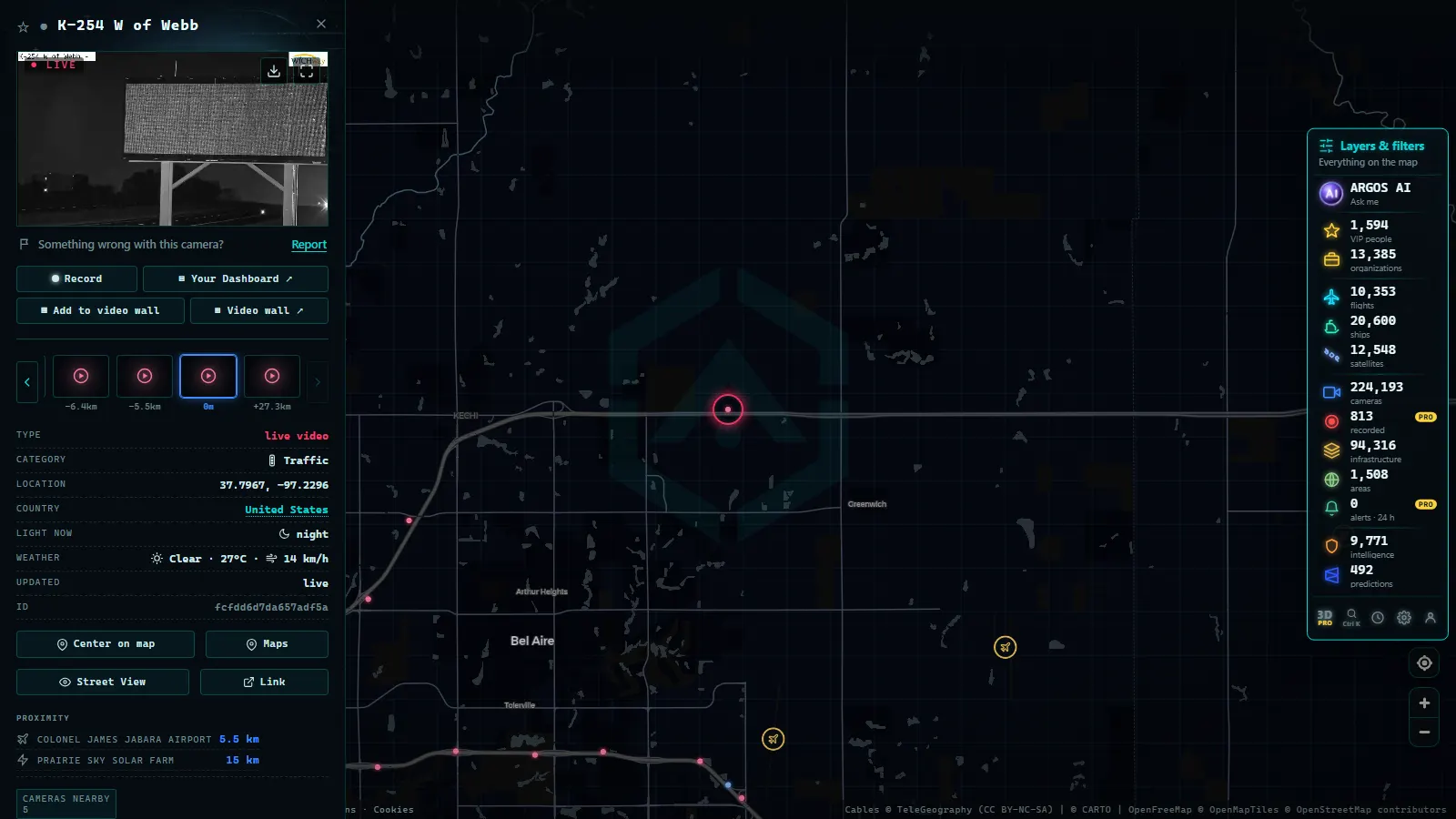
That frame is a mainline interstate camera on I-35 in Kansas, not in Maine. It is here because it shows the exact format you get when you open a Turnpike camera (wide lens, both barrels in shot, a mileposted name) before you go looking for your own exit.
Why Maine reads by exit, not by county
Maine has sixteen counties and hardly anybody navigates by them. The toll road is the spine of the populated half of the state, and its exits match mileposts, so Exit 25 is around mile 25 and Exit 109 is the northern end in Augusta. Signs, radio reports and the camera names all use that number, which makes the exit the natural unit for a camera tour.
The numbering also tells you where the eyes stop. Numbers jump where there is nothing to exit for: between Exit 36 in Saco and Exit 44 in South Portland you cross the Scarborough marsh, and between Exit 86 and Exit 102 there is a long farmland stretch with very little in it. A gap in the numbering is usually a gap in the coverage too.
The southern Maine Turnpike: Kittery to Saco
From mile 0 in Kittery to Exit 36 in Saco is the stretch that decides whether your drive is ninety minutes or three hours. The cameras cluster at Exit 7 (York), Exit 19 (Wells), Exit 25 (Kennebunk) and Exit 32 (Biddeford), which is roughly the order in which a summer Friday backs up: the mainline toll first, then the ramp queues for the beaches at Ogunquit and Old Orchard Beach.
What to read in those frames is not the number of cars, it is the space between them. A southbound Sunday frame at Exit 19 with no gaps left between vehicles means the queue already reaches past the camera, and US Route 1, the old coastal road that parallels the Turnpike the whole way, is the only alternative worth taking.
From the ARGOS ATLAS channel.
Maine Turnpike cameras, exit by exit
These are the ones worth a bookmark, south to north, with the reason to open each.
| Exit (milepost) | Where | What it covers | When to look |
|---|---|---|---|
| 7 | York | Mainline toll area and the beach ramps | Summer Fridays and Sundays |
| 19 | Wells | Open mainline, Wells and Ogunquit traffic | Before any coastal drive |
| 25 | Kennebunk | Interchange plus the service plaza lots | To judge the plaza queue |
| 32 to 36 | Biddeford, Saco | Twin exits feeding the Old Orchard Beach strip | Weekend afternoons |
| 44 | South Portland | Where I-295 splits off toward Portland | Weekday rush, both directions |
| 48 to 53 | Westbrook, Falmouth | Northern Portland ring and the Falmouth spur | Morning inbound commute |
| 63 | Gray | Mainline plaza area and the Route 26 junction | Snow squalls moving inland |
| 75 to 80 | Auburn, Lewiston | The twin cities exits and the truck traffic | Winter mornings |
| 102 to 109 | Gardiner, Augusta | I-295 folding back in, end of the tolled road | Before continuing north on free I-95 |
Portland: the busiest Maine Turnpike cameras
Between Exit 44 and Exit 53 the Turnpike behaves like a city ring road. I-295 leaves the mainline at Exit 44 and runs straight through Portland, so the toll road becomes the bypass and the two routes trade places depending on the hour. For a commuter this is the most useful cluster on the corridor: the Maine Mall and jetport exits, Exit 48 for the Westbrook arterial, and Exit 53 for the Falmouth spur that hands you back to I-295.
Fog is the local specialty. Air off Casco Bay can leave the Portland frames white while the Gray camera, twenty minutes inland, is perfectly clear, so open two cameras before you decide the problem is your windshield.
North of Gray: Auburn, Lewiston and Augusta
North of Exit 63 (Gray) the road changes character: two lanes each way, trees close to the shoulder, long distances between interchanges. Exit 75 (Auburn) and Exit 80 (Lewiston) cover the twin cities, Exit 86 (Sabattus) is the last one before the farmland gap, and Exit 102 and Exit 103 are where I-295 folds back in near West Gardiner. Exit 109 in Augusta ends the tolled section; from there I-95 continues free toward Bangor and the border at Houlton.
These are winter frames rather than summer ones. A squall can sit over the Gray to Auburn stretch while the coast stays dry, and the difference between wet pavement and packed snow shows up in a single still if you look at the tire tracks instead of the sky.
Maine Turnpike toll plazas and service plazas
Tolling here is a mix of mainline gantries at York and New Gloucester and ramp tolls at most interchanges, with E-ZPass lanes beside the ones that still take payment. The cameras near those points answer the question nothing else answers, which is how long the queue actually is right now. A mainline frame at York on a holiday Sunday is the single most informative image on the road.
The service plazas are the other reason people open these cameras. Kennebunk has one in each direction and West Gardiner serves both the toll road and I-295, so a frame of a packed lot tells you to push on to the next one. What the frames never show is fuel prices or whether anything inside is open.
Off the toll road: I-295, Route 1 and the rest of Maine
The Turnpike is 109 miles of a state that runs far further north, and the cameras beyond it belong to the statewide network. I-295 through Portland, Freeport, Brunswick and Bath is the one most people actually need. US Route 1 along the coast has eyes at the choke points rather than continuous coverage, and north of Bangor it thins down to interchanges, border crossings and a few passes.

If you drive across state lines, the neighbours are worth a look: traffic cameras in Connecticut on the I-91 corridor, the 511NY camera network in New York, and the wider view of traffic cameras across the United States.
Winter is what these cameras are really for
Camera season in Maine is not July. From November to April these frames are the cheapest road report available, and reading them is a skill: the lane lines (gone means snow cover), the tire tracks (two dark ruts means wet, white ruts means packed snow), and the spray behind trucks (high spray means standing water, no spray below freezing means ice).
Timing matters more than resolution. Plows hit the toll road first, so a clean mainline frame at Exit 63 says nothing about the county road you turn onto at the bottom of the ramp. And the useful window is short: in December the southern frames go dark by mid afternoon, which is exactly when the drive home starts.
What you won't see
- No video: one still every minute or two, so a crash can happen entirely between frames.
- No identification: faces, plates and vehicle details are not legible, by resolution and by design.
- No enforcement: these cameras do not issue tickets, and Maine does not run automated speed cameras.
- No archive: you see the latest frame, not the one from an hour ago, and nothing is kept for you.
- Night and weather: unlit rural frames are close to black, and snow, rime or road salt on the housing kills the image.
- Outages and gaps: the farmland stretch between Exit 86 and Exit 102 is thin, the state north of Bangor thinner, and storms take cameras offline at the worst moment (why a traffic camera stops working).
Frequently asked questions
Are Maine Turnpike cameras free to watch?
Yes, and without an account. The roadside cameras along the toll road and the statewide ones off it are public, so you open a frame and that is it: no login, no app, no trial. What you pay nothing for is also limited: a still image refreshed every minute or two, never a video stream.
How many cameras are there on the Maine Turnpike?
No number worth quoting. The count of live cameras moves with maintenance, construction and seasonal installs, so printing one would age badly. The pattern is stable, though: expect a camera at most interchanges, more of them around the toll gantries and the Portland exits, and long thin stretches north of Gray with very few.
Do these cameras catch speeding drivers?
No. Maine does not run automated speed or red light enforcement, and the frames are far too coarse for it anyway: at that resolution a car is a few dozen pixels and a plate is a smudge. They exist so drivers, dispatchers and plow crews can see conditions, not to issue tickets.
Which exits are worth checking before a summer weekend drive?
Exit 7 in York, Exit 19 in Wells, Exit 25 in Kennebunk and Exit 36 in Saco. That southern stretch carries the beach traffic for Ogunquit, Old Orchard Beach and the Kennebunk coast, and it is where a Friday afternoon or Sunday evening queue forms first. Exit 44 tells you whether Portland is the problem.
Why is a Maine camera black or frozen when I open it?
Usually night or weather. Outside the lit interchanges around Portland, a December frame after mid afternoon can be almost black, and snow, rime or road salt on the housing turns the image into a grey wash. Storms also knock cameras offline exactly when they matter, and a frozen timestamp means the last upload failed.
- How Traffic Cameras Work (And Why They Are Public)
- DGT Traffic Cameras: 10,894 Live Feeds in Spain
- Watch Live Traffic: Every Way to Check Road Conditions in Real Time
- Traffic cameras and privacy: what they capture, what they don't, and what the law says
- Mountain pass cameras: how to check road snow conditions before you travel
- Traffic cameras in Europe: where to see the roads in each country