Blog · Traffic cameras
Finland Traffic Cameras: Fintraffic, Digitraffic and Lapland
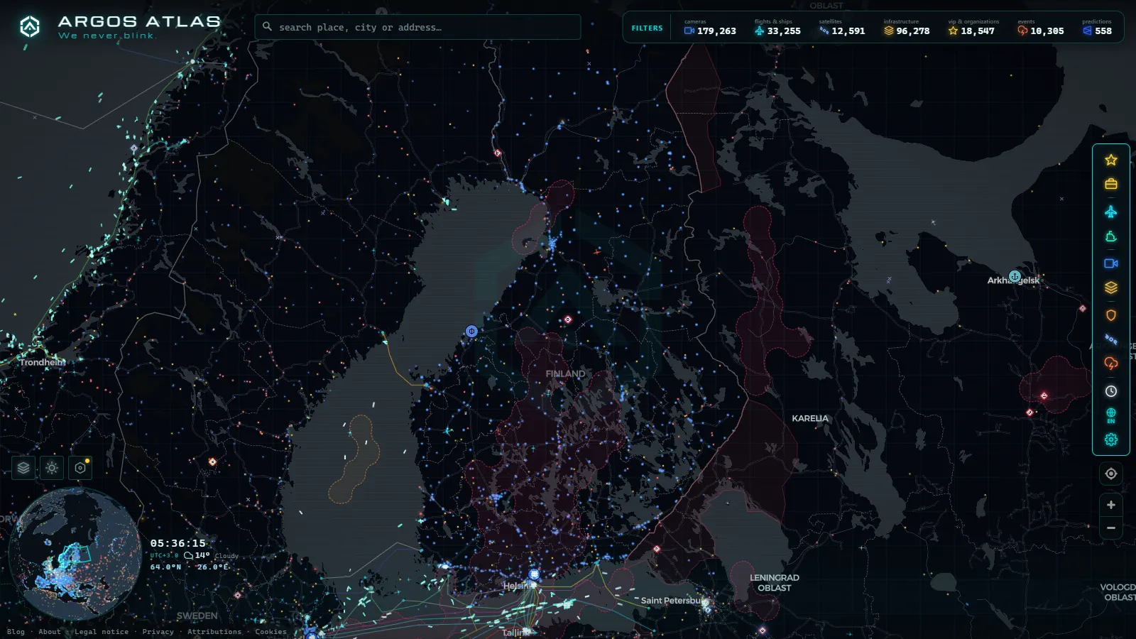
Open a Finnish road camera at nine in the morning in January and there is a good chance you see nothing but dark grey. That is not a broken camera. The images come from Fintraffic, the state group that runs traffic management on Finland's roads, and they work fine. North of Oulu the sun has not risen yet at that hour, and above the Arctic Circle it will not rise at all for several weeks. Point the same camera at the same road in late June and you get a lit, dry surface at two in the morning.
That is the real question behind Finnish road cameras: not where they are, but what any given one is capable of showing you on the day you look at it. This guide covers who publishes the network, which corridors are actually covered (the Helsinki metro area, the west coast, the lake district and the Arctic routes), what changes between winter and summer, and the things these cameras will never show you.
The essentials, in 20 seconds
- Fintraffic: publishes Finland's road camera network through Digitraffic, its open data service, which is why the same images turn up on every third-party map.
- Still JPEGs: the pictures refresh every few minutes rather than streaming live, so refreshing the page will not produce a newer frame.
- Six hours of daylight: Helsinki gets roughly six hours between sunrise and sunset in December, and coverage north of Oulu goes dark even earlier.
- Weeks of polar night: Utsjoki, at the top of the country, gets no sunrise at all for several weeks around the winter solstice.
- Police only: automatic speed and red light cameras are run separately by the police and are never published on this network.
Who operates Finland traffic cameras: Fintraffic and Digitraffic
Two organisations, one that matters to a viewer. Väylävirasto, the Finnish Transport Infrastructure Agency, owns the road infrastructure. Fintraffic manages the traffic on it and publishes the camera images, and it publishes them in two places.
The first is Liikennetilanne, the traffic situation map aimed at drivers, which mixes camera icons with road weather, incidents and roadworks. The second is Digitraffic, Fintraffic's open data service, and that is the one that explains why Finland turns up on almost every third-party traffic map in existence. The camera images, the road weather station readings and the disruption feed are all published openly, documented, under a permissive licence. Aggregators showing you a Finnish camera, ours included, are reading Digitraffic.
Two practical consequences follow. When Digitraffic has a bad hour, every downstream site shows the same stale frame at the same moment, so a frozen picture is almost always the source rather than the site you happen to be on. And the vocabulary you will see everywhere is Finnish: these are kelikamerat, weather cameras, bolted to road weather stations. That word decides everything about what you get.
What Finland traffic cameras actually show (and what they do not)
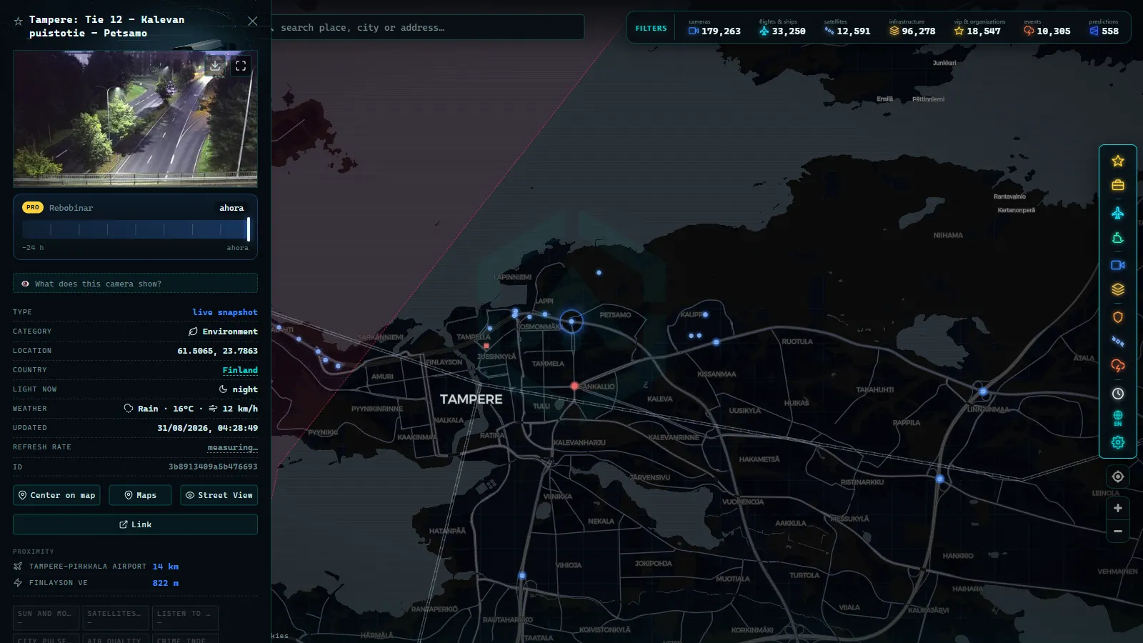
They are still images, not video. A Finnish road camera publishes a JPEG that is replaced on a cycle measured in minutes rather than seconds. You are looking at a recent photograph, and hammering the refresh button will not produce a newer one. The general failure modes are covered in why a traffic camera stops working; Finland adds several of its own, and most of them are weather.
Most stations carry more than one view. A single mast on a main road usually publishes several presets, one per direction and sometimes one aimed at the road surface itself, and each is listed as a separate image. If a corridor looks unusually well covered on a map, that is often one physical site counted several times over.
The purpose is maintenance, not surveillance, and the framing follows from the purpose: wide, low, pointed at the asphalt, with a station identifier and a timestamp. Contractors use these to decide whether to send a plough, a gritter or a sander. Number plates are not legible at that framing, which is deliberate. The legal reasoning behind why this class of image can be public at all is set out in what traffic cameras record, what they do not and what the law says.
What is not in this network: enforcement. Automatic speed and red light cameras in Finland are operated by the police, their images go into a case file, and none of it is published anywhere.
From the ARGOS ATLAS channel.
The corridors: Helsinki, the west coast, the lakes and Lapland
Coverage follows the numbered main roads (valtatie, abbreviated Vt), and density drops off sharply as you go north and east. Here is the network as a viewer experiences it.
| Corridor | Main roads | What the cameras give you | The catch |
|---|---|---|---|
| Helsinki metro area | Kehä I and Kehä III, Länsiväylä, Lahdenväylä | Densest coverage in the country: commuter congestion, airport approaches, ring road junctions | Roughly six hours of daylight in December, plus heavy slush and spray on the lens |
| Helsinki to Turku and Tampere | Vt 1 (E18), Vt 3 (E12) | Motorway standard, closely spaced stations, the most reliable images in Finland | Coastal freeze and thaw means black ice more often than deep snow |
| South east to the border | Vt 7 (E18) toward Kotka and Vaalimaa | Motorway running to the Russian frontier | Border traffic has been abnormal for years, so an empty road here is not a camera fault |
| West coast | Vt 8, Turku to Pori, Vaasa and Oulu | Long single carriageway stretches, wind exposure, sea effect snow | A squall off the Gulf of Bothnia can white out one station while the next is clear |
| Lake district | Vt 5 (E63) via Mikkeli, Kuopio and Kajaani, plus Vt 9 | Forest and lake crossings, the inland winter route | Long gaps between stations: several tens of kilometres with nothing |
| Lapland and the Arctic routes | Vt 4 (E75) to Rovaniemi, Ivalo and Utsjoki, Vt 21 (E8) from Tornio to Kilpisjärvi | The reason most people come: fell roads, reindeer country, the approaches to Norway | Polar night, drifting snow, and stations that can sit a hundred kilometres apart |
Two omissions are worth knowing in advance. Åland is self-governing and its roads are not part of the mainland set, so anyone hunting for Mariehamn is searching the wrong network. And city streets are largely municipal: Helsinki, Tampere and Turku run their own equipment for their own purposes, and only part of it is public.
Winter and summer on Finland traffic cameras
From November to March, the thing to calibrate is your idea of a well maintained road. In the north, main roads are not cleared to bare asphalt. They are maintained as a compacted snow surface on purpose, because salt loses its usefulness at low temperatures, so grit and sand are used instead. A white road on a camera near Sodankylä is a normal open road. The detail that actually carries information is the tracks: two clean wheel lines mean traffic is flowing and a plough has been through recently. Untracked snow means either fresh accumulation or nobody driving.
Southern coastal roads behave completely differently. They are salted, and on camera they read black and wet, which looks reassuring and is often the more dangerous surface of the two when the temperature is hovering near zero. If you have used mountain pass cameras to check snow before setting off, the reading method transfers directly, except that in Finland the hazard is flat, open and windswept rather than steep.
Winter also breaks the cameras in specific ways. Rime and condensation build up on the housing, so a milky white frame at twenty below is ice on the glass, not fog on the road. Nobody is sending a technician two hundred kilometres to wipe it, so it clears when the weather clears. Drifting snow on the open fell sections near Kilpisjärvi can bury the lower half of the frame. And studded tyres, legal for most of the cold season, leave the surface visibly grooved.
Summer inverts the whole thing. The construction season is compressed into roughly May to September, so lane closures and resurfacing cluster hard, and the disruption feed becomes more useful than the camera itself. Caravan and motorhome traffic builds on Vt 4 heading north in July. Image quality is at its best all summer, and in the far north it is good around the clock.
Polar night, midnight sun and the light problem
This is the part that separates Finland from every other European camera network. Around the winter solstice, Utsjoki at the very top of the country sits in polar night for weeks. Rovaniemi, on the Arctic Circle, gets a brief blue twilight rather than a proper sunrise. Even Helsinki, far to the south, has only about six hours between sunrise and sunset in December.
The practical rule: in December and January, the only useful viewing window for anything north of Oulu is the couple of hours around midday local time, when the twilight is strong enough to render the road surface. Outside it you are looking at headlights and the reflective tops of the snow poles that mark the shoulder. Those poles are frequently the only readable object in the frame, and they do tell you something, namely where the road edge is and how much snow is banked against it.
Remember that most Finnish main roads outside built-up areas are unlit, and these cameras have no infrared illumination. A black frame at three in the afternoon is a working camera looking at a dark road. Timestamps are local: Finland runs on UTC+2 in winter and UTC+3 in summer.
Then it reverses. From late May to late July the sun does not set above the Arctic Circle, and a camera at Ivalo or Kilpisjärvi is as readable at one in the morning as at midday. If you only ever look at this network once, do it in June.
Putting Finland on a map with everything else
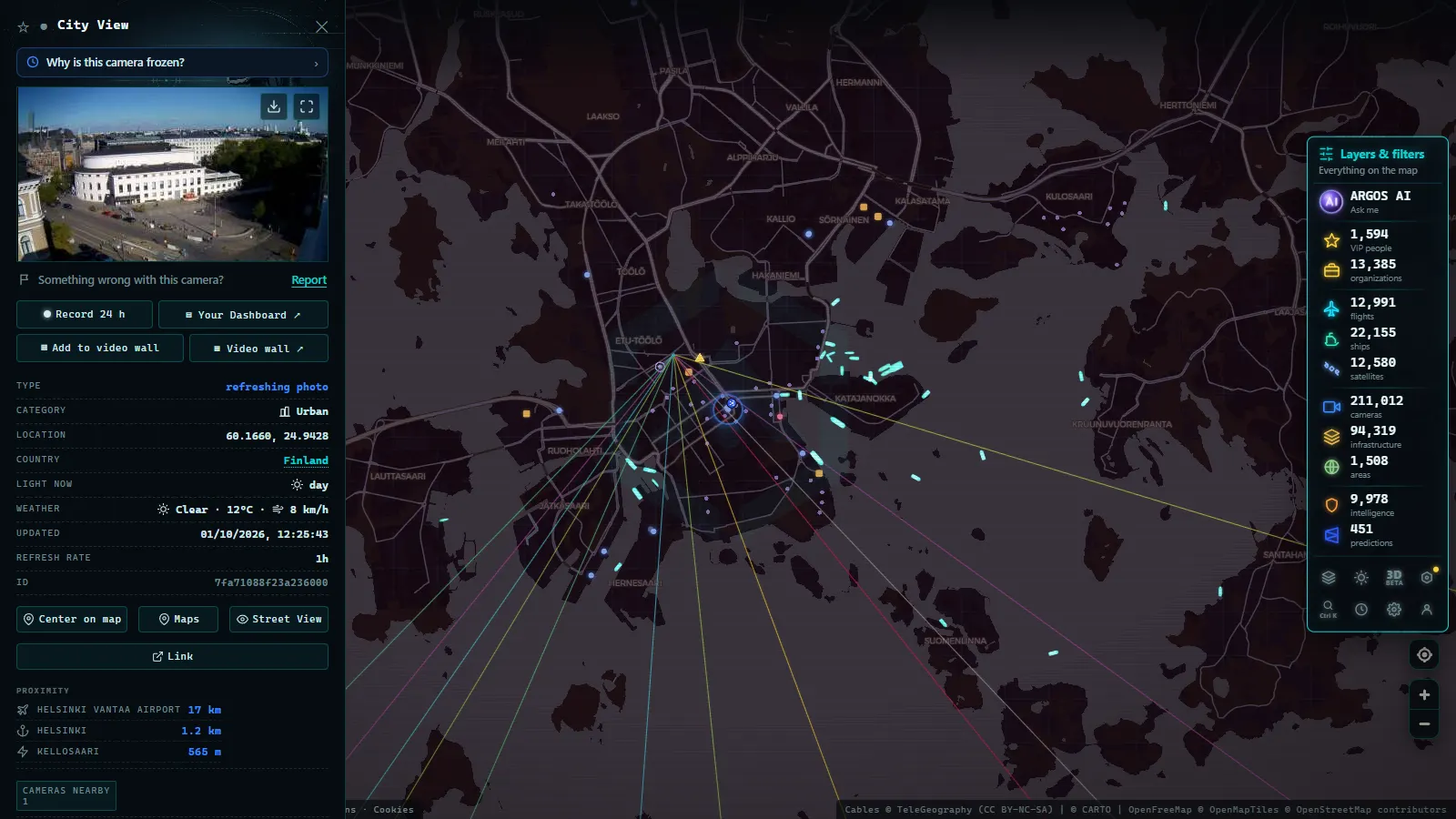
Watching one country's cameras in isolation gets you a picture of a road. Watching them next to the other live layers gets you context, which in Finland means Baltic shipping and the approaches to Helsinki-Vantaa on the same screen as the Vt 4.
On the ARGOS ATLAS live map the Finnish cameras sit inside a catalogue of 200,000+ public cameras (count as of September 2026), alongside aircraft positions and AIS ship tracks. No account, no payment, no app. Zoom to southern Finland, turn on the camera layer, and the Fintraffic stations appear as markers you click to open the latest frame with its timestamp. Filter to a corridor by following the road rather than the administrative boundary, since that is how the stations are actually laid out.
If you want to compare Finland with its neighbours, the country-by-country guide to European traffic cameras covers who operates what across the continent, including the Swedish and Norwegian networks that pick up where the Finnish one ends at Tornio and Kilpisjärvi. And if the underlying question is why any of this is public in the first place, how public traffic cameras work explains the funding and open data logic that made Digitraffic possible.
One last honest note. These images are a snapshot from a few minutes ago on a road that may be hundreds of kilometres long. They are excellent for answering "is this route open and what is on the surface" and useless for answering "what will it look like when I get there in four hours". In a Finnish winter, that gap is the whole game.
Frequently asked questions
Are Finland traffic cameras free to watch, live and without registration?
They are free and require no account. \"Live\" needs a caveat: Finnish road cameras publish still images that are replaced on a cycle of several minutes, not continuous video. On our map you open the camera layer, click a marker in Finland and you get the latest published frame with its timestamp, with no signup and no paywall.
Who operates the road cameras in Finland?
Fintraffic, the state traffic management group, publishes them, and Väylävirasto (the Finnish Transport Infrastructure Agency) owns the roads themselves. The images reach third-party maps through Digitraffic, Fintraffic's open data service. City streets are a separate matter: Helsinki, Tampere and Turku run their own municipal equipment and only part of it is public.
Why is a Lapland camera completely black in the middle of the day?
Because it is dark. Above the Arctic Circle the sun does not rise at all for several weeks around the winter solstice, and most Finnish main roads outside towns are unlit with no infrared illumination on the camera. Around solar noon you usually get a blue twilight strong enough to read the road surface. Outside that window you see headlights and the reflective snow poles marking the shoulder.
Is a white, snow-covered road on a Finnish camera a sign of bad maintenance?
No, and this is the single most misread thing on this network. In northern Finland main roads are deliberately maintained as a compacted snow surface through the winter, because salt stops working at low temperatures and sand or grit is used instead. Two clean wheel tracks on a white road means the route is open and recently ploughed. Untracked snow is the sign worth paying attention to.
Can I see speed cameras or read number plates on these images?
No. Automated speed and red light enforcement in Finland is police business and none of those images are published. The public cameras are road weather cameras, framed wide and low at the surface so plates are not legible, and there is no public pan or zoom control. Any site offering a live Finnish speed camera feed is showing you something else.
- Sweden Traffic Cameras: Trafikverket Roads, Corridor by Corridor
- Austria Traffic Cameras: Alpine Passes, Tunnels and Vienna
- Iowa 511 Traffic Cameras Live: I-80, I-35 and I-380 in One Map
- Iceland road cameras live: Ring Road, passes and black ice
- Bergamo Traffic Cameras: A4, Tangenziale Sud and Orio al Serio
- Taiwan Traffic Cameras: Who Operates Them and How to Read One