Blog · Traffic cameras
Genoa Traffic Cameras: A10, A7, A12 and the Port Live
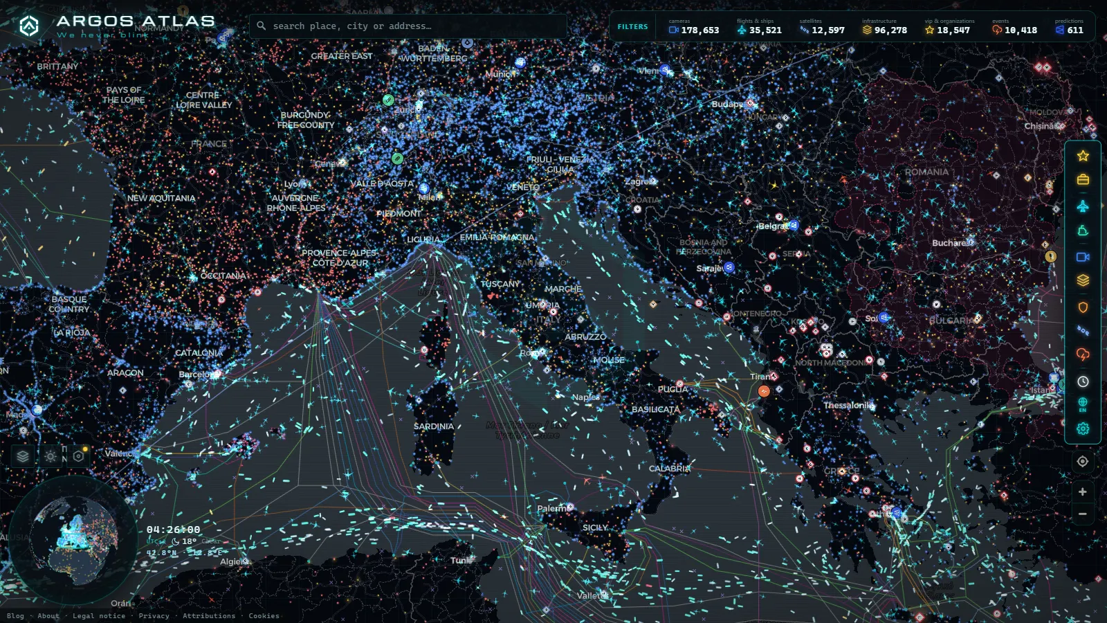
Genoa fits into a strip of coast that is, in places, only a few hundred metres wide before the Apennines start climbing. Into that strip go Italy's largest port, three motorways, a cruise and ferry terminal, an airport built out onto the water, and every lorry that moves a container between the Ligurian Sea and the Po valley. There is no room for a bypass and never was. The road network and the port are not two systems that happen to share a city: they are one system with two names.
That is why watching Genoa traffic cameras on their own tells you less than half of what you want to know. A queue on the A10 westbound near Pra' is often a terminal queue rather than a road one. A quiet A7 at nine in the morning can mean the Milan corridor is flowing, or it can mean nothing has left the docks yet. This piece covers both halves: which camera feeds exist for the Genoa area, who operates them, what they genuinely show, and how to read them next to the ships sitting offshore.
Why Genoa traffic and the port are one problem
Three motorways converge on the city and none of them had an easy site to build on.
- A10 runs west along the coast toward Savona, Ventimiglia and the French border. It is a near continuous chain of viaducts and tunnels because there is nowhere flat to put it. When one section closes, the diversion is the SS1 Aurelia, which runs through the middle of every seaside town on the way.
- A7 climbs north up the Polcevera valley toward Milan. This is the corridor that connects the docks to the rest of Europe. It was the viaduct over that valley whose collapse severed the western terminals from the motorway network, later rebuilt as the San Giorgio bridge. The geography that made that single link so load-bearing has not changed.
- A12 heads east toward Rapallo, La Spezia and Livorno with the same tunnel-and-viaduct problem, plus summer traffic to the Riviera di Levante on top of the freight.
- A26 joins from Voltri and climbs inland, which is why the western container terminals and the western motorway junction are effectively the same congestion point.
On the water side, the activity is spread along the whole waterfront: the container terminals at Voltri and Pra' in the west, the Sampierdarena docks in the middle, and the cruise and ferry berths near the historic centre, with sailings to Sardinia, Sicily, Spain and North Africa. Each of those generates a different kind of road traffic at a different hour, and they all feed into the same three motorways.
Where the Genoa traffic cameras actually come from
There is no single Genoa camera network. What you are looking at is four or five separate operators, each publishing for its own reasons, with no shared standard and no shared map. Italy as a whole works this way, which we broke down in our guide to traffic cameras in Italy, from Autostrade to ANAS and the Alpine passes.
| Operator | What it covers around Genoa | Form of the feed | The catch |
|---|---|---|---|
| Motorway concessionaire | A10, A7, A12 and the A26 branch | Still images refreshed on a timer | Cameras cluster at junctions and tunnel portals, not on the stretches between them |
| State road agency | SS1 Aurelia and the inland roads used as diversions | Still images, coverage in Liguria is patchy | The roads you most need when the motorway shuts are the least covered |
| City and regional mobility | Urban axes, the elevated Sopraelevata, approaches to the centre | Mixed, some published, most not | Control room feeds mostly stay in the control room |
| Port system authority and terminals | Quays, cruise berths, general port panoramas | Panoramic or promotional webcams | Yard and gate cameras that would tell you about lorry queues are not public |
| Harbour and tourist webcams | Porto Antico, the lighthouse, marinas | Live video or fast refresh | Framed for the view, so a road may be in shot only by accident |
Our own catalogue pulls from the public operators in that table and sits alongside everything else we index (200,000+ cameras worldwide, count as of September 2026). We do not publish a Genoa-only figure, because the underlying feeds are grouped by operator rather than by city and any number we gave you would be a guess dressed up as a measurement.
What each motorway camera is actually good for
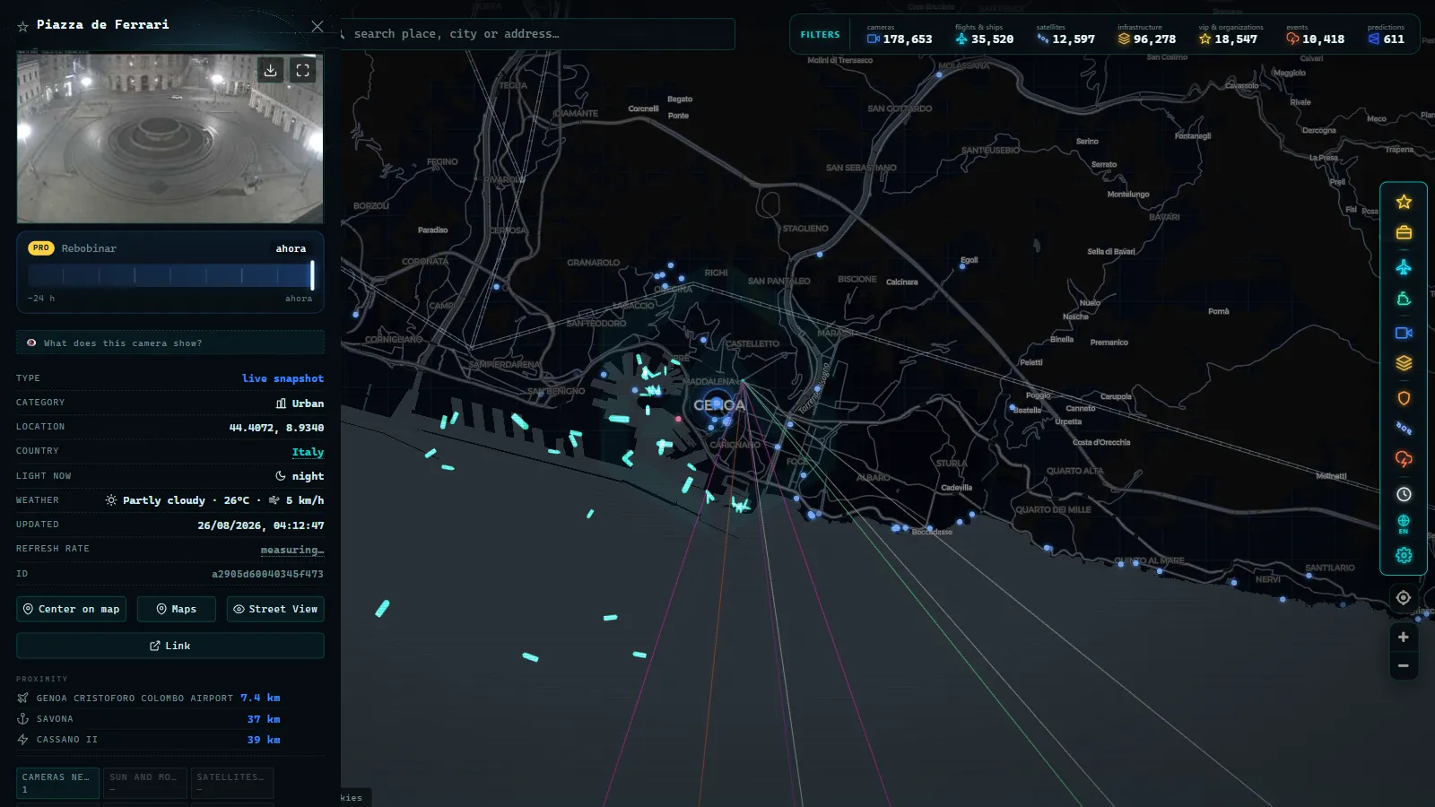
The A10 west of the city is where you check before committing to a coastal run. If the frames near Pra' and Voltri show stopped traffic, the diversion onto the Aurelia is already forming and you have maybe twenty minutes before the town centres behind it fill up.
The A7 north is the one to read as a freight signal. It shares its character with the corridor toward Lombardy, and if your journey continues that way it is worth pairing this with the situation around Milan's ring roads and what those cameras do and do not show, because a problem on either end propagates along the same axis.
The A12 east is seasonal in a way the other two are not. Outside summer weekends it is the calmest of the three; on a July Saturday the tunnels toward Rapallo do the opposite.
Inside the city, the Sopraelevata (the elevated road running along the old port) is the piece with the least camera coverage relative to how much it matters. Assume you will be reading its state indirectly, from the junctions at either end.
From the ARGOS ATLAS channel.
The port half: AIS beats cameras here
For the water, cameras are the wrong instrument. A webcam pointed at a quay shows you one berth. What you want is the whole approach, and that comes from AIS, the transponder signal ships broadcast with their position, course and speed. We explain the mechanics in how AIS works and how ships are located in real time.
The useful pattern is not the ships at the quays but the ones that are not moving offshore. A cluster of vessels holding position in the anchorage south of the port, with speeds close to zero, means berths are occupied or labour is short. That backlog turns into lorry traffic on the A7 hours later, which is the whole reason to watch both layers at once.
Our live layer carries 22,855 vessels reporting at the moment of writing, out of 41,533 tracked over time, against a catalogue of 1,081 ports (counts as of August 2026). Genoa's position among its peers is covered in our rundown of the major European ports, from Rotterdam and Antwerp to Valencia and Piraeus.
What Genoa traffic cameras will not show you
This is the part most pages skip.
- They are stills, not video. A frame every minute or two hides the thing you care about, which is whether the queue is growing or draining. Reload twice before deciding.
- Tunnels are mostly invisible. Given how much of Genoa's motorway network is bored through rock, this removes a large share of the actual road from view.
- Nothing is readable. Resolutions are low by design. No plates, no faces, no vehicle identification. That is deliberate and it is what keeps the feeds publishable.
- Night is often useless. Unlit coastal stretches give you a black rectangle with headlight smears.
- Positions are approximate. Cameras are placed on the map from operator metadata, which sometimes points at a junction rather than the exact mast.
- Feeds go down. Maintenance, storms and network faults take cameras offline for days. If one you rely on vanishes, our notes on why a traffic camera stops working and what to check instead cover the usual causes.
- There is no archive. You see now. You cannot rewind to this morning.
On the AIS side, coverage near the coast is good because receivers are dense, but positions can lag by minutes and a vessel with its transponder off simply is not there.
Where to watch Genoa traffic cameras and ships on one map
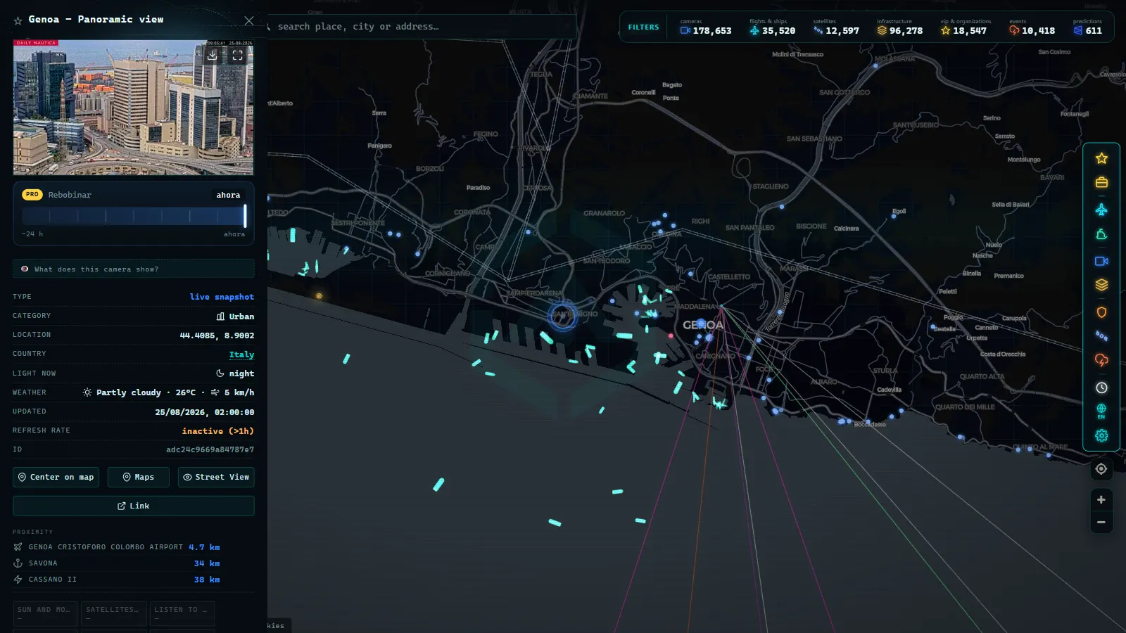
Open the live ARGOS ATLAS map and zoom to the Ligurian coast between Voltri and Nervi. Two layers matter here: cameras and ships. Turn the rest off, because Genoa is dense enough that a full stack of layers turns into confetti at city zoom.
Click a camera marker to get the latest frame with its operator and, where the operator provides one, its timestamp. Click a vessel to get its type, speed and course. If the speed reads under one knot outside a berth, that ship is waiting, not arriving.
A five minute check before you drive
Start wide, at the whole gulf, and look at the anchorage. Count roughly how many vessels are stationary offshore; that is your freight forecast. Then drop to the junction where the A7 meets the A10 and read three or four frames in sequence rather than one. Finish on whichever branch you actually need, west, north or east, and check the last camera before your first tunnel.
If all three motorway frames look wrong at once, the answer is usually not a better route. It is leaving an hour later, which the map will also tell you, for free, before you have burned any fuel finding out.
Frequently asked questions
Is it free to watch Genoa traffic cameras and port traffic, and do I need an account?
Yes on both counts. The camera feeds come from public operators (motorway concessionaires, the state road agency, the city) and AIS positions are broadcast in the clear by the ships themselves. Our map is free, needs no registration and no app: open it, zoom to the Ligurian coast and click a marker. We do not gate anything behind a signup wall.
Are the images live video or still photos?
Almost all motorway and state road cameras in Italy are still images that refresh on a timer, not video streams. You get a fresh frame every so often, so a fast-moving queue can build between two frames. A handful of harbour and tourist webcams around the Porto Antico do stream real video, but they are pointed at the view, not at the road.
Can I see inside the tunnels on the A10 and A12?
Usually not. Tunnel interiors are monitored heavily, but those cameras feed the operator's control room and are rarely published. What you normally get is the portal, the approach and the junction before it. Since a large share of Genoa's motorway kilometres are in tunnel, that is a real gap in coverage, not an oversight on your part.
Why is the A7 jammed when the A10 looks clear?
Because they carry different traffic. The A7 is the freight corridor to Milan and the Po valley, so it reacts to what the container terminals are releasing and to a single incident on a viaduct. The A10 is the coastal axis toward France and reacts to holiday flows and to closures further west. The two only look alike on days when the whole junction area seizes up.
How do I tell if a Genoa camera is down or just dark?
Check the timestamp printed on the frame if the operator includes one, then reload after a couple of minutes. A frozen image with a stale timestamp means the feed is down; an identical dark image with a moving timestamp usually means an unlit stretch at night. Cameras also disappear during maintenance and come back under the same name days later.
- Catania Traffic Cameras: Live Views of the Ring Road and Etna
- Brescia Traffic Cameras: the A4 Corridor and Lake Garda
- Illinois Traffic Cameras: 2,157 IDOT Views Beyond Chicago
- Washington State Traffic Cameras: I-5, 3 Passes and Ferries
- 511PA Traffic Cameras: I-76 and the 4 Turnpike Tunnels
- Nevada Traffic Cameras Live: I-15, I-80 and Sierra Passes