Blog · Traffic cameras
Illinois Traffic Cameras: 2,157 IDOT Views Beyond Chicago
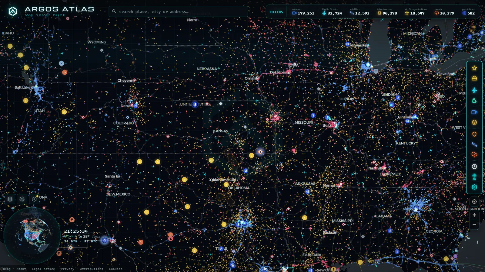
Most guides to Illinois traffic cameras stop at the Kennedy and the Dan Ryan. On paper that makes sense, because the Chicago area alone accounts for 1,118 public cameras in our index (count as of August 2026). But it leaves out the four hundred miles of interstate between the metro line and the Ohio River, and those are the miles where a live frame actually changes a decision. Nobody cancels a trip because the Edens is slow. People do cancel because I-57 is glazed over south of Effingham and there is nowhere to stop for sixty miles.
Statewide we index 2,157 IDOT camera feeds (count as of August 2026). This piece is about the ones outside Cook County: which corridors they sit on, how they are labelled once you leave the metro, what a single still image really tells you, and which parts of Illinois have no camera at all. That last section is the one worth reading twice.
What the Illinois traffic cameras actually cover outside Chicago
IDOT is organized into nine districts, and only District 1 is the Chicago metro. The rest of the state is run out of Dixon, Ottawa, Peoria, Paris, Springfield, Effingham, Collinsville and Carbondale. Cameras are not spread evenly across those districts and were never intended to be. They are traffic management hardware, so they go where an operator needs eyes: major interchanges, Mississippi and Illinois river crossings, long bridges, active work zones, the ring roads of Springfield, Peoria, Champaign-Urbana, Bloomington-Normal and Rockford, and the stretches that ice over first.
The practical consequence is that downstate coverage is a chain of dots, not a line. On a rural interstate you typically get a camera at each significant interchange and at the big river bridges, with ten or twenty miles of nothing between them. If a crash happens inside one of those gaps, no camera will show it to you. What you will see is the tail of the queue at one dot and free flow at the next, and you infer the rest. That inference is genuinely useful, but it is inference, not observation, and it is worth knowing which one you are doing.
The Illinois traffic camera corridors, one by one
| Corridor | Stretch outside the metro | What the cameras really watch | Gaps to expect |
|---|---|---|---|
| I-55 | Joliet to Bloomington, Springfield, Litchfield and the Metro East | The Springfield ring, the Bloomington-Normal interchange with I-74, the descent into the American Bottom | Long rural runs between Lincoln and Litchfield |
| I-57 | Kankakee to Champaign, Effingham, Mount Vernon, Marion | The I-70 and I-64 crossings, the Champaign urban section, winter conditions south of Effingham | Sparse between interchanges from Rantoul to Effingham |
| I-74 | Quad Cities to Peoria, Bloomington, Champaign, Danville | The Mississippi bridge at Moline, the Peoria river crossing, the Champaign approach | Thin between Peoria and Bloomington |
| I-80 | Quad Cities to LaSalle-Peru, Joliet | Truck volume, the I-39 and I-55 interchanges, Illinois River crossings | Rural stretch west of Princeton |
| I-70 and I-64 (Metro East) | Effingham and Mount Vernon to the St. Louis river crossings | The bridge approaches, the dense Collinsville and Fairview Heights interchanges, backups toward Missouri | Coverage stops at the state line, not at the traffic |
| I-39 and I-90 (north) | Bloomington to Rockford and the Wisconsin line | Rockford ring roads, the Rock River crossing, snow belt conditions | Farmland stretches with almost nothing |
| I-72 and I-172 | Springfield to Jacksonville and Quincy | Springfield western approaches, the Illinois River bridge | Very thin west of Jacksonville |
| I-24 and far south | Marion toward the Kentucky line | The I-57 junction, the Shawnee hills grades | The sparsest coverage in the state |
Read the table as a ranking of confidence rather than a ranking of importance. The Metro East and the Springfield ring give you something close to continuous awareness. I-72 west of Jacksonville and I-24 toward Paducah give you a handful of frames and a lot of hoping.
How Illinois traffic cameras are numbered and how often they refresh
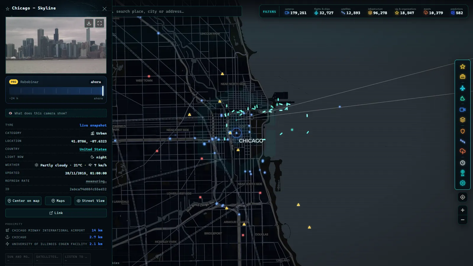
Once you leave Chicago, the useful identifier is not a number, it is a place name. IDOT feeds are labelled by route plus the nearest cross street, exit or milepost, with a direction attached, so you search for the road and the town rather than for a camera ID. When there are two views at one interchange, they are usually the same mast looking each way along the mainline, not two independent sites.
On refresh: these are still images on a short cycle, not video streams. The honest answer about the interval is that the timestamp burned into or attached to the frame is the only thing you should trust, because the cycle varies by site and by network health, and a stale frame looks identical to a fresh one. If you are watching a storm move across the state, reload and compare timestamps rather than pictures. If the timestamp does not advance, the camera is not telling you anything, no matter how clear the image is. The same logic applies to any state network, and it is exactly the discipline that makes a state DOT camera map like Michigan's MDOT network readable.
What you can see in a good daytime frame: whether lanes are moving, whether the pavement is wet, white, or dry, whether there is a plow, whether a shoulder is blocked. What you cannot see: anything at plate resolution, anything behind the horizon, black ice (which looks exactly like wet asphalt), and most of what happens after dark, when a rural camera without lighting gives you headlight streaks and little else. That night limitation is not a fault in the equipment. It is the equipment.
From the ARGOS ATLAS channel.
Chicago is one district, not the whole state
The metro deserves its own treatment because it is a different animal: dense expressway coverage, multiple agencies overlapping, and enough cameras that you can follow a single backup camera to camera. If that is what you came for, the Chicago traffic camera map covers the expressway system in detail.
The boundary matters for a second reason. The Illinois Tollway operates I-88, I-90 north of the city, I-294 and I-355, and the city of Chicago runs its own separate devices. So a blank stretch on a tollway corridor usually marks where one agency's publishing ends, not where the road stops being watched. Any statewide picture of Illinois traffic cameras is really several networks laid side by side, which is also true across the border and visible in the wider map of US traffic cameras.
Where Illinois traffic cameras do not reach
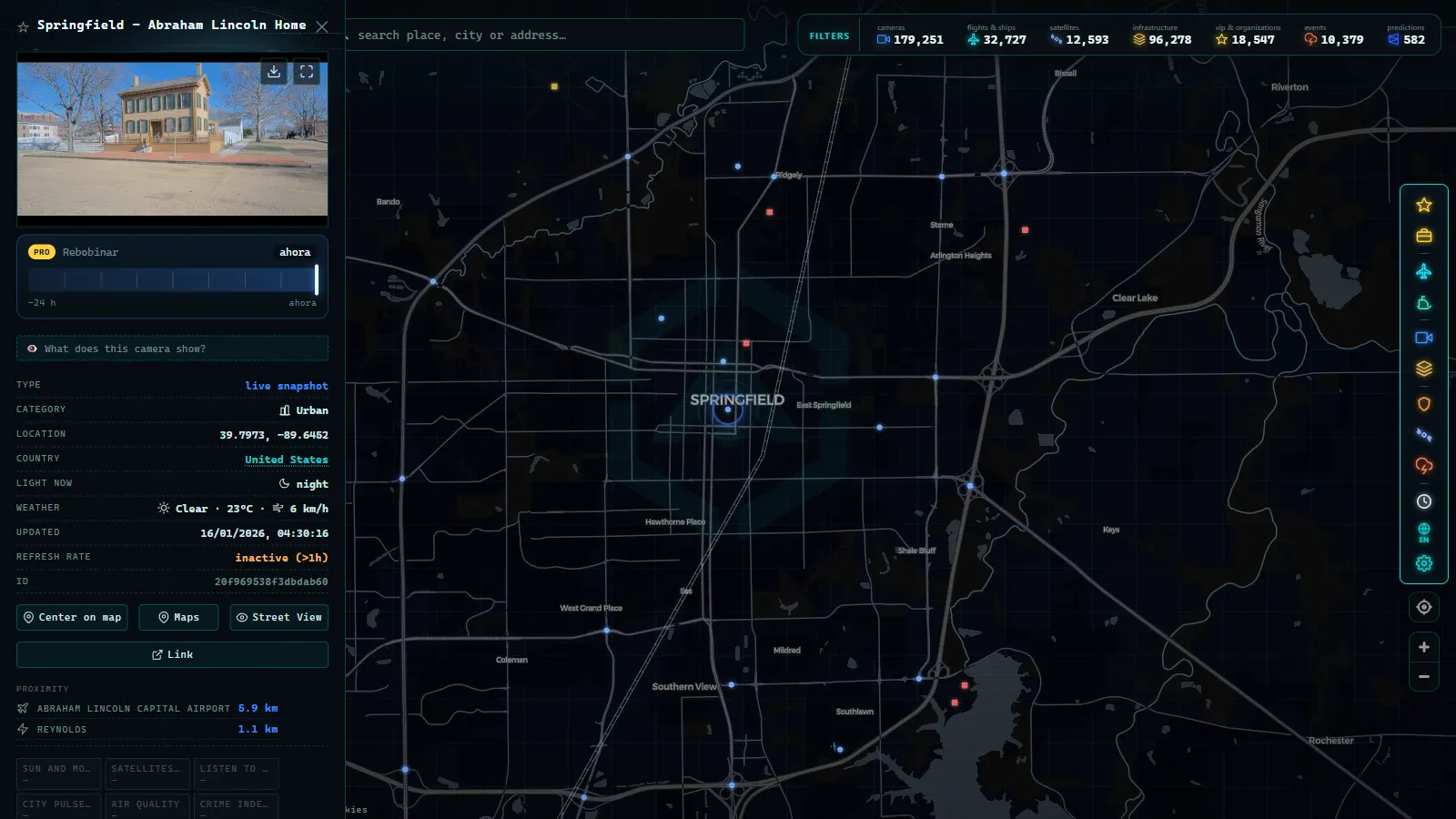
This is the section other guides skip. There is no camera coverage worth the name on:
- Two lane state routes. IL 1, IL 3 along the Mississippi, IL 13 outside the Carbondale and Marion area, IL 47 through the collar counties farmland. Hundreds of miles with nothing.
- Most US routes off the interstate grid. US 67 through western Illinois, US 24, US 45, US 51 between towns. You will find a device at a bridge or a bad junction and nothing else.
- The far southwest and the Shawnee hills. The Ohio River counties are the thinnest part of the state for public cameras, and they are also where fog sits in the bottoms.
- County and township roads. Zero coverage, everywhere, without exception. In a rural Illinois snow event these are the roads that close, and no map will show you that they have.
Add to the geography the ordinary failure modes. Winter takes cameras offline exactly when they are most wanted: ice on the dome, a knocked over mast after a run off, a cut fiber, a power outage that leaves the site publishing its last good frame for hours. If a feed looks wrong, the reasons are usually mundane and are worth recognizing on sight, which is what the guide to why a traffic camera stops working is for. Treat an unavailable camera as an unavailable camera, never as an empty road.
Using the Illinois traffic cameras before you drive across the state
A workable routine for a downstate run. Pick three or four checkpoints on your corridor rather than trying to watch everything: for Chicago to St. Louis on I-55, that is the Bloomington interchange, the Springfield ring, Litchfield and the Metro East approach. Open each, check the timestamp, note pavement colour and whether traffic in the frame has motion blur. Then repeat an hour later. Two frames an hour apart from the same camera tell you more about a storm than twenty cameras looked at once.
All 2,157 IDOT feeds (count as of August 2026) sit alongside the rest of the network on the live camera and traffic map, where you can pan straight down a corridor instead of hunting through a list of dropdowns. They are part of an index of 200,000+ public cameras, so the same habits carry over the moment you cross into Indiana, Missouri, Iowa, Kentucky or Wisconsin, where the coverage rules change with the agency but the reading of a frame does not.
Illinois traffic cameras versus red light and speed cameras: what's the difference
"Illinois traffic camera" search results often mix two completely different systems, and confusing them can cost you a citation, or waste time looking for a ticket photo on the wrong site. The cameras this article covers, run by IDOT, only capture and refresh still images of road conditions: congestion, weather, incidents. They exist to help drivers and traffic managers see the road, not to identify individual vehicles or issue fines. No IDOT feed produces a license plate readable enough for enforcement, and no citation in Illinois is generated from one of these views.
Red light and speed cameras are a separate system entirely, run by municipalities (Chicago being the largest operator; see how Chicago's own camera network compares) or by IDOT only in specific work-zone speed corridors during construction. Those cameras are purpose-built for enforcement: fixed at signalized intersections or work zones, paired with plate-recognition systems, and tied directly to a citation process. If you are looking for a violation photo, a payment portal, or a contest form, you want your city's or county's enforcement page, not a live traffic view.
| IDOT traffic cameras (this article) | Red light / speed cameras | |
|---|---|---|
| Purpose | Show current road conditions | Enforce a violation |
| Image type | Refreshing still image | Triggered capture, plate-readable |
| Who operates them | IDOT | City/county, or IDOT in work zones only |
| Can they issue a ticket | No | Yes |
| Public live view | Yes, openly published | No, images are not published |
This distinction matters outside Chicago too: several of the corridors covered earlier in this article, especially the interstates through Rockford, Peoria, and the Metro East region near St. Louis, pass through cities that run their own red light programs independent of IDOT. A camera icon on a traffic map and a citation in the mail rarely come from the same source, and treating the two systems as one is the fastest way to end up searching for a ticket dispute on a road-conditions site, or the reverse. The same split holds well beyond Illinois: it is the default setup in most US states with public traffic cameras.
Frequently asked questions
Is the Illinois traffic camera map free, live and open without registration?
Yes. The IDOT feeds are public images published by the state, and on our map they open with no account, no email and no paywall. You get the same frames a traffic operator sees, refreshed on the same cycle. The only limit is the one the source imposes: still images, not continuous video.
How many traffic cameras does Illinois have?
We index 2,157 IDOT camera feeds statewide (count as of August 2026), of which the Chicago area accounts for 1,118 (count as of August 2026). The rest are spread across the other eight IDOT districts, concentrated on the interstates and the ring roads of Springfield, Peoria, Champaign, Bloomington, Rockford and the Metro East.
Do IDOT cameras record video or issue tickets?
No. The public IDOT feeds are low resolution stills meant for congestion and weather management, and no archive of them is published. They are not speed cameras and not red light cameras: those are separate municipal systems with their own hardware, and their footage is not on any public map. You cannot read a plate on an IDOT frame, which is the point.
Why does a camera show an old image, a black frame or the wrong direction?
Three usual reasons. The feed froze on its last good frame after a network or power fault, so check the timestamp rather than the picture. The lens is covered by snow, frost, rain or road salt, which happens most in the exact storm you wanted to check. Or the camera is a pan-tilt-zoom unit that an operator swung toward an incident, so the view no longer matches the label.
Are the Illinois Tollway and Chicago city cameras included?
The tollway corridors (I-88, I-90 north of the city, I-294 and I-355) are run by a different agency than IDOT, and the city of Chicago operates its own separate cameras. Coverage of those in any single map is uneven, so treat a gap on a tollway stretch as an agency boundary rather than proof that no camera exists there.
- Washington State Traffic Cameras: I-5, 3 Passes and Ferries
- 511PA Traffic Cameras: I-76 and the 4 Turnpike Tunnels
- Nevada Traffic Cameras Live: I-15, I-80 and Sierra Passes
- Oregon Traffic Cameras on TripCheck: I-5, 3 Passes, US-101
- DriveBC Traffic Cameras: British Columbia's 5 Mountain Passes
- Finland Traffic Cameras: Fintraffic, Digitraffic and Lapland