Blog · World webcams
Airport Webcams Live: Plane Spotting From Your Screen
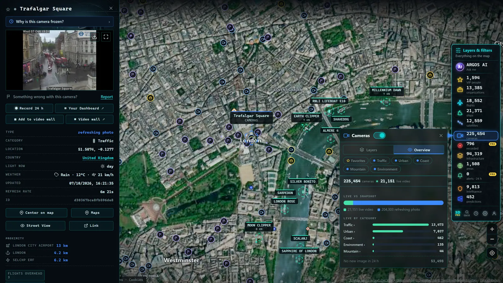
Classic plane spotting means standing by a fence with binoculars. The online version is not a poor imitation of that, it is a different thing, and in one specific respect it is better. At the fence you see the aircraft but you rarely know what it is. On a screen you can see the aircraft and know its registration, its type, where it came from and where it is going, in the same minute.
The trick is that it does not work with one source. It works by combining two layers: public cameras that happen to frame approaches and runways, and the live flight layer that puts a name on whatever crosses the frame. This guide shows how to build that virtual spotting post on the map (which gathers more than 200,000 public cameras worldwide plus a live flight layer (count on the map as of September 2026)) and what to realistically expect from it.
What live airport webcams actually show
The honest part first, because it saves disappointment. There is no global network of official cameras inside airports. An airport is a security-restricted facility, and the operational apron and tower cameras are not published openly. We are also not going to tell you how many airport webcams the map holds, because we have not measured it and we are not inventing the figure.
What does exist, in far greater quantity than people expect, is this:
- City and panoramic cameras in towns whose runway centreline passes overhead. These are the jewels of online spotting: skyline in frame and, every few minutes, something descending through it.
- Coastal and beach cameras under an approach path. Plenty of airports land over water, and beach webcams are free, abundant and usually well lit.
- Traffic cameras on roads that skirt the perimeter or sit beneath a departure track.
- Port cameras in cities where the harbour and the airport share a shoreline.
- Weather and institutional panoramas with wide fields of view that sometimes catch a threshold by accident.
None of these were built for spotting. All of them work for it if you choose well. And they share the nature of the rest of the network: they are live webcams from around the world published by official bodies and local institutions, not private cameras.
The two layers of plane spotting online
A camera alone gives you a silhouette. A flight layer alone gives you a label with no picture. Together they give you a complete sighting, which is the point.
The second layer works because aircraft broadcast their own position over ADS-B: an open message anyone can receive, carrying identifier, altitude, heading and speed. If you want to understand how that data travels from the transponder to your screen, we cover it in what ADS-B is and how flight tracking works.
In practice the workflow never changes:
- Pick a camera with a useful frame and note which way it faces.
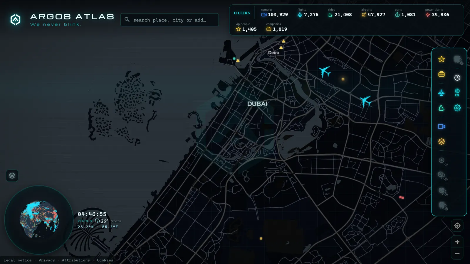
- Turn on the flight layer over that same area.
- When something crosses the frame, read the image timestamp and find which aircraft was there at that instant.
- Open its card: registration, type, origin and destination.
Step four is what turns "a plane went past" into "a widebody twin departing westbound over the Atlantic". The full guide to reading those identifiers is in registrations and callsigns: how to identify an aircraft.
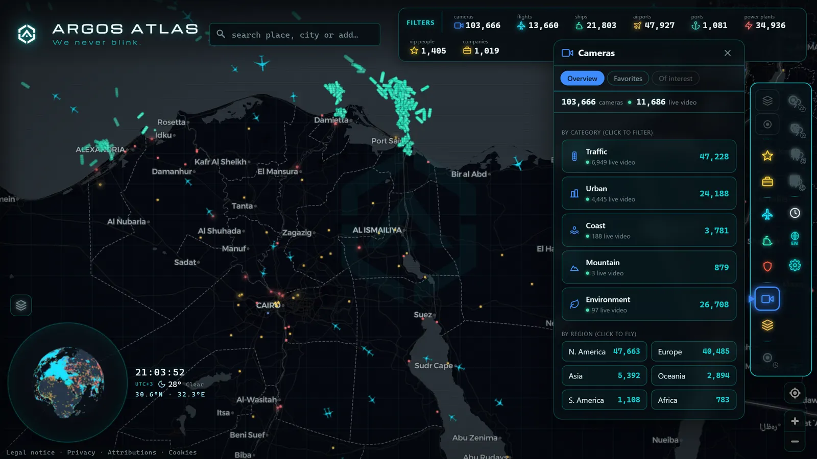
Build your virtual spotting post, step by step
Half an hour of setup buys you a board you can reuse forever. The build:
- Choose the airport. Start with one you know, or one with an approach over water or over a city, those have the most usable cameras around them.
- Work out the runway configuration. Check the runway orientation on the map. Aircraft take off and land into wind, so at any given moment one threshold is in use, and that decides which side of the city sits under the approach.
- Search a wide radius. Do not limit yourself to the perimeter. An approach path runs for many kilometres: a camera ten kilometres out can give a better shot than one at the fence, because the aircraft crosses higher and slower in frame.
- Discard the ones facing the wrong way. An excellent north-facing camera is useless on a day of southerly landings. Keep at least one of each orientation.
- Turn on the flight layer and leave it over the same area.
- Check the camera's refresh rate. This is the single biggest constraint. With a few-second refresh you can chase individual aircraft; with a several-minute refresh you are documenting activity, not catching landings.
That is the board. From there, the difference between a frustrating session and a good one comes down to framing and timing.
From the ARGOS ATLAS channel.
The best framings for watching takeoffs live
Not all shots are worth the same. Ranked by what they actually deliver:
- On-centreline threshold. A camera aligned with the runway, even a distant one, gives you the aircraft head-on, growing in frame. The most spectacular view and the hardest to find.
- Approach over the sea. A clean water background cuts out the silhouette and makes type recognition far easier. Beach cameras also tend to be the best maintained and the best lit.
- Side-on over the city. The aircraft crosses laterally with buildings as reference. Less dramatic, excellent for judging height and direction.
- High panorama. From a viewpoint or a tall building, with kilometres of field. The aircraft are small but there are many of them, and it is the best shot for reading an airport's rhythm.
- Apron or taxiway view. The hardest to find in the open; when it appears, it is usually a wide panorama that includes part of the airfield by chance.
One timing trick that holds at almost any airport: banks. Large hubs cluster arrivals and departures into blocks (early morning, mid-afternoon, late evening) and between banks you can sit twenty minutes with nothing. Checking the flight layer before the camera tells you whether it is worth staying.
What you want to see, and which layer you need
| What you want to see | Layer you need | Trick |
|---|---|---|
| One specific landing | Camera on the approach + flight layer | Check the map first: you get minutes of warning about what is inbound and from where |
| Which aircraft just went past | Flight layer, using the frame timestamp | Rewind a few seconds from the camera clock, the image usually lags |
| The airport's daily rhythm | High panorama + flight layer | Compare a peak hour with mid-morning and the banks draw themselves |
| Long-haul widebodies | Flight layer filtered by type | Intercontinental services keep fixed slots: repeat the same hour |
| A private jet or a known aircraft | Flight layer, by registration | The camera will almost never catch it; the value is in the track, not the picture |
| The airport's real weather | The webcam alone | A frame of a wet runway explains a delay better than any notice |
| Military or state aircraft | Flight layer | Many do not broadcast a position: absence from the map proves nothing |
Spotting private jets and unusual aircraft
The question always arrives: can I watch a particular celebrity's jet on a webcam? The honest answer is almost never. A business jet occupies very few pixels, lands at any hour and usually uses remote terminals that no public camera frames.
What does work is the inverse: follow the track and use the camera for context. The flight layer lets you locate specific aircraft by registration, and that is where the real interest lies (the movements, the routes, the frequency) not in a blurry frame. We develop this in how to track celebrity private jets, with the caveat we always repeat: you are following an aircraft, a registered and public object, not a person.
Genuinely unusual aircraft (outsize freighters, historic types, odd positioning flights) do reward this method. They show up in the flight layer with a type that does not match the airport's normal traffic, which gives you time to open the right camera.
The limits, stated plainly
So the session does not disappoint, it helps to know where the walls are:
- The offset. Map position and camera frame are not synchronised. A few seconds is enough for the aircraft to have already left the shot.
- Night. Most public webcams are not built for low light. A public camera at an airport after dark is a black smear with some pretty lights.
- Weather. Low cloud and fog end the session completely, and they are precisely the conditions when watching would be most interesting.
- Resolution. Almost no public camera has the detail to read a registration painted on a fuselage. That information comes from the flight layer, not the image.
- Uneven coverage. There are enormous airports with not one usable camera nearby and modest airfields with three. It depends on what local administrations publish, not on the size of the airport.
None of this is a flaw in the map: it is the nature of working with cameras somebody installed for another purpose. Knowing it up front is what makes online spotting a satisfying hobby rather than an exercise in frustration.
Start with an airport you know
The best first exercise is your own city's airport, because you already know which way the aircraft come in and you can grade yourself. Open the ARGOS ATLAS map, centre it there, switch on cameras and flights, and spend fifteen minutes identifying three aircraft: the one you see, the one the map says is there, and the one you confirm by opening its card.
Once that feels fluid, change continent. A sunrise approach over the sea on the other side of the world, with the aircraft's name on screen, is enjoyed exactly the same from a sofa. If you want to go deeper into the flight layer first, watching aircraft in real time explains how to read it properly.
Frequently asked questions
Are there official webcams inside airports?
Few, and it varies by airport. Most of the imagery that is useful for spotting does not come from airport cameras at all but from city, coastal, port or traffic webcams that happen to sit under an approach path or face a runway threshold.
How do I know which aircraft I am seeing on a webcam?
By cross-checking the image with the live flight layer. Read the frame's timestamp, find which aircraft was overhead at that moment, and open its card for registration, type, origin and destination. The camera gives the picture; ADS-B gives the identity.
Can I watch takeoffs and landings live for free?
Yes, and with no sign-up. Public cameras and the live flight layer are both open access. Bear in mind that many cameras publish a still image refreshing every few seconds or minutes rather than continuous video.
Why do I see the aircraft on the map but not on the camera?
Usually a timing offset: the map position and the camera refresh are not synchronised, and a few seconds is enough to miss an aircraft on approach. Cloud, light and the plane simply passing outside the frame account for the rest.
Does this work at night?
Not well. Most public webcams have no low-light sensor and return a black smear with some lights. At night, online spotting becomes a data exercise: you follow the flight layer and save the camera for first light.
- Nepal Live Map: What You Can Actually Track in Real Time
- Antarctica live map: what you can really watch right now
- Guatemala live map: what you can see right now, layer by layer
- ARGOS ATLAS vs WorldCam: 3 Free Cameras a Day vs 45 Seconds
- Live Webcam Maps Compared: 6 Ways to Watch the World (2026)
- Travel Without Moving: Watch Cities Around the World Live via Webcam