Blog · Traffic cameras
Alaska Traffic Cameras: Ice, Polar Night and Mountain Passes
Road camera pages in the Lower 48 mostly answer a convenience question: is the interchange backed up, should I leave now or in twenty minutes. In Alaska the same camera answers a different one. Is the road open, is that sheet ice or wet asphalt, and has a plow been through since it got dark. That is why the camera network here hangs off summits, passes and milepost markers instead of commuter ramps, and why it is worth learning to read even when half the frames come back black.
The national overview we published on traffic cameras across the United States does not go down to this level of detail. Alaska needs its own reading: two operators with very different purposes, a short list of corridors that actually matter, and a longer list of things these cameras will never tell you.
Who operates Alaska traffic cameras
The road side belongs to the Alaska Department of Transportation and Public Facilities, published through its 511 service. It is the same 511 family that Washington, New York and Ontario use, but the Alaskan version leans on written road condition reports as heavily as on the pictures: surface condition, plow activity, restrictions and closures, posted by maintenance district. The cameras hang off that reporting rather than the other way round, and if you only look at the images you are using half the system.
The second network is the one visitors never find: the FAA's Alaska weather camera program. It exists for pilots, because across most of the state the aircraft is the road, and it covers airstrips, river valleys and mountain passes no highway camera will ever see. Its best feature is the clear day reference image shown beside the current one. Same view, good weather, so you can tell in a second whether the grey wall in the frame is genuine weather or a housing caked in frost.
Below those two there are municipal cameras around Anchorage, harbor cams run by ports, and lodge and ski area webcams. Useful, but privately operated, and they appear and disappear without notice.
Scale matters here, and it is worth being blunt about it. Illinois alone contributes 2,102 cameras to our index and New York's 511 another 1,870 (counts as of September 2026). Alaska's roadside cameras are counted in the hundreds. The state is larger than those two several times over and has a small fraction of the coverage, because it has a small fraction of the road.
Alaska traffic cameras on the Glenn and the Seward
Two highways leave Anchorage and both are called AK-1. Everything else about them is different.
The Glenn Highway runs north to Eagle River, Palmer and Wasilla, and that first section is the busiest stretch of asphalt in the state: a genuine commuter road where a camera answers the usual traffic question. Past Palmer it changes character completely. The road follows the Matanuska River east through Sutton and Chickaloon, past the glacier, and climbs to Eureka Summit, the highest point on the route. Up there the problem is rarely snowfall. It is wind moving snow that already fell, which builds drifts across the lanes and drops visibility to nothing while the sky overhead stays clear.
The Seward Highway runs south along Turnagain Arm, and this is the corridor to learn first. The road is pinned between the water and a wall of avalanche paths, so it closes for control work, for slides, and occasionally for spray from the arm freezing across the surface. Past Portage it climbs Turnagain Pass, then drops through Summit Lake and Moose Pass to Seward. Anyone driving it in winter checks the pass cameras out of habit.
Two local quirks are worth knowing. Hatcher Pass is closed over the top through the winter, so a camera on one side tells you nothing about getting to the other. And the tunnel to Whittier runs one lane, shared with the railroad, on a fixed timetable. No camera will tell you when your direction opens.
| Corridor | Route | What a camera there actually answers | Hardest months |
|---|---|---|---|
| Anchorage to Palmer (Glenn) | AK-1 | Commuter volume, black ice on the Eagle River hills | November to March |
| Matanuska Valley to Eureka Summit (Glenn) | AK-1 | Drifting, ground blizzard, whether the summit is passable | December to March |
| Turnagain Arm (Seward) | AK-1 | Avalanche control closures, wind, ice over the surface | January to April |
| Turnagain Pass and Summit Lake (Seward) | AK-1 | Snow depth on the lanes, whether a plow has passed | November to April |
| Broad Pass and Cantwell (Parks) | AK-3 | Visibility and drifting between Denali and the Interior | December to March |
| Thompson Pass above Valdez (Richardson) | AK-4 | Snow piling on the banks, gates, depth of the cut | November to April |
| Atigun Pass, Brooks Range (Dalton) | AK-11 | Whiteout, truck movement, whether anything is moving | October to May |
| Tern Lake to Homer (Sterling) | AK-1 | Fog off the inlet, ice on the Kenai flats | November to March |
How to read alaska traffic cameras when the image is dark
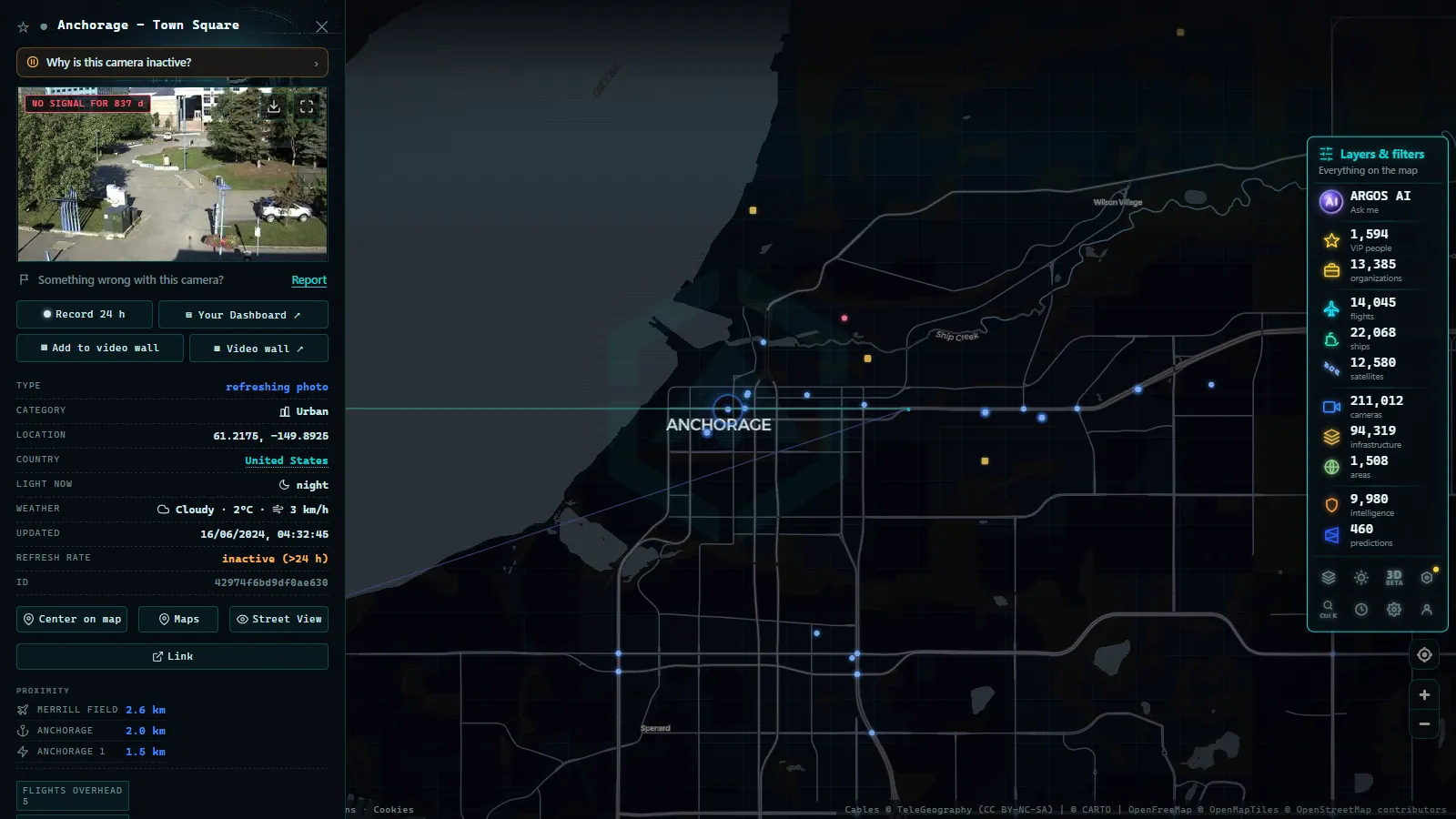
Half the year the useful daylight window is short, and roadside camera sites are not lit. So you learn to read frames that look useless.
Start with the timestamp, always. A still refreshed every few minutes means the clear road you are looking at may be ten minutes old, and ten minutes is enough for a squall on Turnagain Arm. Then look at what light there is. A plow's headlights and beacon in frame is the single most valuable thing a night image can show you, because it means the corridor is being worked. Streaks across the frame are snow caught close to the lens, not necessarily heavy snowfall on the road.
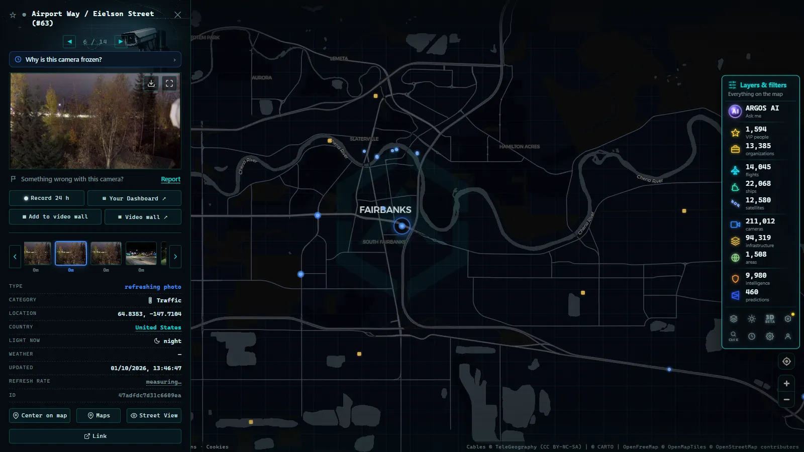
A white bloom across the whole image, evenly, is almost always frost or rime on the camera housing itself. That tells you the air is cold and wet at that site, which is real information, but it says nothing about the surface. In Fairbanks at deep cold you get the opposite trap: the image looks like fog, and it is ice fog formed from exhaust and moisture that will not lift. That one is genuinely dangerous for visibility.
When the picture gives you nothing, fall back on the written 511 report for that section and, if there is an airstrip nearby, on the FAA camera with its clear day comparison. Cameras also simply fail in these conditions, and our piece on why a traffic camera stops working covers what a dead feed does and does not mean.
From the ARGOS ATLAS channel.
Fairbanks, the Interior and the Dalton Highway
Fairbanks sits at the junction of the Parks Highway from the south, the Richardson from Delta Junction, the Steese heading northeast and the Elliott heading northwest. The camera coverage around town is reasonable and thins out fast in every direction.
The Interior problem is not snow volume, which is modest, but cold and wind. Eagle Summit on the Steese drifts shut in conditions that look calm from the valley. Isabel Pass on the Richardson does the same. Around town, the ice fog that forms at extreme cold turns a four lane road into something you drive by memory, and the cameras render it as a flat grey square.
North of Fairbanks the Dalton Highway runs gravel to Deadhorse over Atigun Pass, the highest pass on the state's road system. Coverage exists but the gaps are long, and so are the gaps in cell service. Treat an offline camera up there as an offline camera, not as a closed road. The general logic of mountain pass cameras and reading snow before you travel applies, with the difference that here the nearest alternative route is often a thousand kilometres away or does not exist.
The coast, the ferries and the towns with no road
South and west, the highway system simply ends. Seward, Whittier, Valdez and Homer are road accessible; Cordova, Juneau, Sitka, Nome and Utqiagvik are not. You cannot drive to the state capital. That is not a gap in the camera network, it is the geography, and it changes what you should be watching.
Valdez is reached over Thompson Pass, one of the snowiest places in the country, where the road runs between cut banks taller than the vehicle by late winter. The camera there is worth opening even out of curiosity. For the towns off the road system, the thing that moves is the ferry, and ferries broadcast their position continuously, which means the AIS signal that tracks ships in real time tells you more about whether the link is running than any harbor webcam will.
True polar night, weeks with no sunrise at all, belongs to the far north coast, not to Anchorage or Fairbanks. Those two just get very short days. It is a distinction worth making, because the far north settlements that do have polar night are mostly not connected by road anyway.
What Alaska traffic cameras cannot show you
The list is long and nobody publishes it, so here it is.
- Most of the road. Hundreds of kilometres run between camera sites on the Parks, the Richardson and the Dalton. Nothing is watching in between.
- Village and winter roads. Ice roads and river crossings have no cameras at all.
- Live video. Nearly all roadside sites publish stills at intervals. If you expected a stream, you will be disappointed.
- Moose. The most common serious hazard on the Glenn at night is invisible to a fixed camera.
- Whether a closure is coming. Avalanche control is scheduled and announced. The camera shows the aftermath.
- Grip. No image distinguishes cold dry pavement from black ice. It never has.
Watching alaska traffic cameras on one map
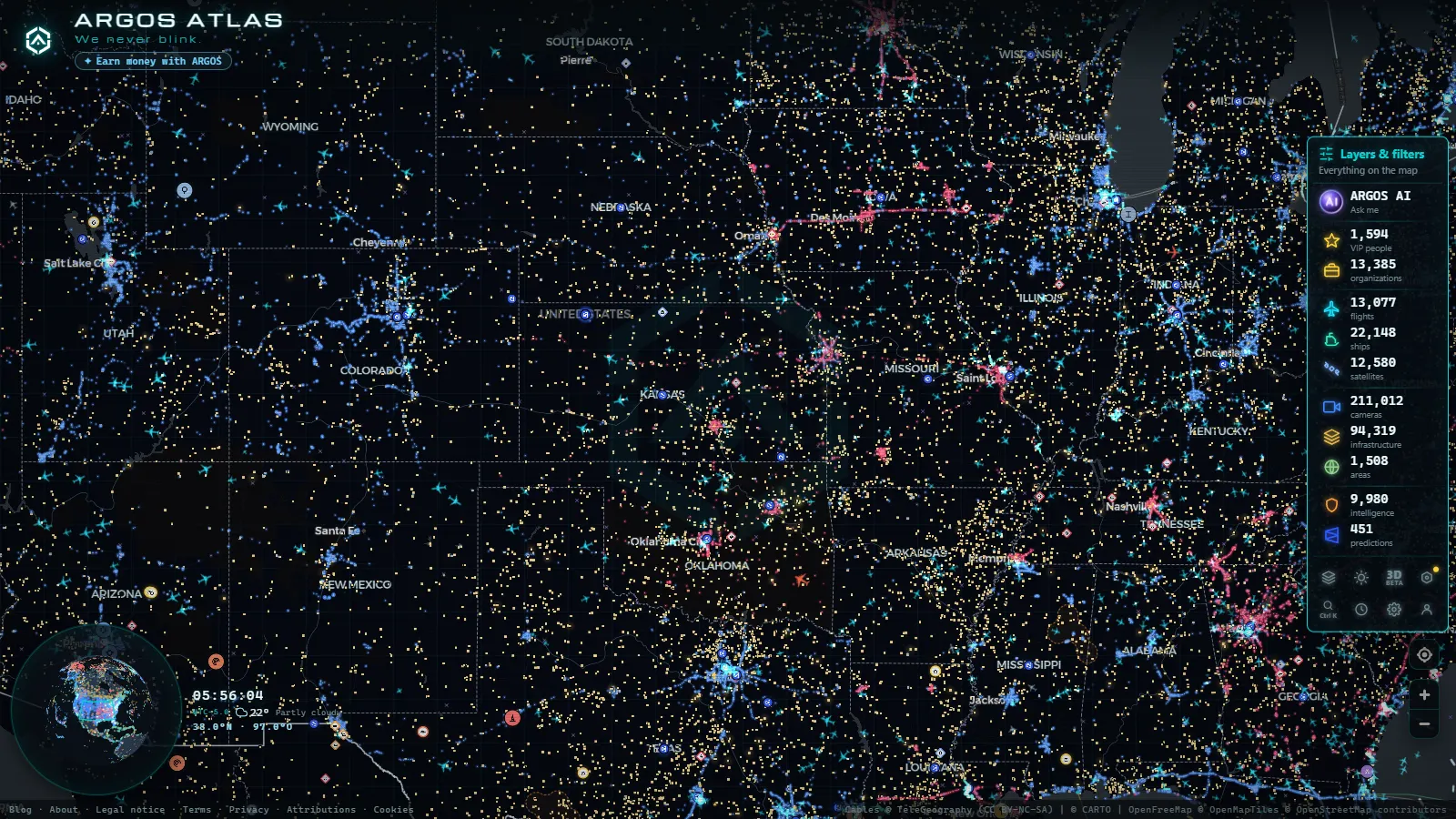
The reason to pull these into a map instead of a state portal is that a map shows you the shape of the problem. Open the live map of public cameras, turn on the camera layer and zoom to Alaska: the dots form a thin skeleton along the road system with enormous empty space either side. That picture is the honest summary of coverage in this state, and no list of camera names conveys it.
Our index holds 200,000+ public cameras worldwide (count as of September 2026), alongside 47,927 airfields, which in Alaska is the more revealing number of the two. It is free, there is nothing to install, and no account is required.
One practical habit for winter: open the corridor you will drive, check the timestamp, then read the written condition report for the same section before you decide. The camera is the detail. The report is the decision.
Frequently asked questions
Are Alaska traffic cameras free to watch, and do they need an account?
Yes, free and with no registration. The state DOT publishes its roadside images through the 511 service and the FAA publishes its weather camera images for pilots, both as public data. On the ARGOS map you get them next to the rest of the world's public cameras without an account. The honest caveat is that most Alaska roadside cameras are still images refreshed every few minutes, not continuous live video.
Which Alaska highway has the most useful camera coverage?
The Seward Highway between Anchorage and Turnagain Pass. It carries the most traffic outside the Anchorage bowl, it closes for avalanche control several times each winter, and the camera sites are dense enough that you can follow conditions from Potter Marsh to Summit Lake. The Glenn Highway east of Palmer is the second one worth learning.
Why is an Alaska traffic camera black in the middle of the afternoon?
Because in December the sun is barely above the horizon in Anchorage and clears it for only a short window in Fairbanks, and most roadside camera sites have no lighting of their own. A black frame at two in the afternoon in midwinter is normal, not a fault. Read the timestamp and the written road condition report instead, and check the image again around local midday.
Can I see the Dalton Highway and the road to Prudhoe Bay on camera?
Partly. There are camera sites on the southern section and around Atigun Pass, but the coverage between Coldfoot and Deadhorse is thin and the gaps run for a long way. A camera going dark up there usually means a power or link problem at a remote site, not a closure, so never read silence as information.
Do the cameras tell me whether a road is closed?
No. Closures are declared by the maintenance district and published as text on the 511 service, often before anything visible happens in the image. The camera confirms what the surface looks like and whether a plow has been through. Use the written report for the decision and the camera for the detail.
- Cagliari Traffic Cameras: SS131, Elmas Airport and the Port
- Treviso traffic cameras: the A27, the A4 and the passes north
- Padua Traffic Cameras: the Tangenziale, the A4 and the A13
- Louisiana Traffic Cameras: 545 on a Live Map, I-10 and Bridges
- Bavaria Traffic Cameras: A8, A9 and 6 Alpine Border Routes
- Lugano traffic cameras: the A2, Chiasso and the lake live