Blog · Traffic cameras
Treviso traffic cameras: the A27, the A4 and the passes north
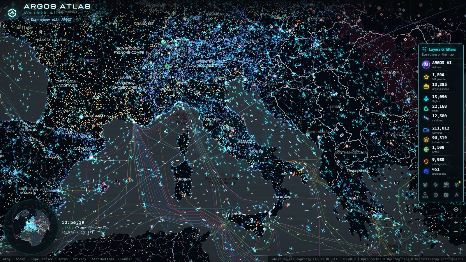
Treviso is where the Venetian plain stops being flat. Most drivers in this province are not going to Treviso at all: they are heading north towards Belluno, the Cadore valleys and Cortina, or south towards the lagoon, the airports and the A4. That one fact changes what is worth watching on a camera here. In Venice you watch a bridge and a car park. In Verona you watch a motorway junction. In Treviso province you watch a corridor, and the corridor has a very clear rhythm: north on Friday evening, south on Sunday afternoon, and everything at once in the first half of August.
This guide covers the roads that carry that traffic (the A27 from Mestre up to Belluno, the A4 and the eastern approaches to Venice, the Treviso ring road and Canova airport, and the passes that connect the Prosecco hills to the Belluno side) and it also says where the public camera coverage runs out. In this province it runs out quickly, and knowing exactly where is more useful than any list of links.
What you are really watching in Treviso province
Four flows overlap on the same asphalt. There is airport traffic, split between Canova in Treviso and Marco Polo down at the lagoon, much of it heading straight for the mountains. There is freight between the industrial belt around Pordenone and the Padua logistics area, which uses the A4 and the A28 and spills onto the old SS13 Pontebbana whenever the motorway slows. There is weekend leisure traffic to the Conegliano and Valdobbiadene hills, which is light on volume but concentrated into a few hours on Sunday. And there is seasonal mountain traffic, skiing in winter and hiking in summer, which turns the top of the A27 into the busiest single stretch of road in the province.
None of that is visible from a camera pointed at a piazza. It is visible from cameras pointed at motorway lanes and junctions, which is what public road operators install and publish.
The A27, the spine from the lagoon to the Dolomites
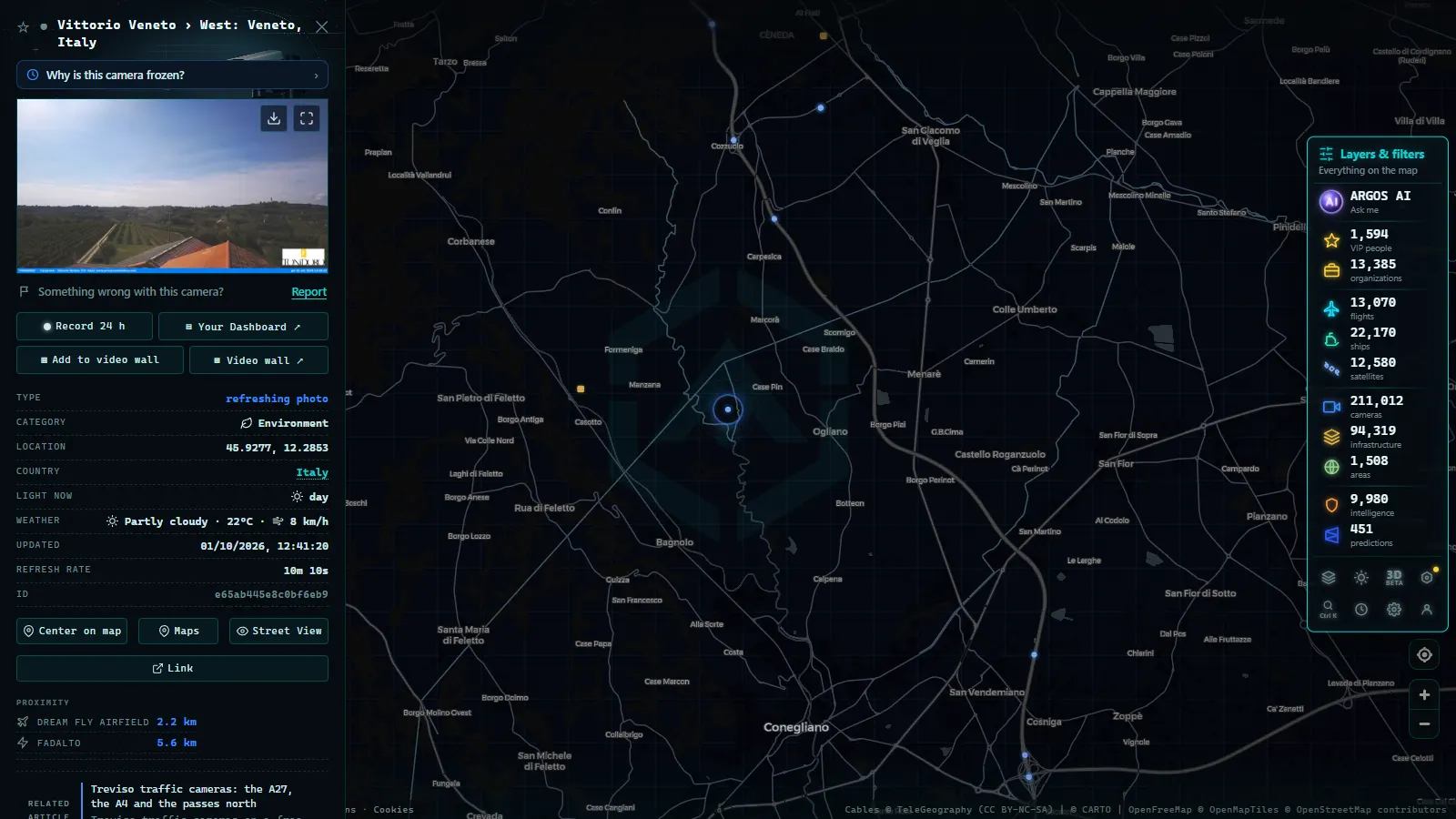
The A27 leaves the Mestre ring, crosses the province from south to north past the Treviso exits, Conegliano and Vittorio Veneto, then climbs through the Fadalto gap alongside the Santa Croce lake and drops towards Belluno. It is the only high capacity road into this part of the Dolomites, and it is run as a tolled concession, which matters because concession operators publish camera images as a courtesy and change the layout of those feeds without warning.
The useful habit is to read the A27 in order rather than jumping to the camera nearest your destination. If the Treviso exits are already slow, the Conegliano stretch will be slow twenty minutes later. If Vittorio Veneto is moving but the Fadalto climb is not, the problem is ahead of the motorway, not on it. The A27 ends well short of Cortina, and the single carriageway that continues north is where the real queue forms on a winter Saturday. A camera cannot show you that final stretch in most cases, so treat the last motorway image as a leading indicator and add time.
Where to find Treviso traffic cameras on the map
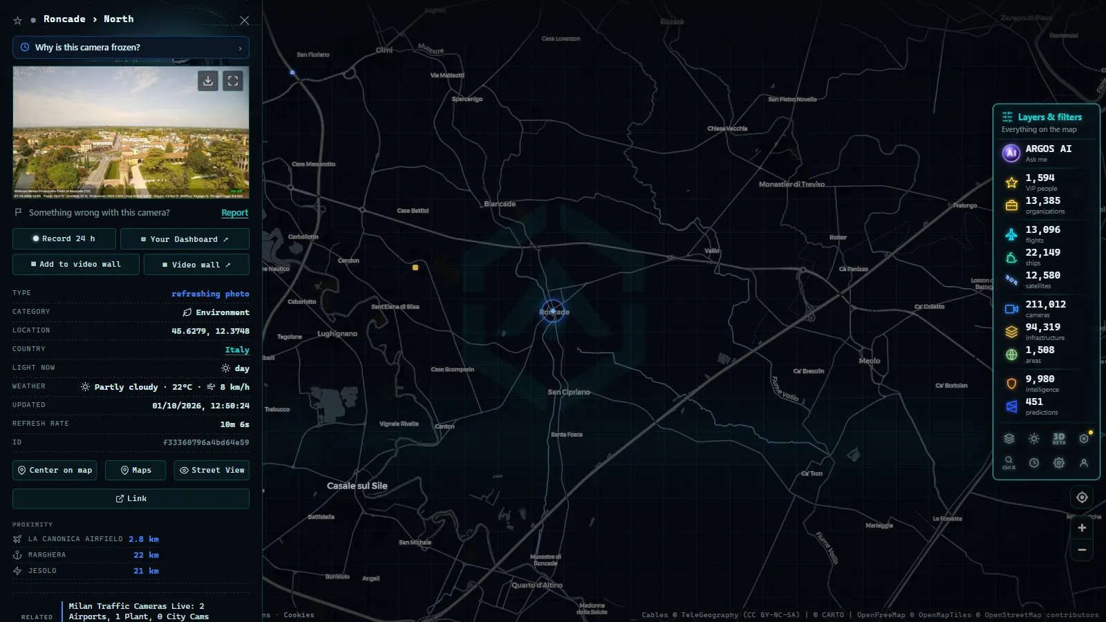
Open the live map with public traffic cameras worldwide, switch on the camera layer and zoom to the band between Venice and Belluno. Markers appear over the motorway corridors and the main trunk roads. Clicking one opens a panel with the latest frame, the name the operator gave that point and a timestamp.
Two things to understand before you trust what you see. First, almost every road camera in Italy publishes stills, not video: the image refreshes on a cycle of a few minutes, so an empty carriageway may mean the frame was taken between two waves of traffic. Second, the timestamp is the only thing that tells you whether the camera is alive. An image with no recent timestamp is a cached picture, not a live one.
The catalogue behind the map holds 200,000+ public cameras worldwide (count as of September 2026), but that global figure says nothing about density in any one province, and Veneto is a good example of why. Coverage here is decent on the motorways and thin everywhere else.
From the ARGOS ATLAS channel.
How Treviso traffic cameras differ from the Venice and Verona views
The three Veneto cities give you three completely different pictures, and mixing them up is the most common mistake.
| Corridor | What it connects | When it matters | What the cameras actually show |
|---|---|---|---|
| A27 (Mestre to Belluno) | Lagoon and airports to the Dolomites | Winter weekends, August | Motorway lanes and junctions, stills on a few minute cycle |
| A4 east of Venice | Padua and Venice to Trieste | Weekday freight peaks, summer transit | Toll plaza and junction views on the concession stretch |
| A28 and SS13 Pontebbana | Treviso to Pordenone and Friuli | Freight diversions when the A4 slows | Partial: motorway yes, old trunk road patchy |
| Treviso ring road and Canova approach | City bypass and airport access | Flight banks, early morning and evening | Very limited public coverage |
| Passes north (San Boldo, Praderadego) | Prosecco hills to Belluno | First snow, autumn fog | Effectively none, use valley and resort webcams |
If you want the lagoon crossing and the causeway instead, the piece on Venice traffic cameras and the Ponte della Libertà covers it properly. For the western side of the region, where the A4 meets the A22 and the Garda exits, the guide to Verona traffic cameras and the A4 is the right one. And the national picture, with the split between motorway concessions and the state road network, is in the overview of traffic cameras across Italy.
Canova airport and what the flight layer adds
Treviso Canova sits on the southwestern edge of the city, close enough that the approach path crosses the ring road. It is a single runway airport with a low cost base, which means traffic arrives in banks: a quiet apron for two hours and then four aircraft in twenty minutes. Road access is short but funnels through a couple of roundabouts, so a delayed bank and a school run can collide badly.
Here is the honest part. There is no public traffic camera aimed at the terminal, the car parks or the apron, and there will not be one, because airport surface video is operational and restricted. What you can watch instead is the aircraft. The map tracks 12,379 flights at a given moment and holds a catalogue of 47,927 airports (count as of September 2026), so you can see whether inbound aircraft are actually inbound, whether one has gone around, and whether winter fog in the plain has sent arrivals to Venice or Bologna. That is usually the question you wanted answered anyway: not how the car park looks, but whether the flight is landing here at all.
The passes north: San Boldo, Fadalto and the Prosecco hills
North of Valdobbiadene and Vittorio Veneto the province turns vertical. San Boldo is the famous one, a stack of hairpins cut through short tunnels, narrow enough that two vans meeting on a bend become an event. Praderadego is narrower still. The Cansiglio plateau road is wider but exposed, and it ices before anything down in the plain does. The Monte Grappa climbs on the western edge of the province behave the same way.
Public camera coverage on all of these is essentially zero. Nobody installs and publishes road cameras on a minor mountain road with a few hundred vehicles a day. What works instead is triangulation: check the A27 approach, check the conditions on the Belluno side, and check altitude webcams at resorts and refuges, which are often published by tourism boards rather than road operators. The method is the same one described in the guide to mountain pass cameras and snow on the road, and it is reliable enough to decide whether to take the pass or go around on the motorway.
What Treviso traffic cameras will not show you
The limited traffic zone in the historic centre is enforced by cameras, and those are not viewing feeds. Nothing from them is published, ever. The same goes for municipal security CCTV and for speed enforcement equipment on the provincial roads. If a page offers you a live view of a Treviso ZTL gate, it is not showing you what it claims.
Beyond that, three practical limits. Night images from road cameras in this province are mostly headlight smears and are not worth much. Fog, which is a genuine feature of the plain from late autumn, defeats the cameras exactly when you most want them. And individual cameras drop out for days at a time during maintenance without any notice; the reasons and the workarounds are laid out in the piece on why a traffic camera stops working.
A five minute routine before driving north
- Open the map, camera layer on, zoom to the Venice to Belluno band.
- Read the A27 south to north, in order, and note the timestamp on each frame.
- If you are flying, check the aircraft on the flight layer rather than looking for an airport camera that does not exist.
- For a pass, check the motorway approach plus the valley on the far side, and accept that the pass road itself is unobserved.
- Decide before you leave, because once you are past Vittorio Veneto the alternatives cost an hour.
That is the whole method. Treviso rewards watching the corridor rather than the town, and it punishes anyone who assumes the coverage is as dense here as it is on a Spanish or British motorway network. It is not, and saying so is more useful than pretending otherwise.
Frequently asked questions
Is it free to watch Treviso traffic cameras, and do I need an account?
It is free, it updates live and there is no registration. Open the map, switch on the camera layer and click any marker in the Veneto. Nothing is stored on your side and no email is asked for. The same applies to the flight and ship layers, which is how you cover Canova airport and the lagoon when the road cameras are not enough.
Are there public cameras inside Treviso city centre?
Not the kind you can watch. The cameras on the ring of the historic centre are access control and enforcement equipment for the limited traffic zone, and those feeds are never published. Public viewing coverage in this province is a motorway and main road business: the A27, the A4 corridor, the ring road and the trunk routes towards Pordenone and Belluno.
What is the best camera to check before driving from Venice to Cortina?
Work north in order along the A27: the Treviso exits first, then Conegliano, then Vittorio Veneto and the Fadalto climb. The queue that ruins the trip usually forms where the motorway ends and the single carriageway to Cortina begins, so if the last A27 camera before the end already shows slow traffic, expect the delay to double beyond it.
Why does a Treviso camera show a blank or frozen image?
Three common reasons: the operator has taken the camera down for maintenance, the still has not refreshed since the last cycle and you are looking at an old frame, or it is night and the sensor has nothing to work with. Check the timestamp in the panel before drawing any conclusion, and if the frame is more than an hour old treat that camera as unavailable.
Can I see snow on the passes north of Treviso with these cameras?
Partly. San Boldo, Praderadego and the smaller roads over the Prealps have almost no public traffic cameras, so the honest answer is that you will not see the surface of those roads. What you can see is the approach on the A27 and the conditions on the Belluno side, plus resort and valley webcams, and that combination is usually enough to decide whether to go.
- Padua Traffic Cameras: the Tangenziale, the A4 and the A13
- Louisiana Traffic Cameras: 545 on a Live Map, I-10 and Bridges
- Bavaria Traffic Cameras: A8, A9 and 6 Alpine Border Routes
- Lugano traffic cameras: the A2, Chiasso and the lake live
- Christchurch Traffic Cameras: Live Now, Free, No Sign-up
- Yunlin Traffic Cameras: What You See on National 1 and 3