Blog · Critical infrastructure
What is critical infrastructure and why does it appear on public maps
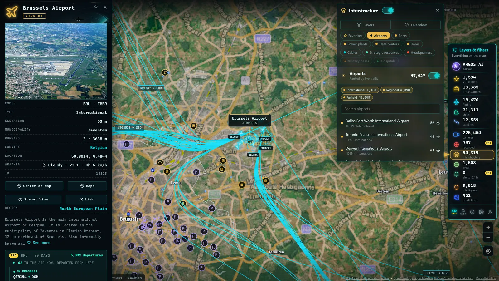
There is a question that arises whenever someone sees a map with airports, ports, and power plants marked for the first time: is it not dangerous for this to be visible? It is a legitimate question, and the short answer is no, for reasons worth understanding properly. Critical infrastructure -- the systems on which the basic functioning of a country depends -- is largely visible by nature, documented in official and open sources, and seeing it aggregated on a map teaches more than it exposes. This article explains what counts as critical, who decides that, what is public and what is not, and why transparency and security are more compatible than they might seem.
What critical infrastructure is: a working definition
Critical infrastructure refers to the systems, facilities, and services whose interruption or destruction would have a severe impact on the health, safety, or economic wellbeing of citizens, or on the functioning of government. The precise definition varies by legal framework, but the core idea is consistent: critical is whatever society cannot do without for more than hours or days.
The sectors typically catalogued as critical are recognisable to anyone:
- Energy: generation, transmission, and distribution of electricity, gas, and petroleum products.
- Transport: airports, ports, rail, roads, and their management systems.
- Water: abstraction, treatment, distribution, and sanitation.
- Communications: telecommunications networks, data centres, undersea cables, and associated systems.
- Health: hospitals, laboratories, pharmaceutical supply chains.
- Financial system: banking, payment systems, markets.
- Food, government, chemical and nuclear industries, space and research, among others.
In the United States, the Cybersecurity and Infrastructure Security Agency (CISA) formally designates sixteen critical infrastructure sectors and coordinates protection across them. In the United Kingdom, the National Protective Security Authority (NPSA) plays an equivalent role. The European Union has progressively harmonised these frameworks through directives that require member states to identify essential entities and impose reinforced obligations for protection and resilience. The fine detail of national registers is classified; the sector architecture and legal frameworks are publicly available.
Why much of it is visible on public maps
It is worth starting with an observation that is obvious yet frequently forgotten: an airport cannot be hidden. It occupies several square kilometres, moves thousands of people every day, appears on motorway signs, and has a website with its address. The same is true of a large port, a power station with its cooling towers, or a dam. These are facilities whose function requires them to be known, accessible, and visible.
That is why their locations have been documented for decades in perfectly legal and open sources:
- Official cartography from national mapping agencies such as Ordnance Survey in the UK and the USGS in the United States, which maps facilities of every type.
- Open government data published by the operators themselves: airport codes and coordinates, port registers, grid data published by network operators such as National Grid or the US Energy Information Administration.
- OpenStreetMap, the collaborative open-cartography project (ODbL licence), where contributors document everything from airfields to substations based on direct observation and compatible sources.
- Public-domain databases such as Natural Earth and OurAirports, used worldwide for cartography and analysis.
The honest distinction -- and this is the heart of the matter -- is which part of the information is sensitive. The location and existence of a facility is inherently public. What is protected is something else entirely: internal floor plans, control system schematics, known vulnerabilities, security protocols, operational details. That information does not appear on any public map, nor should it. Conflating the two -- where a facility is with how it works internally -- is the misunderstanding that drives almost every unfounded alarm.
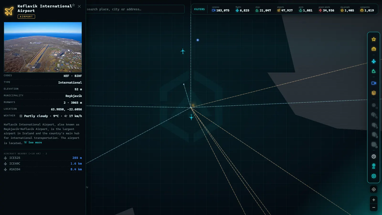
The value of seeing it aggregated: education, journalism, and civic literacy
If the locations are already public, what does bringing them together on a single map add? A great deal, for very different audiences.
Education. Seeing at a glance where the airports, ports, and power plants of a region are is the fastest way to understand its anatomy. The geography of energy and transport stops being abstract when you can explore it interactively.
Journalism and analysis. Reporters and open-source intelligence (OSINT) researchers work constantly with this kind of information: contextualising a news story about a blackout, verifying the location of footage, understanding which facilities are near an incident. Having scattered sources aggregated and geolocated saves hours and reduces errors.
Dependency analysis. Perhaps the most underestimated value: understanding what your daily life actually relies on. Which power station feeds your neighbourhood? Through which port does most of what you buy arrive? Which airport connects you to the world? Looking at an infrastructure map is an exercise in civic literacy -- you value things more when you can see them. And you better understand why distant disruptions end up being felt at home, as happens with the undersea cables that carry the internet.
Critical infrastructure is the silent backdrop of modern life: we only notice it when it fails. Mapping it is a way of looking at it before it does.
From the ARGOS ATLAS channel.
The balance between transparency and security
Where, then, is the line? The practice of public authorities draws it with reasonable clarity.
What is published: the existence, location, and general characteristics of facilities; operational statistics (air and maritime traffic, electricity generation); open data to encourage research and services. Operators themselves publish annual reports, network maps, and near-real-time data, because transparency is part of their mandate and of public trust.
What is not published: detailed criticality catalogues, vulnerability assessments, security plans, control-system configurations, contingency plans. That is the information whose protection regulations require, and with good reason.
An argument worth stating plainly: hostile actors do not rely on public maps. Anyone planning a serious attack against infrastructure has access to reconnaissance methods far superior to a web viewer -- commercial satellite imagery, direct observation, insider knowledge. Removing an airport from a public map would not hide it from anyone with real intent; it would only hide it from students, journalists, and curious citizens. Security through obscurity applied to facilities the size of a town district is, simply, theatre. Real security lies elsewhere: in physical perimeters, in systems, in personnel, and in plans that are precisely not public.
This does not mean that everything is equally inconsequential. It means that the serious debate is not map versus no map, but what level of detail is appropriate. The practical consensus on that question is stable: location and function, yes; operational internals, no.
How it is catalogued: sectors, operators, and plans
Even though the specific registers are classified, the general method is public and worth understanding. Legal frameworks -- whether at national or supranational level -- work in layers:
- Strategic sectors are defined: energy, transport, water, health, and the other families listed above.
- Essential operators are identified within each sector: the specific entities that deliver indispensable services.
- Obligations are assigned: risk analysis, protection plans, designation of security officers, incident notification, and coordination with authorities.
- Supervisory bodies are established that maintain catalogues, coordinate incident response, and link physical protection with cybersecurity -- where agencies such as CISA in the United States and ENISA at EU level play an increasing role.
Recent developments in regulatory frameworks have also reinforced the concept of resilience: it is no longer enough to protect facilities from attack; essential services must also be capable of recovering quickly from any disruption, whether a cyber incident, a natural disaster, or a cascading failure.
Exploring infrastructure layers in Argos Atlas
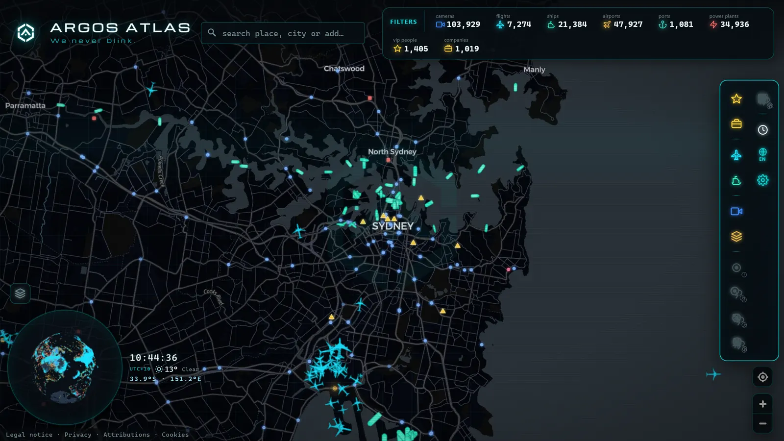
All of this theory becomes clearer with a map in front of you. In Argos Atlas you can explore infrastructure layers covering airports, ports, and power plants worldwide -- geolocated and accompanied by global ranked lists by capacity. This is exactly the type of public, aggregated information discussed throughout this article: location and context, built on open sources, with no operational internals of any kind.
A good way to start: open the map over your own region and identify the pieces your daily life depends on -- your airport, the port through which what you consume arrives, the plants that power your home. Then zoom out and compare with other parts of the world: you will see density patterns that tell entire economic stories. If you want more detail on a specific category, we have dedicated guides, such as the one on the world's largest ports.
Frequently asked questions
What counts as critical infrastructure?
Systems and facilities whose interruption would severely affect the functioning of society: energy, transport, water, communications, health, the financial system, and food supply, among other sectors formally catalogued by US, UK, and EU frameworks. Within each sector, essential operators -- the specific entities providing indispensable services -- are designated with reinforced obligations for protection and resilience.
Is it legal for it to appear on public maps?
Yes. The location of an airport, a port, or a power plant is inherently public information: it appears in official cartography, in open government data published by the operators themselves, and in collaborative projects like OpenStreetMap. What regulations protect is a different layer: internal plans, vulnerabilities, protocols, and operational details. That part does not appear on public maps, nor should it -- and the distinction between the two is precisely what makes transparency and security compatible.
Is viewing infrastructure on a map a security risk?
Viewing its location is not. A facility the size of an airport cannot be concealed, and its position has been recorded for decades in numerous official and open sources. Hostile actors with real capability have access to reconnaissance methods far superior to any web viewer, so removing these facilities from public maps would harm only students, journalists, and citizens. Effective security rests on protecting what is not public: systems, access points, and internal plans.
Who decides what is critical?
Public authorities, through layered legal frameworks. In the United States, CISA formally designates sixteen critical infrastructure sectors. In the UK, the NPSA coordinates national infrastructure protection. In the European Union, specific directives harmonise the identification and protection of critical entities; each member state also maintains its own legislation, catalogues, and responsible bodies. Detailed catalogues are classified, but the sector list and complete legal architecture are public and available to anyone.
Conclusion
Critical infrastructure is the silent machinery that holds everything else together: electricity, water, travel, communications, food on the shelves. The fact that its location is visible on public maps is not a lapse, but the natural consequence of its own function -- and an opportunity to understand what our daily lives depend on. What is sensitive lies in a different layer, well protected where it should be. If you want to test this new perspective, open the map, activate the airport, port, and power-plant layers, and explore your own region first, then the wider world. Few things convey as much real geography in as little time.
Frequently asked questions
What counts as critical infrastructure?
Systems and facilities whose disruption would severely affect the functioning of society: energy, transport, water, communications, health, finance, and food supply, among other sectors. US, UK, and EU frameworks formally catalogue these and designate essential operators within each one.
Is it legal for it to appear on public maps?
Yes. The location of an airport, a port, or a power plant is inherently public information: it appears in official cartography, open government datasets, and collaborative projects like OpenStreetMap. What regulations protect are internal plans, vulnerabilities, and operational details, not the fact that the facility exists and where it is located.
Is viewing infrastructure on a map a security risk?
Viewing its location is not. A large-scale facility cannot be hidden and its position is already recorded in numerous official and open sources. Real security rests on protecting what is not public: systems, access points, internal plans. Hostile actors do not rely on public maps to learn where an airport is.
Who decides what is critical?
Government authorities. In the United States, CISA designates sixteen critical infrastructure sectors. In the UK, the NPSA oversees equivalent frameworks. The European Union has directives that harmonise identification and protection of critical entities, and each member state maintains its own catalogues. Detailed registers are classified; the sectors and legal frameworks are public.
- Busiest Airports in Mexico: Track Live Flights Now
- Europe's Major Seaports: Rotterdam, Antwerp, Hamburg, Valencia, Algeciras and Piraeus
- Europe's Busiest Airports: Heathrow, Charles de Gaulle, Schiphol, Frankfurt, Istanbul and Madrid-Barajas
- Canada's Major Seaports: Vancouver, Prince Rupert, Montreal and Halifax
- Biggest Airports in the US: Ranked List (Live Map)
- The Biggest Airports in the World: 2025 Passenger Ranking