Blog · Live flights
Track Flights in Real Time Over Mexico: A Complete Airspace Guide
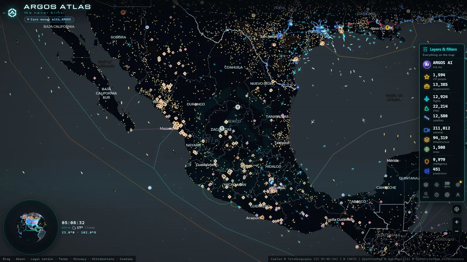
Mexico sits at a crossroads. Its airspace handles traffic flowing between North and South America, bridges the Atlantic routes from Europe, and channels hundreds of domestic connections between its own sprawling cities. With more than 90 million passengers per year across dozens of airports, Mexico is one of the busiest aviation markets in the Western Hemisphere, and with modern ADS-B technology and tools like ARGOS ATLAS, you can follow every aircraft crossing that sky in real time.
Mexico's Airspace at a Glance
Mexico operates 85 airports with scheduled commercial service, of which 63 handle international flights. The Area Control Centre (ACC Mexico) coordinates thousands of daily flight paths that either terminate on Mexican soil or transit through its flight information regions.
The densest corridors link:
- Mexico City to northern border cities (Tijuana, Ciudad Juarez, Monterrey)
- Mexico City to Pacific and Caribbean tourist destinations (Cancun, Los Cabos, Puerto Vallarta)
- Northern border crossings with the United States, where transborder traffic never stops
Mexican airspace is among the most structurally complex in the Western Hemisphere, it blends high-frequency domestic shuttle routes with international corridors connecting North America to South America and Europe.
AICM: The Airport That Never Sleeps
Benito Juarez International Airport, universally known by its ICAO code MMMX and IATA code MEX, sits within the urban sprawl of Mexico City's eastern borough. Its two parallel runways and capacity of roughly 40 million passengers per year once made it among the top three busiest airports in Latin America.
More than 30 domestic and international carriers operate here. Non-stop routes reach cities across Europe, Asia, North America and South America. Aeromexico uses AICM as its primary hub, while low-cost carriers Volaris and Vivaaerobus run dense domestic schedules.
When you open ARGOS ATLAS and center the map over Mexico City, the constant parade of aircraft is immediately visible, planes on approach from the north descending over the Valley of Mexico, others climbing out toward the south or east.
What to watch around AICM
- Holding patterns over the southern mountains when runway demand peaks during morning and evening banks
- Aeromexico widebody jets arriving from Europe or Asia mixing with short-haul turboprops
- General aviation traffic transiting between Toluca airport and the capital
AIFA: Mexico's New Northern Hub
Felipe Angeles International Airport (AIFA) opened in March 2022 on the grounds of a former military airfield in Santa Lucia, in the state of Hidalgo, roughly 50 kilometres north-northeast of central Mexico City. Designed for up to 20 million passengers in its first phase, AIFA was built explicitly to take pressure off AICM.
Adoption was cautious in the early years, business travelers and leisure passengers accustomed to AICM's central location were slow to switch. But traffic has grown steadily. Low-cost carriers including Vivaaerobus and TAR Aerolíneas operate regular schedules, and cargo activity has been particularly strong.
On the ARGOS ATLAS map, AIFA appears to the northeast of the metropolitan area. You can zoom in and observe the differentiated approach corridors for AICM and AIFA, which must be carefully separated because their traffic patterns intersect in the shared airspace above the basin.
From the ARGOS ATLAS channel.
Guadalajara: Mexico's Second Aviation Hub
Miguel Hidalgo y Costilla International Airport (MMGL / GDL) in Guadalajara, Jalisco, is the country's second-largest airport by passenger volume, handling more than 15 million passengers annually. It serves as the aviation gateway for western Mexico and acts as a major connecting point for the Mexican diaspora community traveling to and from the United States.
Key routes from GDL
- Los Angeles, Chicago and Dallas (high-frequency routes driven by the Mexican-American community)
- Mexico City (one of the busiest domestic routes in Latin America)
- Cancun and Los Cabos (domestic leisure travel)
- Madrid and Toronto (long-haul international connections)
On ARGOS ATLAS, Guadalajara shows particularly dense traffic patterns during morning and late-afternoon banking hours, with notable spikes on Friday evenings and Sunday afternoons as weekend travelers return.
Cancun: Mexico's International Tourism Gateway
Cancun International Airport is Mexico's third-busiest by total passengers and its leader in direct international routes. With four active terminals, it draws traffic from across Europe, Canada and the United States throughout the year, with peak loads between December and April.
In the map view, Cancun is one of the more visually striking points of concentration. You can watch long queues of aircraft on approach from the north (US and Canadian flights) and from the east (transatlantic arrivals from Europe). The airport's single active runway creates clearly visible spacing sequences when demand is high, a real-time demonstration of air traffic control choreography.
Monterrey: The Industrial Northeast Hub
General Mariano Escobedo International Airport (MMMY / MTY) in Monterrey, Nuevo Leon, concentrates the corporate and manufacturing-driven air traffic of northeastern Mexico. The region's automotive, electronics and logistics industries generate consistent demand for executive aviation and direct connections to Houston, Dallas, San Antonio and other US economic centers.
Monterrey also sustains one of the highest-frequency domestic routes in Mexico: the Monterrey-Mexico City corridor operates dozens of daily flights and is visible on ARGOS ATLAS as a near-continuous stream of aircraft tracing the same north-south line across central Mexico.
AFAC: Mexico's Civil Aviation Authority
The Agencia Federal de Aviacion Civil (AFAC), established in 2021 as a standalone entity separate from the transport ministry, is Mexico's aviation regulator. Its responsibilities mirror those of the FAA in the United States or EASA in Europe:
- Aircraft and operator certification
- Pilot and aeronautical technician licensing
- Airport operation oversight
- Coordination with the International Civil Aviation Organisation (ICAO) on global standards
- Management of concessions and permits for domestic and foreign carriers
AFAC also administers Mexico's NOTAM (Notice to Air Missions) system, alerts published to inform pilots of temporary airspace restrictions, hazardous zones, runway maintenance, and other operational events affecting flights in Mexican territory.
How ADS-B Tracking Works Over Mexico
ADS-B (Automatic Dependent Surveillance-Broadcast) is the technology that makes real-time flight maps possible. Modern commercial aircraft continuously broadcast their GPS position, altitude, speed and flight identification. Ground-based receivers (operated by networks of aviation enthusiasts and professional companies worldwide) capture those signals and relay them to servers that aggregate and distribute the data globally.
Coverage across Mexico is strong in metropolitan areas and along high-density corridors. The mountainous terrain of the Sierra Madre ranges (particularly in Chihuahua, Sinaloa and Oaxaca) creates some partial-coverage zones, though ground station density has improved markedly over recent years.
ARGOS ATLAS integrates this data into an interactive map where you can:
- See each aircraft's real-time position
- Check flight number, airline, origin and destination
- Review the recent track of the flight's trajectory
- Filter by aircraft type, altitude or region
How to Explore Mexican Airspace on ARGOS ATLAS
Getting started with live flight tracking over Mexico takes less than a minute:
- Open ARGOS ATLAS and enable the flights layer from the side panel.
- Center the map on Mexico using the search bar or manual zoom.
- Click on any aircraft icon to pull up the full flight detail card.
- Use altitude or region filters to narrow down the traffic you want to follow.
One of the advantages of ARGOS ATLAS is that flight data sits alongside other layers (traffic cameras, power infrastructure, ship positions) so you can cross-reference what you see in the air with what is happening on the ground. Want to see whether a cargo flight is landing near a major industrial park? You can verify it directly on the same map.
For deeper context on the technology behind live flight tracking, read our guide on how live flights work and the overview of the world's busiest airports.
Mexico's airspace is a living system, thousands of daily movements connecting cities, communities and continents. ARGOS ATLAS puts that system on your screen, in real time, for free.
Frequently asked questions
How can I track flights over Mexico in real time?
You can use ARGOS ATLAS, which displays an interactive map of all active flights over Mexico using ADS-B data. Just open the map and enable the flights layer.
What is the difference between AICM and AIFA?
AICM (Benito Juarez International Airport) is Mexico City's historic airport in the eastern borough of Venustiano Carranza. AIFA (Felipe Angeles International Airport) is the new hub in Santa Lucia, Hidalgo, inaugurated in 2022 to relieve congestion in the Valley of Mexico.
What does AFAC do and how does it regulate flights in Mexico?
The Agencia Federal de Aviacion Civil (AFAC) is Mexico's civil aviation authority, equivalent to the FAA in the United States. It certifies aircraft, licenses pilots, manages airspace, and coordinates with ICAO on international standards applicable to Mexican territory.
- Live Flights Over Argentina: Ezeiza, Aeroparque and the Patagonian Airports
- Live Flights over Australia and Oceania: Qantas, Virgin Australia and Trans-Pacific Routes
- Live Flights Over Japan: ANA, JAL and the World's Busiest Domestic Routes
- Live flights over India: tracking IndiGo, Air India and SpiceJet in real time
- Live Flights Over Canada: Air Canada, WestJet and the Routes of the Great North
- Flightradar24 Alternatives: Free Flight Trackers Compared