Blog · Ships & AIS
Live Ships in the Mediterranean Sea: Ferries, Cruise Liners and Container Ships
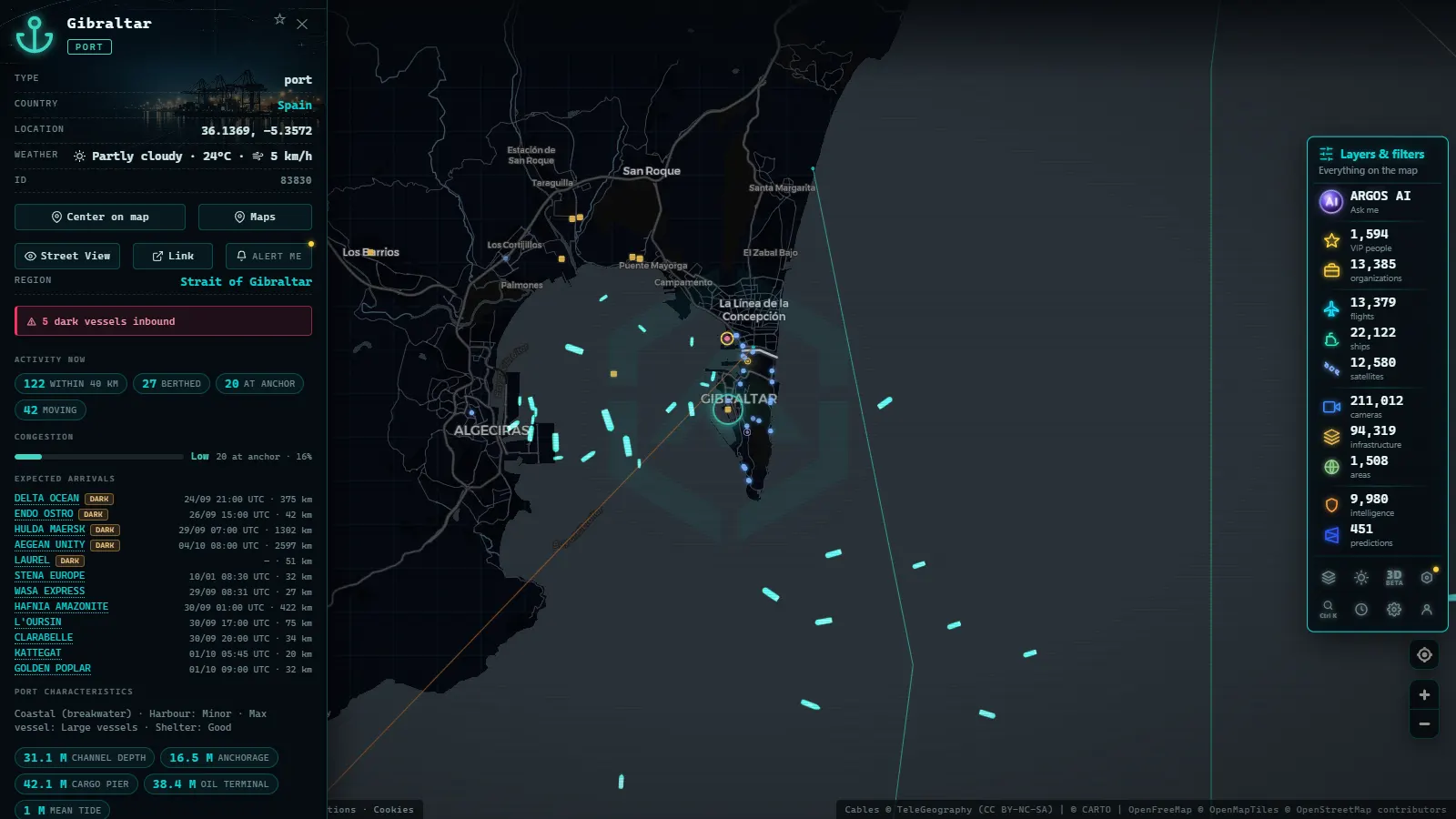
The Mediterranean Sea is far more than a holiday backdrop. Every day, thousands of commercial and passenger vessels cross its waters along routes that bind three continents together. Car ferries loaded with families and vehicles, luxury cruise liners anchoring off volcanic islands, container ships carrying electronics from Asia to southern Europe: all of that movement is captured in real time by the Automatic Identification System (AIS). With ARGOS ATLAS you can watch it unfold on an interactive map without leaving your browser.
The Mediterranean as a Global Maritime Highway
Few bodies of water concentrate as much traffic as the Mediterranean. Its geography makes it the essential link between the Atlantic and the Suez Canal, and by extension between Europe, Asia and Africa. According to estimates from the International Maritime Organization, more than ten percent of global seaborne trade passes through these waters every year.
The main traffic flows follow well-defined patterns:
- East-west axis: container ships and bulk carriers connecting the Suez Canal with major Atlantic ports such as Algeciras, Barcelona and Genoa.
- North-south axis: car ferries and Ro-Ro vessels linking North Africa with Spain, Italy and France.
- Intra-European traffic: medium-distance ferry routes between the Iberian Peninsula, Italy, Greece and Turkey.
The Mediterranean is not a closed sea but a crossroads: any disruption at the Suez Canal or the Strait of Gibraltar ripples immediately through global freight rates.
Traffic Density and Peak Season
In summer the density reaches its maximum. Alongside commercial vessels, hundreds of private yachts, sailing cruisers and leisure craft join the mix. The difference in simultaneous active AIS contacts between January and July in areas like the Gulf of Lion or the Greek islands can be a factor of three to four.
Car Ferries: The Backbone of Mediterranean Passenger Transport
Ferries are the most visible form of transport for the ordinary traveller. They connect islands to mainland shores and countries to one another in a way that no other mode can replicate when you are travelling with a vehicle.
Spain to Italy Routes: Crossing the Tyrrhenian Sea
The longest and most frequent route between the Iberian Peninsula and the Italian boot runs between Barcelona or Valencia and the ports of Genoa, Civitavecchia or Livorno. Crossings take between sixteen and twenty hours, and the vessels used (large Ro-Pax ships of 200 to 230 metres in length) combine capacity for hundreds of vehicles with cabins, restaurants and entertainment areas.
On the ARGOS ATLAS map these vessels appear with typical speeds of 18 to 22 knots in open water, and their trails show the exact trajectory they follow to avoid areas of heavy swell.
Greece and Turkey: The Aegean as a Ferry Labyrinth
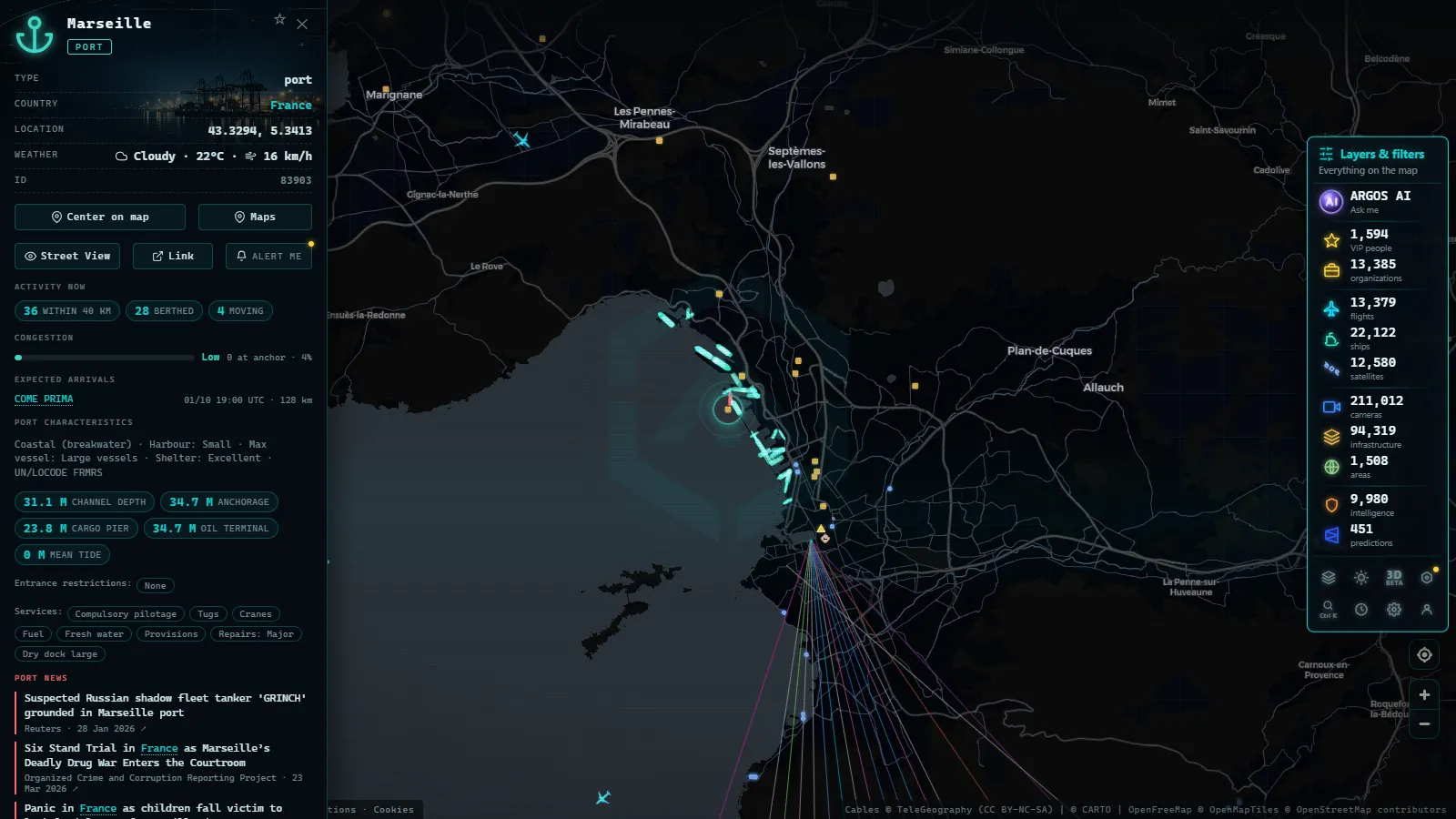
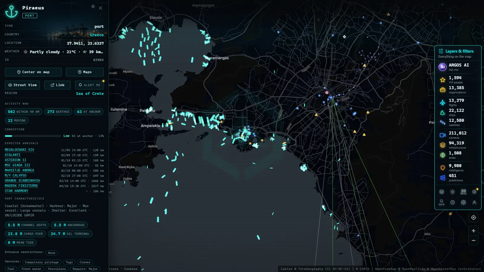
The Aegean Sea is arguably the densest ferry network in the world. Dozens of Greek operators run connections from Piraeus to the Cyclades, the Dodecanese and the Turkish Aegean ports. Competition between Greece and Turkey for tourist traffic has generated a web of cross-border links (Rhodes to Marmaris, Chios to Cesme, Lesbos to Dikili) served by high-speed ferries (catamarans and fast monohulls) capable of covering the distance in under an hour.
Tracking these movements on ARGOS ATLAS is especially revealing: in high season the Aegean appears to boil with moving dots, each one a vessel carrying passengers, cars and rolling cargo.
Cruise Ships: The Floating Palaces of the Mediterranean
The Mediterranean is the world's most visited cruising destination, with ports such as Barcelona, Venice, Civitavecchia, Piraeus, Dubrovnik and Palma de Mallorca topping the lists of most-called ports.
How to Identify a Cruise Ship on the Map
Modern large cruise ships (the so-called mega ships) have lengths exceeding 300 metres and gross tonnages above 200,000 GT. On the ARGOS ATLAS map they are easy to distinguish by:
- Their cruising speed (15 to 22 knots in transit, slower on approach to port).
- Their AIS vessel category, which identifies them as "Passenger ship".
- Their precise curved trajectories, which follow fixed itinerary routes week after week.
Seasons and Concentrations
From April to October, cruise ships concentrate mainly in the western Mediterranean (Spain, France, Italy) and the Aegean. In winter, many reposition to the Caribbean or South-East Asia, so Mediterranean traffic drops markedly between November and March.
From the ARGOS ATLAS channel.
Container Ships: The Silent Engine of Mediterranean Trade
While ferries and cruise ships capture the travelling public's attention, container ships are the true backbone of the global commerce that crosses the Mediterranean. Each twenty-foot equivalent unit (TEU) may contain electronics, textiles, dismantled vehicles or processed food.
Major Shipping Lines in the Mediterranean
Carriers such as MSC (headquartered in Geneva but with its operational heart in the Mediterranean), CMA CGM, Hapag-Lloyd and Evergreen operate regular services calling at ports including Algeciras, Valencia, Genoa, La Spezia, Gioia Tauro and Piraeus. These vessels (with capacities of 10,000 to more than 20,000 TEU) travel at speeds of 14 to 18 knots, and their sheer size makes them recognisable even on a continental-scale map.
Gioia Tauro and the Transhipment Hub
The port of Gioia Tauro in Calabria, Italy, is one of the largest transhipment hubs in the Mediterranean. Its central geographic position allows large mainline vessels arriving from Asia or Northern Europe to transfer cargo to smaller feeder ships that serve secondary ports in the Adriatic, the Aegean or North Africa. Watching the flow of arrivals and departures at Gioia Tauro on the map illustrates perfectly how modern container logistics works.
The Strait of Messina: A Traffic Bottleneck Between Sicily and Calabria
The Strait of Messina, barely three kilometres wide at its narrowest point, is one of the most intense maritime passages in the Mediterranean. Its combination of strong currents, limited depth for deep-draught vessels and the constant cross-traffic of short-sea ferries makes it a demanding navigation environment.
What You See in the Strait
- Short-crossing ferries: services between Messina (Sicily) and Villa San Giovanni or Reggio Calabria operate 365 days a year, with crossings of just twenty minutes. The map can show up to a dozen of these vessels active simultaneously during peak hours.
- Container ships and general cargo vessels that prefer the Strait of Messina over the southern Sicily route when heading to the Adriatic or the Black Sea.
- Superyachts and passage yachts taking advantage of the Italian coastal route to avoid the swell of the open Tyrrhenian.
Opening ARGOS ATLAS and zooming into the Strait of Messina on a July afternoon is an almost hypnotic experience: the traffic never stops for a moment.
How to Use ARGOS ATLAS to Follow Mediterranean Traffic
The maritime layer in ARGOS ATLAS integrates real-time AIS data. From the map you can:
- Filter by vessel type: passenger ships, cargo ships, tankers, special-purpose vessels.
- Click on any ship to see its name, flag, speed, heading and declared destination.
- Review recent historical tracks to understand the trajectory covered in the past several hours.
- Compare traffic densities across different zones by toggling other layers on and off, flights, cameras, critical infrastructure.
Practical Use Cases
- A geography student can analyse commercial flows between regions.
- A journalist can verify whether a cargo vessel declared a destination that does not match its actual trajectory.
- A sailing enthusiast can plan a passage by checking what traffic they will encounter along their route.
- A logistics professional can monitor vessel arrivals at ports of interest.
The Mediterranean as a Geopolitical Thermometer
Mediterranean maritime traffic does not merely reflect the economy: it also registers geopolitical tensions. Routes shift around conflict zones, vessels change flags or names to evade sanctions, and strategic chokepoints like the Bosphorus Strait or the Suez Canal act as valves that regulate global flows. Watching the map over the course of a week reveals these patterns with a clarity that no press article can match.
For millennia the Mediterranean has been the heart of world commerce. Today, thanks to AIS data and tools like ARGOS ATLAS, anyone can look out over that permanent current of steel and salt in real time.
Frequently asked questions
How can I track ships in the Mediterranean in real time?
ARGOS ATLAS lets you follow all vessels with an active AIS signal across the Mediterranean, including car ferries, cruise liners and container ships, updated continuously.
What types of vessels pass through the Strait of Messina?
The Strait of Messina sees short-sea ferries between Sicily and mainland Italy, container ships heading to the Adriatic and Black Sea, and in high season a dense stream of cruise liners and superyachts.
Why is the Mediterranean so important for global shipping?
The Mediterranean links the Atlantic with the Suez Canal and the Black Sea, making it one of the busiest maritime corridors on the planet, handling over 220,000 vessel movements per year.
- Live Ships in the Strait of Malacca, the World's Busiest Shipping Lane
- Live Ships in the North Atlantic: Europe to North America Trade Routes
- Port of Santos Live: Sugar Terminals & Congestion Tracker
- IMO Ship Tracking: Look Up Any Vessel Live, Free
- South America Ports List: The Major Ports, Country by Country
- Ceuta Live Camera: 7 Feeds & Real-Time Ship Traffic