Blog · Critical infrastructure
Iran on a Live Map: Airports, Flights and Hormuz Ships
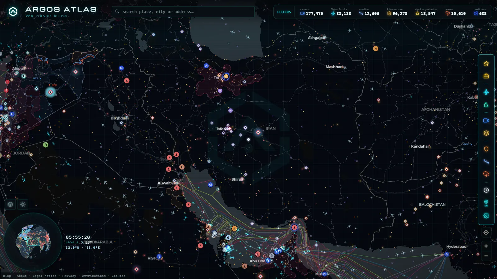
Pan an Iran live map across the plateau and the layers do not fail together. Ports, power sites and airfields sit there in full, because they are catalogue data drawn from open infrastructure and aeronautical sources. The ships crowding the Strait of Hormuz are dense and readable. The sky above the country, meanwhile, is thin and intermittent, and sometimes blank for long stretches. And there is not a single public traffic camera anywhere inside the borders.
That uneven picture is not a fault in whichever map you are using. It is the actual shape of the open data. This piece walks through what you can genuinely see over Iran, what you cannot, and why each gap exists, because those gaps are the reason most people open an Iran page, stare at it for ten seconds and close it without an answer. (The Gulf hubs across the water, Dubai and Doha, have a completely different data profile and deserve their own piece.)
The essentials, in 20 seconds
- Zero: no Iranian agency publishes a public traffic camera feed, out of 177,475 tracked worldwide
- Strait of Hormuz: ship traffic there is dense and readable, the opposite of the thin sky above the country
- 4,444 of 11,325: tracked flights worldwide carry estimated, not freshly received, positions, and the gaps run longest over central and eastern Iran
- Dozens: of Iranian civil and military airfields sit on the map as fixed markers, including Imam Khomeini and Mehrabad in Tehran
- 1,497: vessels worldwide are flagged as sanctioned, some visible among the Gulf traffic near Hormuz
What an Iran live map shows the moment you open it
There are two kinds of layer on any live map and they behave in opposite ways. Catalogue layers are lists of fixed things: an airport has coordinates, a port has coordinates, a substation has coordinates. They render whether or not anything is happening. Live layers are streams of moving objects, and a moving object only appears if something, somewhere, received its broadcast.
Aircraft positions come from ADS-B, a signal the aircraft transmits about itself, picked up by a volunteer network of ground receivers. No receiver under a patch of sky means no aircraft over that patch, however busy it really is. Ship positions come from AIS, also self-broadcast, collected by coastal stations and satellites. Gulf coverage is good because the water is narrow and ringed with receivers, which is precisely why Hormuz is the strongest thing on the map here.
Here is the honest layer-by-layer summary, with the global counts behind each one as of August 2026:
| Layer | Global count (Aug 2026) | Over Iran | What the number does not tell you |
|---|---|---|---|
| Airports and airfields | 47,927 | Dozens, civil and military | Static locations only, no activity |
| Live flights in a snapshot | 11,325 | Sparse, often near borders | 4,444 of those are estimated positions |
| Military-tagged flights | 71 | Rarely any | Most state aircraft never broadcast |
| Ships on AIS | 21,270 shown, 28,573 tracked | Dense in the Gulf | Silence can be a gap or a choice |
| Sanctioned vessels flagged | 1,497 | Several in Gulf traffic | Flags the hull, not the current cargo |
| Sanctioned aircraft flagged | 344 | Occasional | Only when the transponder is on |
| Ports | 1,081 | Present on both coasts | No live berth occupancy |
| Power infrastructure sites | 34,936 | Present | Location, not operational status |
| Public traffic cameras | 177,475 | Zero | No Iranian agency publishes a feed |
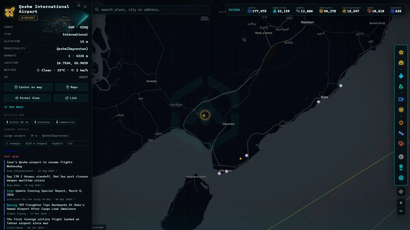
Iranian airports and air bases on the map
The airport layer is built from open aeronautical data, the same sources that feed flight planning tools worldwide. It includes Iranian civil airports, a good number of regional strips, and several fields with a known or joint military role. What it is not is an order of battle: the tagging of military use is uneven across countries, some fields are listed only by their ICAO identifier, and a few are simply missing.
The main civil airports you will find, and what each one tends to look like on screen:
| Airport | IATA | ICAO | City | Typical live picture |
|---|---|---|---|---|
| Imam Khomeini International | IKA | OIIE | Tehran | The country's long-haul gateway; marker always present, aircraft on top of it appear in bursts |
| Mehrabad | THR | OIII | Tehran | Domestic hub sharing its field with military use; heavy schedule, patchy tracking |
| Mashhad International | MHD | OIMM | Mashhad | One of the busiest domestic fields; visible mainly on approach corridors |
| Isfahan Shahid Beheshti | IFN | OIFM | Isfahan | Civil terminal alongside a military presence; little live traffic on the map |
| Shiraz International | SYZ | OISS | Shiraz | Regional traffic, sporadic ADS-B returns |
| Tabriz International | TBZ | OITT | Tabriz | Close to the Turkish border, so better reception than the interior |
| Bandar Abbas | BND | OIKB | Bandar Abbas | Port city on the Strait; the surrounding water is far better covered than the air above it |
| Kish Island | KIH | OIBK | Kish | Island field in the Gulf, decent coastal reception |
| Abadan | ABD | OIAA | Abadan | Near the Iraqi border and the oil terminals of the north Gulf |
A marker on an airfield tells you a runway exists at those coordinates. It does not tell you what is parked on it, whether it is open today, or whether anything took off this morning. If you want that, you need imagery or reporting, and neither is a live map layer. Treat the airport layer as an index of places to watch, not as a status board. The same discipline applies to every fixed asset, which is the point made at length in the piece on what counts as critical infrastructure and why it appears on public maps.
From the ARGOS ATLAS channel.
Civil air traffic over Iranian airspace: why the map goes quiet
Iranian airspace is a genuine crossroads. Routes between Europe and South and East Asia have historically threaded through it, and each time a neighbouring corridor closes, traffic redistributes across the region. So the airspace is not empty. The map often is.
The reason is receiver geography. ADS-B is line of sight, and its range depends on an antenna having a clear view of the aircraft. Dense receiver networks exist where hobbyists, plane spotters and businesses install and share them. Inside Iran there are very few, so most of what you see over the country is picked up obliquely by receivers in Turkey, Iraq, the Caucasus, the Gulf states or Pakistan, catching high-altitude aircraft near the edges. Central and eastern Iran are the weakest.
Watch for the tell: a flight appears at cruise level, tracks smoothly for a while, then freezes or jumps. In a typical snapshot of 11,325 tracked flights, 4,444 carry estimated positions, meaning the position shown is interpolated from the last known heading and speed rather than freshly received. Over a coverage hole that estimate can run for a long time and look entirely plausible while being wrong by a hundred kilometres or more.
Military flights are a separate matter and mostly a dead end in open data. Of the flights tagged as military in a typical snapshot, only a handful worldwide, and rarely any over Iran. State and combat aircraft either do not broadcast, broadcast with filtered identity, or broadcast only briefly. If you want the full explanation of what is and is not visible there, it is set out in the guide to military aircraft in flight and what open sources actually show. The short version: absence of a military aircraft on the map is not evidence of anything.
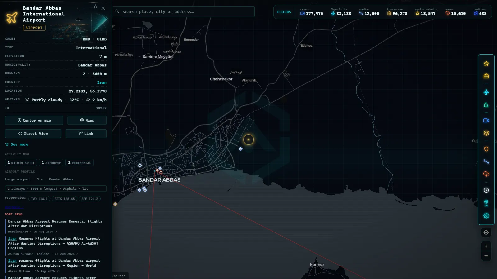
The Strait of Hormuz: ships in, ships out
This is where an Iran live map earns its keep. The Strait is narrow enough that inbound and outbound lanes are squeezed together, close to receivers on several coasts, and carrying a large share of the world's seaborne crude and LNG. Zoom in and you get a genuinely dense picture: tankers queueing off Bandar Abbas and the Omani side, product carriers heading for the Indian Ocean, container ships bound for Jebel Ali, and the tugs and bunkering craft that never leave the area.
Useful habits when reading the Strait:
- Watch the anchorages, not just the lanes. A cluster sitting still off a terminal for days says more about loading delays or sanctions friction than any single transit does.
- Note the draught and the direction. Loaded tankers running east and light ones running west is the normal pattern; a change in that balance is a real signal.
- Follow the choke point, not the vessel. Individual ships are noisy. Traffic through the gate is the number that matters, which is the logic behind the piece on the straits and canals that carry world trade.
The sanctioned-vessel layer overlays flagged hulls onto that traffic (1,497 vessels flagged as of August 2026). It marks the hull, not the cargo or the current owner, and hulls change name, flag and manager often. Treat a flag as a reason to look closer, never as a conclusion.
What you cannot see: no Iranian traffic cameras
This is the flattest gap on the whole map and worth saying in plain words: there are no public Iranian traffic cameras in the catalogue. Not few, not low quality. None.
The camera layer holds 177,475 public feeds (count as of August 2026), and every one of them exists because a road authority, a transport agency, a port or a city chose to publish its stream on the open web. Spain's DGT does it, Transport for London does it, several US state departments of transportation do it. Iranian agencies do not. There is no scraping trick, no mirror and no back door that changes this, and anyone selling you a live street view of Tehran is selling you something else, usually recycled video.
So if your question is what the traffic looks like on the Karaj road right now, an open live map cannot answer it, and no honest one will pretend otherwise.
GPS jamming and AIS blackouts in the Gulf
The Gulf is one of the world's most affected areas for satellite navigation interference, and it changes what you see in ways that look like normal map behaviour. Positions drift inland. A ship appears to be sitting on an airport. A track teleports across the peninsula and back. Aircraft show impossible ground speeds for a few seconds.
The interference layer tracks 72 zones of known navigation disturbance worldwide, which helps you recognise the pattern rather than argue with it. Three separate things produce the same visual result and it is worth keeping them apart:
- Reception gap. Nobody heard the broadcast. The vessel or aircraft is exactly where you would expect.
- Deliberate silence. The transponder was switched off, which is common on routes under sanctions pressure and covered in detail in why some ships turn off their AIS.
- Spoofing. The broadcast is being received fine, but the position inside it is false.
You usually cannot tell which from a single screen. What you can do is check whether neighbouring vessels in the same water went dark at the same moment. If they all did, it is the environment. If one did and the others carried on, it is the ship.
How to read an Iran live map without fooling yourself
Start from the water and work inward. The Hormuz maritime picture is solid, so use it as your anchor and treat everything on land as thinner evidence. Then apply four rules.
First, separate fixed from live in your head every single time. An airport marker is a claim about geography; an aircraft icon is a claim about right now, and only the second one can go stale.
Second, distrust smooth motion in a coverage hole. Estimated positions look identical to received ones unless you are looking for the difference.
Third, never read absence as evidence. No aircraft over Isfahan on your screen means nothing was received, full stop.
Fourth, timestamp everything you take away. Every count in this article is dated to August 2026 for the same reason: a live map is a photograph of a moving thing, and a number without a date is not a fact.
With those four in place, open the live map, pin the Strait, and let the ship traffic run. It is the one part of the Iranian picture that open data really does answer, and it happens to be the part that matters most.
Frequently asked questions
Is the Iran live map free, live and open without registration?
Yes. The map opens in a browser with no account, no email and no trial. Ship and aircraft positions refresh continuously from AIS and ADS-B feeds, and the infrastructure layers (airports, ports, power sites) are catalogue data that loads straight away. There is no paywall on the Iranian view or on the Strait of Hormuz.
Why do I see almost no aircraft over Iran?
Because ADS-B coverage is built from volunteer ground receivers, and there are few of them inside the country. Aircraft over central and eastern Iran are often out of range of any receiver, so they vanish from the map and reappear when they cross toward Turkey, Iraq, the Gulf or the Caspian. An empty sky on the map means no reception, not an empty sky in reality.
Can I see Iranian military aircraft or air bases in real time?
No. Airfields with a military role appear as static markers when they exist in open aeronautical data, but a marker is a runway location, not activity. Military aircraft that broadcast at all usually do so with filtered or absent identity, and combat and transport flights inside Iranian airspace are essentially not visible in open sources.
Why do ships disappear in the Strait of Hormuz?
Three reasons that look identical on screen: a receiver gap between coastal stations and satellite passes, a transponder switched off deliberately, or a spoofed position pushed by GPS interference. Tankers linked to sanctioned trade routinely go dark for days and reappear elsewhere, so a gap in a track is information, not just a glitch.
Are there public traffic cameras in Iran on the map?
None. The camera catalogue holds 177,475 public feeds (count as of August 2026), all of them published by road authorities, transport agencies and municipalities that put their streams online. No Iranian agency publishes an open feed, so the country has zero cameras on the map and that will not change until one does.
- Biggest Airports in the Middle East: 6 Hubs, Live Data
- Italy Airports Live Map: 4 Fields and What They Hide
- Mumbai live map: ships, flights and port data in real time
- Philippines Airports Live Map: Manila, Clark, Cebu, Davao
- Poland Airports Live Map: Chopin, Gdansk, Krakow and More
- India Airports Live Map: Delhi, Mumbai, Hyderabad, Chennai