Blog · Traffic cameras
Oregon Traffic Cameras on TripCheck: I-5, 3 Passes, US-101
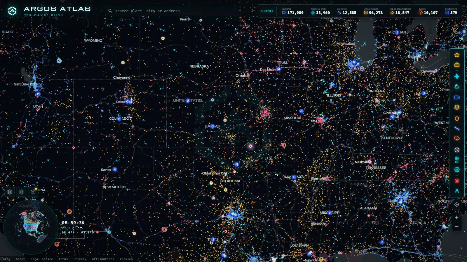
Oregon publishes its road cameras through TripCheck, the traveler information service run by the Oregon Department of Transportation (ODOT), and those are the same images you get when you pan over the state on our map. No account, no app, no waiting list. The road is public, and so are the pictures of it.
The complication is that Oregon is three driving problems stacked into one state. The I-5 corridor from Portland down to Medford is a busy interstate with dense camera coverage. The Cascade passes carry snow, chain requirements and closures for a good share of the year. The US-101 coast is fog, wind and long stretches with nothing pointing at the road at all. The cameras behave differently in each one, and telling them apart is what stops you from staring at a frozen frame and concluding the highway is empty.
What you see when you open Oregon traffic cameras on the map
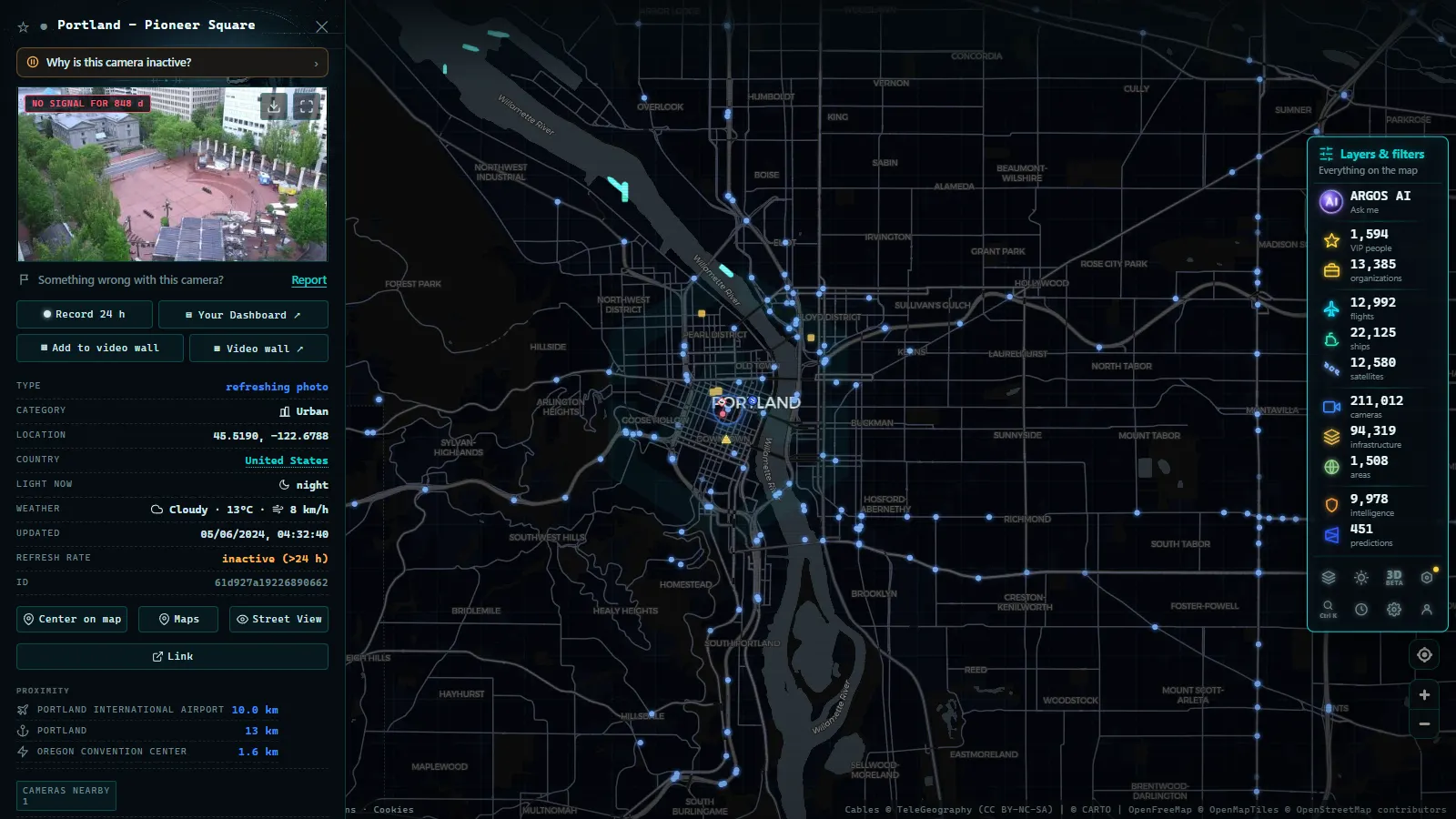
Drag the live world map to the Pacific Northwest and Portland fills in first: the I-5 crossings of the Willamette, the I-84 exit toward the Gorge, the I-205 loop, the climb of US-26 out of town. Click any marker and you get the latest frame that camera pushed, with the name ODOT gave it (normally a route plus a milepost or a cross street) and the time it was captured.
Follow I-5 south and the density drops in steps. Salem and Eugene keep a decent spread. Between Roseburg and Grants Pass the markers thin out to junctions, grades and the spots that ice first. That thinning is not a hole in our data, it is how the network was actually deployed: cameras go where decisions get made, not evenly along the asphalt.
Oregon's feeds sit inside a catalogue of 200,000+ public cameras worldwide (count as of September 2026), which is why the interface does not change when you cross a state line. The United States traffic camera map puts the state DOT feeds side by side, so moving from Oregon to its neighbours is a drag rather than three browser tabs.
TripCheck and ODOT: name the official source first
TripCheck is the brand to remember. It is ODOT's public system and it carries the camera stills, the mountain pass reports, the incident list, the road work and the winter chain conditions. If a local tells you to "check TripCheck", they mean this and nothing else.
Two details matter for anyone reading images instead of headlines. First, the cameras exist for traffic management, so they are aimed where operations staff need to look: mainline flow, ramps, grades, bridge decks. Nobody framed them for scenery. Second, ODOT also posts pass conditions in words, and those words are often more current than the picture, because a camera can be dark or iced over while a maintenance crew has just radioed in an accurate report.
The I-5 corridor: Portland to Medford in one scroll
I-5 is the spine and the best served corridor in the state. From north to south you can chain the views without leaving the map.
| Segment | What the cameras cover | Typical behaviour | Watch for |
|---|---|---|---|
| Portland metro | Willamette bridges, I-84 and I-205 junctions, US-26 | Dense, frequent updates, several units that pan | Peak backups, stalls on tunnel approaches |
| Salem to Albany | Mainline and interchanges on the valley floor | Regular spacing, mostly fixed | Winter fog that sits for hours |
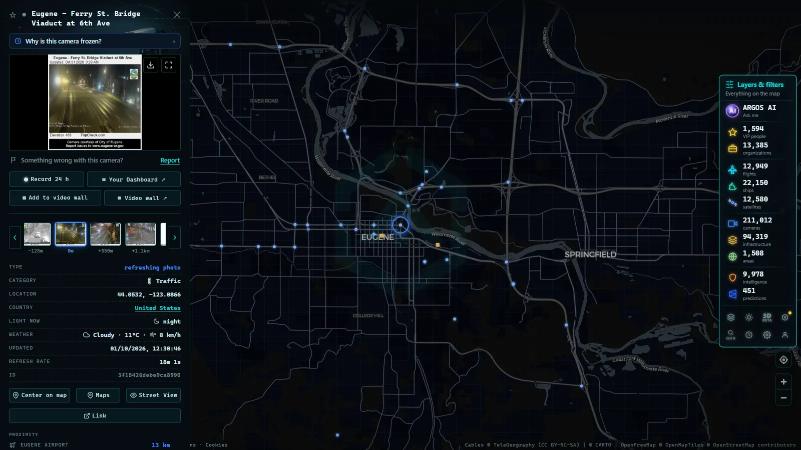
| Eugene and Springfield | I-5 with OR-126, city approaches | Good coverage, mixed types | The OR-58 turnoff toward the pass |
| Roseburg to Grants Pass | Grades, curves, canyon sections | Sparse, slower refresh | Ice on shaded curves, truck slowdowns |
| Medford and the Siskiyou climb | Southern approach to the state line | Sparse, weather driven | Chain restrictions near the summit |
If you drive the border to border run, open the map once and step down the corridor instead of loading a page per city. Northbound it continues into the Washington state camera network and southbound into the California traffic camera map, with the same click behaviour throughout.
From the ARGOS ATLAS channel.
Cascade passes: US-26, OR-58, US-20 and half a year of snow
The passes are why camera watching became a habit for so many Oregon drivers. US-26 over Government Camp, OR-58 at Willamette Pass, US-20 at Santiam Pass and the I-84 run up the Gorge toward the Blue Mountains all change character from November into April, sometimes May.
What pass cameras are genuinely good at: telling you whether the pavement is black, white or slushy, whether snow is falling right now, and whether traffic is moving in a line or parked. What they are bad at: night. A pass camera at three in the morning gives you a grey rectangle with a few headlight smears, and no amount of squinting turns that into road surface information.
So pair the camera with the posted restriction, always. The image answers "what does it look like", the restriction answers "what am I required to carry". The same discipline works anywhere in the world, and it is laid out in the guide to mountain pass cameras and checking snow before you travel.
US-101 and the coast: fewer cameras, harder weather
The coast is the part people expect to be well covered and it is not. US-101 from Astoria through Tillamook, Newport, Florence, Coos Bay and down to Brookings has cameras at the structural chokepoints: the big bridges, a handful of junctions with the routes crossing the Coast Range, and the sections that flood or slide. Between them there are long stretches with nothing at all.
Coastal cameras also fight their environment. Salt haze on the glass, fog that flattens the frame to white, wind driven rain that turns an image into streaks. When a coastal camera looks broken it usually is not: it is photographing fog accurately.
The Coast Range crossings (OR-6, OR-18, OR-22, OR-38) deserve more attention than they get, because in winter that is where a coastal trip is actually decided, not on the shoreline itself.
Fixed, pan and tilt, and the cameras that only send a photo
Three behaviours, and it pays to know which one you are looking at before you judge it.
| Type | How it behaves | Where it shows up in Oregon |
|---|---|---|
| Fixed still | Same framing forever, a new image on a timer | Most rural and pass sites |
| Pan, tilt, zoom | Framing changes when an operator moves it | Portland metro, major interchanges |
| Slow refresh remote | One photo every several minutes | Interior, high desert, isolated summits |
A pan and tilt unit swung onto a ramp is not malfunctioning, someone is working an incident with it. A rural site handing you the same frame for four minutes is not stale data either, that is the real update interval, because bandwidth on a remote mountain site is expensive and a still every few minutes is what the link supports.
None of these are video. They are photographs on a timer, and treating them as a live stream is the single most common misreading of any state camera network.
What Oregon traffic cameras on TripCheck will not show you
The honest list, because it saves time:
- No continuous video, no rewind, no playback, no archive of yesterday.
- No plate reading for the public. These are operations cameras, not enforcement devices.
- Sites go offline: power cuts, winter damage, construction, seasonal removals on the high routes.
- The timestamp is when the frame was captured, not when your browser loaded it.
- Rural coverage has real gaps, and eastern Oregon has the biggest ones.
- A black frame at night is normal behaviour, not a fault.
When one specific site stays stuck, the diagnostic order in why a traffic camera is not working applies here as well: check the timestamp, check a neighbouring camera, then assume the site and not the map.
A three step routine before driving Oregon in winter
- Open the map on your corridor and look at two or three cameras spaced along it, not just one. A single frame can be an outlier, three in a row tell you the truth.
- Read the ODOT pass report and the chain requirement next to the image, especially between dusk and dawn when the picture stops being informative.
- Re-check the same cameras right before leaving. Mountain conditions in Oregon change on a scale of tens of minutes, and a frame you looked at two hours ago is a memory, not a forecast.
Done in that order it takes under a minute, and it is the difference between arriving at Government Camp informed and arriving at a queue of stopped trucks with no idea how long it stretches.
East of the Cascades: I-84, the Columbia River Gorge, and US-97 near Bend
Oregon traffic cameras on TripCheck do not stop at the passes covered above. A large share of the eastbound traffic and the winter closures that make national news happen on I-84 between Portland and the Idaho line, and on US-97, the north-south spine of Central Oregon. If you searched for Oregon cameras and landed here looking for that corridor, this is the part of the state the sections above do not walk through.
I-84 climbs out of the Columbia River Gorge, a stretch known for wind rather than snow for most of the year: high-profile vehicle restrictions and gusty crosswinds close it more often in spring and fall than ice does. Cameras cluster around Troutdale, Hood River, and The Dalles, where the Gorge narrows and wind gusts are strongest. Further east, Cabbage Hill (the grade between Pendleton and La Grande) is the single stretch ODOT flags most for chain requirements and full closures in winter, similar in role to Snoqualmie Pass on the Washington side of I-90 (see our Washington state traffic cameras guide for that comparison). TripCheck places cameras on both approaches to Cabbage Hill, not just at the summit, so you can check the grade before you start climbing, not after.
US-97 runs the length of Central Oregon, past Bend, Redmond, and Klamath Falls, then joins the routes into California and Washington. It sees different conditions from I-5: less traffic, but longer stretches without services, and high-desert weather that can flip from dry pavement to black ice within a few miles. TripCheck's cameras on US-97 sit further apart than on I-5, so treat a clear image at one camera as informative for that spot only, not for the twenty miles beyond it.
Neither corridor gets the volume of drivers that I-5 does, which is part of why TripCheck's own app and homepage foreground the west side. If you are planning a trip east of the Cascades, search TripCheck's camera list by highway number rather than by browsing the map view, since the eastern cameras are spaced out and easy to miss when zoomed to the whole state.
Frequently asked questions
Is it free to watch Oregon traffic cameras, and do I need to sign up?
It is free and there is no registration. TripCheck is public by design, and our map shows the same Oregon feeds with no account, no app and no trial. Open it, drag to the state and click a marker.
What is TripCheck?
TripCheck is the traveler information service run by the Oregon Department of Transportation (ODOT). It carries the state road camera images, pass conditions, incidents, work zones and winter chain requirements. Oregon's 511 phone line is the voice version of the same data.
Why does an Oregon camera show the same picture for several minutes?
Because most rural and pass sites are still images on a timer, not video. Remote locations run on limited connectivity, so a new JPEG every few minutes is the actual update rate. Check the timestamp on the frame rather than assuming it froze.
Which Oregon cameras can move?
Pan, tilt and zoom units are concentrated in the Portland metro area and at major interchanges, where operations staff need to follow an incident. If the framing looks wrong, someone has probably aimed it at a ramp or a stalled vehicle on purpose.
Can I check whether a Cascade pass is drivable using cameras alone?
Not on its own, and especially not at night, when a pass camera gives you a grey rectangle with headlight smears. Pair the image with the written pass report and the posted chain restriction: the camera tells you what it looks like, the restriction tells you what you must carry.
- DriveBC Traffic Cameras: British Columbia's 5 Mountain Passes
- Finland Traffic Cameras: Fintraffic, Digitraffic and Lapland
- Sweden Traffic Cameras: Trafikverket Roads, Corridor by Corridor
- Austria Traffic Cameras: Alpine Passes, Tunnels and Vienna
- Iowa 511 Traffic Cameras Live: I-80, I-35 and I-380 in One Map
- Iceland road cameras live: Ring Road, passes and black ice