Blog · Critical infrastructure
Spain Airport Codes: IATA & ICAO + Live View
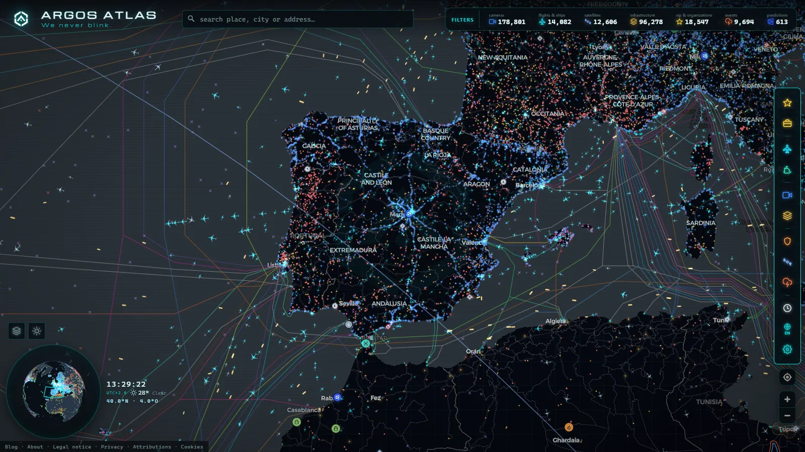
MAD, BCN, PMI... and also LEMD, LEBL, LEPA. Every Spanish airport carries two official codes that appear on tickets, baggage tags, flight plans and aviation maps. Learning to read them is more useful than it sounds: it prevents booking mistakes, lets you follow an aircraft on a live map, and explains curious details, like why the Canary Islands don't share a prefix with the mainland.
Here is the full code list for Spain's main airports gathered in a single table, what each organization's letters mean, and how to use them to watch any airport live.
The essentials, in 20 seconds
- IATA: three-letter codes for bookings, tickets and baggage tags, assigned by the airlines' association.
- ICAO: four-letter codes for flight plans and air traffic control, assigned by the UN's civil aviation body.
- LE: prefix for every mainland and Balearic airport, as in LEMD (Madrid) and LEBL (Barcelona).
- GC: prefix for the Canary Islands, as in GCLP (Gran Canaria) and GCTS (Tenerife South).
- AGP: Málaga's IATA code, one of the cases that doesn't match the city name.
What the airport code abbreviations mean: IATA and ICAO
Two organizations assign airport codes worldwide, each with a different goal:
- IATA (the airlines' association) assigns three-letter codes built for the commercial side: bookings, tickets, schedules and baggage. These are the codes everyone knows: MAD, BCN, AGP.
- ICAO (the UN's civil aviation body) assigns four-letter codes built for technical operations: flight plans, air traffic control, aeronautical weather. They are hierarchical: the first letters indicate the region and country.
The same airport lives happily with both: Madrid-Barajas is MAD on your boarding pass and LEMD for the pilot flying over it. The quick rule of thumb: three letters, ticket; four letters, cockpit. If you want the full picture of how the system works, we have a dedicated guide to IATA and ICAO airport codes.
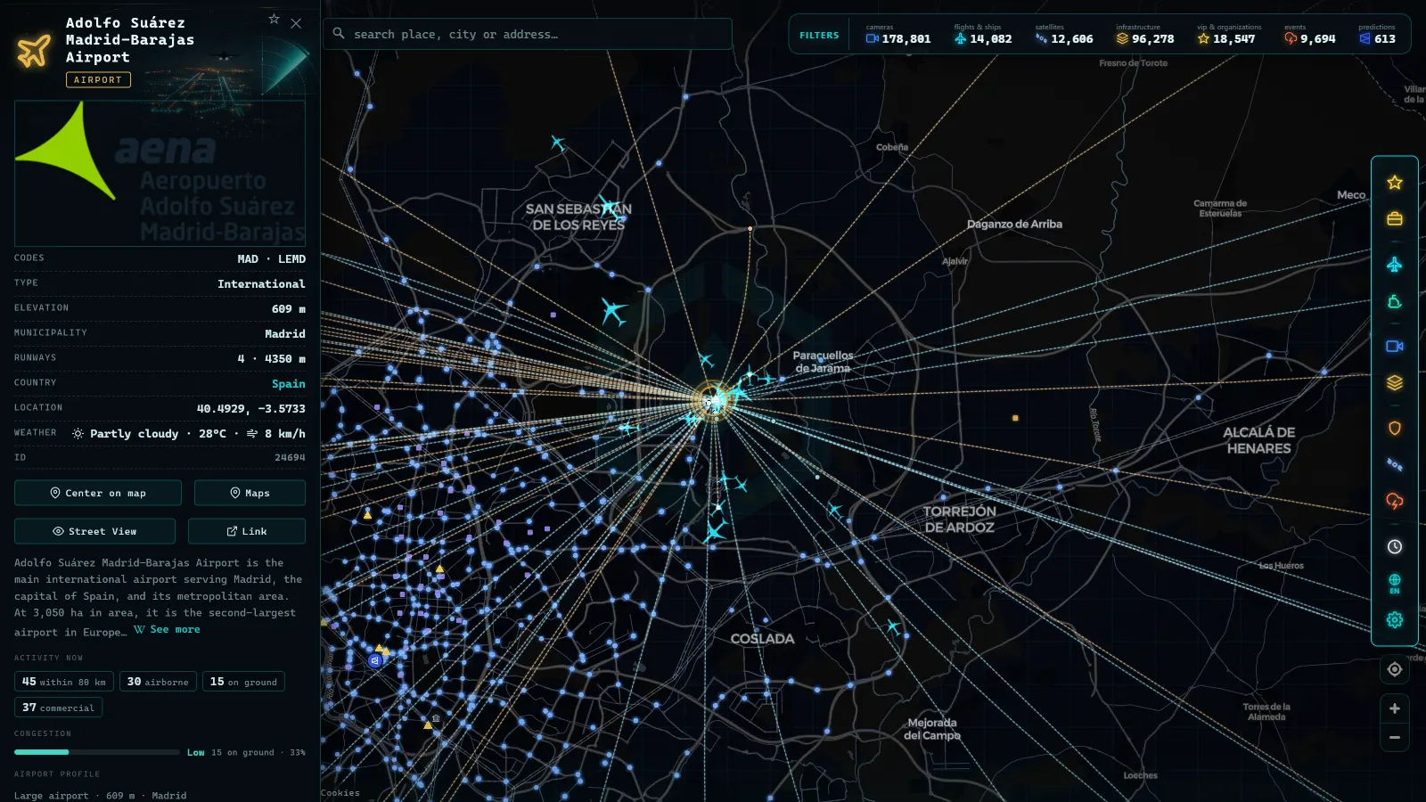
The full list: IATA and ICAO codes for Spain's airports
Here is the quick reference for the most relevant Spanish airports, laid out the way you will meet it on tickets, tags and maps:
| IATA | ICAO | Airport | City |
|---|---|---|---|
| MAD | LEMD | Adolfo Suárez Madrid-Barajas | Madrid |
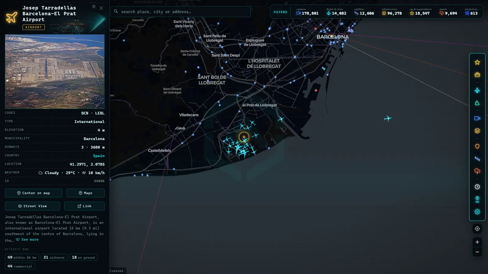
| BCN | LEBL | Josep Tarradellas Barcelona-El Prat | Barcelona |
| PMI | LEPA | Palma de Mallorca | Palma de Mallorca |
| AGP | LEMG | Málaga-Costa del Sol | Málaga |
| ALC | LEAL | Alicante-Elche | Alicante |
| VLC | LEVC | Valencia | Valencia |
| SVQ | LEZL | Seville | Seville |
| BIO | LEBB | Bilbao | Bilbao |
| LPA | GCLP | Gran Canaria | Las Palmas de Gran Canaria |
| TFN | GCXO | Tenerife North | Tenerife |
| TFS | GCTS | Tenerife South | Tenerife |
| SCQ | LEST | Santiago de Compostela | Santiago de Compostela |
Note the cases that defy intuition: Málaga's IATA code is AGP (not "MAL"), Seville's is SVQ, and Gran Canaria's is LPA, after Las Palmas. IATA codes don't always derive from the city name as we write it today: many come from historical names or simply from whichever combinations were still free when they were assigned. The table also previews the other Spanish quirk: every mainland and Balearic ICAO code starts with LE, while the Canarian ones start with GC. Here is why.
From the ARGOS ATLAS channel.
How to read Spanish ICAO codes: LE and GC
ICAO codes tell a small geographic story. The first letter identifies a large world region and the second narrows it down to a country or zone:
- LE: mainland Spain and the Balearics. The L covers southern Europe (Italy is LI, Portugal is LP, Greece is LG) and the E identifies Spain. Hence LEMD (Madrid), LEBL (Barcelona) and LEPA (Palma).
- GC: the Canary Islands. The G belongs to a region grouping northwest Africa, consistent with the archipelago's geographic position, and the C identifies the Canaries. That is why Gran Canaria is GCLP and Tenerife South is GCTS.
As a table, the split is as simple as this:
| ICAO prefix | Territory | Examples |
|---|---|---|
| LE | Mainland Spain and the Balearics | LEMD (Madrid), LEBL (Barcelona), LEPA (Palma) |
| GC | Canary Islands | GCLP (Gran Canaria), GCTS (Tenerife South), GCXO (Tenerife North) |
The last two letters usually point to the specific airport: MD for Madrid, BL for Barcelona-El Prat, LP for Las Palmas. This hierarchical system has one huge practical advantage: from any ICAO code, a pilot or an enthusiast instantly knows roughly where in the world the airport sits, something IATA codes cannot tell you.
What the codes are for in practice
Beyond trivia, the codes have very concrete uses:
- Booking flights without mistakes. Searching by IATA code removes ambiguity between similarly named cities or cities with several airports. In Spain the classic case is Tenerife: TFN (North) and TFS (South) are a considerable distance apart, and mixing them up complicates a trip.
- Reading your baggage tag. The three-letter code printed on the tag is your suitcase's final destination. Checking it on connections is a habit that saves headaches.
- Following flights in real time. Aviation maps identify origin and destination by code. If you know a relative is flying LPA to MAD, spotting their aircraft is instant. Our guide to watching aircraft in real time explains the ADS-B system that makes it possible.
- Understanding aviation as infrastructure. Major airports are nodes of critical infrastructure: they concentrate connectivity, cargo and essential services, and their codes are the standard way to refer to them in any analysis.
How to watch each Spanish airport live on the map
A code stops being an abstract acronym when you see it on a map with real data. On the ARGOS ATLAS map, every Spanish airport has its own card: open it and you see its position, its codes and the aircraft arriving and departing in real time, thanks to the ADS-B signals broadcast by the aircraft themselves. Around it you can switch on more layers (public cameras in the area, ships if the airport sits on the coast) and build a complete picture of the surroundings.
It is a very visual way to compare airports: the traffic density of MAD or BCN versus regional fields, the constant drip of inter-island flights in the Canaries, or the summer peaks at PMI and AGP. If you are curious how Spain's big hubs compare with the rest of the continent, we have an analysis of Europe's busiest airports; and if Spain leaves you wanting more, carry on with Mexico's biggest airports and compare how traffic is organized on the other side of the Atlantic.
Any public cameras you may find near an airport, like all cameras on the map, show wide general views and cannot identify people: they are there to show the state of the sky or the traffic, not to watch anyone.
Next time you spot LEMD on a flight plan or TFS on a baggage tag, it won't be a mystery: it is aviation's shared language, and now you speak it too.
Frequently asked questions
What is the airport code for Madrid?
Adolfo Suárez Madrid-Barajas Airport uses the IATA code MAD and the ICAO code LEMD. MAD is what you see on tickets and baggage tags; LEMD is what pilots, controllers and flight plans use.
Why do Canary Islands airports start with GC instead of LE?
ICAO codes are organized by region. The LE prefix covers mainland Spain and the Balearics, while the Canary Islands fall within a different region and use the GC prefix, such as GCLP for Gran Canaria or GCTS for Tenerife South.
Which code should I use when booking a flight?
Always the IATA code, the three-letter one. Search engines, airlines and baggage tags all work with IATA codes like MAD, BCN or PMI. The four-letter ICAO code is for technical use and never appears in ticket sales.
Can I watch flights at a Spanish airport in real time?
Yes. On a map with ADS-B data, such as ARGOS ATLAS, you can open each airport's card and watch arriving and departing aircraft in real time, alongside public cameras and other live layers in the area.
Is there a free map to see Spain's airports live?
Yes. The ARGOS ATLAS map is free: every Spanish airport has its own card with its IATA and ICAO codes and the aircraft arriving and departing in real time via ADS-B, alongside public cameras and other live layers in the area.
- Biggest Airports in the US: Ranked List (Live Map)
- The Biggest Airports in the World: 2025 Passenger Ranking
- Iran on a Live Map: Airports, Flights and Hormuz Ships
- Biggest Airports in the Middle East: 6 Hubs, Live Data
- Italy Airports Live Map: 4 Fields and What They Hide
- Mumbai live map: ships, flights and port data in real time