Blog · Critical infrastructure
Busiest Airports in Mexico: Track Live Flights Now
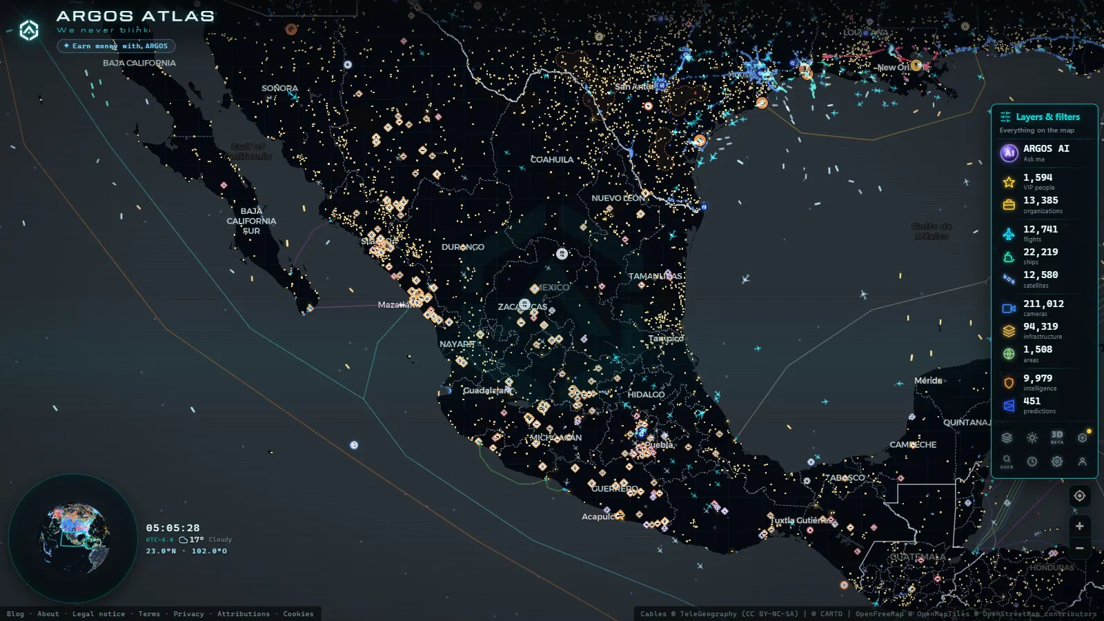
Mexico operates one of the largest and most complex aviation networks in Latin America. The country's airports handle more than 85 million passengers a year across the national system (a figure that surpasses pre-pandemic levels) making air travel a critical pillar of both the tourism economy and domestic connectivity. This article profiles Mexico's most important airports, examines their traffic and route networks, and shows how ARGOS ATLAS lets you watch live aircraft movements over each of them.
The essentials, in 20 seconds
- AICM: Mexico City's Benito Juarez airport handles over 40 million passengers a year, the busiest in the country
- AIFA: opened in March 2022 about 50 km north of Mexico City, with a 4,200 meter runway, the longest in Mexico
- 20 million passengers: AIFA's designed capacity for its first phase, versus roughly 32 million at AICM
- 8 km: AICM's distance from central Mexico City, compared with AIFA's roughly 50 km
- 85 million passengers: total annual traffic across Mexico's national airport system
AICM: Mexico City's Historic Aviation Hub
The Benito Juarez International Airport in Mexico City (AICM), IATA code MEX, is the highest-traffic airport in Mexico and one of the busiest in all of Latin America. Operating since the 1940s, it currently handles over 40 million passengers annually under chronically saturated conditions.
Its location inside the urban fabric of Mexico City (Metro Line 5 connects directly to Terminal 1) makes it remarkably accessible from the city center, but it also imposes severe operational constraints. Runways are shorter than modern large-body aircraft prefer, and platform space limits simultaneous operations. Delays during peak periods are common, and slot allocation is tightly controlled.
AICM's international network is extensive, connecting Mexico City with Los Angeles, Miami, New York, Houston, Chicago, Madrid, Bogota, Lima and Sao Paulo, among dozens of other destinations. Aeromexico, Volaris, VivaAerobus, American Airlines, Delta, United, Iberia, Air France, Lufthansa and KLM all maintain regular operations here.
"AICM functions at or above its nominal capacity during major holiday periods, making it one of the most operationally constrained major airports in the Americas relative to its traffic volume."
AIFA: The Government's Bet on Decongestion
The Felipe Angeles International Airport (AIFA), IATA code NLU, was inaugurated in March 2022 on the site of the Santa Lucia Air Force Base in the State of Mexico, roughly 50 kilometers north of central Mexico City. The federal government invested approximately 75 billion pesos and positioned it as the structural answer to AICM's saturation.
AIFA's main runway stretches 4,200 meters (the longest in Mexico) and can accommodate wide-body aircraft. The terminal was designed for 20 million passengers per year in its first phase. However, traffic growth has been gradual. The distance from Mexico City's downtown core (between 50 and 90 minutes depending on road traffic) and limited mass transit options have slowed widespread adoption by travelers and airlines alike.
As of mid-2026, AIFA operates domestic routes alongside select international services to the United States, Cuba and Central America. Its medium-term growth depends heavily on whether the federal government can negotiate frequency transfers from AICM to AIFA with major commercial carriers.
Infrastructure Comparison: AICM vs AIFA
| Feature | AICM (MEX) | AIFA (NLU) |
|---|---|---|
| Runways | 2 (3,900 m / 3,985 m) | 1 civil (4,200 m) + 1 military |
| Terminals | 2 (T1 and T2) | 1 |
| Designed capacity | ~32 M pax/year | 20 M pax/year (phase 1) |
| Distance to CDMX center | ~8 km | ~50 km |
From the ARGOS ATLAS channel.
Guadalajara: Mexico's Second Metropolis in the Air
Miguel Hidalgo y Costilla International Airport (GDL) serves the Guadalajara Metropolitan Area, Mexico's second-largest city and its technology manufacturing capital. With approximately 12 to 14 million annual passengers in recent figures, it is the second-busiest airport in Mexico for regular commercial traffic.
International routes from Guadalajara connect to major US cities including Chicago, Dallas, Houston, Los Angeles, San Jose, San Francisco, Seattle and Las Vegas, as well as Canadian cities and seasonal European destinations. Guadalajara's role as Mexico's "Silicon Valley" (home to Intel, IBM, HP and dozens of other technology companies) generates consistent corporate travel demand that stabilizes the airport's traffic through business cycles.
The terminal has undergone modernization and expansion in recent years, though peak holiday periods (Semana Santa and December in particular) push it close to operational limits.
Cancun: King of International Tourism
Cancun International Airport (CUN) occupies a unique position in Mexico's aviation system. By international passenger volume, it may well be the most significant airport in the country. It handles more than 25 million passengers annually, the majority of them tourists from the United States, Canada and Europe arriving for the Riviera Maya.
Cancun handles an unusually high proportion of charter and seasonal flights, particularly from Canadian and European cities during the northern winter. Its three active terminals (T2, T3 and T4, after T1 was repurposed) distribute traffic among low-cost carriers, full-service airlines and tour operators.
Key origin markets include Miami, New York, Toronto, Montreal, Chicago, Atlanta, Houston, Dallas, Madrid, Amsterdam, London and Frankfurt. The airport's ability to absorb direct long-haul leisure traffic without the runway and slot constraints of AICM makes it structurally different from any other Mexican airport.
Why Cancun Dominates Beach Tourism
Several factors explain Cancun's outsized role as an international gateway:
- Proximity to high-value beach destinations (Playa del Carmen, Tulum, Holbox, Cozumel, Bacalar)
- Massive hotel inventory that justifies long-haul direct routes
- Fewer operational constraints than AICM
- Continuous infrastructure investment by airport group ASUR (Grupo Aeroportuario del Sureste)
- Year-round favorable climate that smooths seasonal demand
Monterrey: The Industrial Northeast's Hub
General Mariano Escobedo International Airport (MTY) serves the Monterrey Metropolitan Area, Mexico's industrial and financial capital in the north. With a base of corporate rather than leisure travelers, its traffic ranges between 10 and 12 million passengers annually, showing robust recovery and growth since the pandemic.
The most important routes connect Monterrey with Mexico City, Houston, Dallas, Chicago, Miami and northern border cities. Monterrey's geographic proximity to Texas (less than 200 kilometers from the border by road) makes it a logical node for binational businesses and supply chain operations in the manufacturing-intensive northeast.
The airport operates two terminals and has expanded in recent years to accommodate growth from low-cost carriers Volaris and VivaAerobus, which now dominate much of Mexican domestic aviation.
Los Cabos: Luxury Tourism at the Southern Tip
Los Cabos International Airport (SJD) serves the Los Cabos tourism corridor in Baja California Sur. Its absolute passenger numbers (between 4 and 6 million annually) are smaller than Cancun or Guadalajara, but its traveler profile skews toward high-income leisure visitors and the proportion of international flights is high.
The primary feeder markets are western US cities: Los Angeles, San Francisco, Las Vegas, Phoenix, Seattle and San Diego. The airport shows pronounced seasonality, with peaks during the northern hemisphere winter when demand for warm-weather destinations in North America is at its highest. Operations are managed primarily by airport group GAP (Grupo Aeroportuario del Pacífico).
Tracking Live Air Traffic Over Mexico
ARGOS ATLAS aggregates real-time ADS-B aircraft position data across all of Mexico. On the map you can watch approach and departure trajectories over AICM, AIFA, Cancun, Guadalajara, Monterrey and Los Cabos, identify which airlines are operating at any given moment, and follow individual flights as they cross Mexican airspace.
The airport layer marks major terminals as fixed nodes on the map, letting you correlate aircraft movement with ground infrastructure. From the live flights tab, you can filter by geographic area and observe how air traffic over Mexico City is consistently denser than anywhere else in the country, a visible reflection of AICM's central role in the national network.
For those interested in critical infrastructure, Mexican airports offer a window into the country's real connectivity: the traffic distribution between AICM and AIFA, Cancun's weight in international tourism, and the growth trajectory of cities like Monterrey and Guadalajara all provide indirect readings of economic development and regional integration.
Explore live air traffic over Mexico on ARGOS ATLAS, where flights, ships, cameras and critical infrastructure come together on a single real-time map. You can also read more about global aviation infrastructure in our coverage of the world's busiest airports.
Frequently asked questions
Which is the busiest airport in Mexico?
Mexico City's Benito Juarez International Airport (AICM) remains the highest-traffic airport in the country, handling over 40 million passengers annually. The new Felipe Angeles International Airport (AIFA) was built to relieve congestion and has greater theoretical capacity but is still ramping up traffic.
What is the AIFA airport and how does it differ from AICM?
AIFA (Felipe Angeles International Airport) opened in March 2022 on the former Santa Lucia military base, about 50 km north of Mexico City. It operates domestic and some international flights with less congestion but limited public transport links to the city center.
Can I track live flights over Mexican airports?
Yes. ARGOS ATLAS displays real-time ADS-B aircraft positions across Mexico. You can watch approach and departure paths over AICM, Cancun, Guadalajara, Monterrey and other airports directly on the live map.
- Europe's Major Seaports: Rotterdam, Antwerp, Hamburg, Valencia, Algeciras and Piraeus
- Europe's Busiest Airports: Heathrow, Charles de Gaulle, Schiphol, Frankfurt, Istanbul and Madrid-Barajas
- Canada's Major Seaports: Vancouver, Prince Rupert, Montreal and Halifax
- Spain Airport Codes: IATA & ICAO + Live View
- Biggest Airports in the US: Ranked List (Live Map)
- The Biggest Airports in the World: 2025 Passenger Ranking