Blog · Traffic cameras
Jakarta Traffic Cameras Live, on a Map
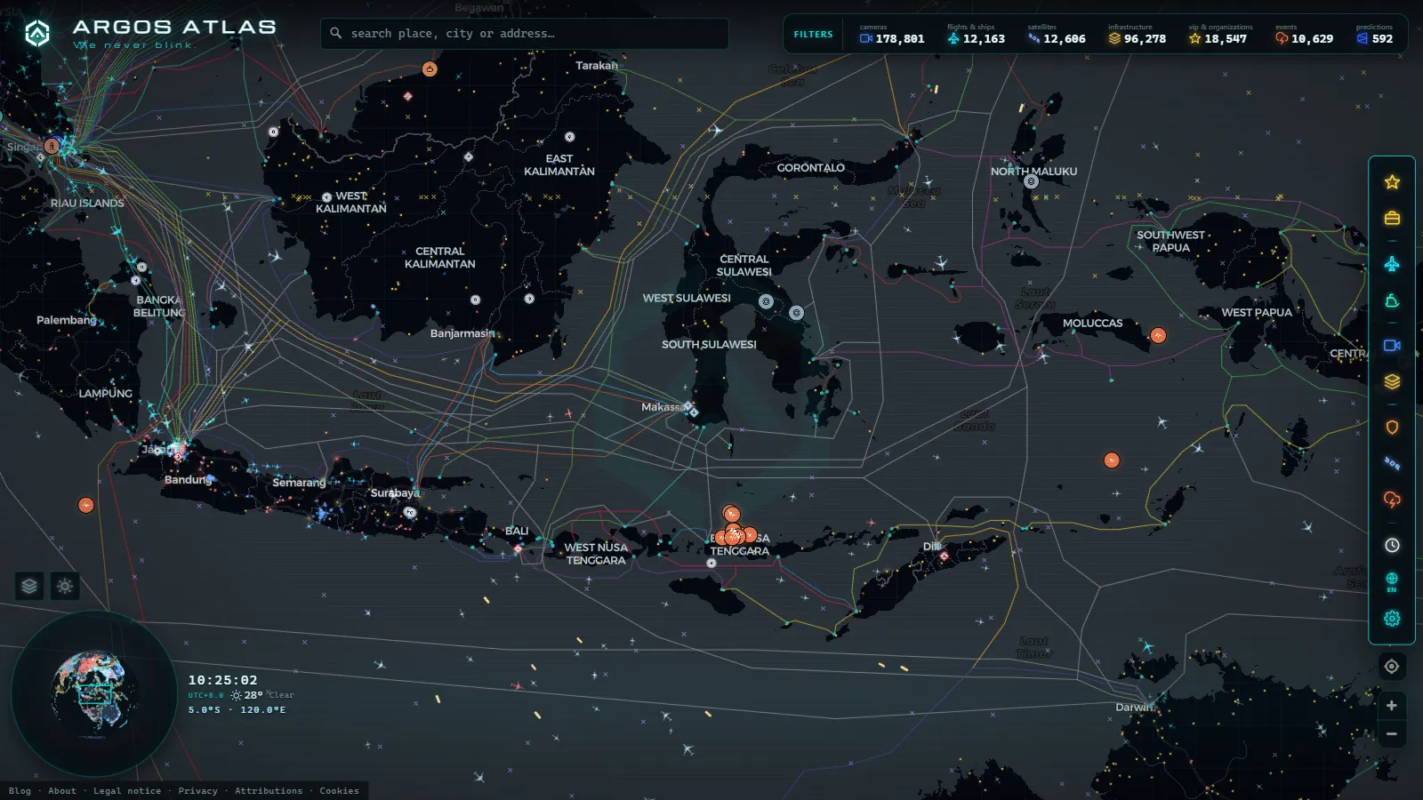
Jakarta is the largest single-city cluster of public traffic cameras in our catalogue, which currently holds 200,000+ cameras worldwide (count as of September 2026). That is not a quirk of scraping. When a metropolitan area of tens of millions of people carries a congestion problem that keeps appearing in global rankings, camera feeds stop being a security asset and start being a public service. The city publishes them, and anyone can look.
What follows is a working guide to that estate: which agencies run the feeds, why Central Jakarta (Jakarta Pusat) and South Jakarta (Jakarta Selatan) carry most of the useful cameras, which corridors you actually get to see, and the hours when watching pays off. It also says plainly what you will not see, because in Jakarta the gaps tell you as much as the coverage does.
The essentials, in 20 seconds
- 200,000+ cameras worldwide: Jakarta is the largest single-city cluster in our catalogue (count as of September 2026).
- Four operators: Dinas Perhubungan DKI Jakarta, Jakarta Smart City, TMC Polda Metro Jaya and Jasa Marga each run a separate network.
- Jakarta Pusat and Jakarta Selatan: these two districts carry most of the useful cameras, covering the Thamrin-Sudirman spine and the southern commuter corridors.
- 06:30 to 09:30 WIB: the morning peak window for Central Jakarta's junction cameras.
- 16:30 to 20:00 WIB: the evening peak window for South Jakarta's arterial and interchange cameras.
Who operates Jakarta traffic cameras
Jakarta's cameras are not one system. They are at least four, run by organisations with different jobs and different reasons to point a lens at a road.
Dinas Perhubungan DKI Jakarta, the provincial transport agency, is the backbone. Its cameras belong to the Area Traffic Control System, the network that manages signal timing across the city. They sit on signal gantries and mast arms at junctions, aimed down an approach lane rather than at a skyline. That is why so many Jakarta views look like an engineer's angle: because that is exactly what they are.
Jakarta Smart City is the reason much of that feed is reachable from outside a control room. It is the city's data arm, the same organisation behind the JAKI app and the municipal open data effort, and its job is publication rather than operation.
TMC Polda Metro Jaya, the metropolitan police traffic management centre (with NTMC Polri above it at national level), has a different bias. Police cameras cluster on incident-prone arteries, on the big interchanges and at the points where enforcement happens. They are also the ones most likely to be panned by a human operator while you are watching.
Jasa Marga, the toll road operator, covers what the city agency does not: the elevated and at-grade toll network, including the inner ring, the Jagorawi route towards Bogor, and the airport run out to Soekarno-Hatta.
One distinction matters more than all four names. A camera that exists is not a camera that is published, and only feeds released as open streams ever reach an aggregator. The general version of that argument is in our explainer on how traffic cameras work and why they are public, and it is the first thing to check anywhere in the world.
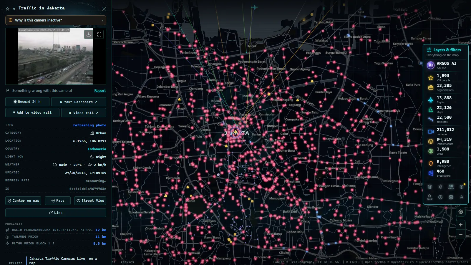
Jakarta traffic cameras live: why Central and South carry the weight
Central and South Jakarta hold the majority of the cameras worth opening, and the reason is economic geography rather than administrative favouritism.
Jakarta Pusat contains the national government quarter, the Monas area, Bundaran HI and the northern half of the Thamrin and Sudirman axis, which is the single most important road in the country in terms of daily vehicle load. It is also the oldest part of the signal control network, so the junction density and the camera density track each other closely.
Jakarta Selatan is where the office towers, the embassies and the commuter funnel meet. Traffic arriving from Depok, Bogor and the southern suburbs enters the city through South Jakarta, which means its cameras are the ones that tell you whether the evening exodus has started. The southern half of Sudirman, the Semanggi cloverleaf, Kuningan and the TB Simatupang arterial all sit here.
We do not publish a per-district camera count, and that is deliberate. Our catalogue records the publishing source, not Indonesian administrative boundaries, and plenty of cameras sit exactly on the seam between the two districts (a camera on Jalan Gatot Subroto can reasonably be filed under either). Rather than invent a split, here is what each district's cameras are actually good for.
From the ARGOS ATLAS channel.
Jakarta traffic cameras by district: what each group watches
| District | Camera character | Corridors you will actually see | Best window (WIB) |
|---|---|---|---|
| Jakarta Pusat (Central) | Dense grid of junction gantry cameras, fixed angles | Jalan MH Thamrin, Bundaran HI, northern Sudirman, Senen, Salemba, Kemayoran | 06:30 to 09:30 |
| Jakarta Selatan (South) | Arterial and interchange cameras, more spread out | Southern Sudirman, Semanggi, Jalan HR Rasuna Said (Kuningan), Blok M, Fatmawati, TB Simatupang | 16:30 to 20:00 |
| Toll network (Jasa Marga) | Mast cameras looking along the carriageway | Cawang to Tomang to Pluit inner ring, Jagorawi, airport road | Useful all day |
| Jakarta Barat and Utara (West and North) | Thinner, concentrated on major junctions and port approaches | Grogol, Slipi, Tanjung Priok approaches | 06:30 to 09:30 |
| Jakarta Timur (East) | Sparse outside the interchange complexes | Cawang, Halim approaches, eastern ring links | 16:30 to 20:00 |
The pattern in that table is worth stating out loud: coverage follows the arterial grid and the toll network, not population. A district can hold millions of people and still show up as a handful of dots, because the cameras are there to manage signals on big roads, not to observe neighbourhoods.
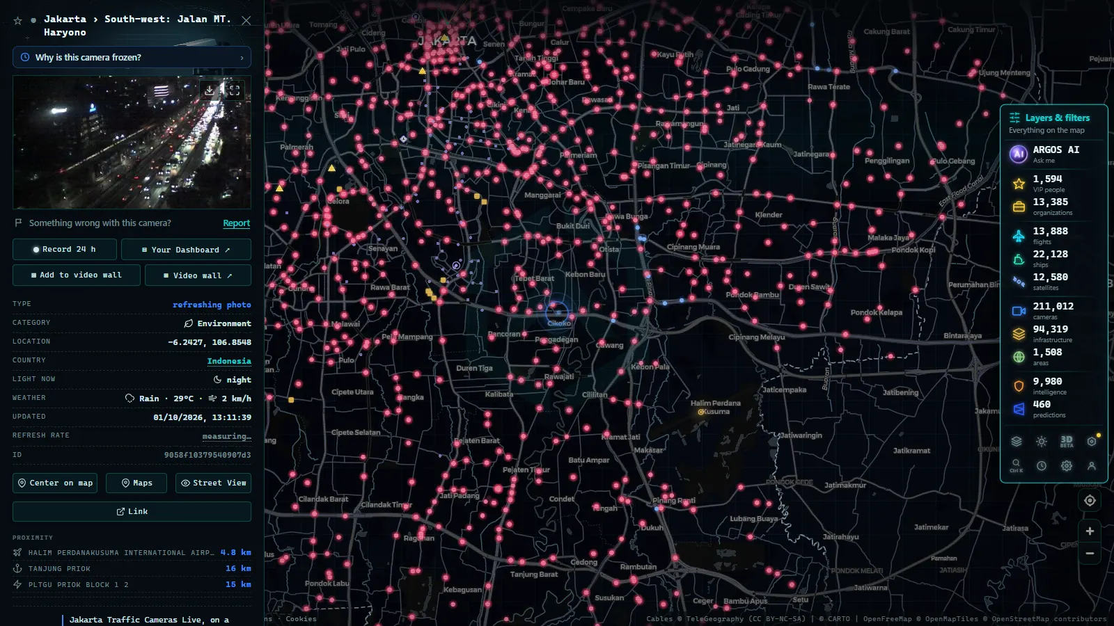
The corridors these cameras actually cover
If you only ever watch one thing in Jakarta, watch the Thamrin and Sudirman spine. It runs from the Monas area south through Bundaran HI, past the Semanggi interchange and on towards Blok M, and it carries the TransJakarta bus rapid transit corridor down the middle. Because the busway has dedicated lanes, the cameras give you two readings at once: general traffic on the outside lanes and BRT flow in the centre. When the centre lane is also stopped, something structural has happened.
The second corridor is Jalan Gatot Subroto, the inner ring arterial that crosses the spine at Semanggi. Semanggi itself is the most photogenic junction in the city and one of the most useful, because a blockage there propagates in four directions within minutes.
Third is Jalan HR Rasuna Said through Kuningan, the embassy and office strip that absorbs a large share of the evening southbound load. Fourth is TB Simatupang, the southern arterial that acts as an outer bypass for traffic that does not want to enter the core at all.
There is one Jakarta-specific use that no other city on our map matches: rain. During the wet season, the underpasses and low sections flood fast, and a camera is the quickest honest answer to whether a route is passable. A weather app tells you it is raining. The camera tells you there is standing water at the underpass and that three lanes have merged into one.
What Jakarta traffic cameras will not show you
This is the part most guides skip, so here it is straight.
- Many feeds are refreshing stills, not video. You get a recent frame, often a few seconds old, not a broadcast. That is normal for an Area Traffic Control System and it is enough for flow assessment.
- Night coverage is weak. A large share of junction cameras have no infrared illumination, so after dark you get headlights on a dark field and little else.
- No audio, no identification. The published resolution cannot read a number plate or recognise a face, and it is not meant to. Enforcement runs on a separate network that is not public.
- The residential city is invisible. Kampung streets, gang alleys and the small roads where a large part of daily movement happens carry no cameras at all. What you are watching is the arterial skeleton.
- Cameras drop out constantly. Power cuts at the junction cabinet, maintenance and link failures are routine in a network this size. If a view is dark or frozen, our guide to why a traffic camera stops working covers the usual causes and what to try instead.
We also do not host any of this video. We link to the operator's own stream, which means the picture you see is the picture the agency is publishing, with no re-encoding and no middleman. If you want to verify that for yourself, the method is in how to tell whether a webcam is official.
Best hours to watch Jakarta traffic in real time
Jakarta runs on WIB, which is UTC+7. That makes the morning peak (roughly 06:30 to 09:30 local) land in the middle of the European night and the late European afternoon, and the evening peak (roughly 16:30 to 20:00 local) fall in the European morning. For a viewer in Madrid or London, the evening rush is the convenient one.
Three local rhythms are worth knowing. Friday midday brings a shift in flow around prayer times that shows up clearly on the central cameras. The wet season, broadly from late in the year through to spring, produces afternoon storms that turn a normal peak into a standstill. And the days around Eid al-Fitr produce the mudik exodus, when the toll cameras on the outbound routes become the most interesting views in the country and the city cameras show something Jakarta almost never is, which is empty.
How to open Jakarta traffic cameras live on the map
Open the live map, zoom into Jakarta and turn on the camera layer. Each dot is one published feed. Clicking it opens a panel with the operator, the location and a direct link to the stream, so you always know who is showing you the picture. There is no account, no paywall and no app.
A practical tip for a city this dense: zoom in before you start clicking. At city-wide zoom the dots cluster into blobs and you cannot tell a Sudirman gantry from a side-street junction. Zoom to a single corridor, follow it dot by dot, and you can read the whole length of a jam in about a minute.
If you want to compare how different countries handle the same problem, the contrast with other Asia-Pacific networks is instructive: Japan's traffic cameras are split between a national expressway operator and prefectural police, while Australia's state road authorities publish under a single per-state brand. Jakarta sits between the two, with a strong city agency, a police network alongside it and a toll operator filling the gaps.
Frequently asked questions
Is watching Jakarta traffic cameras free, live and without an account?
Yes. The feeds are published by Indonesian public bodies, and our map shows them without registration, payment or an app install. Open the map, zoom to Jakarta, click a camera dot and the stream opens. \"Live\" needs one caveat: many Jakarta cameras deliver a still image that refreshes every few seconds rather than continuous video, so what you get is a very recent photograph, not a broadcast.
Who actually operates the traffic cameras in Jakarta?
Four organisations cover almost everything. Dinas Perhubungan DKI Jakarta runs the Area Traffic Control System cameras on signal gantries, which is the bulk of the network. Jakarta Smart City publishes much of that data. TMC Polda Metro Jaya, the metropolitan police traffic centre, operates cameras on incident-prone arteries. Jasa Marga covers the toll roads, including the inner ring and the airport route.
Which Jakarta corridors have the best camera coverage?
The Thamrin and Sudirman axis running north to south through Central and South Jakarta is the best covered stretch in the city, followed by Jalan Gatot Subroto and the Semanggi interchange, Jalan HR Rasuna Said through Kuningan, and the Blok M and Fatmawati approaches in the south. Coverage thins quickly once you leave the arterial grid.
Why does a Jakarta camera show a black, frozen or missing image?
The most common reasons are night hours on a camera without infrared illumination, a maintenance window, a power or link failure at the junction cabinet, or an operator moving a pan-tilt-zoom unit mid-frame. Heavy rain also produces images that are technically working and visually useless. If a camera stays dead for days, the operator has usually taken it out of service.
Can these cameras identify people, vehicles or number plates?
Not at the resolution published to the public. The open streams are compressed heavily and framed for flow assessment: you can tell whether a lane is moving, whether a junction is blocked and whether an underpass has standing water. Reading a plate or recognising a face from these images is not possible, and the enforcement systems that do that are a separate, non-public network.
- Utah Traffic Cameras UDOT: Live on a Map
- Milan Traffic Cameras Live: 2 Airports, 1 Plant, 0 City Cams
- Naples Traffic Cameras Live: What You Can Really Watch
- Palermo live cameras and port: ferries, cruises and flights
- Turin Traffic Cameras: the 3 Roads That Decide Your Trip
- Bologna traffic cameras: A1, A14 and Marconi airport