Blog · Traffic cameras
Palermo live cameras and port: ferries, cruises and flights
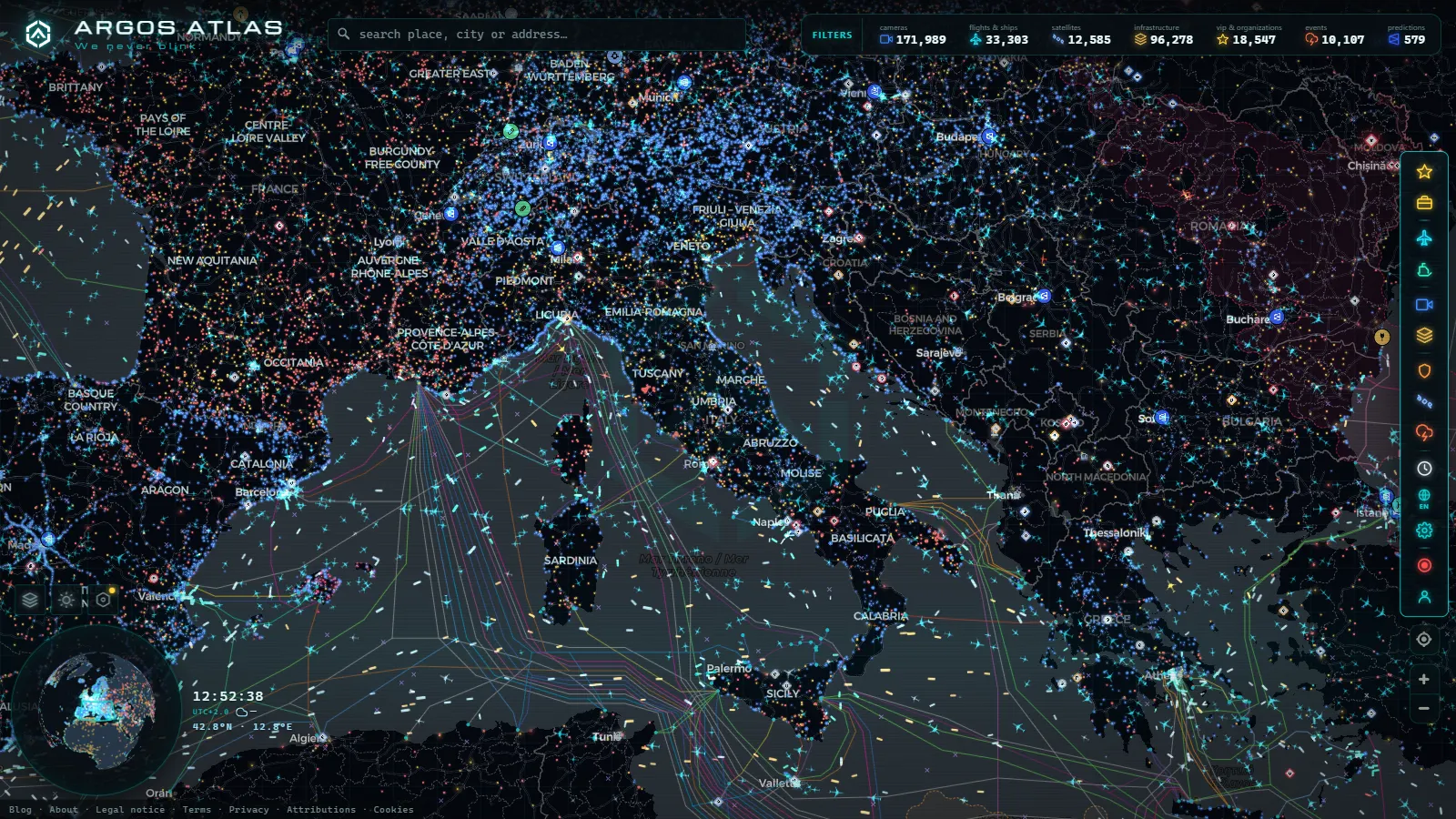
Palermo is easier to follow from the water than from the street. The port broadcasts constantly: every ferry heading for Naples, every overnight run to Genoa, every cruise ship that ties up for eight hours and leaves again, all of it carries an AIS transponder that a receiver on the Sicilian coast can hear. The streets are the opposite. There is no public municipal traffic camera feed for Palermo on our live map, and pretending otherwise would only waste your afternoon.
So this article is built the way the data is built, with the port as the spine and the city hanging off it. What follows is layer by layer: what you can genuinely watch in and around Palermo right now, what sits behind each layer, and which layers are simply blank over Sicily.
What "Palermo live cameras port" actually gets you today
People typing that phrase usually want one of three different things, and they are not equally available.
The first is a webcam pointed at the harbour, the postcard shot of the Cala at sunset. Those feeds exist, run by hotels, marinas and local news sites, but they are private, they change URL without warning and they go dark for months. We index official public sources, so they are not in our catalogue. The camera layer is large (200,000+ cameras worldwide, count as of September 2026) and still has nothing to show you on a Palermo street corner.
The second is the actual movement of the port: which ship is alongside, which one just cleared the breakwater, where the Naples ferry is at two in the morning. That is fully available, and it is the reason this page exists.
The third is the air side, meaning arrivals and departures at Falcone-Borsellino. Also available, with the usual caveats about how ADS-B behaves over water.
The port of Palermo live: ferries to Naples and Genoa
Palermo is a passenger port first. The commercial quays sit at the northern edge of the old town, close enough that the superstructure of a cruise ship becomes part of the skyline for the day, and the routes that dominate the traffic are the Tyrrhenian crossings: Naples, Genoa, Civitavecchia, plus the seasonal island and North African services. Operators such as Grandi Navi Veloci and the Grimaldi group have worked these lines for years, and the Naples crossing in particular is a night run in both directions during most of the year.
That rhythm is what makes the port readable. Late evening, two or three large passenger vessels leave within the same hour and their tracks fan out northeast across the Tyrrhenian. Early morning, the same shapes come back in. Between those two windows the harbour is mostly cruise calls, tugs, pilot boats, coastal cargo and the fishing fleet.
The port layer holds 1,081 ports worldwide (count as of August 2026), and what a port marker gives you is context rather than a picture: position, the traffic clustered around it, the vessels currently stopped inside it. If you want the same view for the giants of the continent, the piece on the largest European ports covers Rotterdam, Antwerp, Hamburg, Valencia, Algeciras and Piraeus, all of which behave very differently from a Sicilian passenger port.
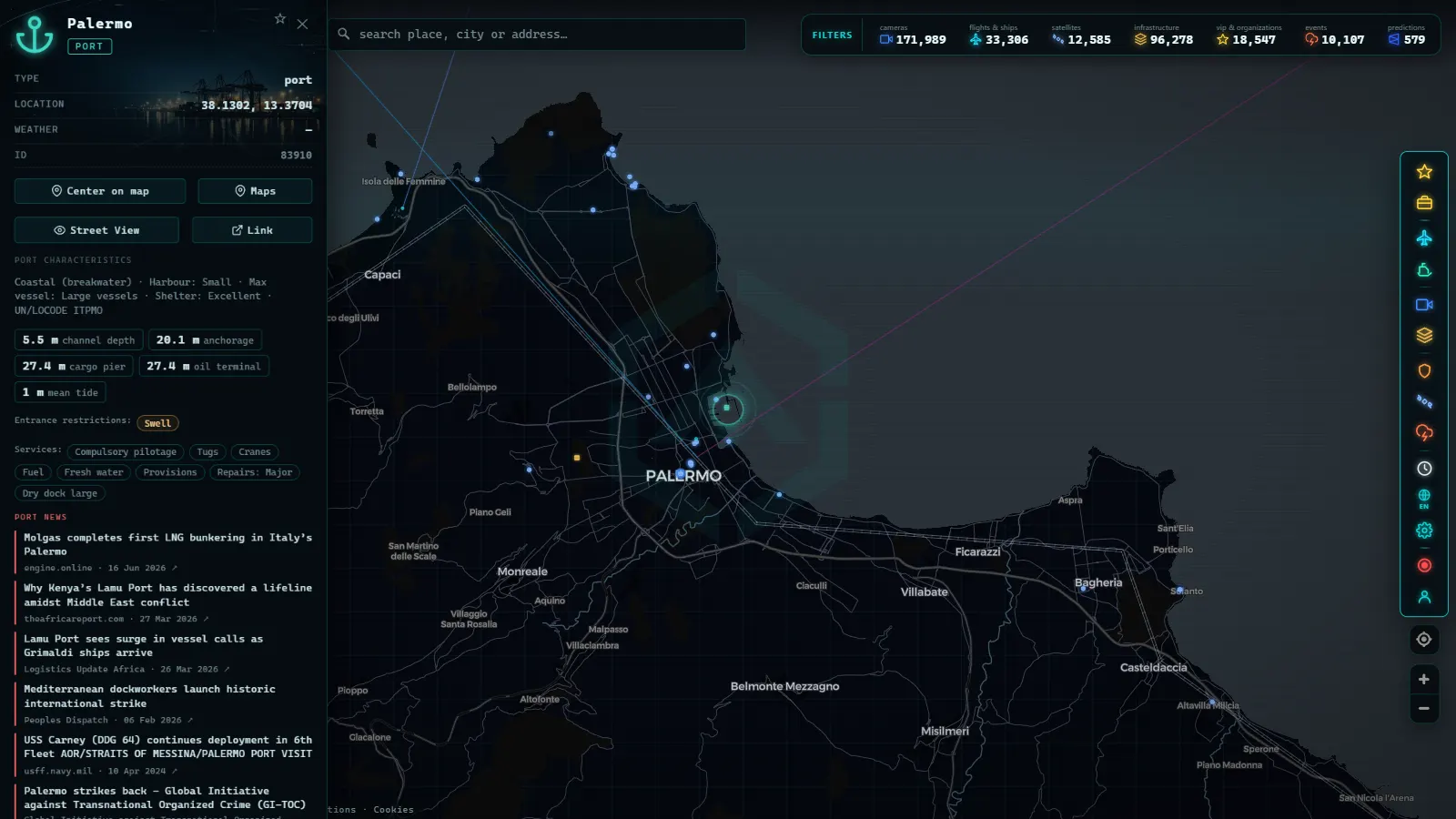
Reading the ship layer like a port worker
The live map is currently showing 22,959 vessels transmitting, out of 35,600 tracked over the recent period. Around Palermo the density is comfortable rather than overwhelming, which makes it a good place to learn how to read the layer.
Three habits do most of the work:
- Speed tells you the phase. Zero knots alongside means berthed. One to four knots with a swinging heading means manoeuvring, usually with tug assistance. Anything above twelve knots outside the breakwater is a passenger ship already on passage.
- Type separates the traffic. A passenger vessel and a container ship look identical as a dot and behave nothing alike. Filter by type before you try to guess.
- Track history beats a snapshot. A single position tells you almost nothing. The previous hour of track tells you whether a ship is arriving, leaving or holding offshore waiting for a berth.
AIS was designed for collision avoidance between ships, not for the public, which is exactly why it is so useful to us. The mechanics, including what a vessel can legally switch off, are explained in the guide to how AIS ship tracking works. For the wider basin, from the Sicily Channel to the Aegean, the article on live ships in the Mediterranean is the better starting point.
One honest limitation: AIS is received by coastal stations, so coverage follows the coastline. Palermo's approaches are well covered. The middle of the Tyrrhenian is thinner, and a ferry can go quiet for a stretch before reappearing near Capri. That silence is a gap in reception, not a mystery.
From the ARGOS ATLAS channel.
Palermo live cameras: the honest answer about street views
Here is the part most pages skip. There is no live traffic camera on the streets of Palermo in our map. Not a small number, not a low quality one. None.
The reason is structural rather than technical. In Italy the cameras published as open feeds belong overwhelmingly to the motorway and trunk road operators, so the coverage we can legally and reliably ingest runs along the autostrade and the mountain passes, not through city centres. Sicily gets some of that road coverage on its main corridors, but a city like Palermo, where the municipal cameras are operated for traffic management and enforcement rather than for public viewing, contributes nothing.
If road conditions are what you are after, the country-level piece on traffic cameras in Italy explains which operators publish what, and where the useful views actually are. And if you want a comparison with a city that does publish generously, look at how different London or the American state systems feel: thousands of public street views in a single metropolitan area, versus a Sicilian capital with none.
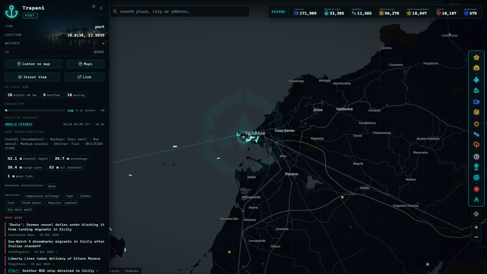
Falcone-Borsellino and the flights over western Sicily
The airport sits about thirty kilometres west of the city at Punta Raisi, wedged between the mountains and the sea, which is why the approach is one of the more photogenic in Italy and why the flight layer over that stretch of coast is worth watching.
Globally the map is tracking 16,377 aircraft in the air right now, with 3,595 of those positions estimated between updates and 134 identified as military. The airport layer itself carries 47,927 entries worldwide, from major hubs down to airstrips, so Falcone-Borsellino appears with its runway geometry and the traffic around it rather than as a bare pin.
What to expect in practice: a steady trickle of domestic services to Rome and Milan through the day, a heavy northern European charter and low cost load in summer, and long gaps overnight. Two caveats worth stating plainly. ADS-B coverage over the sea depends on ground receivers, so aircraft can go briefly dark over open water on the southern and western approaches. And military traffic is inconsistent by design: some transponders are simply off. The primer on tracking aircraft in real time goes through what the signal contains and what it never will.
Which layers have data over Sicily, and which are empty
This is the summary worth bookmarking. It is specific to Palermo and its surroundings, not to the global product.
| Layer | Palermo and Sicily | What you actually get |
|---|---|---|
| Ships (AIS) | Strong | Ferries, cruise calls, cargo, fishing fleet, live position and track |
| Ports | Yes | Port markers worldwide (1,081 as of August 2026) with the traffic around them |
| Flights | Yes | Live aircraft over the island, with gaps over open water |
| Airports | Yes | Falcone-Borsellino and the smaller Sicilian fields |
| Traffic cameras | Empty for the city | No municipal street cameras, motorway coverage only elsewhere in Italy |
| Energy infrastructure | Yes | Part of a global layer of 34,936 power assets |
| Conflict and fronts | Empty | 16 active fronts across 8 theatres worldwide, none in Italy |
The pattern is consistent: anything that moves and broadcasts is well covered, anything that depends on a local authority choosing to publish a video stream is not.
Opening Palermo on the map in under a minute
The fastest route to a useful view:
- Open the live map and search for Palermo. The view lands on the city with the default layers on.
- Zoom until the harbour fills roughly a third of the screen. Below that zoom the vessels cluster and you lose the individual movements.
- Turn off what you do not need. For a port session, ships and ports are enough. Turning off the rest makes the harbour far easier to read.
- Click any vessel to open its panel, then look at speed, type and recent track together rather than at the position alone.
- Switch the flight layer back on when you want the airport, and drag west to Punta Raisi.
Best times to look: the late evening departure window, when the northbound passenger ships leave within an hour of each other, and early morning, when they come back. A midday visit in low season can look almost static, which is accurate rather than broken.
One last piece of honesty. If you came here hoping to watch Palermo's traffic in a live video window, this map will not give you that today, and neither will most of the alternatives claiming to. What it will give you is something the postcard webcams never do: the port working, ship by ship, with the same data the harbour uses.
Frequently asked questions
Is the Palermo live map free, live and usable without an account?
Yes. The map is free, it updates live and it asks for no registration or email. Open it, search for Palermo and the ship, flight, port and infrastructure layers load straight away. There is no paywall on the layers described in this article and nothing to install.
Are there live traffic cameras on the streets of Palermo?
Not on our map. The Italian camera coverage we index is motorway and trunk road oriented, and Palermo's municipal cameras are not published as a public feed we can ingest. Harbour and seafront webcams run by hotels or local sites do exist elsewhere on the internet, but they are private feeds that appear and disappear, so we do not list them. What you get for Palermo instead is the port, the shipping around it, the airport and the flights above it.
Can I see the ferry from Palermo to Naples while it is at sea?
Usually yes, for most of the crossing. AIS reception is strong along both coasts, so departure from Palermo and arrival into Naples are well covered. The weakest stretch is the middle of the Tyrrhenian, where a vessel can go quiet for a while before reappearing. A ship that stops updating mid-sea is almost always a coverage gap, not a problem on board.
Why does a cruise ship in Palermo show a speed of zero knots?
Because it is alongside. AIS keeps transmitting while a ship is berthed, so a large vessel sitting at zero knots inside the harbour for several hours is simply moored at the cruise terminal. Watch the heading and speed together: a slow creep of one or two knots with a changing heading means it is manoeuvring, and anything above ten knots outside the breakwater means it has sailed.
Does the map show anything about Sicily's conflict or security layers?
Almost nothing, and that is the correct answer. The conflict layer tracks 16 active fronts across 8 theatres worldwide and none of them are in Italy, so over Sicily those layers are empty. The layers that do have substance there are maritime traffic, ports, aviation and energy infrastructure.
- Turin Traffic Cameras: the 3 Roads That Decide Your Trip
- Bologna traffic cameras: A1, A14 and Marconi airport
- Bari traffic cameras: the 3 ways into the city, live
- Genoa Traffic Cameras: A10, A7, A12 and the Port Live
- Catania Traffic Cameras: Live Views of the Ring Road and Etna
- Brescia Traffic Cameras: the A4 Corridor and Lake Garda