Blog · World webcams
Antarctica live map: what you can really watch right now
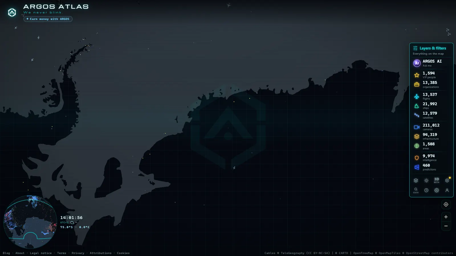
Open an Antarctica live map for the first time and the honest reaction is disappointment. Most of the continent is blank. That is not a failure of the map, it is the place: an ice sheet larger than Europe, with no terrestrial radio network, almost no coastal receivers and a scattering of research stations that talk to the outside world through satellite links they ration carefully.
The short answer to what you can watch: the seasonal flights as far as the gateway airports, ships gathering at the Ushuaia end of the Drake Passage, and a handful of station webcams that refresh a still image every few minutes when weather, power and bandwidth allow. Everything else, which is nearly everything, is dark. This article covers both halves, because the dark half is the one that teaches you how live maps actually work.
The essentials, in 20 seconds
- Drake Passage ships: visible around Ushuaia and the Beagle Channel, then fade out past Cape Horn.
- Gateway airports (Christchurch, Cape Town, Hobart, Punta Arenas): where the seasonal Antarctic flights actually show up live.
- Station webcams: a still image refreshed every few minutes to an hour, not video.
- 47,927 airports and airfields on the live map worldwide, among them Antarctica's ice runways like Williams Field and Teniente Marsh.
- Austral summer: the only season with flights, ship traffic and daylight for the cameras.
What an Antarctica live map actually shows
Three layers carry almost everything on any real time map: aircraft broadcasting ADS-B, ships broadcasting AIS, and public cameras publishing images to the open web. The live world map carries 200,000+ public cameras (count as of September 2026) and 47,927 airports and airfields, along with tens of thousands of vessels at any given moment. In Antarctica all three layers degrade at once, and for the same underlying reason: each one needs somebody nearby, on land, listening.
That leaves a very specific, very small set of things you can genuinely follow. Here is what is realistic, layer by layer:
| Layer | What you can see | What is missing | How fresh |
|---|---|---|---|
| Flights | Departures and arrivals at the gateway airports (Christchurch, Cape Town, Hobart, Punta Arenas) | The leg over the Southern Ocean and the landing on the ice | Seconds while in receiver range, then nothing |
| Ships | Traffic in the Beagle Channel, around Ushuaia and off Punta Arenas | Most of the Drake crossing and the Peninsula anchorages | Minutes near shore, hours or days offshore |
| Station webcams | A small number of base cameras, mostly still frames | Video, the whole polar night, cameras offline for a season | Minutes to hours |
| Airfields and bases | Fixed points: names, coordinates, runway locations | Whether anything is happening there right now | Static reference data |
If a layer is not in that table, assume you cannot see it. On this continent, absence of data is the normal state, not an outage.
The ice runways: where the season's flights land
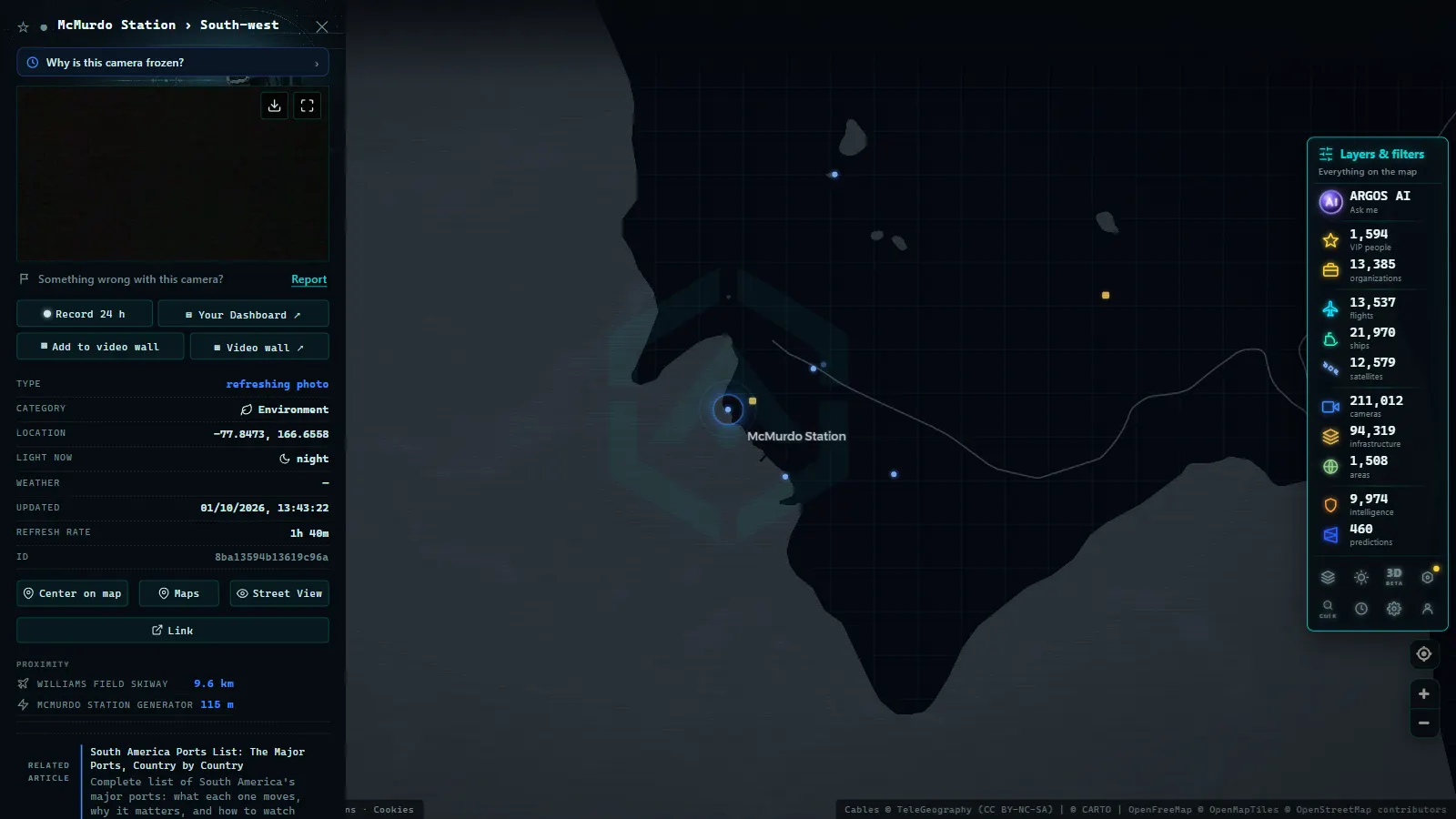
Antarctica is entered through a short list of runways, and they are not runways in the ordinary sense. Some are blue ice, a natural wind scoured surface hard enough to take wheeled heavy aircraft. Others are compacted snow skiways, usable only by ski equipped planes. Williams Field and the newer Phoenix Airfield serve the Ross Island stations. Troll Airfield and Novolazarevskaya handle the Queen Maud Land traffic out of Cape Town. Wilkins Aerodrome connects Hobart with Casey. Teniente Marsh on King George Island is the busiest door into the Peninsula, and Union Glacier serves private and expedition operations deep inland.
The aircraft are distinctive: heavy transports on the Christchurch run, ski equipped Hercules for the inland skiways, Ilyushin freighters on the Cape Town route, and Twin Otters and Basler turboprops hopping between stations. Almost none of that traffic appears on a public tracking map once it leaves the coast of the departure country.
The practical trick is to stop watching the destination and start watching the gateway. Set yourself over Christchurch, Cape Town, Hobart or Punta Arenas during the austral summer and you will catch the departures, including aircraft types that never show up anywhere else. After that the aircraft keeps broadcasting into an empty sky and the map simply stops updating it. If you want the mechanics of why that happens, the guide on how to track aircraft in real time explains what a receiver network actually needs in order to hear a plane.
Recorded straight off the map, no sound.
Drake Passage ships: what AIS reaches the map
AIS is a VHF broadcast. A ship announces its identity, position, course and speed, and a receiver within line of sight picks it up. Along a normal coastline that works beautifully, because ports, authorities and hobbyists have receivers everywhere. The Drake Passage has open water on one side and an ice coast with almost no shore stations on the other.
So the pattern you see is consistent and slightly frustrating. Expedition cruise vessels light up while they are loading in Ushuaia, they stay visible down the Beagle Channel, and then they fade out somewhere past Cape Horn. Research and resupply ships behave the same way. Krill fishing vessels working the Scotia Sea appear and vanish depending on who happens to be nearby. Satellite AIS exists and does cover the poles, but it is a commercial product with reporting delays, and it is not what a free map is showing you.
What this means in practice: a gap on the map is not proof that a ship stopped, turned back or sank. It usually means nobody was listening. The explainer on how AIS locates ships is worth reading before you draw conclusions from a track that ends mid ocean, because the same blind spots exist in the middle of every ocean, just less obviously.
Base webcams: live, but not the way you expect
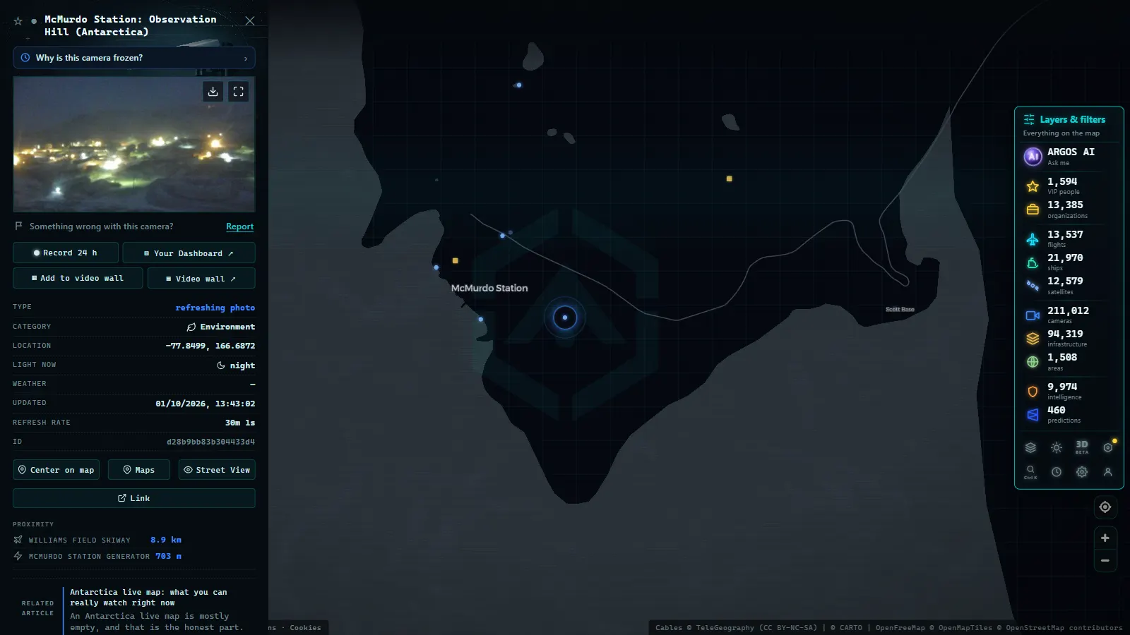
A few stations do publish public cameras, among them bases on the Antarctic Peninsula, at Ross Island and along the Queen Maud Land coast. Open one expecting a streaming video feed and you will be let down. What you almost always get is a JPEG, refreshed every few minutes, sometimes every hour, because the station is pushing it over a satellite link that also has to carry science data, telemedicine and everybody's email.
Then there is the light. During the polar winter the sun does not rise for months at the high latitude stations, so the camera is technically working and the image is technically live, and the image is black. Blizzards produce the same result in white. Cameras also go down and stay down, because a failure that takes an hour to fix anywhere else may wait until the next flight window.
None of that makes them useless. A station camera in good summer light is one of the few unmediated views of the continent that exists, and the timestamp tells you it is real. Just read the timestamp before you believe what you are looking at. The same discipline applies everywhere, which is why the guide to finding live webcams around the world starts with checking the source and the refresh time rather than the picture.
Why an Antarctica live map is mostly empty
It helps to understand where live map data normally comes from. Traffic cameras come from national road agencies. Port traffic comes from harbour authorities. Flight positions come from a volunteer receiver network plus commercial feeds. Every one of those is an institution with a budget, a mandate and a jurisdiction.
Antarctica has no such institution. Under the Antarctic Treaty there is no sovereign administration running a road network, no municipality installing street cameras, no port authority publishing arrivals. There are national programmes operating stations for their own scientists, and publishing a public webcam is a courtesy, not a duty. The result is a continent where the usual pipelines simply do not exist, on top of the physical problem that there is no terrestrial network to carry them.
This is the extreme version of something you meet in plenty of populated places too. Coverage follows infrastructure and institutions, not importance. The same logic explains why a mountainous, thinly connected country shows so little on a live map, as in the case of what does and does not reach the map in Nepal.
How to read the Antarctica live map without wasting a night
A few habits make the difference between a useful session and twenty minutes of staring at grey.
- Work the gateways, not the continent. Christchurch, Hobart, Cape Town, Punta Arenas and Ushuaia are where the Antarctic season is actually visible in real time.
- Go in the austral summer. Outside it the flight programme mostly stops, ship traffic collapses and the cameras have no daylight to show.
- Zoom the Peninsula first. It is the closest part of the continent to inhabited land, so it has the densest ship activity and the best odds of a working camera.
- Check timestamps before you trust an image. A still frame with no time on it is not evidence of anything.
- Treat gaps as gaps. A track that ends over open water means the signal was not heard, not that something happened.
The honest summary is that Antarctica is the one place where a live map is mostly an inventory of what it cannot see. That turns out to be the useful part. Once you understand why the ice is blank, you read every other blank area on a world map correctly, and you stop mistaking silence for an empty ocean.
Frequently asked questions
Is the Antarctica live map free, live and available without signing up?
Yes. The map opens with no account, no email and no paywall, and the layers refresh on their own. Flights and ships update as new broadcasts arrive, cameras update whenever their source publishes a new frame. The limit in Antarctica is not access, it is that there is very little signal coming out of the continent to show you.
Can I track a specific cruise ship crossing the Drake Passage?
Only in parts. You will usually see it in the Beagle Channel and around Ushuaia, where shore based AIS receivers are listening, and then it disappears for most of the crossing. It may reappear near the South Shetlands if another vessel or a station relays its signal. Free maps do not carry the commercial satellite AIS that fills those gaps.
Why do Antarctic flights vanish from the radar map after takeoff?
ADS-B is a line of sight broadcast that needs a ground receiver within range. South of the gateway airports there is essentially nobody listening, so the aircraft keeps transmitting into an empty sky. Follow the departure out of Christchurch, Cape Town, Hobart or Punta Arenas and treat the rest of the route as unobserved.
Are there real webcams at Antarctic research stations?
Several stations publish one, including well known bases on the Peninsula, at Ross Island and on the Queen Maud Land coast. Most are still images refreshed every few minutes rather than video, because bandwidth is satellite and expensive. Expect cameras to be offline for weeks, and expect a black frame during the polar night.
What is the best time of year to watch Antarctica in real time?
The austral summer, when the stations are fully staffed, the seasonal flights run and the cruise and resupply season is open. In the winter months the flight programme mostly stops, ship traffic collapses and the daylight cameras show nothing at all, so the map is quieter for real reasons rather than technical ones.
- Guatemala live map: what you can see right now, layer by layer
- ARGOS ATLAS vs WorldCam: 3 Free Cameras a Day vs 45 Seconds
- Live Webcam Maps Compared: 6 Ways to Watch the World (2026)
- Public cameras online: what types exist and which ones you can legally watch
- How to Tell Whether a Webcam Is Official (and Why the Source Matters)
- Weather Webcams: See Real Conditions Before You Go