Blog · World webcams
Weather Webcams: See Real Conditions Before You Go
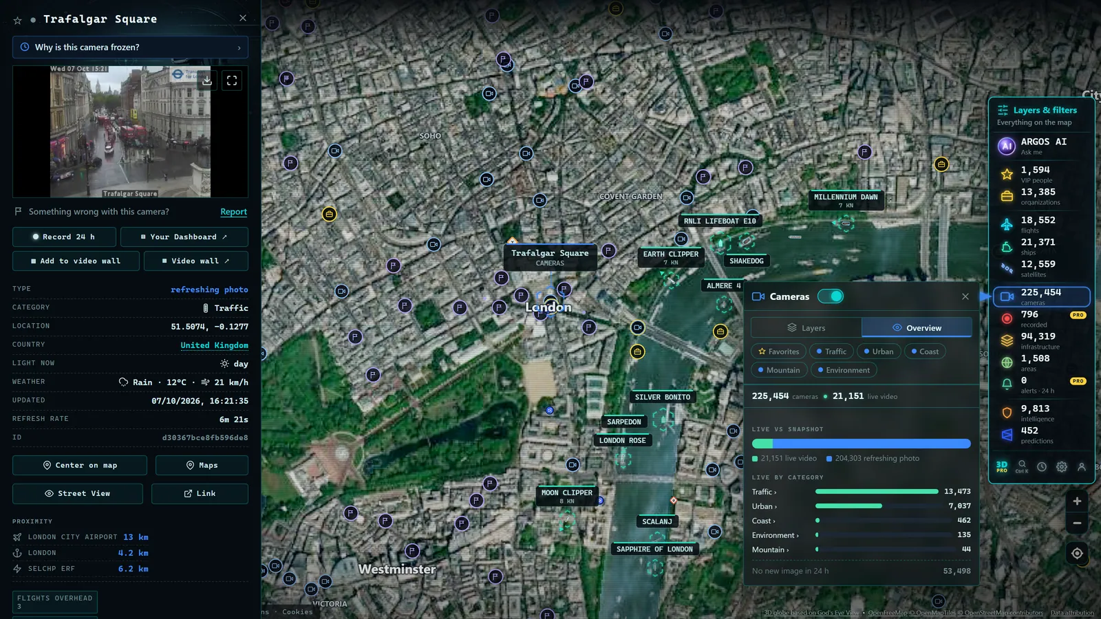
The forecast says "partly cloudy with a chance of showers." What you actually need to know is whether the mountain pass on your route is getting snow right now. That is exactly what weather webcams are for: cameras pointed at roads, ski runs, coastlines, and mountain ridges that show you what conditions actually look like at a specific point on the map, right now. Seeing live weather does not replace a forecast, it complements it with something no numerical model can match: an unfiltered photograph of the present moment.
This guide will show you how to use weather cameras as a practical tool: when they beat the forecast, how to read an image correctly, and how to combine both sources before you leave the house.
Forecast and observation: two different things that need each other
Start with a distinction that most people overlook. A weather forecast is the output of a model: a system that ingests observations, processes them, and estimates how the atmosphere will evolve over the next hours or days. It is an extraordinary tool, but by design it works with probabilities and limited spatial resolution. A model can accurately predict "rain in the region" and still miss whether your particular valley gets it at 9 a.m.
An observation, by contrast, does not estimate anything, it shows. A weather webcam aimed at a mountain road does not calculate the probability of snow; it shows whether there is snow on the asphalt or not. The camera has no idea what will happen in three hours, but on the immediate present, it is hard to argue with it.
That is why combining the two is so powerful. The model tells you where the weather is headed; the camera tells you where it stands right now. If the forecast called for sunshine but the camera shows solid fog, you have just saved yourself an unpleasant surprise.
When the camera wins: situations where a live image beats the model
Some weather phenomena are poorly handled by models because of their very nature, intensely local, fast-moving, or highly terrain-dependent. These are the situations where weather cameras become indispensable.
Valley fog
Fog is the classic example. It forms and dissipates within minutes, depends on the humidity and topography of each hollow, and can blot out a stretch of highway while the sun shines two kilometers away. A forecast can warn of "patchy morning fog," but only a camera tells you whether that patch is sitting right on your specific section of road. The same applies on US interstates threading through the Appalachians, UK A-roads crossing the Pennines, or French routes nationale cutting through the Loire Valley.
Real conditions on a ski run
Resorts publish snow reports, but those reports are written at a fixed time and conditions change. A high-altitude camera shows whether it is snowing right now, whether there is a whiteout, whether visibility is good, or whether yesterday's powder has turned to ice. Before you load skis onto the roof rack (whether you are heading to the Rockies, the Alps, or the Pyrenees) two minutes of live camera feed is worth more than any written description.
Surf and swell at the coast
For surfers, anglers, and swimmers, the gap between "moderate swell" in a buoy report and what is actually breaking on the shore is enormous. A camera aimed at the ocean shows real wave size, whether the wind is chopping the surface, and whether the beach is safe to use. Buoys and wave models give numbers; the camera gives context.
Mountain passes and high routes
Passes concentrate every challenging condition: snow, fog, ice, wind. Road authorities worldwide know this, and many of their cameras are positioned at the most hazardous points, precisely the places you need to see before you commit to a route. If you want to go deeper, there is a dedicated guide on checking mountain pass cameras when snow is falling.
How to read a weather image like a professional
Watching a webcam seems trivial, but extracting reliable information from a still frame takes a little method. Here are the elements to check, in order.
Light and local time. Before interpreting anything, orient yourself temporally. Does the image correspond to dawn, midday, or dusk? Most official cameras overlay the date and time; check them against the visible light. A bright image with a midnight timestamp is telling you something is wrong, either the feed is frozen or the clock is misconfigured.
Visibility and the horizon. Notice how far you can see. If you know the framing (that ridge in the background, that building at mid-distance), you can estimate visibility. A sharp horizon means clean, stable air; a hazy one may indicate dust, forming fog, or distant precipitation moving in.
Precipitation on the road surface or ground. Drops on the lens are obvious, but the most reliable indicator is the surface itself. Wet asphalt has a sheen and reflects lights; dry asphalt is matte. Puddles at the road's edge indicate recent rain even if it is no longer falling. On traffic cameras, the dark tire tracks standing out against a whitening surface are an unmistakable sign that snow is settling.
Snow: is it sticking? Falling flakes do not mean a white road. Watch the margins: if snow is accumulating on verges, signs, and vegetation but the carriageway is still dark, it is either not sticking on the warmer asphalt or plows are keeping ahead of it. If the lanes themselves are starting to pale and only the dark tracks of vehicles remain, conditions are deteriorating fast.
A single image is a data point; two images twenty minutes apart are a trend. If you can, check the same camera again after a short interval, you will know whether conditions are improving or worsening.
From the ARGOS ATLAS channel.
Camera plus official forecast: a sensible five-minute workflow
The right way to use a weather webcam is not in isolation but as part of a small verification routine.
- Check the official forecast for your area. In the US, NOAA and the National Weather Service set the reference; in the UK, the Met Office; in other countries, each national meteorological agency. This gives you the frame: what is expected, with what probability, whether active warnings are in force.
- Open cameras at the critical points on your route or destination, the pass you will cross, the beach you are heading to, the city where you have a meeting. Check whether reality is ahead of, behind, or at odds with the forecast.
- Decide using both sources. If the forecast and the camera agree, proceed with confidence. If they disagree, give more weight to the camera for the next hour and to the forecast for the medium term, with an extra margin of caution.
This method works especially well with severe-weather alerts: the alert tells you something might happen across a broad area; the cameras tell you whether it is already happening at your exact location.
Traffic cameras: a weather observation network nobody designed as one
Here is an idea that changes how you see the whole subject. Road authorities in dozens of countries maintain thousands of cameras above their highways and trunk roads. They were installed to monitor traffic, but every one of them is, in practice, a meteorological observation post: if it is raining on that section of freeway, you can see it; if snow has settled on that alpine pass, you can see it; if fog has closed that stretch of motorway, you can see it.
Few observation networks have as many eyes distributed across the landscape as traffic cameras. And because they are typically positioned at the points most sensitive to weather (mountain passes, viaducts, known fog zones) their meteorological value is enormous even though it was never the design intent. The historic problem was fragmentation: the UK's National Highways, the US state DOTs, Germany's BASt, France's BISON futé, each publishes its cameras on its own website, with its own interface, and tracking down the camera at the exact location you care about could take longer than the journey itself. That fragmentation is precisely the problem that map aggregators solve.
Reading the weather of an entire region from a single map
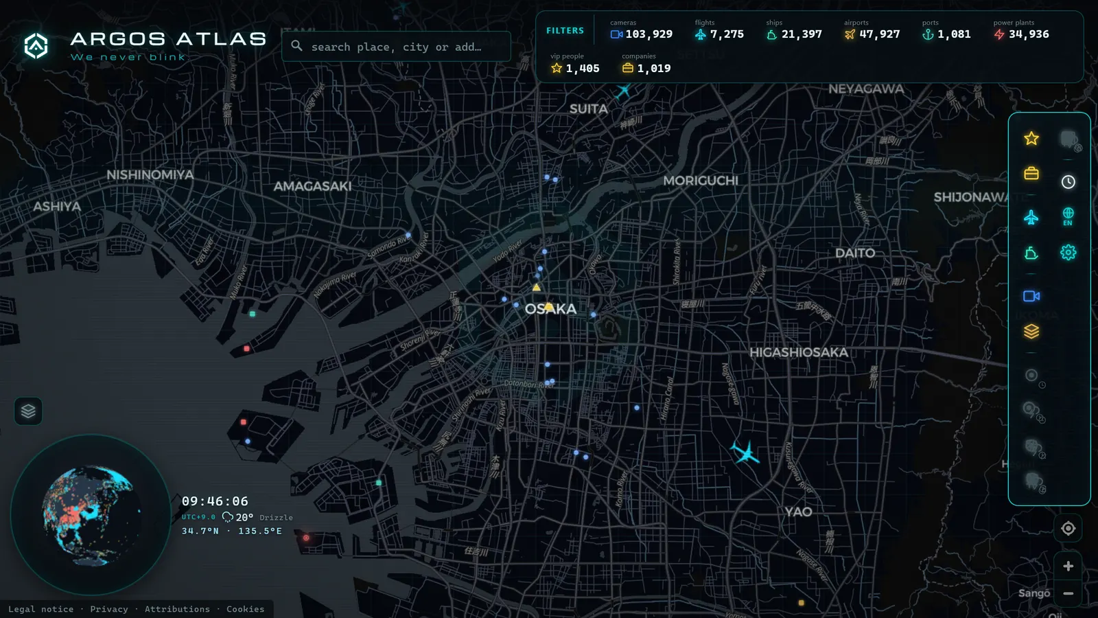
When cameras stop being individual web pages and become dots on a map, a new capability appears: reading the weather of a whole region at a glance. Open the Alpine arc and work camera by camera along the elevation line where rain turns to snow. Follow an Atlantic front as the coastal cameras darken before the inland ones. Check whether the storm warned for the next county is already dropping precipitation there.
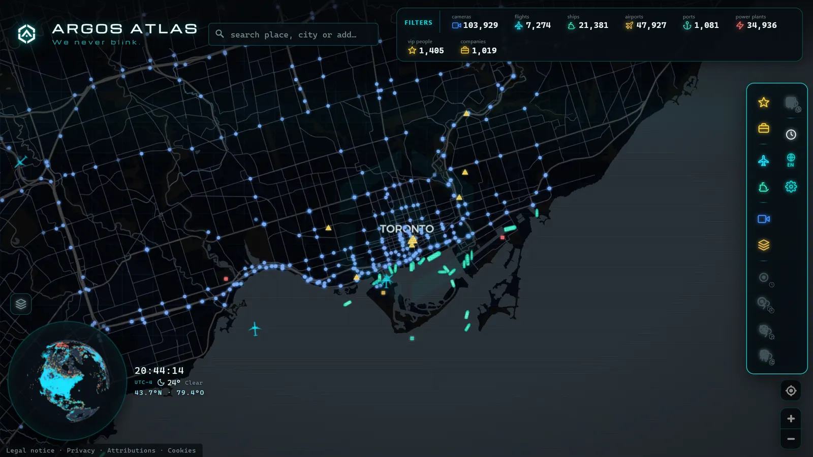
Argos Atlas aggregates thousands of official public traffic cameras onto a single interactive map, geolocated, with each source cited, showing the latest frame published by each agency. That turns a scattered collection of institutional websites into something resembling a visual weather radar: it does not measure millimeters of precipitation, but it shows you where it is genuinely raining. The same logic applies to watching cities around the world in real time and comparing conditions in capitals thousands of kilometers apart.
One important note: not all webcams on the internet are equal. Before trusting an image to plan a journey, it pays to know who publishes it and how often it refreshes. There is a guide on how to tell whether a webcam is official and what its source is, the difference between observing real-time weather and looking at a three-day-old photograph.
Frequently asked questions
Is a webcam more reliable than a weather forecast?
They are not competing, they do different things. A forecast estimates what will happen over the next hours or days across an area; a webcam shows what is happening right now at a specific point. For deciding whether to head out in the next hour through a mountain pass, the camera is usually more useful. For planning your weekend, the forecast model wins. The intelligent play is to use both: the forecast as a framework and the camera as ground-truth verification.
Where do I find mountain or beach cameras?
Road authorities worldwide publish cameras at mountain passes and coastal roads; ski resorts maintain cameras on their runs and access roads; many port authorities and marinas offer sea views. The challenge is not that cameras are scarce, it is that they are scattered across dozens of different websites. An aggregated map like Argos Atlas brings together thousands of official, geolocated cameras, so all you need to do is navigate to the area you care about and open the available points.
How do I know if the camera image is current?
Three quick checks. First, look for the date and time stamp that most official cameras overlay on the image. Second, cross-check that stamp against the visible light, if the timestamp says nighttime but the image is bright daylight, the frame is stale or the clock is wrong. Third, verify that the source is an identifiable official agency. Refresh rates vary by source: some cameras update every few seconds, others every several minutes.
Are weather webcams useful at night?
Less than during daylight, but not useless. Road cameras are typically in areas with artificial lighting or have enough night sensitivity to distinguish the essentials: wet pavement (from the reflections of streetlights), settled snow (the white stands out even in low light), or dense fog (the diffuse halo around light sources gives it away). In remote mountain terrain without artificial lighting, nighttime information is limited and it is worth waiting for dawn or relying on the forecast.
Conclusion
Weather webcams will not replace forecast models, and they are not trying to. Their value lies elsewhere: showing you the present without intermediaries. The fog the model did not resolve. The snow that settled earlier than predicted. The swell that is half the height the forecast announced. Anyone who learns to read these images and cross them with the official forecast makes better decisions, leaves earlier, reroutes in time, or stays home when that is the right call.
And the best way to start is to stop hunting for cameras one website at a time. You can open the map right now, navigate to your mountain pass, beach, or city, and see with your own eyes what the weather actually looks like. No estimates. Pure observation.
Frequently asked questions
Is a webcam more reliable than a weather forecast?
They do different things, they are not in competition. A forecast estimates what will happen; a webcam shows what is happening right now at a specific point. For deciding whether to head out in the next hour, the camera usually wins. For planning your weekend, the forecast model wins. The smart move is to use both.
Where do I find mountain pass or beach cameras?
Road authorities publish cameras at mountain passes and coastal routes worldwide; ski resorts and port authorities maintain their own. An aggregated map like Argos Atlas brings together thousands of official, geolocated cameras so you can browse by location instead of jumping between agency websites.
How do I know if the camera image is current?
Look for the date and time stamp most official cameras overlay on the image, then cross-check it against the visible light. If it reads 8 p.m. in winter but the image is bright daylight, the feed is stale or frozen. Also confirm that the source is an official agency with a known refresh rate.
Are weather webcams useful at night?
Less so than during daylight, but not useless. Road cameras are often in artificially lit areas or have enough night sensitivity to distinguish wet pavement (reflections), settled snow (white stands out even in low light), or dense fog (the halo around streetlights gives it away). In remote mountain locations with no artificial lighting, nighttime information is limited.
- Live Webcams from Latin American Cities: Buenos Aires, Mexico City, Bogota, Lima and Santiago
- Live Webcams from European Cities: Paris, Rome, Berlin, Amsterdam, Vienna, Prague and Brussels
- Live Webcams from Caribbean Coasts: Cuba, Dominican Republic, Jamaica, Puerto Rico, Aruba and Barbados
- APRR Webcam Live: Every Camera, One Live Map
- Spain Eclipse Traffic Measures Aug 12: Path & Live Webcams
- Spain Beach Webcams: Watch the Coast Live Before You Go