Blog · OSINT & verification
What Is OSINT? Open-Source Intelligence Explained with Real Examples
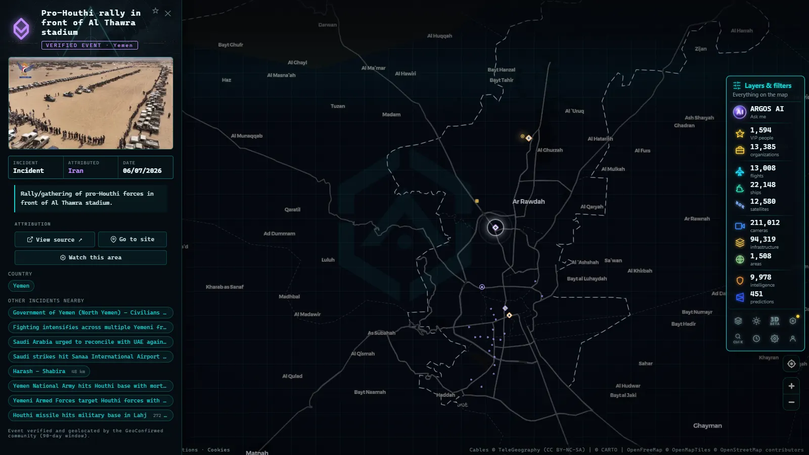
If you are wondering what OSINT is, the short answer is this: intelligence derived from publicly accessible sources. The acronym stands for Open Source Intelligence, and it describes a discipline that involves no hacking, no access to secret information, and nothing covert. Instead, it does something that sounds humbler but is in practice far more powerful: looking carefully at what is already visible. A public video, a satellite image, a corporate registry entry, a live traffic camera. Scattered pieces that, ordered with method, answer questions that seemed unanswerable.
This guide will help you understand where OSINT came from, what sources it uses, how practitioners work with them, and who uses it today, with concrete examples. It is the ideal starting point if you want to get into open-source investigation without losing your way.
A serious definition (and what OSINT is not)
OSINT is the process of collecting, verifying, and analyzing information from public sources to answer a specific question. All three parts matter. Collecting without verifying is accumulating noise. Verifying without analyzing is stopping at raw data points. And doing all of it without a guiding question is simply browsing the internet.
Two misunderstandings are worth clearing up. First: OSINT is not hacking. There is no intrusion, no stolen passwords, no unauthorized access to systems. If obtaining a piece of data requires bypassing a technical or legal barrier, that is something else, and probably a crime. Second: OSINT is not magic. The spectacular investigations you see published represent hours of methodical work, cross-checks, and dead ends that nobody reports.
The raw material of OSINT is not secret. What is valuable is the method: knowing where to look, how to cross-reference sources, and when to distrust what seems obvious.
A brief history: from press clippings to collaborative investigation
Open-source intelligence did not begin with the internet. For much of the twentieth century, the intelligence services of major powers employed entire teams dedicated to reading foreign press, monitoring radio broadcasts, and analyzing the adversary's technical publications. Much of what one country knew about another did not come from spies, it came from analysts reading newspapers with a red pencil.
The internet changed the scale, and social media changed the nature of the game. Millions of people suddenly began publishing photos, videos, and locations in real time, and satellite imagery ceased to be the exclusive domain of governments. The result was an unprecedented democratization: techniques that previously required a state agency became available to anyone with a browser and rigor.
The symbol of this era is the collaborative digital investigation collective, with Bellingcat as the best-known name. Their work on the downing of flight MH17 over Ukraine in 2014 (reconstructing the journey of a missile launcher using photos and videos posted on social media) demonstrated to the world that open-source investigation could reach solid conclusions about events that the governments involved were actively denying. Since then, the method has spread into journalism, international justice, and civil society globally.
The catalog of open sources: where investigators look
What counts as an open source? Any information accessible without breaching access controls. The catalog is vast but fits into six broad categories.
Websites and social media. Public profiles, posts, comments, forums, corporate websites, archived web pages. This is the most voluminous source and also the noisiest, here, verification is critical.
Images and video. Photographs and footage published by witnesses, media organizations, or institutions. Every image contains visual clues (signs, architecture, vegetation, shadows) that allow it to be placed in space and time. This is the basis of techniques like geolocating a photograph, one of the core skills of modern OSINT.
Maps and satellite imagery. Collaborative cartography like OpenStreetMap (published under the ODbL license), satellite views, and street-level imagery. These allow investigators to confirm or rule out location hypotheses by comparing what an image shows against the actual terrain.
Public and commercial registries. Official gazettes, company registries, procurement records, property records, published sanctions lists. These are the backbone of financial investigations: who owns what, who contracts with whom. In the US, SEC EDGAR filings, state business registries, and FOIA-released records are essential; in the UK, Companies House is publicly searchable; most democracies maintain equivalents.
Open transport data. Civil aircraft broadcast their position via ADS-B (on the 1090 MHz frequency), and ships broadcast via AIS, a system that the IMO's SOLAS convention makes mandatory for vessels of 300 GT or more on international voyages and for all passenger vessels. Networks of amateur receivers and public platforms collect those signals, allowing anyone to track flights and ships in real time.
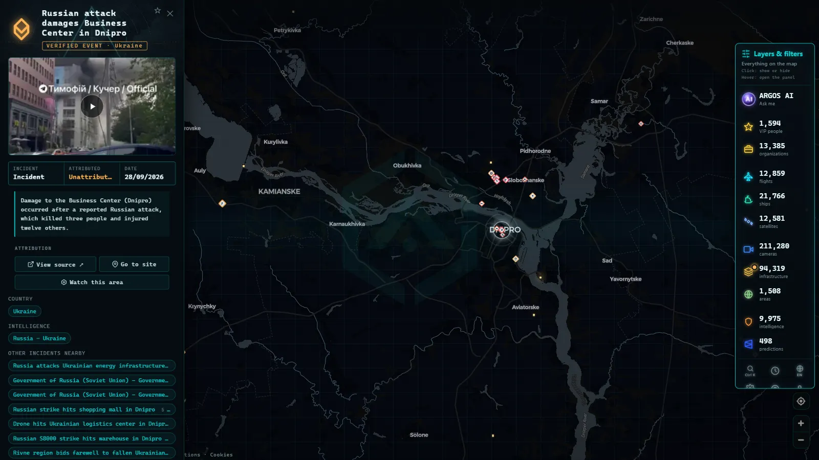
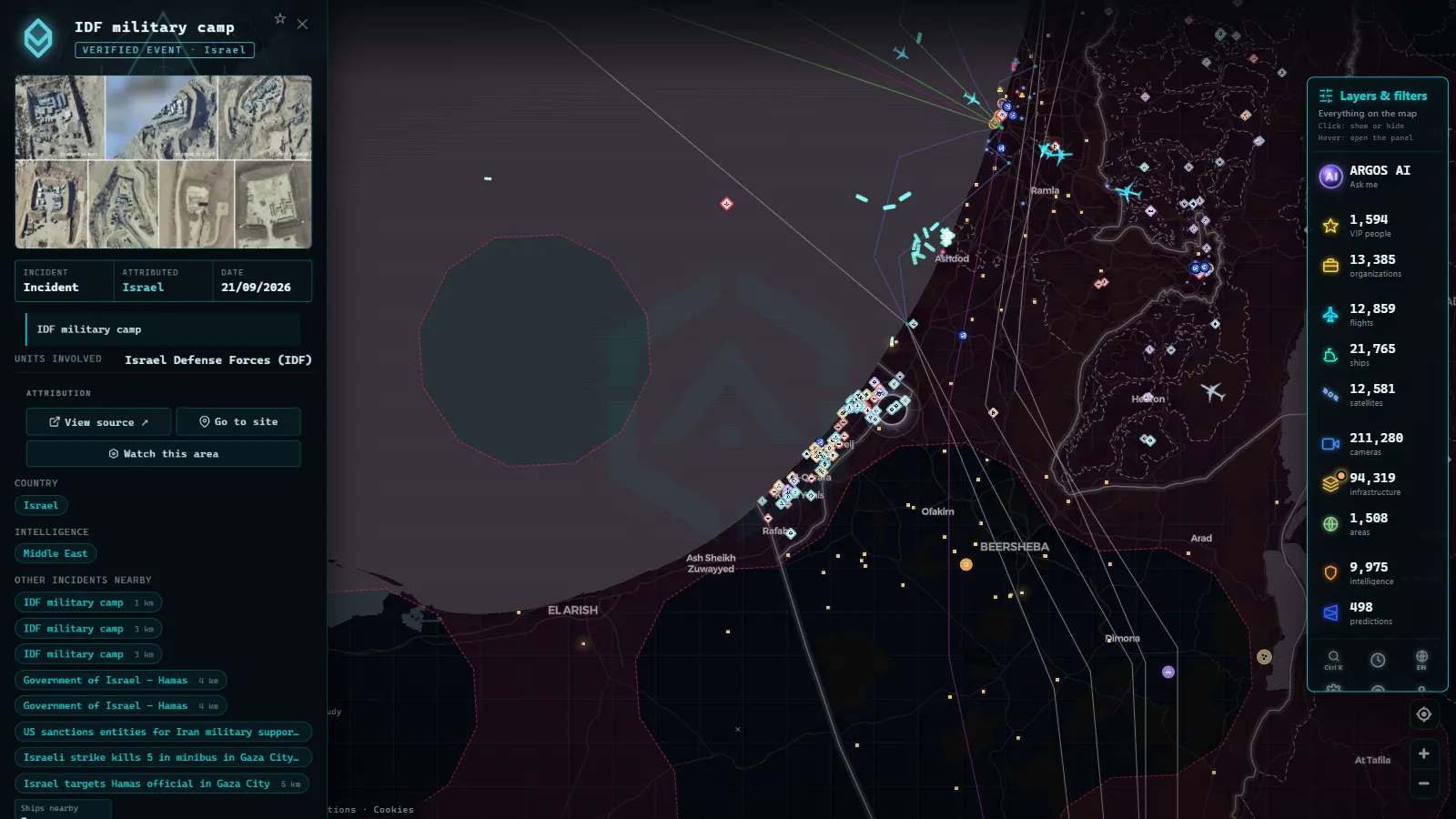
Public live cameras. Official agencies (road authorities, port authorities, municipal governments) publish cameras showing roads, cities, and coastlines in real time. For an investigator they are neutral witnesses: a fixed point, with a known location, showing what is happening now. Platforms like Argos Atlas aggregate thousands of these official cameras onto a single map, alongside live flights and ships.
From the ARGOS ATLAS channel.
The OSINT cycle: from question to report
Serious investigations do not begin by opening browser tabs, they begin by formulating a question. The classic working cycle has five phases, and skipping any of them tends to be costly.
- Define the question. What exactly do you want to know? "Investigate this company" is not a question; "Who are the directors of this company and what other entities do they share?" is. A precise question defines which sources to consult and when to stop.
- Collect. Gather information from diverse sources, always recording the origin of each data point, URL, date consulted, screenshot. What is published today may be gone tomorrow.
- Verify. This is the phase that separates the investigator from the rumor mill. Every relevant data point must be confirmed with at least one independent second source. Is the photo actually from the location it claims? Is the account that posted the video the original or a downstream amplifier?
- Analyze. With verified data, build the answer: timelines, connections, patterns. This is where scattered pieces become intelligence. And this is where to actively watch for confirmation bias, deliberately search for what would contradict your hypothesis.
- Document. Write up conclusions, honestly distinguishing what is proven from what is probable and what remains unknown. A good OSINT report allows a third party to retrace the steps and arrive at the same place.
This cycle is iterative: analysis usually generates new questions that restart the process. Real investigations are spirals, not straight lines.
OSINT in practice: everyday and professional examples
The best way to understand the discipline is to see the range of problems it solves, from the mundane to the high-stakes.
Journalism and fact-checking. A viral video claims to show an event "happening right now" in a certain city. The verification team searches for the earliest upload of the video, geolocates the scene from its buildings, checks that the visible weather matches historical records for that day, and cross-references with public cameras in the area. Within hours, the video is confirmed or debunked with evidence.
Corporate security. A company audits what sensitive information it is inadvertently exposing: photos revealing office interiors, job postings that detail their technology stack, documents accidentally indexed by search engines. This is defensive OSINT, looking at yourself through the eyes of an adversary.
Academic research. A researcher studies maritime traffic in a disputed region using open AIS data, satellite imagery, and public port records. A decade ago, that work would have required expensive commercial data subscriptions.
Everyday uses. Checking whether a vacation rental listing corresponds to a real apartment by matching the photo against street-level imagery. Verifying that an online shop has a genuine legal existence before purchasing. Confirming whether the "taken today" photograph someone sent you is actually recent. OSINT at small scale is defensive digital literacy.
Who uses OSINT today
The range of users has expanded enormously. Journalists and fact-checkers use it daily against disinformation. Security and cybersecurity analysts use it to assess threats and exposure. Law enforcement agencies have incorporated it into their procedures within each country's legal framework. Academic researchers apply it in social, environmental, and conflict studies. And a growing community of rigorous enthusiasts participates in geolocation challenges and collaborative projects that function as practical training grounds.
That diversity has an implication: the same techniques serve legitimate purposes and others that are not. This is why serious OSINT training always includes the ethical and legal component, which we cover in detail in the guide on the legal and ethical limits of OSINT.
How to start without getting lost
If you want to take your first steps, forget the lists of two hundred tools. Start with the method and three concrete moves.
First, train your eye with geolocation exercises: take a public photo of an unknown place and try to locate it using only its visual clues and free maps. This is the exercise that builds the OSINT muscle fastest. Second, put together a minimal toolkit: a clean browser, general-purpose and reverse image search engines, maps with satellite view, and a system for saving timestamped screenshots. The guide on free OSINT tools has a curated selection. Third, verify by default: before accepting anything as fact, ask yourself who published it, when, and whether an independent second source confirms it.
And explore live visual sources, among the most undervalued for beginners. Navigating a map with thousands of public cameras, live flights, and ships teaches you more about how the world looks "in open data" than many hours of theory.
Frequently asked questions
Is OSINT legal?
Consulting publicly accessible sources is, as a general matter, legal: there is no intrusion, no unauthorized access, no breach of any access control. What is regulated is the subsequent use of the information, particularly when it involves personal data. In the EU, the GDPR applies even to data obtained from public sources; in the US, various state and federal privacy laws apply depending on context; most developed jurisdictions have equivalent frameworks. The practical red line is simple: if obtaining a piece of data requires bypassing a password, an access control, or a security measure, that is no longer OSINT.
What counts as an open source?
Any source accessible without breaching technical or legal barriers: public websites and profiles, news archives and press databases, official and commercial registries, published maps and satellite imagery, open transport data such as ADS-B signals from aircraft and AIS from ships, and live public cameras published by official agencies. A caveat worth noting: the fact that something is accessible does not mean every use of it is appropriate. Ethics and proportionality matter as much as legality.
Who uses OSINT?
Investigative journalists and verification teams, corporate security and cybersecurity analysts, law enforcement within their legal frameworks, academic researchers, and collaborative citizen investigation communities. Also companies monitoring their own reputation and supply chains, and a growing number of enthusiasts who practice through challenges and open projects.
Do I need technical skills to start?
No. The core of OSINT is methodological, not technical: formulating good questions, searching systematically, verifying before concluding, and documenting the process. The entry-level toolkit is a browser, search engines, free maps, and discipline. Advanced technical skills (scripts, data analysis, automation) multiply your capacity, but they come later, once the method is already solid.
OSINT in One Sentence: What the Acronym Actually Stands For
OSINT stands for Open-Source Intelligence, the discipline of turning publicly available information into a specific, actionable answer. The definition has three parts, and each one rules something out: "open-source" means the material is public and legal to access (no hacking, no insider leaks, no classified feeds), "information" means raw material of any kind (a photo, a shipping manifest, a livestream, a flight record), and "intelligence" means that material only counts as OSINT once someone has verified it, cross-checked it, and connected it to a question worth answering. A folder of screenshots is data. The same folder, dated, geolocated, and compared against three independent sources, is OSINT.
The acronym itself breaks down like this:
| Letter | Stands for | What it rules in or out |
|---|---|---|
| O | Open | No paywalled leaks, no hacked databases, no stolen credentials |
| S | Source | The origin has to be traceable and citable, not an anonymous rumor |
| INT | Intelligence | Raw material only counts once it's verified and applied to a question |
People often ask what OSINT means in contrast to other intelligence disciplines, and the distinction is simple: SIGINT (signals intelligence) intercepts communications, HUMINT (human intelligence) relies on informants and interviews, and GEOINT (geospatial intelligence) works from maps, satellite imagery, and location data. OSINT overlaps with all three but stays open by definition, meaning everything it uses could, in principle, be found by anyone with enough patience. That overlap is exactly why a live map built from public traffic cameras, flight transponders, and ship transponders (see real OSINT examples) counts as a geospatial OSINT tool: none of the underlying feeds are secret, but stitched together in real time they answer questions that no single source could answer alone.
The short version, if a plain definition is all that's needed: OSINT is public information, verified and connected, used to answer a specific question. Everything else in this guide (the sources, the cycle, the practical uses) is what happens after that first sentence.
Conclusion
OSINT is, at its core, a way of looking: treating public information not as background noise but as pieces of a puzzle that, properly assembled, answer real questions. It requires no credentials and no special equipment, it requires method, skepticism, and honesty about your own limits. Anyone who internalizes the cycle (question, collect, verify, analyze, document) holds one of the most useful skills of this decade.
And since OSINT is learned by looking, not by reading about it, there is no better first exercise than exploring real open sources. You can open the map and browse thousands of official public cameras, live flights, and ships in real time: the world in open data, visible to anyone who knows how to observe it.
Frequently asked questions
Is OSINT legal?
Consulting publicly accessible sources is generally legal: there is no intrusion and no unauthorized access. What is regulated is the subsequent use of that information, particularly when it involves personal data, in the EU under GDPR, and in many other jurisdictions under various privacy frameworks. The practical red line is clear: if getting a piece of data requires bypassing a password or an access control, that is no longer OSINT.
What counts as an open source?
Any source accessible without breaching access controls: public websites and social media profiles, news archives, official and commercial registries, published maps and satellite imagery, open flight and ship data, and publicly streamed cameras. Accessibility does not mean every use is appropriate, ethics matter as much as legality.
Who uses OSINT today?
Investigative journalists and fact-checkers, corporate security and cybersecurity analysts, law enforcement agencies within their legal frameworks, academic researchers, and growing communities of rigorous citizen investigators. Also companies monitoring their own reputation and supply chains.
Do I need technical skills to start?
No. The core of OSINT is methodological: asking good questions, searching systematically, verifying before concluding, and documenting everything. The basic toolkit is a browser, search engines, maps, and patience. Advanced technical skills (scripting, data analysis, automation) come later, if you need them.
- How to Verify a Viral Video: A Practical Visual Verification Guide
- Live Cameras as a Journalistic Verification Tool
- How to Get Started With OSINT: Beginner's Guide & Free Tools
- OSINT Examples: 8 Techniques You Can Try Today
- Ukraine War Map, Live: Front Lines and Black Sea Ships
- Area 51 Live Map: What Open Sources Really Show Over Groom Lake