Blog · World webcams
Nepal Live Map: What You Can Actually Track in Real Time
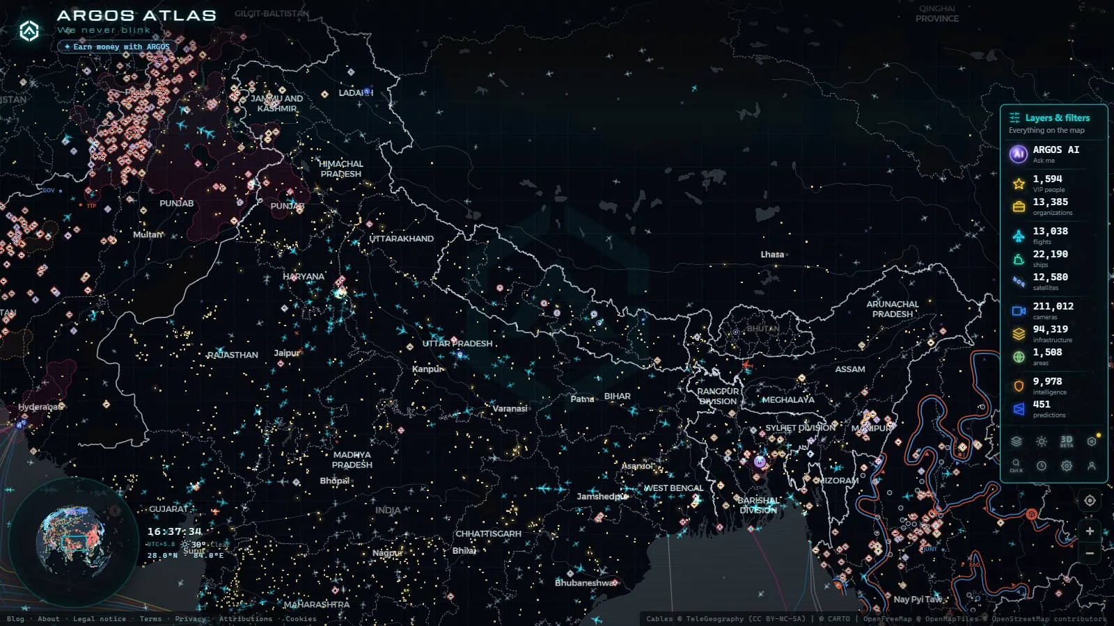
Type "Nepal" into the search box of a live map and you do get answers back. The airport catalogue returns Tribhuvan, Pokhara, Bhairahawa, Biratnagar. The flight layer has traffic over the valley. The terrain is right there under it. What you will not find anywhere on the open web is a straight answer about which parts of Nepal can be watched in real time and which cannot, so people end up clicking through a dozen webcam aggregators that promise Everest and deliver a frozen frame from some year nobody records.
Nepal is genuinely hard to observe from open sources, and it is worth saying why before saying what works. It is landlocked, so one entire family of live data is structurally absent. It has no national traffic camera programme publishing open feeds the way state transport departments do in the United States or the DGT does in Spain. Most of what streams publicly from the country is private: hotel cameras, trekking lodges, a few valley views, none of it under an authority that guarantees the feed will still be up next month. What Nepal does have, and has in quantity, is aviation.
What a Nepal live map can actually show you
Three things carry the weight, and the rest is thinner than the promises suggest.
Aircraft. ADS-B coverage over Nepal is solid at cruise altitude and patchy near the ground, which is exactly the pattern you would predict for a country of deep valleys and volunteer receivers. Long haul jets crossing the Himalaya between South Asia, China and Central Asia show up cleanly, hour after hour, and most of them will never touch Nepali ground. Domestic turboprops hopping between Kathmandu and the hill strips fade in and out depending on whether a ridge is sitting between the aircraft and a receiver. The live layer was tracking 11,248 aircraft worldwide at the moment this was written, and a handful of them were over Nepal at any given time.
Airports as objects. The airport layer is a catalogue, not a feed. It holds 47,927 airports worldwide, and Nepal's are all in it: the international fields, the domestic strips with a single scheduled flight a day, and short takeoff airstrips that never see anything larger than a Twin Otter. Clicking one gives you its codes and position, not a live board of arrivals. That distinction matters and we will come back to it.
Terrain. The base map carries the relief, and over Nepal the relief is the story. Watching a flight track bend around high ground instead of crossing it tells you more about how the country works than any statistic. If you want the general mechanics of how aircraft positions get onto a screen at all, the guide on how to watch aircraft in real time on a flight radar covers the signal side without the marketing.
Kathmandu: the busiest thing on any Nepal live map
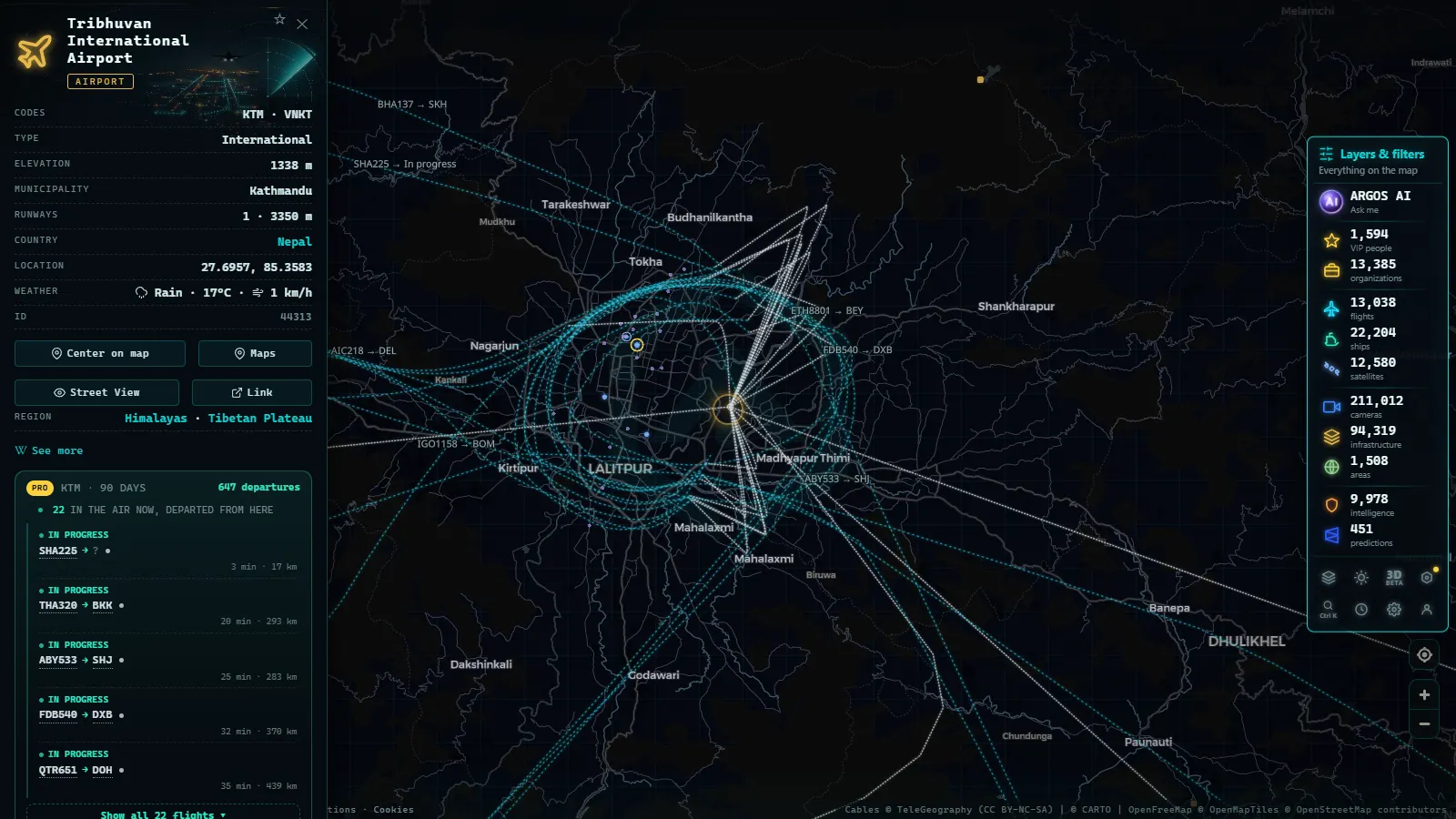
Tribhuvan International (KTM, ICAO VNKT) is the country's one international gateway of any consequence, and it sits in a bowl ringed by hills. Everything funnels through it. If you open the map over the Kathmandu valley you are looking at a single runway absorbing international widebodies, regional narrowbodies and the entire domestic network at once.
The rhythm is readable once you know it. Mornings carry the domestic departures, because the mountain strips are flown early while the air is still calm and the afternoon valley winds have not built. The international bank runs heavier later, with traffic to the Gulf, to Delhi and other Indian cities, to Kuala Lumpur and Bangkok, and onward to points that use Kathmandu as a connection rather than a destination. A large share of the aircraft you see are Indian operators or aircraft routed through Indian airspace, which is why the live flight coverage over India is a natural companion to this one.
Approaches are the part worth watching. Traffic arrives over the valley rim rather than on a long flat final, and on the map you see tracks doing things they do not do at sea level airports: circling to lose height, joining from an angle, occasionally holding while the weather at the field decides what it is doing. In monsoon months you will see diversions, and diversions are visible on a live map in a way they never are on an airline app.
The mountain airstrips, and why they are hard to follow
This is where a Nepal live map gets interesting and where it starts lying by omission if you do not know the limits.
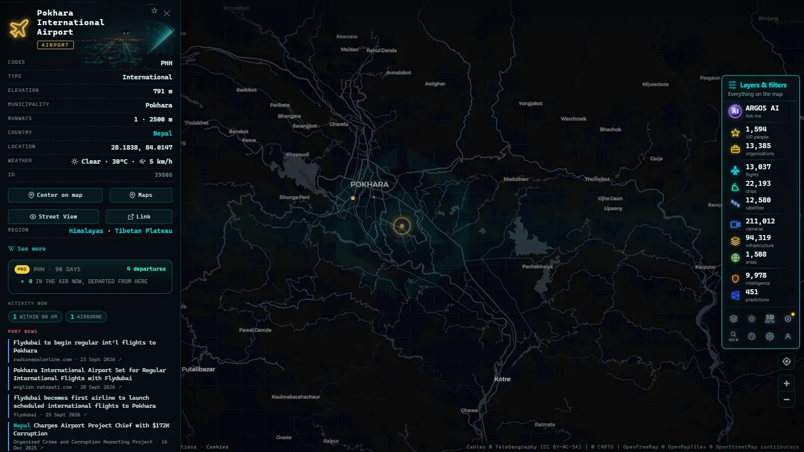
Lukla (LUA, VNLK), the strip that serves the Everest trekking routes, is the famous one: short, sloped, cut into a hillside, flown only in visual conditions and only when the weather over the ridge cooperates. Jomsom (JMO, VNJS) serves the Annapurna side and is known for wind that shuts the field by mid morning. Simikot, Phaplu, Taplejung and a dozen others sit in the same category.
During the busy trekking seasons, many Lukla flights do not depart from Kathmandu at all. They stage out of Ramechhap, also called Manthali, a few hours east by road, to keep the pressure off Tribhuvan. Travellers who did not read the fine print end up staring at an empty Kathmandu departure board while their aircraft is airborne from somewhere else entirely. On the map, that shows as flight activity around a strip most people have never heard of.
The honest limit: many of these aircraft simply do not appear. Small turboprops on short hops may not transmit ADS-B, and when they do, the signal often cannot clear the terrain to reach a receiver. A track that vanishes mid valley and reappears later has flown behind a mountain, nothing more.
Recorded straight off the map, no sound.
Layer by layer: what works over Nepal and what does not
| Layer | Over Nepal | The honest limit |
|---|---|---|
| Flights (ADS-B) | Works, best at altitude | Low domestic hops drop out behind terrain, some aircraft never transmit |
| Airports | Full catalogue, all fields included | It is positions and codes, not a live arrivals board |
| Public cameras | Very thin | The layer holds 200,000+ cameras worldwide (count as of September 2026), concentrated where an authority publishes them |
| Ships (AIS) | Nothing, permanently | Landlocked. The 22,025 vessels on the layer are all somewhere else |
| Ports | Nothing | Same reason. The port layer covers 1,081 sea ports worldwide |
| Power infrastructure | Partial | 34,936 objects mapped worldwide, and it is location data, not live output |
| Conflict and OSINT events | Occasional at most | Nepal is not an active theatre, so the layer is usually quiet |
Read that table as a filter, not a complaint. Two of the seven rows are empty for reasons that will never change, one is thin for reasons that could change if a Nepali authority decided to publish, and the rest work.
What no Nepal live map will give you
Saying this plainly is the point of the article.
There is no live view of the Everest summit. There is no live camera on the Kathmandu Ring Road, no traffic feed for Thamel, no border crossing camera at Birgunj or Kodari that a member of the public can just open. There is no live power output for the hydro plants in the eastern hills, only their positions. There is no vessel traffic, ever.
The webcam aggregators that appear when you search for this are mostly recycling the same handful of private streams, many of them dead, and none of them tied to an operator you can verify. If a feed matters to you, check who runs it before you trust what it shows: the piece on how to tell whether a webcam is official is the short version of that habit. For countries where the public camera networks really are dense, the world webcam map guide shows what the difference looks like.
How to work the map when the data is thin
A few things make Nepal worth opening anyway.
- Start over the Kathmandu valley, not over the country. Zoomed out to national scale you see overflight traffic that has nothing to do with Nepal. Zoomed into the valley you see the actual operation.
- Filter to the flight layer. With cameras and vessels contributing nothing here, turning them off cleans the view considerably.
- Click a track, then follow it. The route, altitude and speed tell you immediately whether you are looking at a Doha bound widebody at cruise or a Dornier working its way to a hill strip.
- Watch the early morning window in local time. That is when the mountain sectors fly, and it is the only reliable time to see them at all.
- Watch the weather months. During the monsoon the pattern visibly degrades: cancellations, diversions, tracks that hold. During the clear autumn window the domestic network runs at full stretch.
Where the observable ends
A Nepal live map is an aviation map with some geography attached, and that is an honest description rather than an apology. You can follow the Kathmandu corridor in real time, see which mountain sectors are flying on a given morning, and watch traffic cross the Himalaya continuously overhead. You cannot watch a street, a border post, a summit or a river, because nobody publishes those feeds openly and no amount of software fixes that.
If you want to see exactly where the line falls, open the map over the Kathmandu valley and turn the layers on one at a time. The empty ones will tell you as much as the full ones. And if you want to understand why one of them is structurally empty rather than merely underserved, the explainer on how AIS locates ships in real time makes the landlocked problem obvious in about two minutes.
Frequently asked questions
Is the Nepal live map free, live and open without registration?
Yes. The map is free, it needs no account and no download, and the flight layer updates continuously while the tab is open. There is no paywall on Nepal or on any other country, and nothing about the country changes what you get: the same layers load for Kathmandu as for London.
Can I watch Mount Everest live on the map?
No, and anyone promising it is selling something. There is no public, authority-operated camera pointed at the summit that streams continuously to the open web. What the map does show near Everest is air traffic in the corridor and the airstrips that serve the region, mainly Lukla. Private lodge cameras exist, they go dark for months, and none of them is a source we would treat as reliable.
Why do domestic flights inside Nepal disappear from the map?
Two reasons, both physical. Small turboprops on the mountain routes do not all transmit ADS-B, and the ones that do are often flying below ridge lines that block the signal from reaching a receiver. A track that vanishes in a valley and reappears twenty minutes later has not crashed, it has simply flown behind a mountain.
Are there traffic cameras in Kathmandu on the map?
Effectively no. Nepal has no national programme publishing open traffic camera feeds the way road authorities do in Spain, France, Canada or most US states. The camera layer holds 200,000+ cameras worldwide (count as of September 2026), and they cluster where an authority chose to publish them. Nepal is not one of those places.
Why does the ship layer show nothing over Nepal?
Because Nepal is landlocked. AIS is a radio system used by vessels at sea and on major navigable rivers, so there is nothing to receive. This is not a coverage gap that will be fixed, it is geography. The nearest live vessel traffic to Nepal is in the Bay of Bengal, several hundred kilometres south.
- Antarctica live map: what you can really watch right now
- Guatemala live map: what you can see right now, layer by layer
- ARGOS ATLAS vs WorldCam: 3 Free Cameras a Day vs 45 Seconds
- Live Webcam Maps Compared: 6 Ways to Watch the World (2026)
- Travel Without Moving: Watch Cities Around the World Live via Webcam
- Public cameras online: what types exist and which ones you can legally watch