Blog · Traffic cameras
DGT Traffic Cameras: 10,894 Live Feeds in Spain
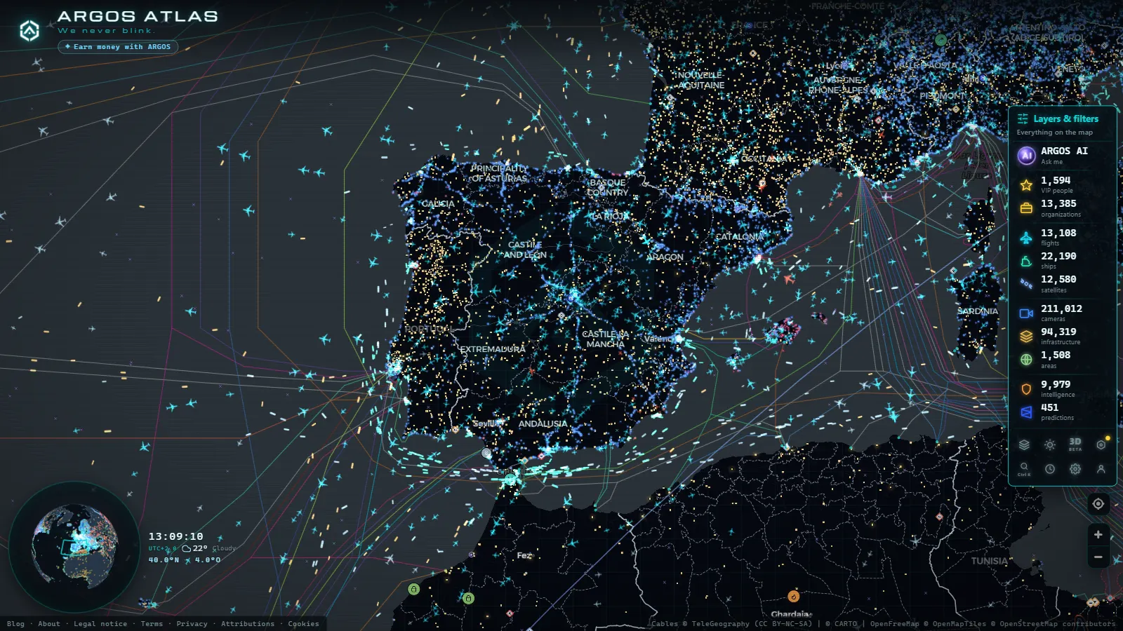
If you have ever wanted to know whether the I-95 is moving before leaving New York, whether fog is sitting on the M25 outside London, or whether snow has closed a pass in the Alps, live traffic cameras are the most direct answer. Road agencies across the US, UK, Europe, and much of the rest of the world maintain thousands of roadside observation points and publish their images openly, so anyone can check conditions before getting behind the wheel. This guide explains what these cameras are, how to find them country by country, what you can realistically expect from them, and how to view thousands at once on a single map without jumping between agency websites.
The essentials, in 20 seconds
- Argos Atlas: aggregates thousands of public traffic cameras from official agencies worldwide onto one interactive map, free and without registration.
- DGT: publishes Spain's national traffic cameras, while Catalonia and the Basque Country run their own separate services.
- National Highways: covers England's strategic road network, with Traffic Scotland, Traffic Wales and the PSNI managing their own regions.
- Still frames: most official sources publish a periodic captured image rather than a continuous live stream.
- 15 to 20 minutes: a frame older than that should be treated as indicative rather than definitive, so always check its timestamp.
What traffic cameras are and why they exist
Traffic cameras were not built so you could plan your weekend drive, though they turn out to be excellent for that. Their core purpose is traffic management: control centers need real-time visibility across the road network to detect congestion, crashes, roadworks gone wrong, or severe weather, and then respond by activating message signs, rerouting traffic, or dispatching crews.
From there, most agencies made a straightforward decision: if the images already exist, why not share them with drivers? Publishing them openly turns an internal operational tool into a public service. You see what the traffic controller sees (a wide shot of the road) and make decisions based on real conditions rather than guesswork.
It is worth being clear about what these cameras are and are not. They provide wide-angle views of the roadway designed to assess flow: vehicle density, visibility, surface conditions. They are not speed cameras, they do not issue fines, and they are not designed to identify anyone. If you want to understand the technology in more depth, our article on how traffic cameras work breaks it down piece by piece.
How to find official cameras by country
Different countries organise their road camera networks differently, but the logic is consistent: look for the national or regional road authority.
- United States: the Federal Highway Administration coordinates but publication is primarily by state DOTs. Most US states run 511 systems (call or visit 511.org-style portals) with live camera feeds on interstates and major highways. States like California (Caltrans), Texas (TxDOT), and New York (NYSDOT) maintain hundreds of public cameras each.
- United Kingdom: National Highways (formerly Highways England) operates the strategic road network in England and publishes camera feeds. Traffic Scotland, Traffic Wales, and the PSNI manage their own equivalents.
- France: the BISON FUTÉ national traffic information service aggregates data from both the public route network and the toll motorway operators (APRR, SANEF, Vinci Autoroutes, etc.).
- Germany: the BASt (Federal Highway Research Institute) and individual Länder transport ministries. Coverage is solid but fragmented across regional portals.
- Spain: the DGT publishes cameras on its national network; Catalonia and the Basque Country run their own services due to devolved powers.
- Alpine and Nordic countries: Switzerland (ASTRA), Austria (ASFINAG), Norway (Vegvesen), and Sweden (Trafikverket) maintain some of the densest networks of all, with cameras specifically designed to monitor mountain pass and winter road conditions.
The practical search within each portal works around three variables:
- Road identifier (I-95, M1, A9, E45): the quickest filter if you know your route.
- Location or region: useful when you want to survey a general area rather than a specific road.
- Mile marker or kilometer point: the exact camera position on the route, which tells you whether the image covers the stretch you care about or one fifty miles away.
A practical tip that applies everywhere: always check the timestamp burned into the image or shown in the metadata. That is your only guarantee that you are seeing a recent frame rather than one frozen hours ago.
From the ARGOS ATLAS channel.
Still frames versus streaming: what you will actually see
When traffic agencies talk about "live cameras," they almost never mean a continuous broadcast like a sports stream. What the vast majority of official sources publish (from the US 511 networks to the UK's National Highways) is a periodic still frame: a fixed image that the camera captures and uploads at a set interval.
Why this format? Efficiency and proportionality. Streaming thousands of simultaneous live feeds to everyone who wants to watch would be enormously expensive in bandwidth, and a frame every few minutes is more than adequate for the actual purpose: knowing whether there is congestion, snow, or clear road ahead. The still format at moderate resolution also reduces any realistic possibility of identifying individuals or licence plates, which is consistent with the public-information purpose of these cameras.
The exact refresh rate varies by source and camera. Some update frequently; others are slower. There is no universally guaranteed interval across any national network, so the rule is the same everywhere: check the timestamp, and if the frame is more than 15–20 minutes old, treat it as indicative rather than definitive.
Cameras beyond the national network: regional and municipal feeds
A detail that surprises many users: national road agencies do not cover every road. In the US, state DOTs cover interstates and major state highways, but county roads and city streets are typically managed by local authorities, some of which publish their own cameras. In the UK, National Highways covers the strategic network; local councils and city traffic management units handle urban roads separately.
Major cities (New York, Los Angeles, Chicago, London, Paris, Amsterdam) often operate their own urban traffic camera networks, and many publish them publicly. The result is a mosaic: to see "all road cameras" in a country you would theoretically need to visit dozens of different portals, each with its own interface, search logic, and update rhythm.
This is not a flaw in any particular system; it is the natural consequence of how road management authority is distributed. But for a driver who simply wants to know what the road looks like, it creates real friction, and that friction is exactly what an aggregator can remove.
Viewing them all together: the map as the common interface
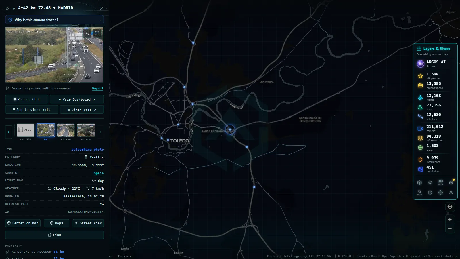
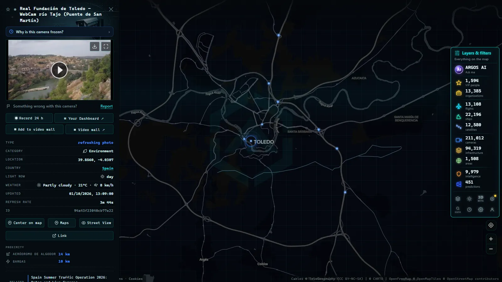
This is where the experience changes. Instead of memorising which agency manages which stretch and visiting its website, you can open a single map where all cameras appear pinned to their real geographic location. Zoom in on your route, see the available camera points along it, and open each image, regardless of whether the source is a national highway authority, a state DOT, or a city traffic center.
That is exactly what Argos Atlas does: it aggregates thousands of public traffic cameras published by official agencies worldwide and places them on an interactive map, free and without registration. For each camera, only the latest frame published by the source is shown, in the resolution the agency provides, with attribution to its origin, you see exactly what you would see on the official portal, but with the geographic context of a map and all sources in one place.
The practical difference is enormous: on an agency portal you search for cameras through lists; on a map you discover them by following your route with your finger.
For a long journey, this turns a pre-trip check into a matter of a couple of minutes: trace your route mentally across the map, open cameras at the sections that concern you, and leave knowing what to expect.
Practical tips for getting the most out of traffic cameras
Drivers who use these cameras regularly develop small habits that multiply their usefulness. The most valuable ones:
- Before a long trip, check cameras at the classic bottlenecks on your route: city approaches, ring roads, major interchange junctions. These are the stretches where a hold-up costs you an hour.
- In winter, cameras positioned at mountain passes are invaluable: they show whether the road surface is wet and black or white with snow right now, something no forecast can guarantee. We have a dedicated guide on how to use mountain pass cameras to check snow conditions before you travel.
- Combine the camera with other sources: the image shows one specific point, but you build the picture of the whole route by combining it with congestion maps and official incident reports. In all the ways to watch traffic live we explain how each piece fits.
- Do not trust an image without a timestamp: if you cannot verify when the frame was taken, do not make important decisions based on it alone.
One final note of common sense: never check cameras while driving. Do it before you set off or when stopped at a rest area. This information is for planning, not for distraction at the wheel.
Frequently asked questions
Is it free to watch traffic cameras online?
Yes, completely free. Road agencies worldwide publish their camera images as public information at no cost, with no account required. The same applies to aggregators that bring those images together responsibly, like Argos Atlas: open access, no sign-up needed.
How often does the image update?
There is no single cadence across any national network, it depends on each camera and source. Most publish a frame that refreshes every few minutes, but some are slower. This is why the timestamp matters: it is your guarantee that you are seeing something recent and not a frozen frame from hours ago.
Do they stream video or just still frames?
The public-facing standard is the periodic still frame, a fixed photograph that updates automatically at set intervals. Continuous video exists but is generally used inside traffic management centers rather than on public websites. For a driver's purpose (knowing whether there is congestion or bad weather) the still frame is more than sufficient.
Is it legal to view them?
Completely legal. These are images that road authorities deliberately publish as public service information, just like electronic message boards on motorways or official traffic broadcasts. Viewing them requires no permission and carries no risk. If you want more detail on the legal and privacy framework, we cover it thoroughly in our article on traffic cameras and privacy.
Conclusion
Traffic cameras are one of those quietly powerful public services that, once you discover them, become indispensable: a thirty-second check before you leave can save you hours in a jam or a nasty surprise with snow on a mountain pass. Official portals do the job for occasional single-route checks, and when you want to go further (viewing your full route, pulling in regional and municipal networks, or checking roads in another country) a map-based aggregator gives you the complete picture without the effort. Try it: open the map, zoom in on your next route, and see the road with your own eyes before you set off.
Frequently asked questions
Is it free to watch traffic cameras online?
Yes, completely free. Road agencies worldwide (from the US DOT and state DOTs to the UK's National Highways) publish their cameras as a public service, with no registration or cost. Aggregators that bring those images together, like Argos Atlas, are also free and open access.
How often does the image update?
It depends on each camera and agency. Most publish a static frame that refreshes every few minutes; there is no single universal cadence across any national network. If you need to track a fast-changing situation, reload the image and compare the timestamp.
Do they stream video or just still frames?
The public-facing standard is the periodic still frame: a fixed image that updates automatically at set intervals. Continuous video streaming is generally reserved for traffic management centers, not for public websites.
Is it legal to view them?
Yes. These are images that the authorities deliberately publish as public information. Viewing them is as legal as reading a motorway message board.
- Mountain pass cameras: how to check road snow conditions before you travel
- Why Is a Traffic Camera Not Working? Outages, Maintenance, and Alternatives
- Live Traffic Mexico City: 15,000+ CDMX Cameras In Real Time
- Live Traffic Cameras in Buenos Aires: Urban Autopistas, Metrobus, and the North-South Corridor
- Live Traffic Cameras in Bogota, Colombia: IDU, Movilidad, TransMilenio and Pico y Placa
- Santiago Traffic Cameras: Local Traffic Updates Live from Chile